
- Brief description
-
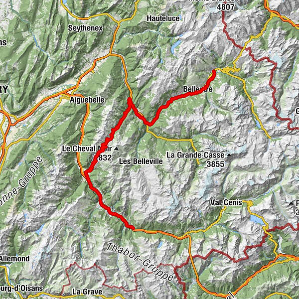
This other variant of the main route is an alternative that avoids the passage through Val d'Isère and Haute-Maurienne, useful for those who want to make the Route des Grandes Alpes when Col de l'Iseran is still closed and to offer another incredible alpine pass, Col de la Madeleine.
- Difficulty
-
difficult
- Rating
-
- Route
-
Bourg-Saint-Maurice0.0 kmLe Petit Resto6.8 kmLes Granges8.1 kmBellentre8.9 kmLes Provagnes13.8 kmFontaine de village14.4 kmAime14.4 kmCentron19.9 kmSaint-Marcel23.9 kmPomblière25.5 kmMoûtiers28.5 kmLe Grillon31.6 kmMarmotte32.2 kmGrand-Aigueblanche32.3 kmChâteau Feuillet34.9 kmNotre-Dame-de-Briançon36.3 kmPussy40.4 kmBonneval44.9 kmVillard-Soffray45.5 kmVillard Benoit47.2 kmLe Crozat49.0 kmLe Chezalet50.2 kmLa Thuile51.6 kmCelliers52.6 kmLa Chapelle52.8 kmHôtel du Grand Pic52.9 kmAu Pachu53.0 kmCelliers Dessus53.7 kmLa Banquise 2000 - Chalet de la Madeleine63.0 kmLes Perelles67.1 kmLongchamp68.2 kmSlalom 268.2 kmSlalom 168.2 kmSaint-François-Longchamp 165068.4 kmSaint-François-Longchamp70.9 kmL'Epalud71.6 kmLe Planet72.8 kmMontoudras76.9 kmMaisons Puges77.7 kmMontailler78.3 kmLa Côte78.8 kmNotre-Dame-du-Cruet80.0 kmLe Mollard80.3 kmLe Clocher des Pères80.6 kmSaint-Martin-sur-la-Chambre80.6 kmReverdy80.8 kmLes Clairières81.0 kmLes Grands Prés81.1 kmPrés du Bourg81.1 kmSur Ville81.9 kmCollégiale Saint-Marcel82.1 kmLa Chambre82.5 kmBaillat82.9 kmL'escale Gourmande83.0 kmSaint-Avre83.4 kmLa Plantaz88.1 kmPontamafrey88.8 kmSaint-Julien-Mont-Denis97.9 kmLes Plantées99.0 kmLa Scudéria105.1 kmSaint-Michel-de-Maurienne105.2 kmO comptoir des tontons105.6 km
- Best season
-
JanFebMarAprMayJunJulAugSepOctNovDec
- Description
-
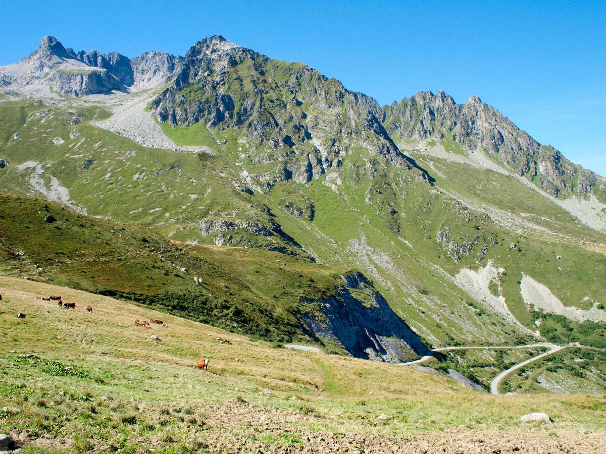
On this stage, a big pass awaits the traveler, Col de la Madeleine which culminates at 1993 meters, between Maurienne and Tarentaise. From Bourg-Saint-Maurice, we join Moutiers before climbing again towards La Léchère. We arrive further at Col de la Madeleine. Then, it is the descent to the ski resort of Saint-François-Longchamps, to join the main axis of the Route des Grandes Alpes at Saint-Michel-de-Maurienne.
- Directions
-
From Bourg-Saint-Maurice, follow the D84c on the right bank of the Isère, then the bike path on the left bank. Take the D990 further to Aime-la-Plagne. Continue carefully on the N90 and cross Moutiers then continue to Aigueblanche. Further take the direction of Léchère on the D97 and follow the direction of Col de la Madeleine. Get down to la Chambre and arrive at Saint-Michel de Maurienne.
- Highest point
- 1,994 m
- Height profile
-
 © outdooractive.com
 - Tips
-
The museum of folk tradition in Moutiers, if there is a museum to do on the Route des Grandes Alpes, it is this one! Focused on the rural civilization of Tarentaise, the art and the Alpine traditions, this cultural place proposes through 8 rooms an interesting staging to go back in time, before going up the slope!
- Additional information
-
On E-bike, a beginner can not achieve this step without recharging the battery, ideally around Moutiers.


- Author
-
TILT COM’SEILThe tour Route des Grandes Alpes - Variante by Col de la Madeleine is used by outdooractive.com provided.