


- Brief description
-
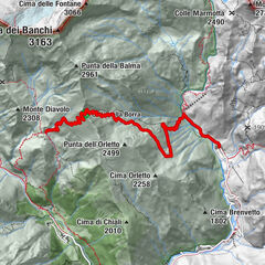
Itinerary that retraces the ancient Royal Hunting Roads, built in the middle of the last century by the House of Savoy to connect the five "Royal hunting lodges" of the Reserve.
- Difficulty
-
difficult
- Rating
-
- Starting point
-
Rifugio Città di Chivasso
- Route
-
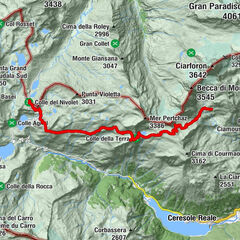
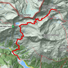
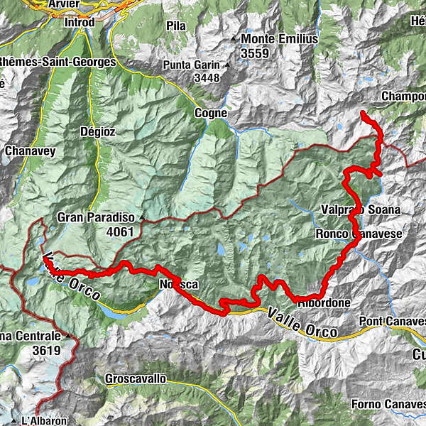
Rifugio Città di Chivasso0.0 kmAlpe della Comba (2,553 m)5.0 kmAlpe di Breuil15.9 kmAlpe Foges16.7 kmAlpe Gran Piano20.3 kmBorgà Sassa27.5 kmCascata di Noasca29.1 kmNoasca29.9 kmGere di Sopra29.9 kmJamonin30.4 kmBorno31.4 kmGere Eredi (952 m)31.6 kmCateri32.4 kmGrusiner (895 m)33.4 kmBorgata Comba33.8 kmJerener (859 m)34.3 kmFrera Inferiore (841 m)34.9 kmPrà35.4 kmChimpendola35.6 kmPrà al Ger36.2 kmDavion36.2 kmLilla36.4 kmFey (800 m)36.7 kmNora37.0 kmMesonette37.5 kmCosta38.0 kmCasa Barrera38.4 kmMeinardi39.5 kmSantuario Sant'Anna (1,491 m)39.5 kmPerebella42.5 kmBertodasco43.2 kmCosta Bugni44.4 kmRocci44.5 kmBuriat44.9 kmSan Lorenzo45.5 kmBouro45.8 kmCiadagn46.3 kmAlpe La Cà47.7 kmAlpe Praghetta Inferiore48.6 kmAlpe Praghetta Superiore49.2 kmAlpe La Colla50.4 kmAlpe Montagne di Sopra51.4 kmAlpe Giasset54.0 kmMonte Arzola (2,156 m)55.3 kmAlpe Arzola (1,793 m)56.8 kmPosio (1,395 m)58.6 kmCiantel58.8 kmBar Ristorante The Wolf - Grisolano59.3 kmTalosio59.3 kmBoscalera59.6 kmTorre Roc (1,772 m)62.5 kmGrotta della Faja (1,790 m)62.7 kmAlpe Roc62.9 kmAlpe Ciavanassa65.7 kmBetafin67.9 kmConvento68.1 kmBetassa68.8 kmAlpetta69.3 kmRamo Verde69.6 kmLocanda Centrale69.7 kmRonco Canavese69.9 kmNivolastro (1,425 m)72.0 kmRifugio Nivolastro (1,434 m)72.0 kmAlpe Andorina74.4 kmValprato Soana75.2 kmChiesale76.0 kmCampiglia Soana78.0 kmPignone79.2 kmGrangia della Borra84.3 kmCasotto P.N.G.P.84.7 kmPiamprato88.6 kmAlpe Prariond (1,643 m)89.6 kmGrangia Ciavanassa90.9 kmRifugio Ciavanassa91.1 kmCimetta Rossa (2,500 m)97.3 kmRifugio Dondena (2,110 m)100.3 km
- Best season
-
JanFebMarAprMayJunJulAugSepOctNovDec
- Description
-
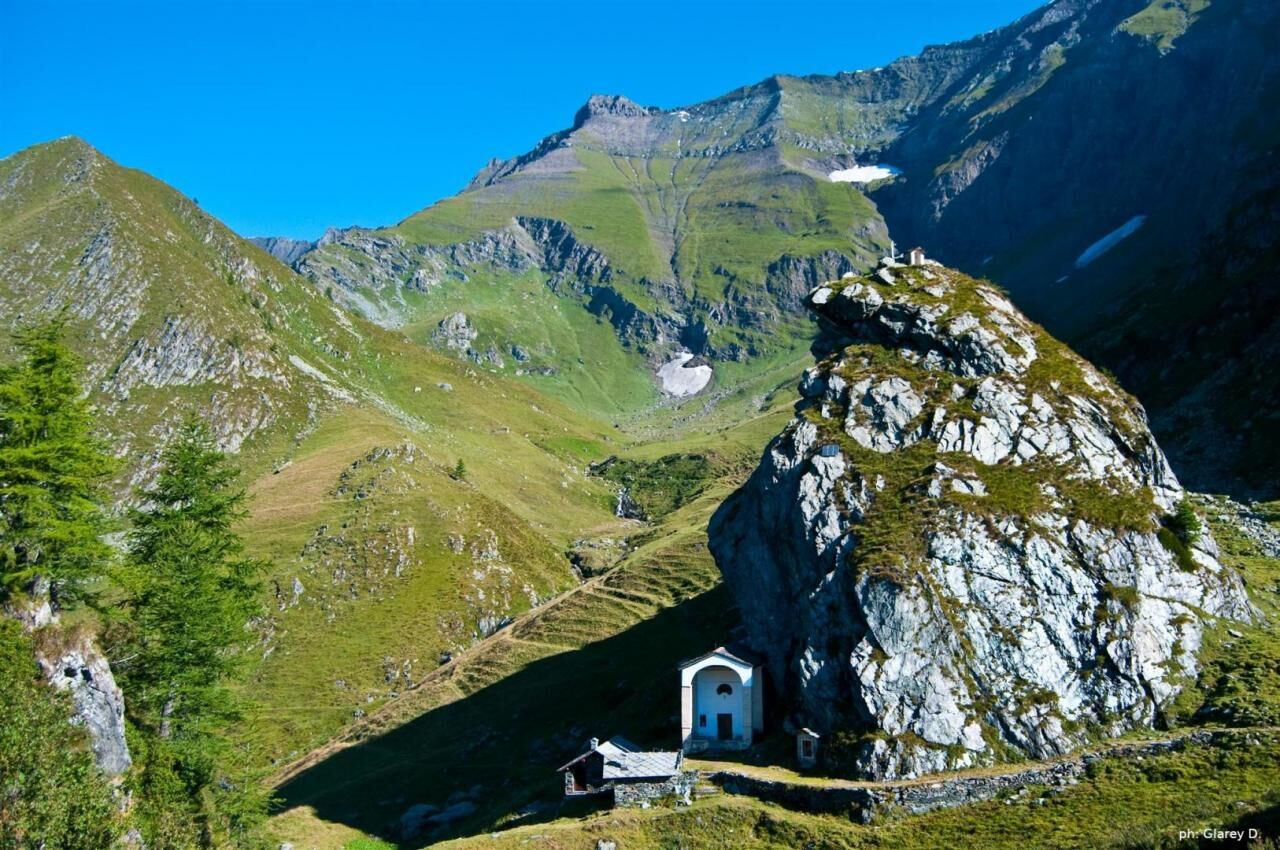
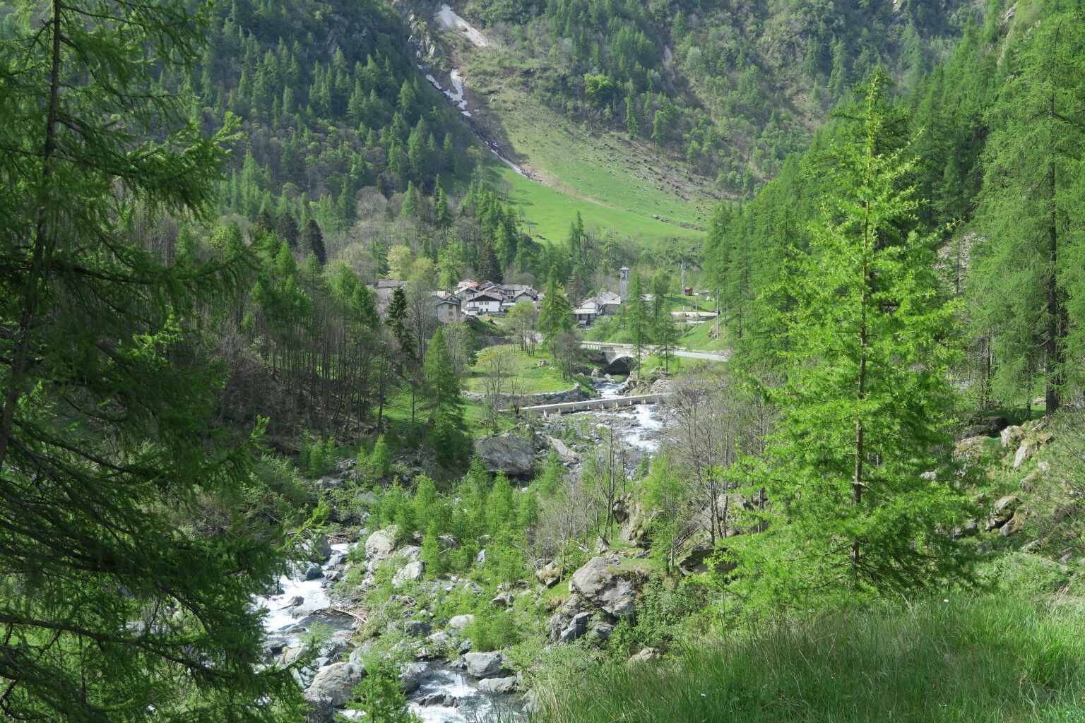
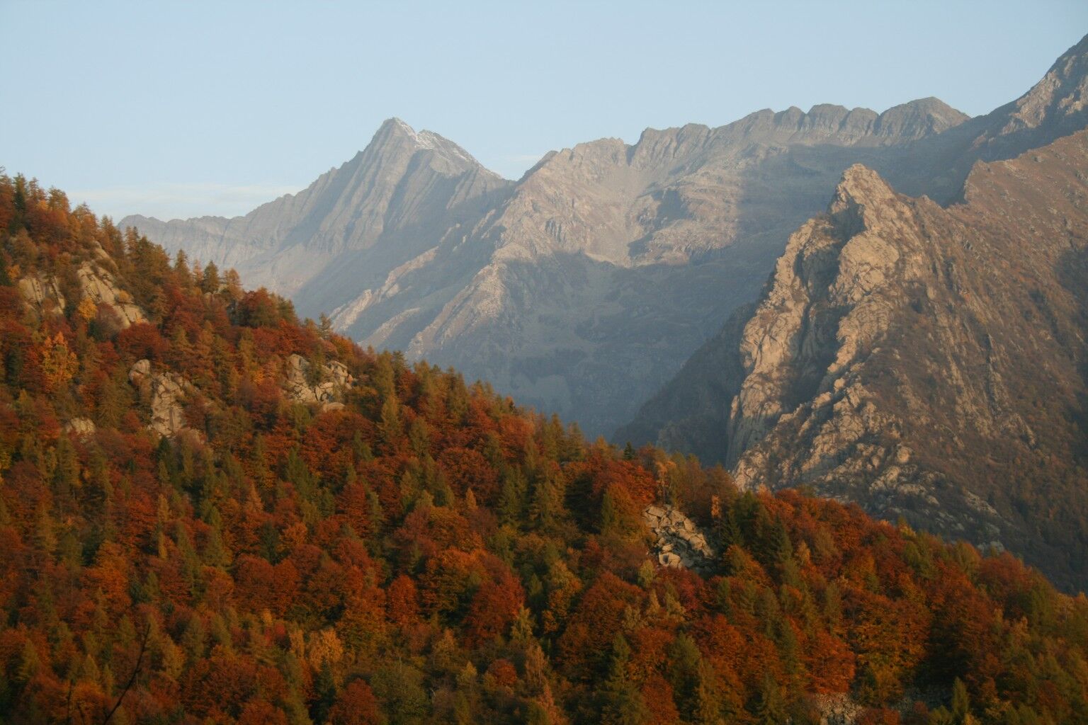
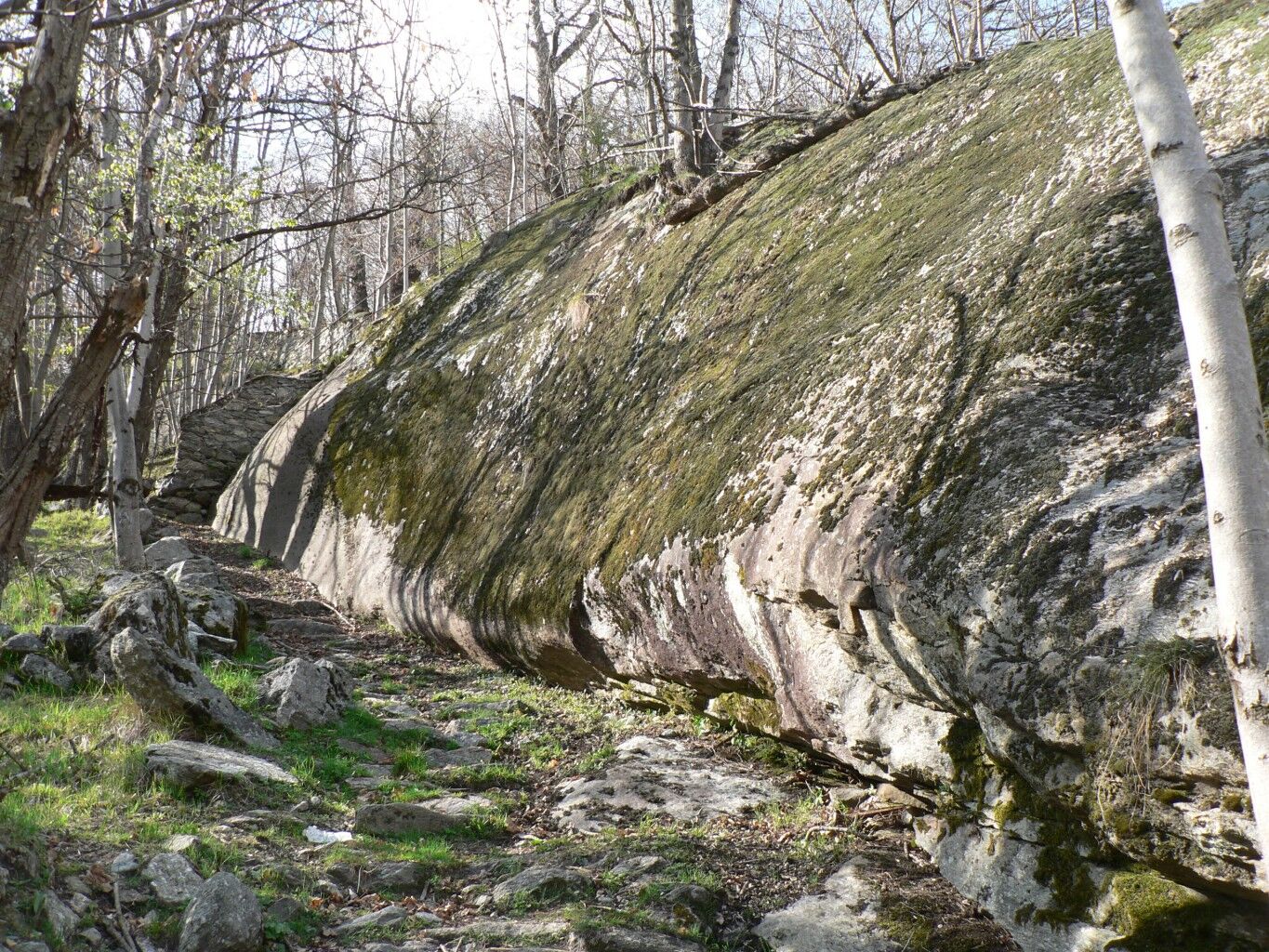
The Giroparco Gran Paradiso itinerary largely retraces the former Royal Hunting Roads built by the House of Savoy in the mid 1800s to connect the five "royal hunting lodges" of the Reserve, which in 1922 became Italy's first National Park.With a constant gradient of around 8/10%, and with admirable dry stone walls and paved sections, they had to provide rideable pathways so that the royalparty could easily access the lodges. Some sections of the itinerary are at high altitude,offering extensive views of the spectacular scenery of the Orco and Soana Valleys, with their valuable landscape and environmental heritage.
- Directions
-
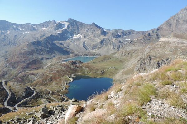
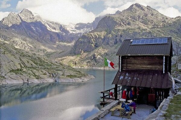
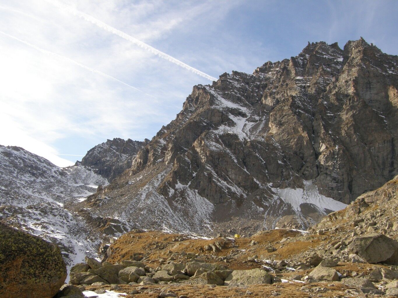
From the refuge you descend to Lake Losere following the trace of the old mule track interrupted by hairpin bends from the road that goes up to Colle del Nivolet. Alongside the lovely Losere Lake, the mule track continues slightly downhill along the valley, with a grandiose panorama of the Levanne and Lake Serru. The route then continues flat, crossing some small streams and the Videsott path that goes up from Chiapili di Sopra. In this area it is possible to admire the valley from some hunting positions, still perfectly preserved. After this point the mule track begins to climb more steeply, but with a regular slope up to Colle della Terra, from where, in two minutes you can reach Punta Rocchetta, with a splendid view of Lake Ceresole and the valley below. From the Colle in about ten minutes you descend to the beautiful Lake Lillet, nestled under a rock wall. From the lake, take the track that goes up over stony ground, crossing, a little further on, route 540 that goes up from Mua-Ceresole. Keeping left, the path quickly reaches Colle della Porta 3002 m. From the Colle the ancient royal road descends with a few turns on the opposite side, between snowfields and debris, towards the Giraudo bivouac. At an altitude of approximately 2700 m, when the mule track bends to the right, abandon it and continue left along tracks that disappear between the large blocks of scree up to Lago della Piatta and the nearby Bivacco Giraudo 2630 m (6 beds, always open, water nearby).
- Highest point
- 3,026 m
- Endpoint
-
Colle Larissa/Rif. Dondena - Champorcher (AO)
- Height profile
-
 © outdooractive.com
 - Tips
-
In addition to simple day excursions, Gran Paradiso offers real trekking routes in stages along the paths. These can be done in summer and require several days with the possibility of sleeping in tents in the designated areas. With a continental alpine climate, with very cold winters and temperatures below 0 and mild summers, the Gran Paradiso National Park is ideal to visit all year round thanks to the many activities it offers. Pay attention to rainfall: slightly more abundant on the Piedmont side, the rainiest months are May, June, July and August.
- Author
-
The tour GPR - Giroparco Gran Paradiso is used by outdooractive.com provided.