


- Brief description
-
A tour for active skiers, ski tour enthusiasts and fans of adventure. La Traversata heads over a via ferrata on the border between Switzerland and Italy and is ideal for freeriders, too.
- Difficulty
-
medium
- Rating
-
- Starting point
-
Mountain station Furggsattel (3,349 m)
- Route
-
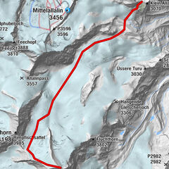
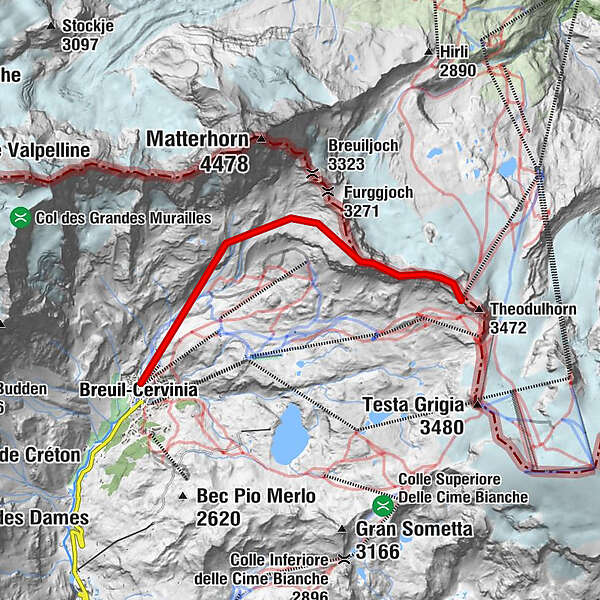
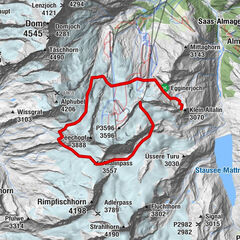
Furggsattel (3,365 m)0.0 kmTesta di Breuil (3,451 m)0.3 kmCretaz6.4 kmLe Breuil - Cervinia (2,050 m)6.6 km
- Best season
-
AugSepOctNovDecJanFebMarAprMayJunJul
- Description
-
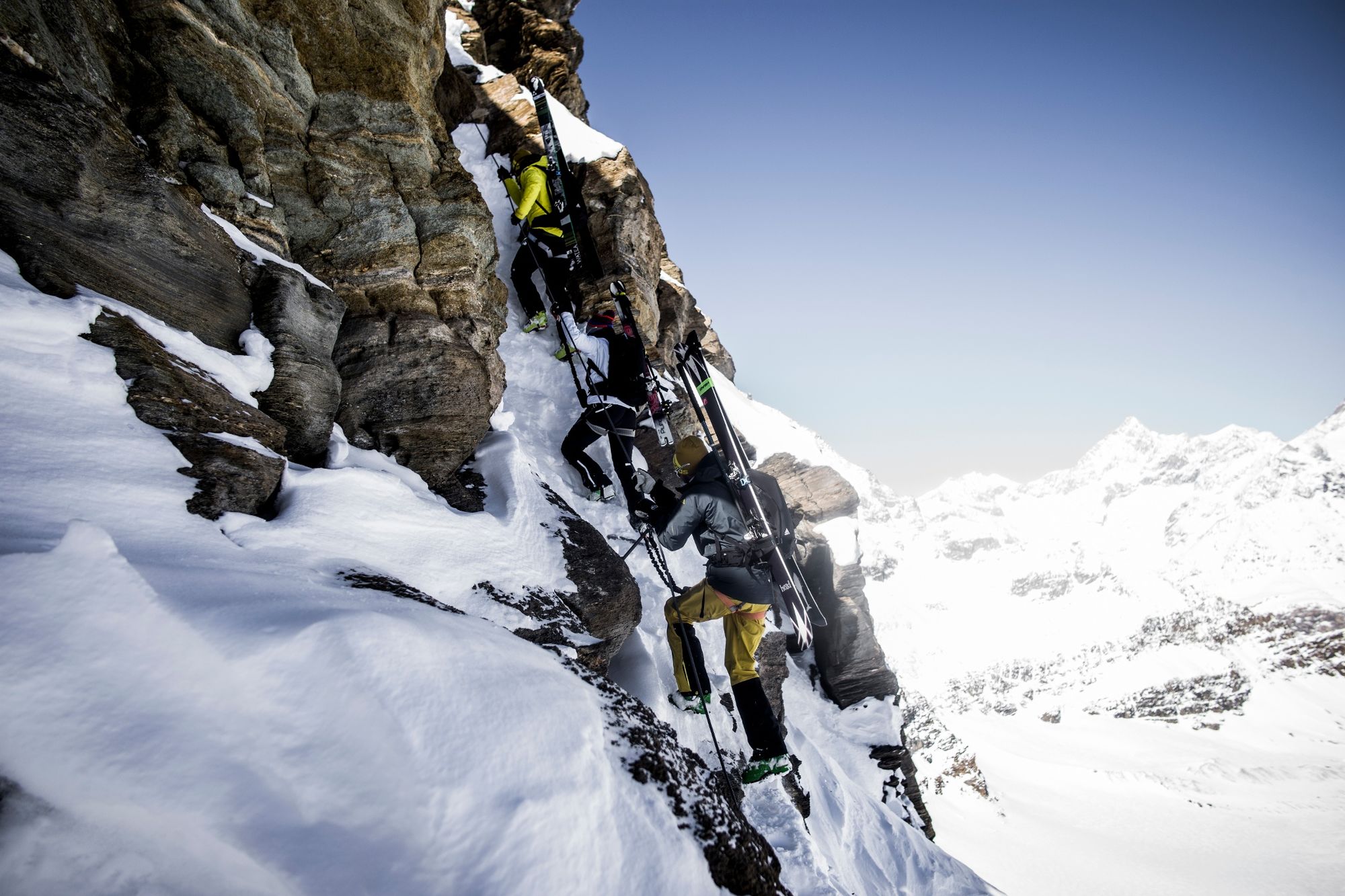
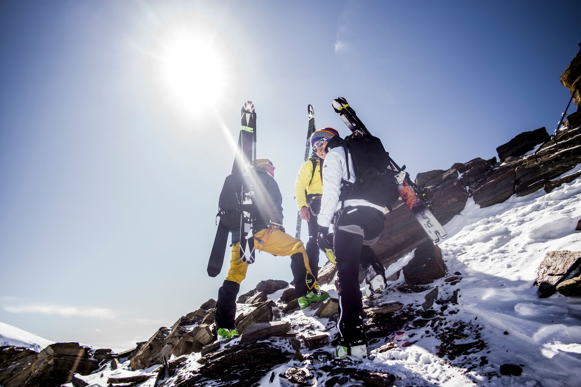
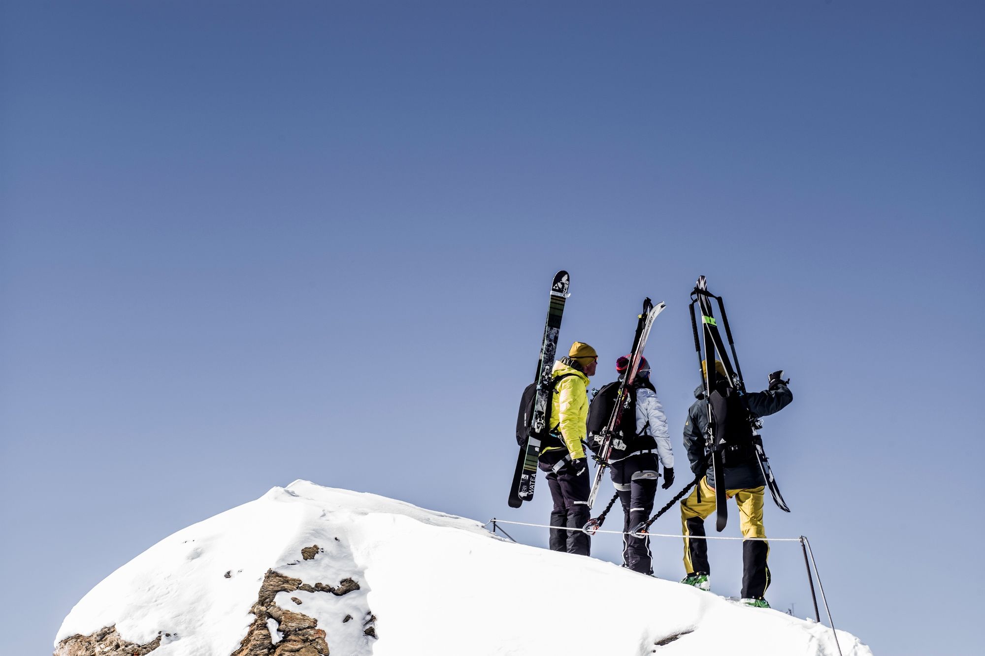
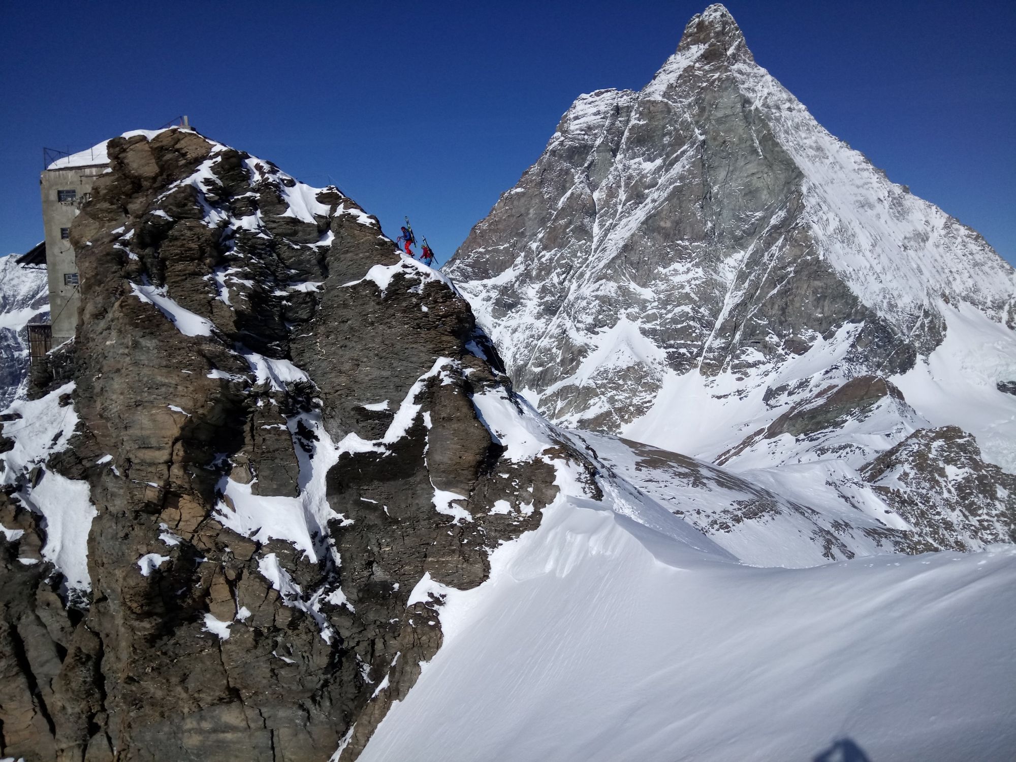
This ski tour starts at the Furggsattel mountain station. From there, it takes an hour to reach the entry point for the winter via ferrata “La Traversata”. With your skis on your backpack, you then climb the via ferrata – this takes about an hour – until reaching the historic Furggen mountain station (3,500 metres). To finish off, strap your skis back on and enjoy a 1,500 metre-long freeride descent to Italian Breuil-Cervinia, with the south face of the Matterhorn behind you all the way.
Climb rock and ice with skis on your backpack (and crampons) Only for confident alpinists with a head for heights Excellent skiing abilities and ski tour experience required - Directions
-
Mountain station Furggsattel – entrance to the winter via ferrata – mountain station Furggen – Breuil-Cervinia (IT).
We recommend to book a mountain guide who knows well the place. - Highest point
- 3,483 m
- Endpoint
-
Breuil - Cervinia (IT) (2,050 m)
- Exposition
- Height profile
-
 © outdooractive.com
 - Equipment
-
We recommend:
Ski touring equipment: touring ski-boots, touring skis with touring bindings, ski poles, skins, crampons Climbing harness Via ferrata kit Backpack, shovel, probe Avalanche transeiver Warm weatherproof clothing Warm gloves and warm hat Sunglasses and sunscreen Warm drinks Snack (high energy foods such as chocolate, dried fruit etc.)Important! Requirement: very good skiing skills and abilities, ski touring experience, surefooted with no fear of heights
- Safety instructions
-
Always go with a mountain guide on a tour Stay up-to-date with the weather and avalanche status: Snow Report
More information is available in the Swiss avalanche bulletins (www.slf.ch) Always maintain visual contact with accompanying persons Use key sections and extremely steep slopes individually Never go into a wild game protection zone (these are marked and one will be fined) Always switch the avalanche transceiver (LVS device) unit to transmission Always carry a shovel and a probe Pay close attention to daily atmospheric warming and continually re-evaluate the situationTip: “Be searchable”. Equip yourself with an additional RECCO rescue reflector*. Whether summer or winter. Available in our Online-Shop or our information desk.
*The additional reflector does not replace an avalanche beacon. - Tips
-
This tour is also accessible in summer but it takes a bit longer to get to the start.
The historically important Furggen mountain station was a pioneering effort of the tourism visionaries from Breuil-Cervinia in Italy. It was used as the mountain station for a cable car lift well into the 1990s. - Additional information
- Directions
-
Zermatt is car-free. Private vehicles are permitted only as far as Täsch (5 km before Zermatt). The Täsch–Zermatt road is closed to the public.
Onward travel to Zermatt is either by private taxi or shuttle train. Trains depart every 20 minutes; the journey takes about 12 minutes, and ends at the Bahnhofplatz in Zermatt. - Public transportation
-
By train to the Matterhorn village: 3½ hours from Zürich airport or 4 hours from Geneva airport. Change at Visp onto the Matterhorn Gotthard Bahn (Matterhorn Gotthard Railway). From Visp, the railway leads through the Mattertal valley past idyllic small villages to Zermatt.
Zermatt is also the start and finish point for the world-famous Glacier Express panoramic train journey (Zermatt to St. Moritz or Davos). - Parking
-
Täsch has car parks with both covered and open-air parking – e.g. at the Matterhorn Terminal or privately operated facilities.
Onward travel: see “Getting there”.
- Author
-
The tour La Traversata is used by outdooractive.com provided.

General info
-
Unterwallis
93
-
Mattertal
38
-
Breuil Cervinia
4


 im ersten Licht des Tages.")