Winter
Summer
Weather
Webcams
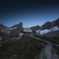
Accommodations
Tours
Search history
Search suggestions
No results found
Search
Tyrol
Home
Summer Österreich
Tyrol
Tours
Regions
Weather
Webcams
Tours
Highlights
Bathing lakes
Accommodations
Offers
Sports provider
Events
Ski resorts
Cross-country skiing
Snow parks
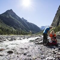
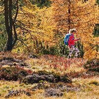
Hiking
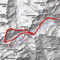
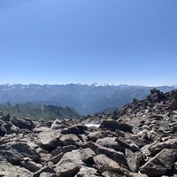
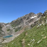
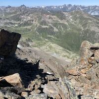
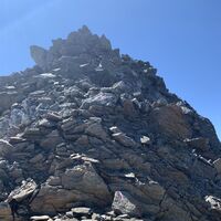
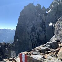
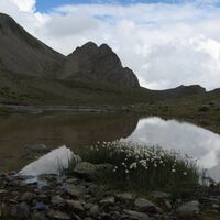
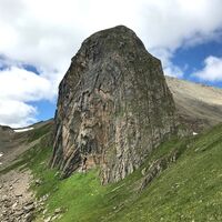
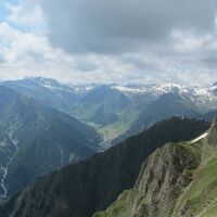
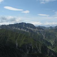
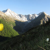
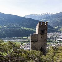
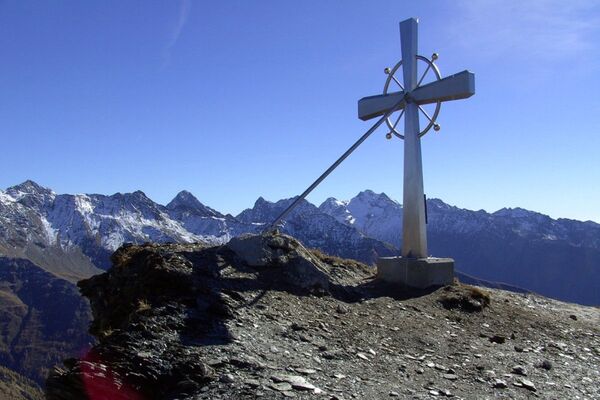
Hexenkopf
Gipfel (3.034 m)
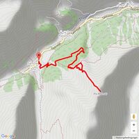
Map
show
hide
Filter tours
Tour type
(All)
Hiking (2)
Full-text search
Fitness
min.
1 easy
2 moderate
3 medium difficulty
4 difficult
5 very difficult
6 extremely
max.
1 easy
2 moderate
3 medium difficulty
4 difficult
5 very difficult
6 extremely
Technique
min.
1 easy
2 moderate
3 medium difficulty
4 difficult
5 very difficult
6 extremely
max.
1 easy
2 moderate
3 medium difficulty
4 difficult
5 very difficult
6 extremely
Length (km)
Altitude metres
other filters
Search
Reset
2 Tours.
sorted by
Relevanz
Relevance
längste Distanz
kürzeste Distanz
longest duration
shortest duration
most altitude meters
fewest altitude meters
high condition
low condition
high technology
low technology
Name A-Z
Name Z-A
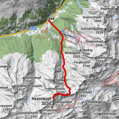
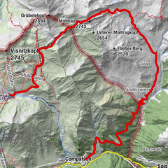
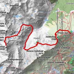
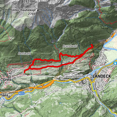
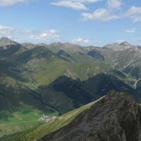
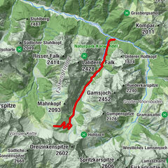
S.8.: Hexenkopf
Hiking
20.39
km
08:33
h
2,077
hm
1,036 - 3,023
m
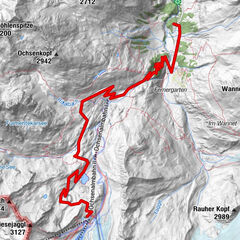
Hexenkopf
medium
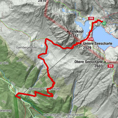
Hiking
13.14
km
04:06
h
755
hm
2,428 - 3,025
m
Technique
Fitness
Other tours in the vicinity
Schwarz- und Grünsee am Dreiländereck
medium
Hiking
14.03
km
07:30
h
931
hm
1,056 - 1,846
m
Technique
Fitness
Memminger Hütte - Zams / E5
long-distance walking trail
13.73
km
05:25
h
388
hm
775 - 2,588
m
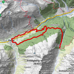
Fliesseralpe and Alp Bella
difficult
Hiking
16.9
km
07:20
h
983
hm
1,700 - 2,538
m
Technique
Fitness
Samnaun-Compatsch
medium
Hiking
13.69
km
05:35
h
508
hm
1,698 - 2,697
m
Technique
Fitness
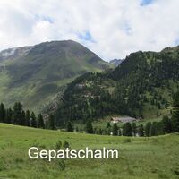
Gepatschhaus - Kaunertaler Gletscher
medium
Hiking
10.16
km
02:32
h
862
hm
1,914 - 2,747
m
Technique
Fitness
G.04 Waldweg zur Larein Alpe
Hiking
12.22
km
03:51
h
372
hm
1,529 - 1,857
m
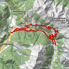
Prutz - Falkaunsalm
medium
Hiking
27.2
km
06:47
h
1,143
hm
864 - 1,964
m
Technique
Fitness
Fiss: Rotpleiskopf über den Spinnseeweg
medium
Hiking
3,4
9.9
km
09:00
h
1,678
hm
1,953 - 2,864
m
Technique
Fitness
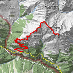
Kreuzjoch via Muttakopf
Hiking
19.1
km
07:45
h
1,417
hm
1,647 - 2,680
m
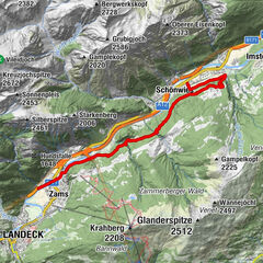
Tiroler Burgenweg Etappe 4: Zams-Kronburg-Schönwies
Hiking
12.32
km
03:45
h
270
hm
734 - 1,033
m
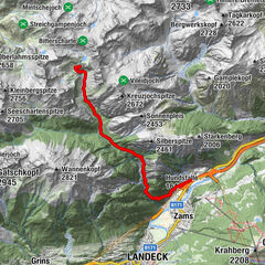
Zams - Steinseehütte - Württemberger Haus - Zams
Hiking
10.54
km
03:41
h
31
hm
775 - 2,200
m
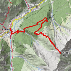
From Samnaun to Piz Motnair
medium
Hiking
9.9
km
05:10
h
881
hm
1,832 - 2,717
m
Technique
Fitness
K.1.: Kappler Berg - Perpat - Althof - Untermühl - Kappl
Hiking
6.93
km
02:06
h
190
hm
1,213 - 1,423
m
Talwanderung Samnaun am Südhang
Hiking
4.05
km
01:10
h
17
hm
1,734 - 1,822
m
Mot Grond and Chè d’Mot
medium
Hiking
3,0
7.14
km
03:00
h
384
hm
1,746 - 2,113
m
Technique
Fitness
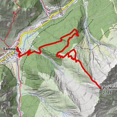
Von Samnaun auf den Piz Motnair
Hiking
9.81
km
03:49
h
874
hm
1,830 - 2,729
m
Grins - Stanz - Ruine Schrofenstein
Hiking
8.44
km
02:03
h
338
hm
996 - 1,177
m
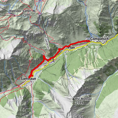
Tschlin - Vadrain - Vinadi
medium
Hiking
4,0
11.95
km
04:30
h
242
hm
1,092 - 1,713
m
Technique
Fitness
Tours by type
Hiking
Hiking
Countries
Austria
Switzerland
Germany
Italy
Slovenia
France
Netherlands
Belgium
Czechia
Slovakia
Spain
Croatia
Bosnia and Herzegovina
Luxembourg
Liechtenstein
Andorra
Tyrol
Salzburg
Styria
Vorarlberg
Carinthia
Upper Austria
Lower Austria
Vienna
Burgenland
Touren nach Regionen
Samnaun
858
Popular tours in the area
Falkenhütte
Hiking
8.72
km |
827
hm |
03:45
h
Wangennitzsee Hütte
medium
Hiking
3.8
km |
835
hm |
02:30
h
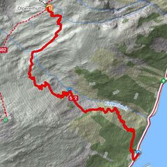
Schlegeis-Stausee - Olperer Hütte
easy
Hiking
6.3
km |
375
hm |
03:30
h
Figerhorn
medium
Hiking
6.71
km |
796
hm |
03:45
h
No entries found.
The search is currently not available.
Please refine your search.
Local search results
(<= 25km)
More results
(> 25km)
%count% Search results
%name%
%type%
%elevation%
%population%
%lpButton%