

- Brief description
-
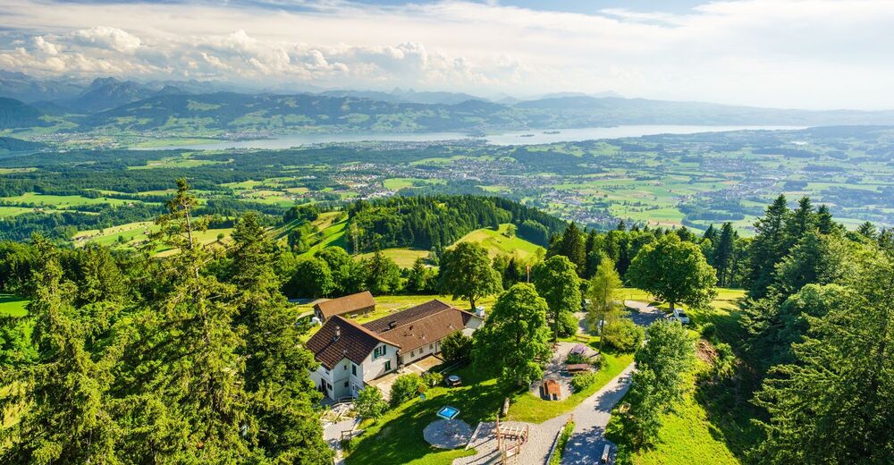
Auf der dreistündigen Wanderung warten Käsereien, Restaurants, ein Alpenbad und der eindrückliche «Bachtelspalt» – eine meterhohe Nagefluh-Furche, die sich – glaubt man der Legende – langsam schliesst.
- Difficulty
-
medium
- Rating
-
- Route
-
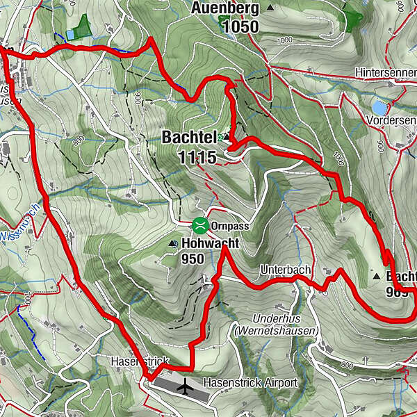
WernetshausenWirtschaft zum Bachtel0.0 kmHasenstrick2.3 kmLandgasthof Hasenstrick2.3 kmOrn3.5 kmUnterbach4.0 kmBachtelhörnli (969 m)5.8 kmBachtel (1,115 m)7.3 kmBachtel-Kulm7.3 kmBachtelturm7.4 kmWirtschaft zum Bachtel9.5 kmWernetshausen9.5 km
- Best season
-
JanFebMarAprMayJunJulAugSepOctNovDec
- Highest point
- 1,109 m
- Endpoint
-
Wernetshausen, Dorf
- Height profile
-
 © outdooractive.com

-

-
AuthorThe tour Wernetshausen – Bachtel: «Abenteuerwanderung am Bachtel» is used by outdooractive.com provided.
GPS Downloads


General info
Refreshment stop
A lot of view
Other tours in the regions
-
Schwyz
1748
-
Zürcher Oberland
596
-
Wald ZH
226


