- Brief description
-
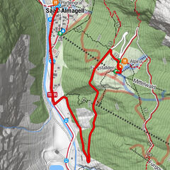
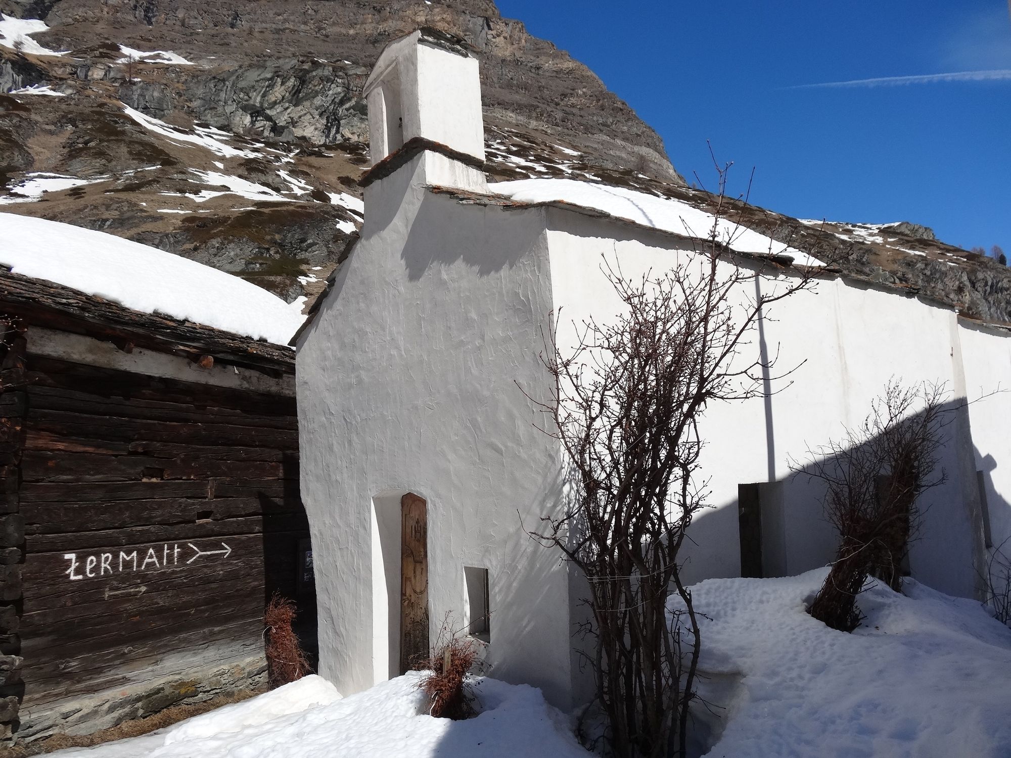
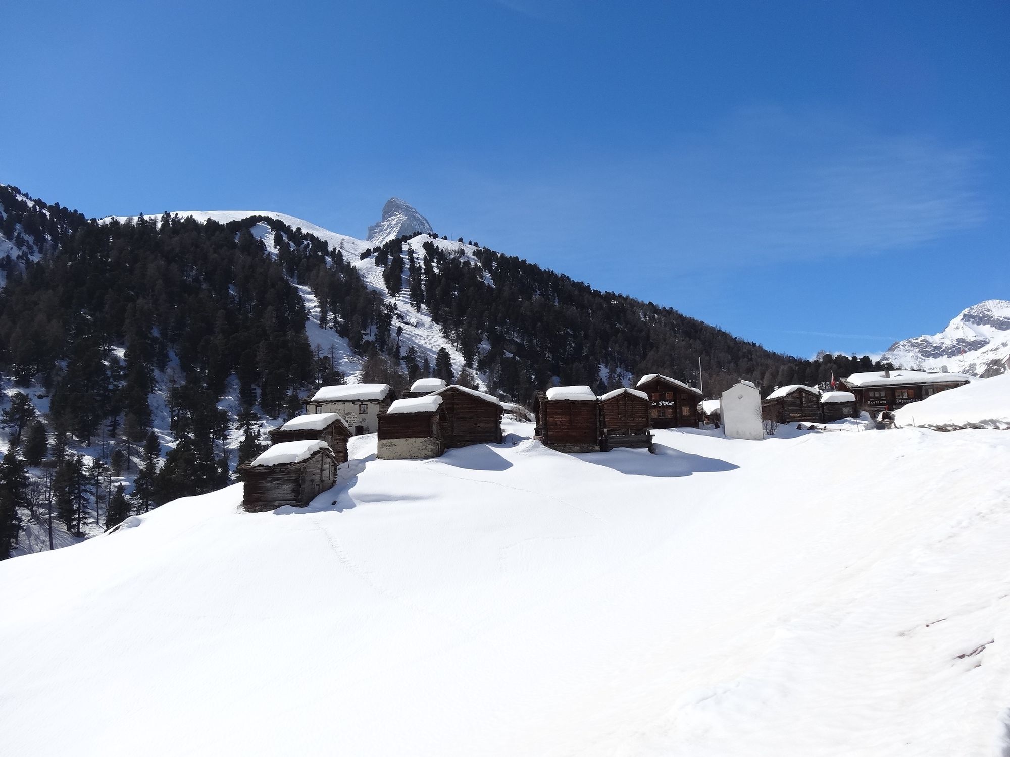
This winter hiking trail from Zermatt to Zmutt has several interesting features to discover, including the Zmuttbach mountain stream and a chapel.
- Difficulty
-
medium
- Rating
-
- Starting point
-
Zermatt (1,620 m)
- Route
-
Zermatt (1,608 m)Zum See1.5 kmKapelle Zum See, Heilige Barbara1.6 kmFeriche3.3 kmZmutt3.6 kmRestaurant Jägerstube3.6 km
- Best season
-
AugSepOctNovDecJanFebMarAprMayJunJul
- Description
-
The walk passes the last houses at the end of the village of Zermatt before climbing gently towards Zmutt. But hikers soon turn off this path, down to the left, in the direction of Zum See / Bielti. The air is fresh and healthy and the sun shines brightly – until the trail enters shady and rather steeper terrain. The route leads across the Zmuttbach mountain stream and up to the houses of Zum See, later on reaching the agricultural road coming down from Stafel. It then follows the road along the shady slope up the valley. In order to cross the Zmuttbach a second time, the trail leads gently downhill before reaching the sunny hamlet of Zmutt.
- Directions
-
Zermatt (Zen Stecken) – Zum See – Bielti/Furi – Zmutt
(Hiking time for the walk back: approx. 1h20)
- Highest point
- 1,942 m
- Endpoint
-
Zmutt (1,936 m)
- Height profile
-
 © outdooractive.com
 - Equipment
-
We recommend:
Good footwear Hiking poles (optional) Warm winter clothing appropriate for the weather - Safety instructions
-
Plan every mountain tour carefully and adapt to participants’ fitness level as well as the weather and season. Weather conditions can change quickly in the mountains. Appropriate clothing is therefore essential, along with adequate supplies of food and water. In uncertain weather, turn back in good time. Inform others of planned route, and whenever possible avoid going alone. Do not leave the marked routes; do not venture onto glaciers without a mountain guide. It is forbidden to walk on the ski pistes. Please be considerate to other walkers and to plants and animals.
Note: Plan departure time carefully – in the afternoon it becomes shady early in Bielti.
Tip: “Be searchable”. Equip yourself with an additional RECCO rescue reflector*. Whether summer or winter. Available in our Online-Shop or our information desk.
*The additional reflector does not replace an avalanche beacon. - Tips
-
There are some beautiful, cosy places to stop for a rest along the trail.
- Directions
-
Zermatt is car-free. Private vehicles are permitted only as far as Täsch (5 km before Zermatt). The Täsch–Zermatt road is closed to the public.
Onward travel to Zermatt is either by private taxi or shuttle train. Trains depart every 20 minutes; the journey takes about 12 minutes, and ends at the Bahnhofplatz in Zermatt. - Public transportation
-
By train to the Matterhorn village: 3½ hours from Zürich airport or 4 hours from Geneva airport. Change at Visp onto the Matterhorn Gotthard Bahn (Matterhorn Gotthard Railway). From Visp, the railway leads through the Mattertal valley past idyllic small villages to Zermatt.
Zermatt is also the start and finish point for the world-famous Glacier Express panoramic train journey (Zermatt to St. Moritz or Davos). - Parking
-
Täsch has car parks with both covered and open-air parking – e.g. at the Matterhorn Terminal or privately operated facilities.
Onward travel: see “Getting there”.

- Author
-
The tour Zermatt-Zmutt (via Bielti/Furi) (Nr. 120) is used by outdooractive.com provided.
General info
-
Unterwallis
151
-
Mattertal
88
-
Zermatt
28