
- Brief description
-
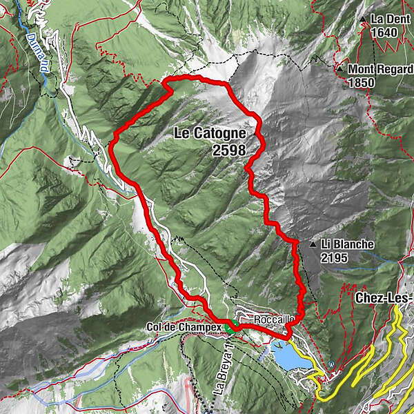
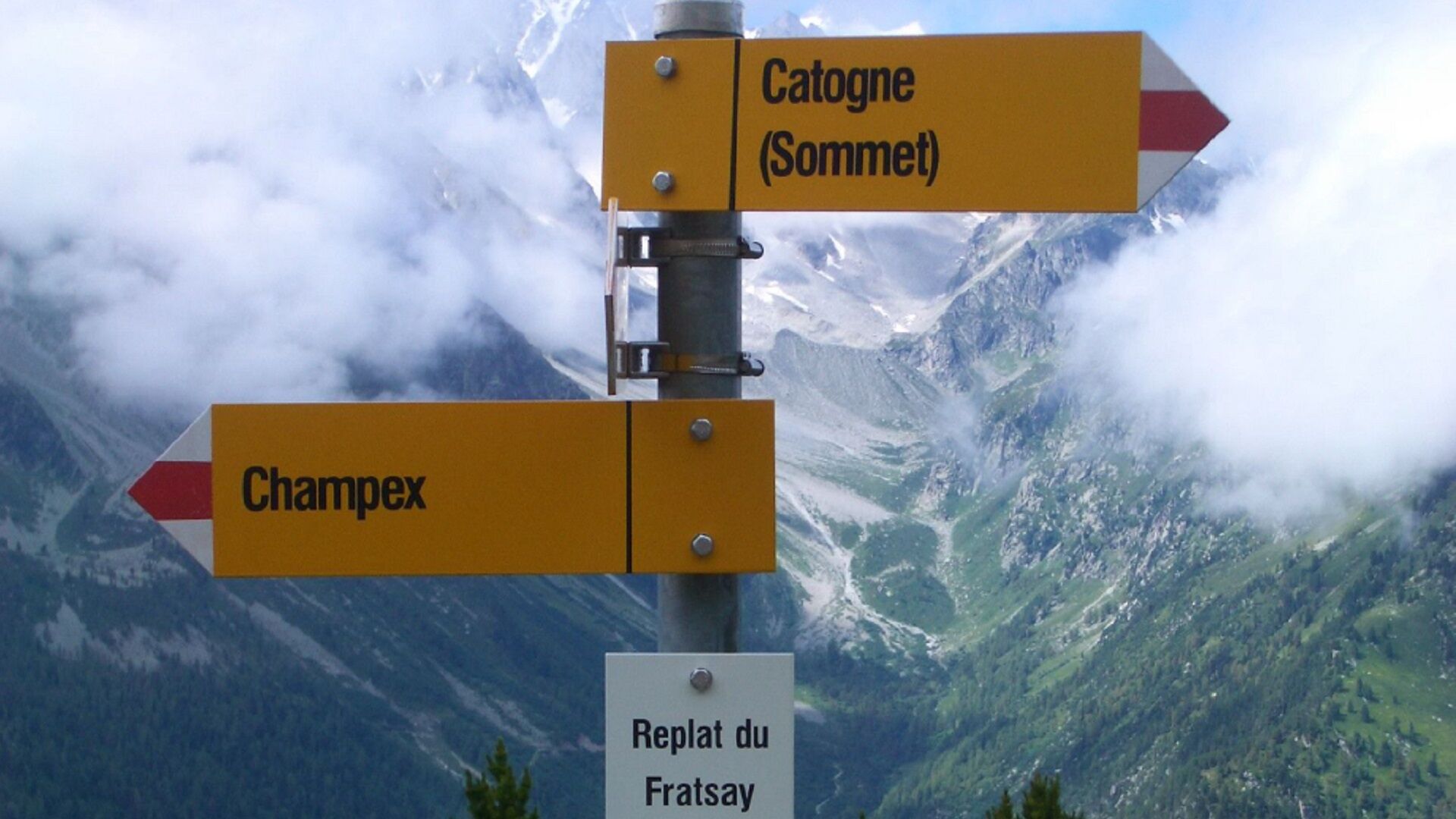
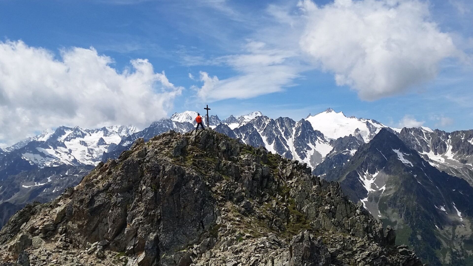
Day hike to the top of Catogne
- Difficulty
-
difficult
- Rating
-
- Starting point
-
Champex-Lac
- Route
-
Champex-LacChampex d'en haut1.7 kmChampex d'en bas2.5 kmLe Catogne (2,598 m)7.7 kmChampex-Lac11.9 km
- Best season
-
JanFebMarAprMayJunJulAugSepOctNovDec
- Description
-
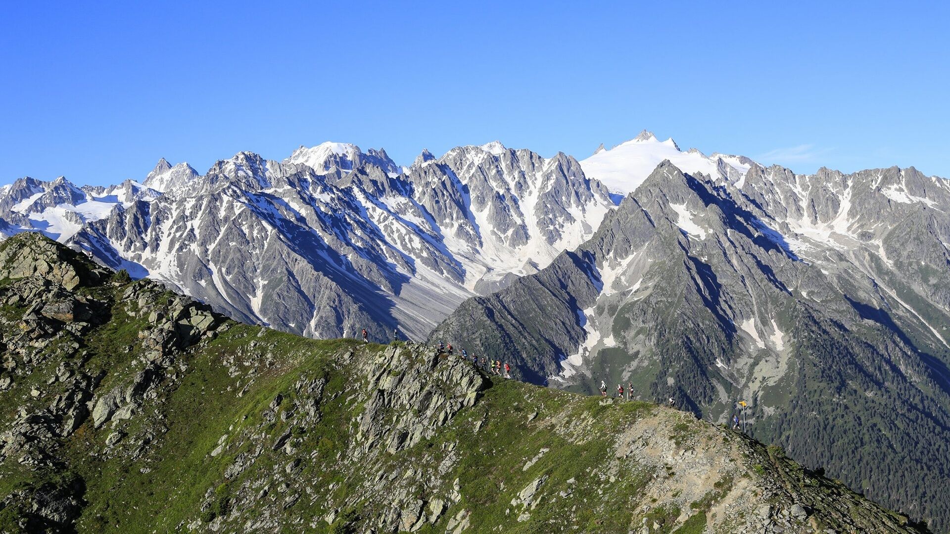
From Champex-Lac, go towards Champex-d'En Bas to reach the mythical summit of Catogne before going down by the south ridge to reach the resort again. About 5 hours of walking.
- Directions
-
Departure from Champex-Lac direction Champex-d'en Haut (chairlift) then Champex-d'en-Bas. Turn right at La Poya and climb to the top of the Catogne. Return towards the south with a superb view of the lake of Champex.
- Highest point
- 2,579 m
- Endpoint
-
Champex-Lac
- Height profile
-
 © outdooractive.com
 - Equipment
-
Walking shoes, sticks.
- Safety instructions
-
Several dizzying passages
- Directions
-
Exit the motorway at Martigny. Follow the direction Grand-Saint-Bernard then leave the main road at Orsières and follow Champex-Lac.
It is also possible to leave the main road at Bovernier and go through Les Valettes but the road is narrow and very winding.
- Public transportation
- Parking
-
Large free car park at the foot of the chairlift.


- Author
-
The tour N. 12 Le Catogne is used by outdooractive.com provided.
GPS Downloads


General info
Healthy climate
A lot of view
Other tours in the regions
-
Thyon les Collons
1435
-
Pays du Saint-Bernard
319
-
Champex-Lac
100