

- Brief description
-
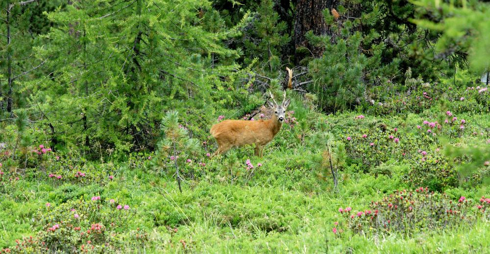
This path through the shady forest of Swiss stone pine and larch is wonderfully relaxing. It’s peaceful; depending on time of day there’s hardly anyone around. There’s even the chance of spotting roe deer.
- Difficulty
-
easy
- Rating
-
- Starting point
-
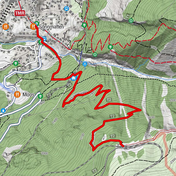
Riffelalp (2,211 m)
- Route
-
RiffelalpFindelbach (1,770 m)2.4 kmKapelle der Heiligen Familie3.1 kmZermatt (1,608 m)3.1 km
- Best season
-
JanFebMarAprMayJunJulAugSepOctNovDec
- Description
-
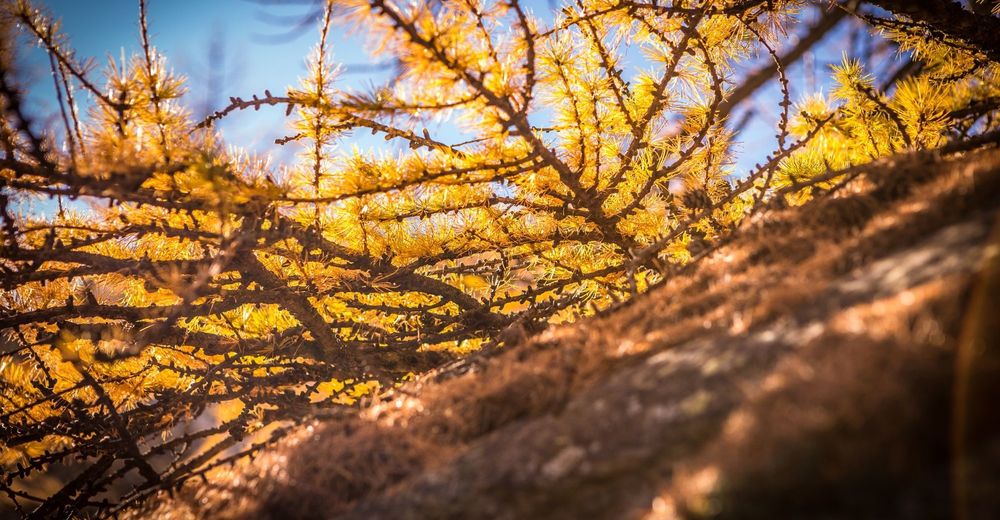
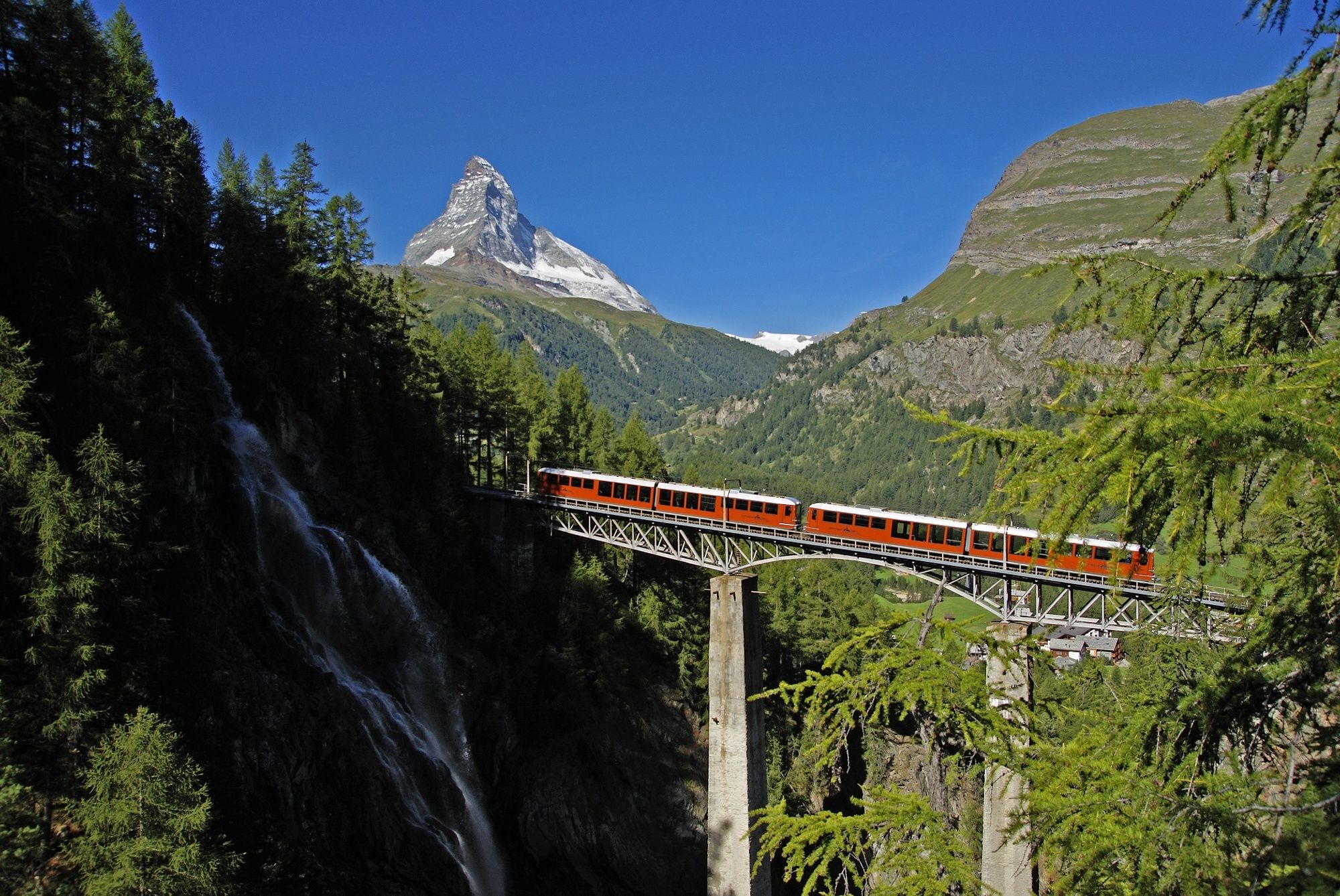
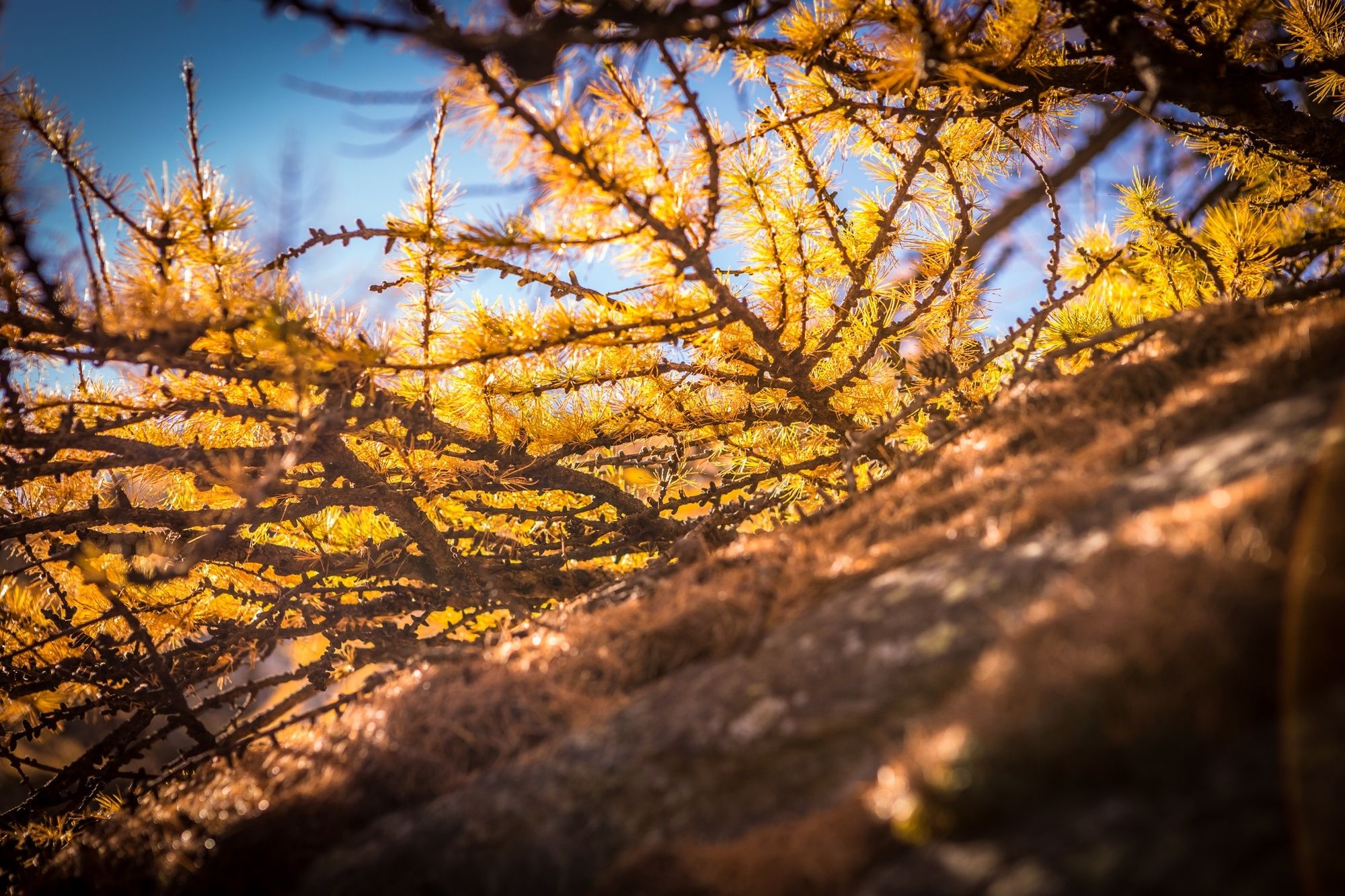
The Vorderi Wälder region is a nature reserve, home to numerous roe deer. The Swiss stone pine, “King of the Alps”, is as much a feature of the Zermatt landscape as the Matterhorn and the glaciers. The wood, resin and needles of the Swiss stone pine contain a volatile substance called pinosylvin whose scent has a beneficial effect on humans. When a forest of Swiss stone pine is bathed in strong sunshine, the air is full of this soothing aroma.
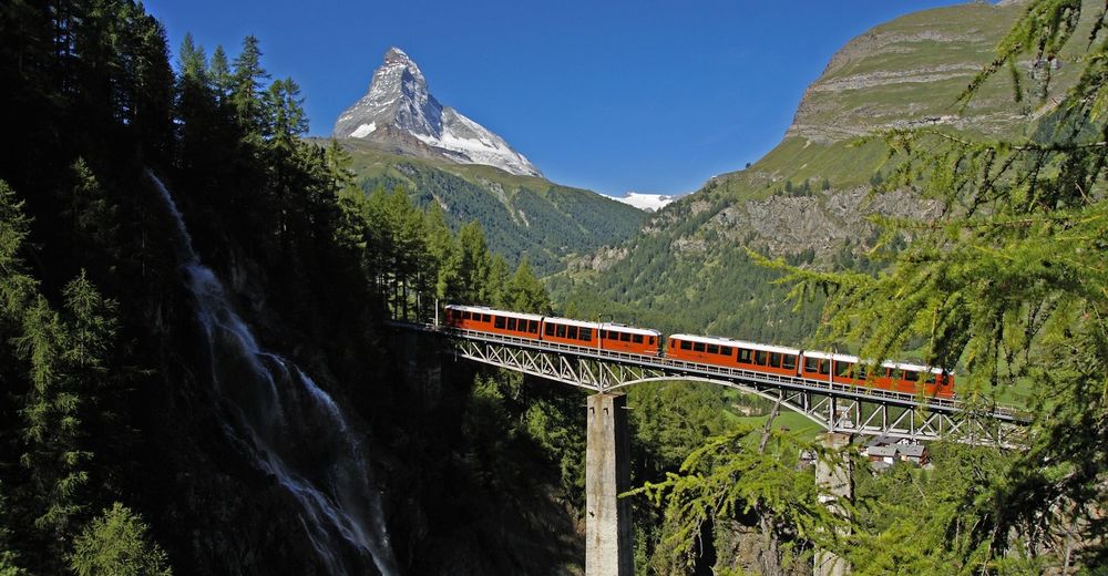
The Swiss stone pine is also known as the Swiss pine, Arolla pine or cembra pine Swiss stone pines can grow to an age of 1,000 years and a height of 25 m Swiss stone pine needles grow in bunches of five At Riffelalp, in summer: Europe’s highest-altitude tram
The forests of Swiss stone pine and larch offer a treat for the eyes, too: endless different shades of green all around, offsetting the copper colour of the forest floor due to the soft pine needles that cover the path. Another delightful surprise is the sight, at a bend in the path, of a waterfall plunging into the Findelbach river. - Directions
-
Riffelalp - Findelbach - Winkelmatten (chapel)
(Hiking time in reverse direction: approx. 1h 40)
This hike is marked on the signposts as “Arvenweg”.
- Highest point
- 2,198 m
- Endpoint
-
Winkelmatten (1,650 m)
- Height profile
-
 © outdooractive.com
 - Equipment
-
We recommend:
Good footwear Hiking poles (optional) Clothing suitable for the weather (always carry a waterproof) - Safety instructions
-
Plan every mountain tour carefully and adapt to participants’ fitness level as well as the weather and season.
Weather conditions can change quickly in the mountains. Appropriate clothing is therefore essential, along with adequate supplies of food and water. In uncertain weather, turn back in good time.
Inform others of planned route, and whenever possible avoid going alone.
Do not leave the marked routes; do not venture onto glaciers without a mountain guide.
Please be considerate to other walkers and to plants and animals.
Take note of the warning signs drawing attention to the constant danger in river beds and along watercourses below dams and reservoirs. - Tips
-
Enjoy the typical postcard panorama of the Matterhorn. You have an especially beautiful view from one of the mountain restaurant terraces around Riffelalp.
When you are at Riffelalp, be sure to visit the "Herz Jesu" chapel.
- Directions
-
Zermatt is car-free. Private vehicles are permitted only as far as Täsch (5 km before Zermatt). The Täsch–Zermatt road is closed to the public.
Onward travel to Zermatt is either by private taxi or shuttle train. Trains depart every 20 minutes; the journey takes about 12 minutes, and ends at the Bahnhofplatz in Zermatt. - Public transportation
-
By train to the Matterhorn village: 3½ hours from Zürich airport or 4 hours from Geneva airport. Change at Visp onto the Matterhorn Gotthard Bahn (Matterhorn Gotthard Railway). From Visp, the railway leads through the Mattertal valley past idyllic small villages to Zermatt.
Zermatt is also the start and finish point for the world-famous Glacier Express panoramic train journey (Zermatt to St. Moritz or Davos). - Parking
-
Täsch has car parks with both covered and open-air parking – e.g. at the Matterhorn Terminal or privately operated facilities.
Onward travel: see “Getting there”.

- Author
-
The tour Swiss Stone Pine Trail (Nr. 14) is used by outdooractive.com provided.


General info
-
Unterwallis
1192
-
Mattertal
555
-
Zermatt
154


