

- Brief description
-
The Rothorn Hut attracts a colourful variety of mountaineers seeking high-altitude challenges. Regular mountain hikers, too, enjoy the climb up to the Eseltschuggen.
- Difficulty
-
difficult
- Rating
-
- Starting point
-
Zermatt (1,620 m)
- Route
-
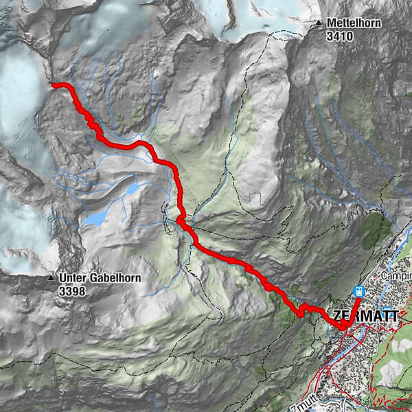
Zermatt (1,608 m)0.3 kmBerggasthaus Trift (2,337 m)3.9 kmRothornhütte (3,198 m)8.1 km
- Best season
-
JanFebMarAprMayJunJulAugSepOctNovDec
- Description
-
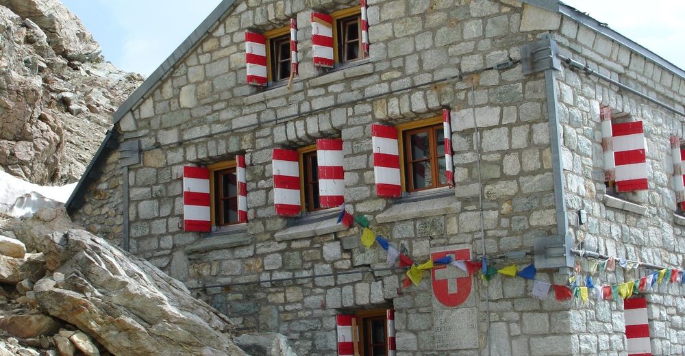
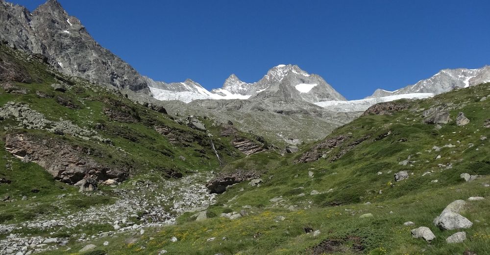
The Rothorn Hut at the foot of the Zinalrothorn is a popular starting point for ascents of various attractive peaks including the Zinalrothorn, Obergabelhorn, Wellenkuppe, Trifthorn and Aeschhorn. After the Viehboden area, hikers leave the gentle world of the lush alpine pastures to enter a mysterious landscape carved by glaciers long ago, formed of stone, rock, ice and snow. Here, hikers should keep an eye on the sky above: a pair of eagles can often be seen circling overhead.
Abundant wildlife including chamois Eagles in the region Alpine flora: alpine toadflax may be spotted among the scree, providing orange-and-violet splashes of colour - Directions
-
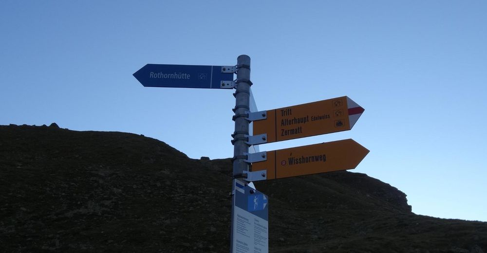
Zermatt (station) - Alterhaupt (Edelweiss) - Trift - Rothorn Hut
(Hiking time for the walk back: approx. 3h)
This hike is marked on the signposts as “Rothornhütte”.
- Highest point
- 3,169 m
- Endpoint
-
Rothorn Hut SAC (3,198 m)
- Height profile
-
 © outdooractive.com
 - Equipment
-
We recommend:
Good footwear Hiking poles (optional) Clothing suitable for the weather (always carry a waterproof)Important! A good head for heights, a sure foot and mountain experience are needed
- Safety instructions
-
Plan every mountain tour carefully and adapt to participants’ fitness level as well as the weather and season.
Weather conditions can change quickly in the mountains. Appropriate clothing is therefore essential, along with adequate supplies of food and water. In uncertain weather, turn back in good time.
Inform others of planned route, and whenever possible avoid going alone.
Do not leave the marked routes; do not venture onto glaciers without a mountain guide.
Please be considerate to other walkers and to plants and animals.
Take note of the warning signs drawing attention to the constant danger in river beds and along watercourses below dams and reservoirs. - Tips
-
Please contact the Rothorn Hut for the most up-to-date information on trail conditions.
A hike to the Rothorn Hut needs to be planned way ahead of time, because the hut is only open each summer for a short time from about mid-July to mid-September.
- Directions
-
Zermatt is car-free. Private vehicles are permitted only as far as Täsch (5 km before Zermatt). The Täsch–Zermatt road is closed to the public.
Onward travel to Zermatt is either by private taxi or shuttle train. Trains depart every 20 minutes; the journey takes about 12 minutes, and ends at the Bahnhofplatz in Zermatt. - Public transportation
-
By train to the Matterhorn village: 3½ hours from Zürich airport or 4 hours from Geneva airport. Change at Visp onto the Matterhorn Gotthard Bahn (Matterhorn Gotthard Railway). From Visp, the railway leads through the Mattertal valley past idyllic small villages to Zermatt.
Zermatt is also the start and finish point for the world-famous Glacier Express panoramic train journey (Zermatt to St. Moritz or Davos). - Parking
-
Täsch has car parks with both covered and open-air parking – e.g. at the Matterhorn Terminal or privately operated facilities.
Onward travel: see “Getting there”.

- Author
-
The tour Hike to the Rothorn Hut (Nr. 34) is used by outdooractive.com provided.


General info
-
Oberwallis
1873
-
Mattertal
555
-
Zermatt
154


")
