
- Brief description
-
This varied walk offers a fascinating experience of different aspects of the alpine world: views of towering mountains, a surprising variety of alpine flora and a glimpse behind the scenes of a mountaineers’ hut.
- Difficulty
-
difficult
- Rating
-
- Starting point
-
Täsch (1,450 m)
- Route
-
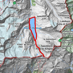
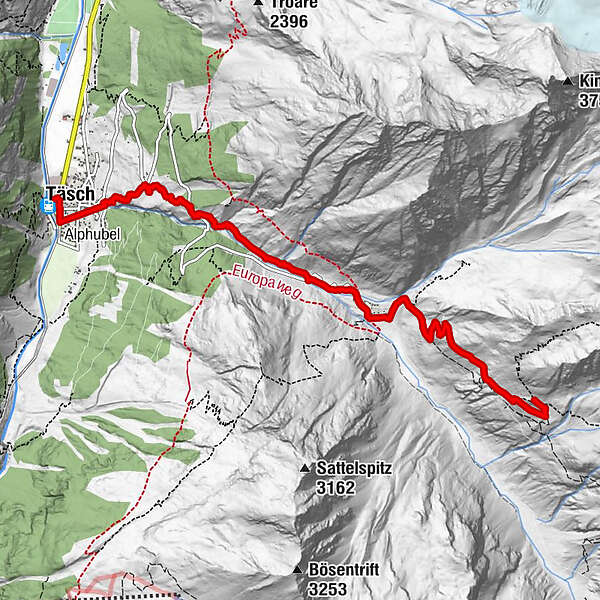
Täsch (1,449 m)0.0 kmRestaurant Walliserkanne0.1 kmTäscherhof0.1 kmEggenstadel2.4 kmTäschalp Restaurant & Lodge4.1 kmOttafe (2,205 m)4.1 kmTäschhütte (2,701 m)7.2 km
- Best season
-
JanFebMarAprMayJunJulAugSepOctNovDec
- Description
-
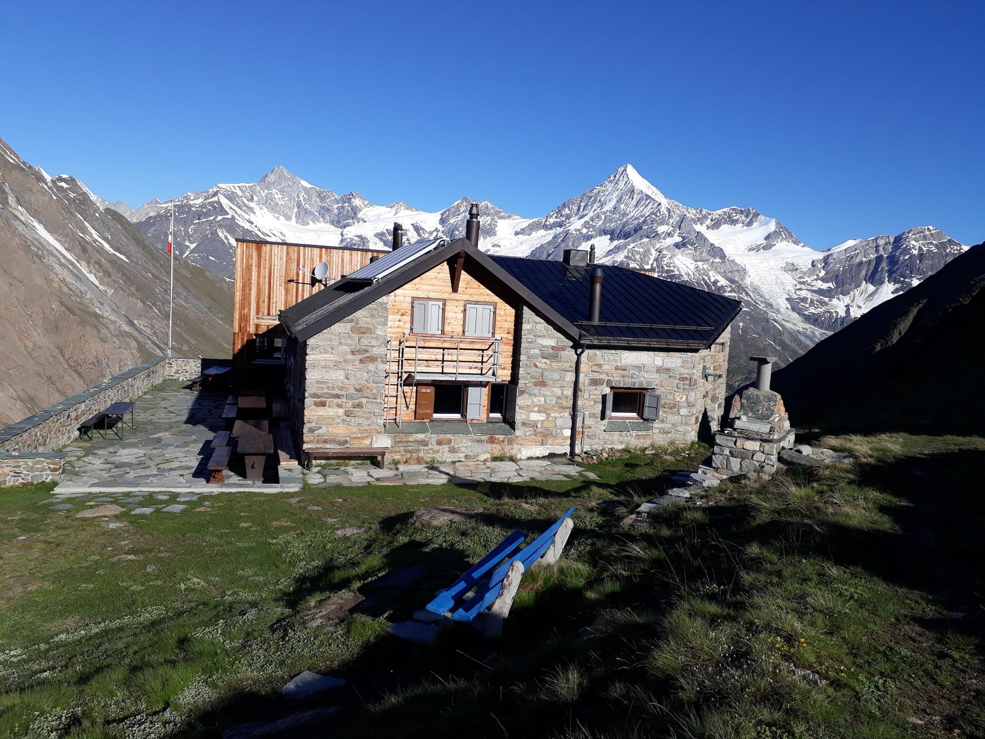
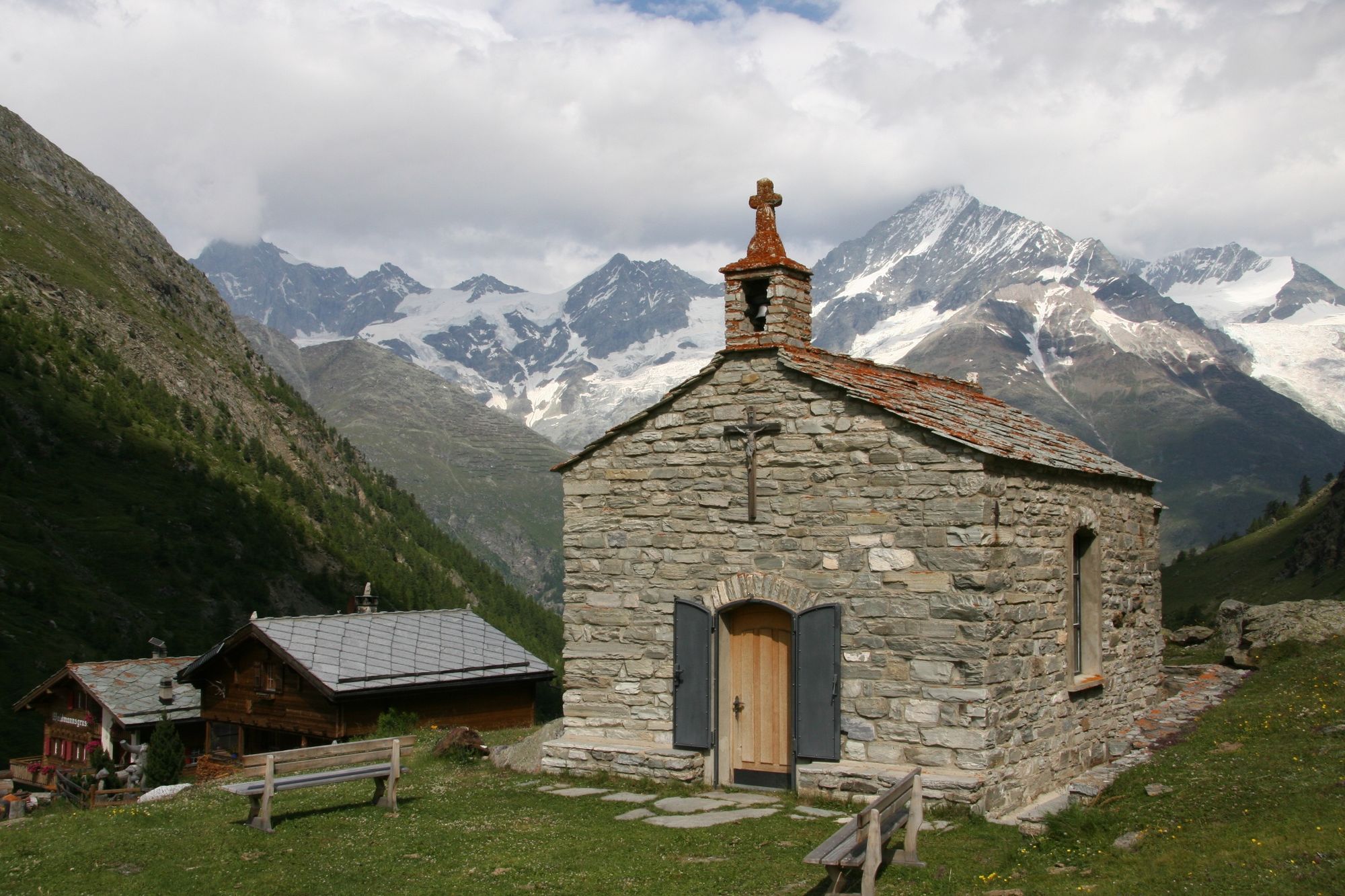
The cows grazing at Täschalp produce milk that is made into cheese on the spot. Nature lovers admire the variety of grasses, lichens and alpine flowers. As the path proceeds, it reveals ever more dramatic views. Up at the Täsch Hut, hikers meet mountaineers who have set their sights high: on the Alphubel, Täschhorn and other 4,000-metre peaks.
Views of the Zinalrothorn, Schalihorn, Weisshorn View of the Dufourspitze from the Täsch Hut Plentiful wildlife Variant: by taxi from Täsch to Täschalp - Directions
-
Täsch (station) - via Täschberg - Täschalp - Täsch Hut
(Hiking time for the walk back: approx. 2h 20)
- Highest point
- 2,698 m
- Endpoint
-
Täsch Hut (2,701 m)
- Height profile
-
 © outdooractive.com
 - Equipment
-
We recommend:
Good footwear Hiking poles (optional) Clothing suitable for the weather (always carry a waterproof) - Safety instructions
-
Plan every mountain tour carefully and adapt to participants’ fitness level as well as the weather and season.
Weather conditions can change quickly in the mountains. Appropriate clothing is therefore essential, along with adequate supplies of food and water. In uncertain weather, turn back in good time.
Inform others of planned route, and whenever possible avoid going alone.
Do not leave the marked routes; do not venture onto glaciers without a mountain guide.
Please be considerate to other walkers and to plants and animals.
Take note of the warning signs drawing attention to the constant danger in river beds and along watercourses below dams and reservoirs. - Tips
-
Täschalp: cheese and Ziger soft cheese for sale.
- Additional information
- Directions
-
The drive from Visp to Täsch takes about 30–40 min. The road leads through the wild and beautiful Mattertal valley.
- Public transportation
-
By train to Täsch: less than 3½ hours from Zürich airport or 4 hours from Geneva airport. Change at Visp onto the Matterhorn Gotthard Bahn (Matterhorn Gotthard Railway). From Visp, the railway leads through the Mattertal valley past idyllic small villages to Täsch.
- Parking
-
Täsch has car parks with both covered and open-air parking – e.g. at the Matterhorn Terminal or privately operated facilities.
- Author
-
The tour Hike to the Täsch Hut (Nr. 45) is used by outdooractive.com provided.


General info
-
Oberwallis
1887
-
Mattertal
555
-
Täsch
196