


- Brief description
-
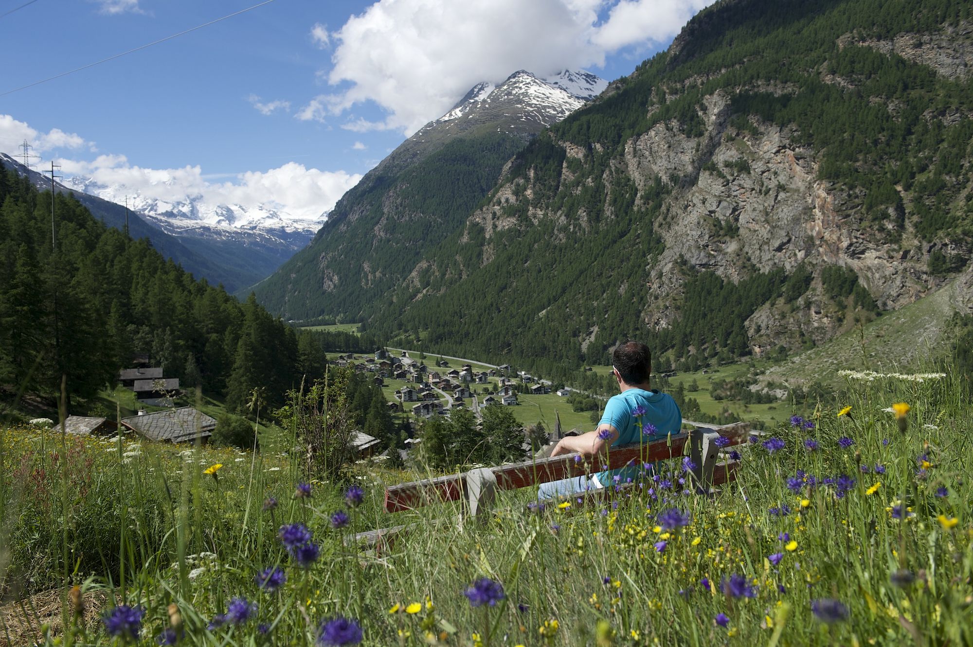
This walk through the protective forest above Randa, suitable for children, often has surprises in store: ibex may even put in an appearance.
- Difficulty
-
medium
- Rating
-
- Starting point
-
Randa (1,439 m)
- Route
-
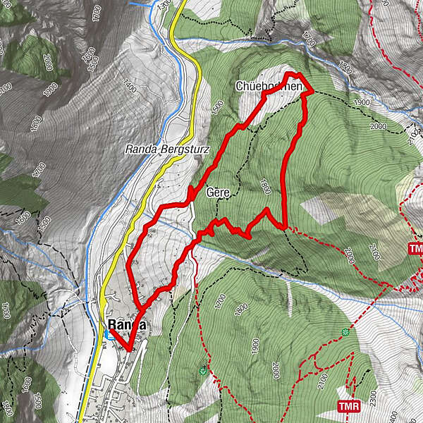
Randa (1,406 m)0.0 kmTreff 4940.3 kmKirche St. Sebastian0.3 kmChüebodmen2.4 kmGere4.5 kmKirche St. Sebastian5.5 kmTreff 4945.6 kmRanda (1,406 m)5.8 km
- Best season
-
JanFebMarAprMayJunJulAugSepOctNovDec
- Description
-
The landscape around Randa offers a glimpse of the ancient alpine protective forests of towering larches and Swiss stone pines. In this world of moss-covered rocks and sinister boulders, twisted tree trunks and lichen and a forest floor as soft as a carpet, imaginations run wild. A delight for families!
Appropriate for children from age 6 Medelplatte rock ledge with wayside shrine and statue of the Virgin Mary Chüebodmen with small chapel dedicated to the Virgin Mary - Directions
-
Randa (station) - Chüebodmen - Waldweg - Lärchberg - Gere - Randa (station)
(Hiking time in reverse direction: approx. 2h 20)
This hike is marked on the signposts as “Waldweg”.
- Highest point
- 1,893 m
- Endpoint
-
Randa (1,439 m)
- Height profile
-
 © outdooractive.com
 - Equipment
-
We recommend:
Good footwear Hiking poles (optional) Clothing suitable for the weather (always carry a waterproof) - Safety instructions
-
Plan every mountain tour carefully and adapt to participants’ fitness level as well as the weather and season.
Weather conditions can change quickly in the mountains. Appropriate clothing is therefore essential, along with adequate supplies of food and water. In uncertain weather, turn back in good time.
Inform others of planned route, and whenever possible avoid going alone.
Do not leave the marked routes; do not venture onto glaciers without a mountain guide.
Please be considerate to other walkers and to plants and animals.
Take note of the warning signs drawing attention to the constant danger in river beds and along watercourses below dams and reservoirs. - Tips
-
Visit the Lorihiischi built in 1256, which is now a museum allowing you to see into the domestic culture of the Walser.
- Directions
-
The drive from Visp to Randa takes about 30–40 min. The road leads through the wild and beautiful Mattertal valley.
- Public transportation
-
By train to Randa: less than 3½ hours from Zürich airport or 4 hours from Geneva airport. Change at Visp onto the Matterhorn Gotthard Bahn (Matterhorn Gotthard Railway). From Visp, the railway leads through the Mattertal valley past idyllic small villages to Randa.
- Parking
-
There is a public multi-storey car park by the railway station in Randa; simply follow the signs.

- Author
-
The tour Randa Forest Trail (Nr. 66) is used by outdooractive.com provided.


General info
-
Oberwallis
1873
-
Mattertal
555
-
Täsch
195


