

- Brief description
-
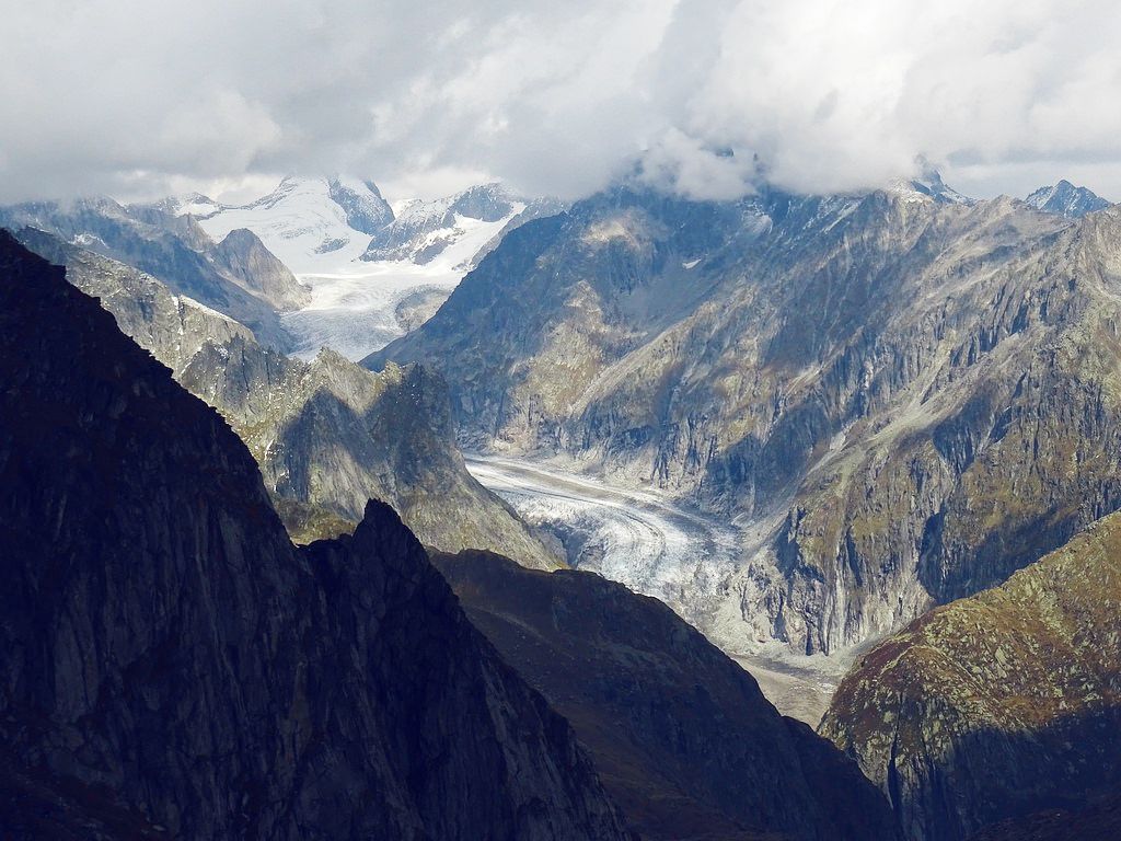
High-altitude hike for a view of the second-longest glacier in the Alps – and over the Goms valley and the 4,000-metre peaks of Valais. Scenic ride to hike starting point by chairlift.
- Difficulty
-
medium
- Rating
-
- Starting point
-
Richenen chairlift summit station
- Route
-
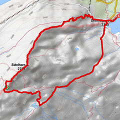
Richinen (2,080 m)0.0 km
- Best season
-
JanFebMarAprMayJunJulAugSepOctNovDec
- Description
-
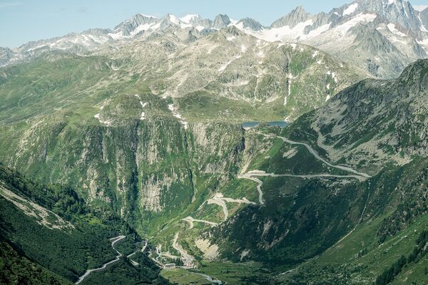
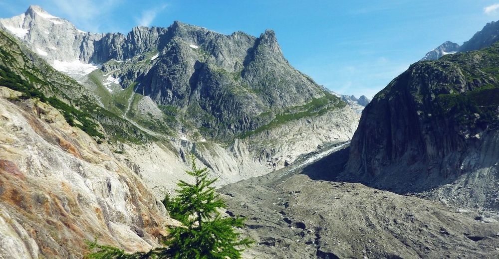
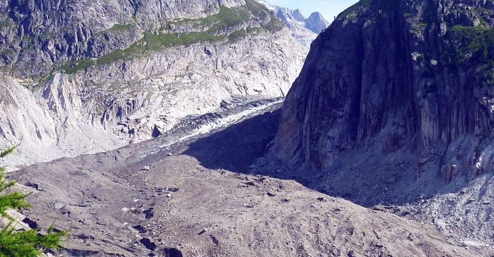
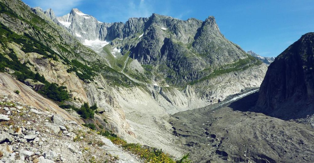
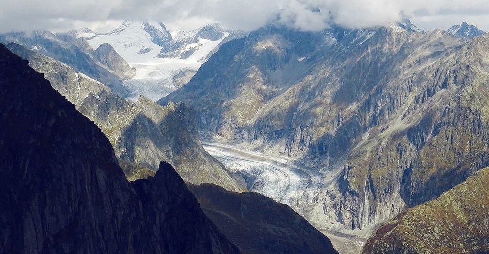
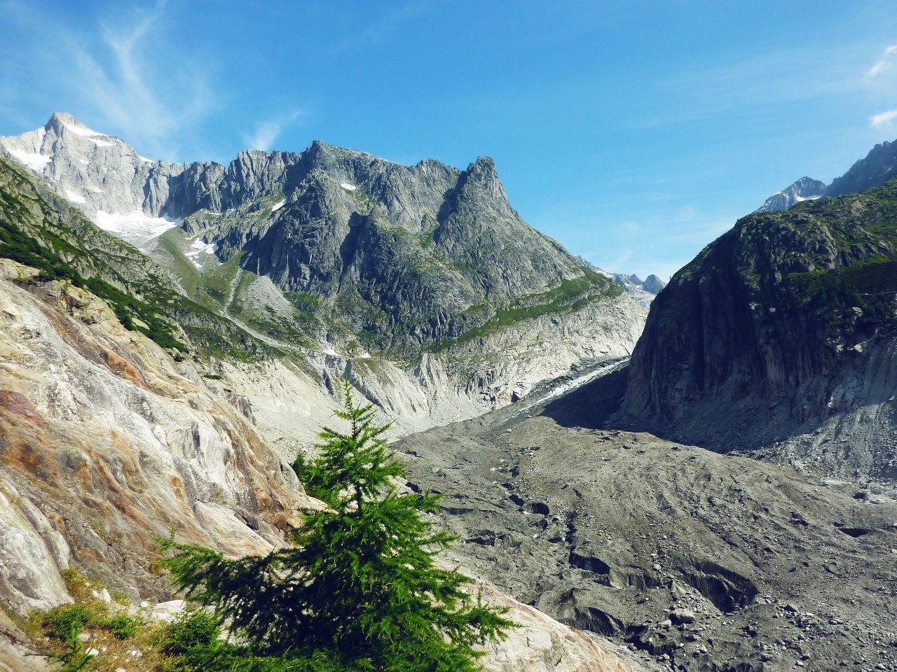
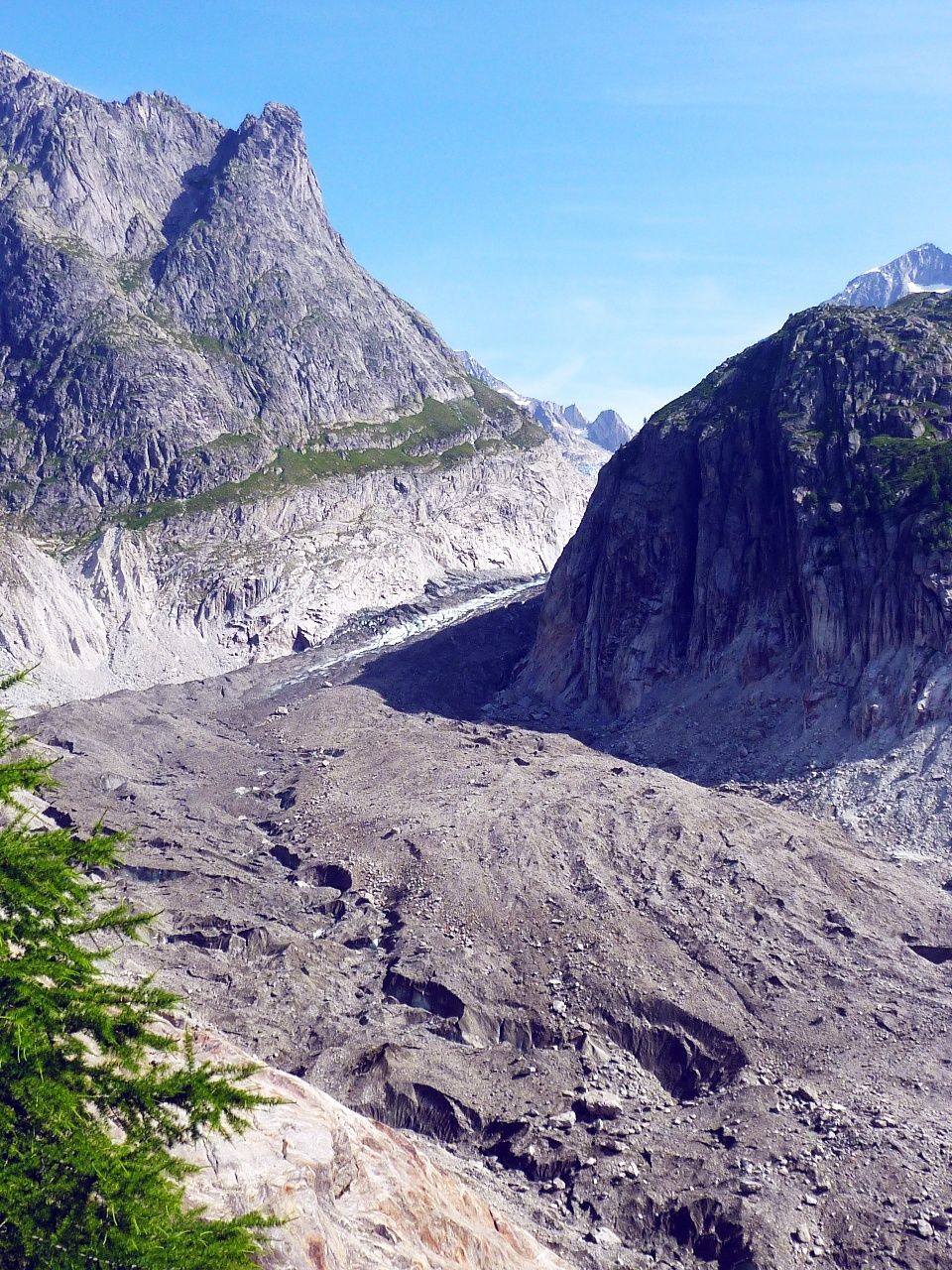
The Fiescher Glacier is the second-longest in the Alps, at nearly 15 km. It is one of the jewels of the UNESCO World Heritage Site of “Swiss Alps Jungfrau-Aletsch”, which protects the most glaciated region in the Alps. The reserve is home to nine peaks above 4,000 m including the mighty Finsteraarhorn (4,273 m), which towers high above the glacier.
This exhilarating hike climbs the slopes above Bellwald to a vantage point that reveals an impressive view up the river of ice. From here, the trail returns to the starting point via another path a couple of hundred metres higher, showcasing spectacular views of the upper Rhône valley.
A leisurely chairlift ride from Bellwald brings walkers up to the starting point of the hike at Richenen. This is a popular sport for families with its friendly mountain restaurant, lake and adventure trail for young children. Stations include a play ship by the lake, a tree house, slide, musical instruments, tests of skill and a research station that encourages young guests to get to know the local flora and fauna.
Walkers should also allow time to explore the village of Bellwald, one of the oldest and best-preserved in Valais, located on one of the sunniest patches of mountainside in the Goms valley. Life here changed little for centuries until the cable car up from Fürgangen railway station opened in 1956. The car-free village centre, with its ancient houses, sun-bronzed wooden stables and baroque church, is full of historical charm. Families, especially, appreciate the tranquillity: no wonder the village has won the coveted “Family Destination” label of the Swiss Tourism Federation.
Highlights:
Sunny, high-level hike with sweeping views of the upper Rhône valley View of the second-longest glacier in the Alps, part of the UNESCO World Heritage Site of Swiss Alps Jungfrau-Aletsch Scenic chairlift ride to hike starting point: restaurant and children’s adventure play trail - Directions
-
The hike starts at Richenen chairlift summit station, by the mountain restaurant. From here, the trail climbs steadily north-westwards up the flank of the Fiescher valley to reach the vantage point known as Gletscherblick (“glacier view”). The return leg follows the outward route for a couple of hundred metres before branching to the left and following a higher route back to Richenen.
The itinerary can easily be made into a longer hike – for example, by walking from Richenen back down to Bellwald, instead of taking the chairlift.
Various local walks incorporate two spectacular suspension footbridges, among the latest additions to the growing network in Valais. The Aspi-Titter bridge, which opened in 2016, spans the gorge just below the Fiescher Glacier: 160 m long, it floats 120 m above the river bed. The Goms Bridge, which opened in 2015, spans the Rhône close to the bottom station of the cable car down from Bellwald, and offers an exhilarating 280-metre walk through thin air.
- Highest point
- 2,426 m
- Endpoint
-
Richenen chairlift summit station
- Height profile
-
 © outdooractive.com
 - Equipment
-
We recommend:
good footwear clothing suitable for the weather: always carry a waterproof jacket hat or cap sunscreen bottle for water picnic camera binoculars (optional) hiking poles (optional) printout of this hike (click “Print” icon, to download)For certain walks:
Swimwear - Safety instructions
-
Use of the trails and the information on this website is at hikers’ own risk. Local conditions may entail changes to routes. Valais/Wallis Promotion accepts no liability for the accuracy and completeness of information on this website.
For all hikes:
Bring a map. Download full description of this route including large-scale map by clicking on “Print” icon, top right of this page. Use marked trails only, and observe all signposting – for your own safety, to safeguard grazing animals and to avoid disturbing wildlife. Close gates after passing through. Please be considerate to other trail users, and to the plants and animals. Do not leave any waste in nature.For mountain hikes:
Take extra care protecting yourself from the sun at altitude. UV radiation can be exceptionally strong, even in cloudy weather. Plan hike carefully: take into consideration fitness level of each participant, weather forecast and season. Weather conditions can change quickly in the mountains, without warning. Appropriate clothing is therefore essential, along with adequate supplies of food and water. In uncertain weather, turn back in good time.For high-altitude hikes:
Inform others of the route you plan to take. Whenever possible, avoid going alone. Do not venture onto glaciers without a mountain guide. Take note of the warning signs that point out the constant danger in river beds and along watercourses below dams and reservoirs: water levels may rise rapidly without warning. - Tips
-
Free chairlift rides in summer in Bellwald with the guest card.
- Additional information
- Directions
-
A9 motorway and main road up the Rhône valley to Fürgangen. At roundabout, take left turning for Bellwald.
- Public transportation
-
Train to Fürgangen (Matterhorn Gotthard Bahn), then cable car up to Bellwald. Walk 10 minutes up through the village to chairlift station for Richenen. Find full timetable information at sbb.ch
- Parking
-
Large car parks near the bottom station of the Richenen chairlift.

-

-
AuthorThe tour Hike to the glacier viewpoint from Bellwald is used by outdooractive.com provided.


General info
-
Aletsch Arena
1471
-
Goms
525
-
Bellwald
88