
- Brief description
-
The final stage of the Chemin du Vignoble («Vineyard Trail») links French- and German-speaking Valais, and takes in medieval villages, a vast nature park and an innovative wine centre.
- Difficulty
-
medium
- Rating
-
- Starting point
-
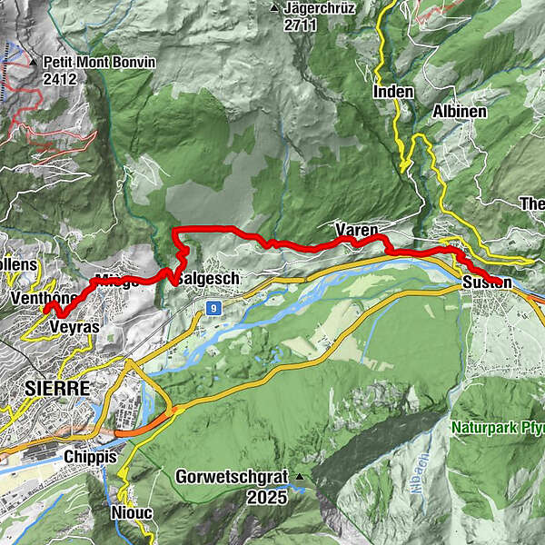
Venthône
- Route
-
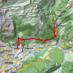
Venthen (799 m)église St-Sébastien0.3 kmSiders (533 m)0.6 kmVeyras (645 m)0.7 kmEglise de Miège2.1 kmMiesen (702 m)2.1 kmLe Relais Miègois2.2 kmVaronne9.0 kmLeuk Stadt (731 m)11.4 kmSusten (630 m)12.5 kmLeuk (623 m)12.6 km
- Best season
-
JanFebMarAprMayJunJulAugSepOctNovDec
- Description
-
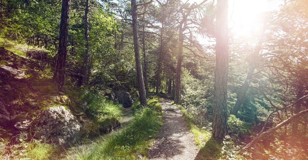
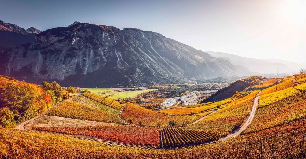
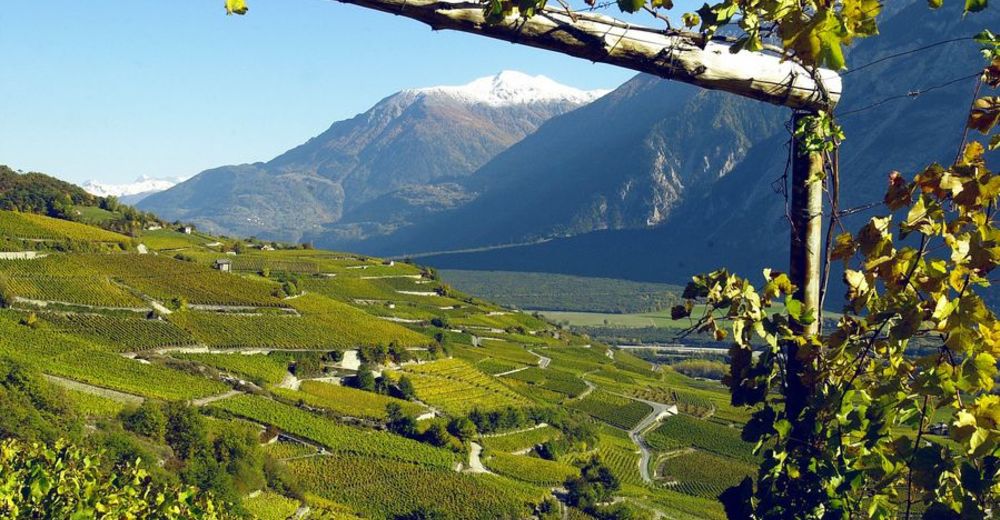
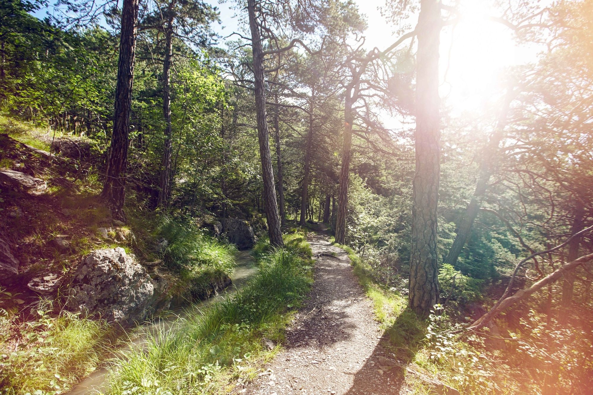
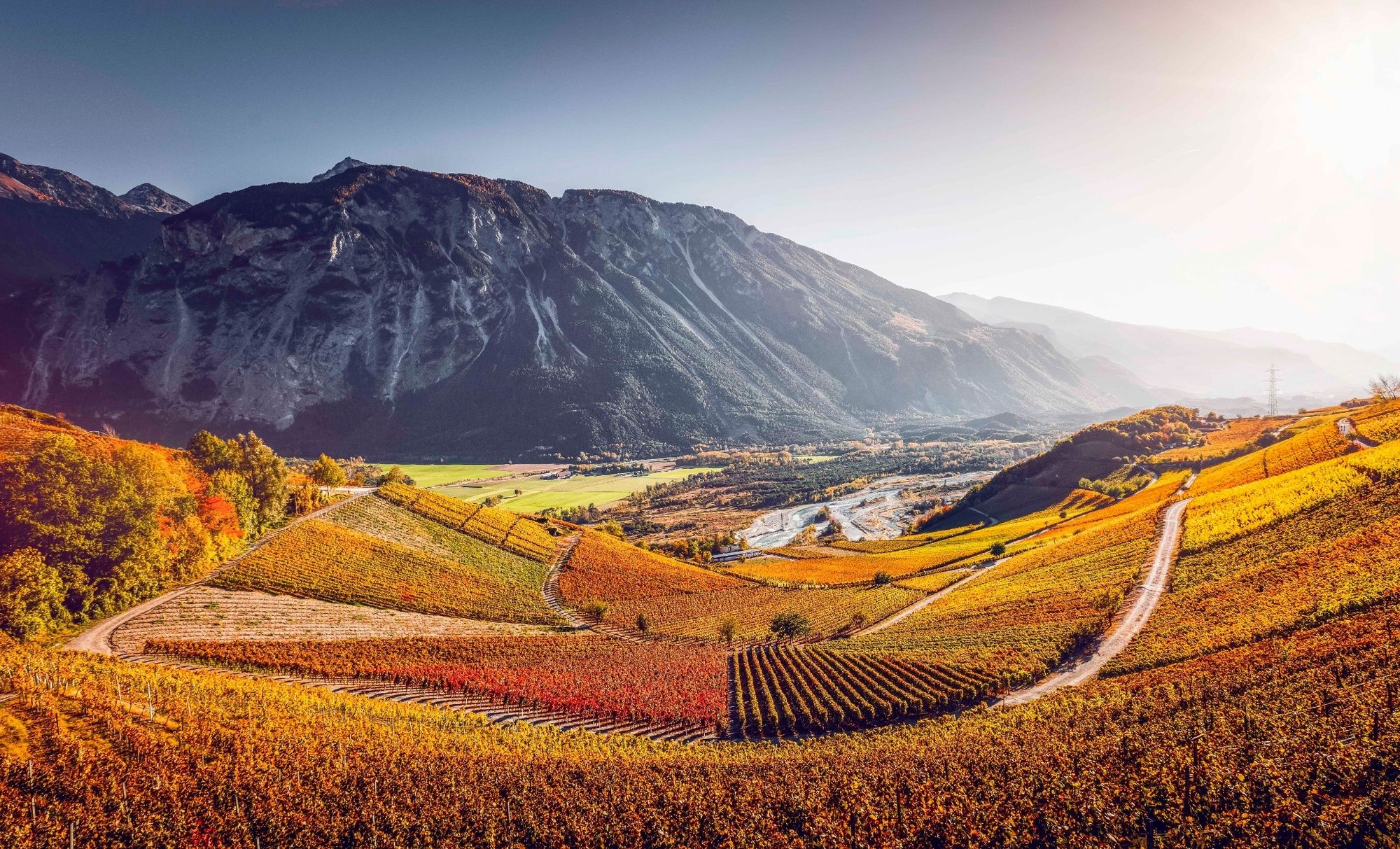
There are three versions of the Chemin du Vignoble («Vineyard Trail») through the main winegrowing villages of Valais: for motorists, for cyclists and for hikers. The 4-stage, 65-km hiking trail culminates in this dramatic walk along the wildest stretch of the entire lower Rhône valley.
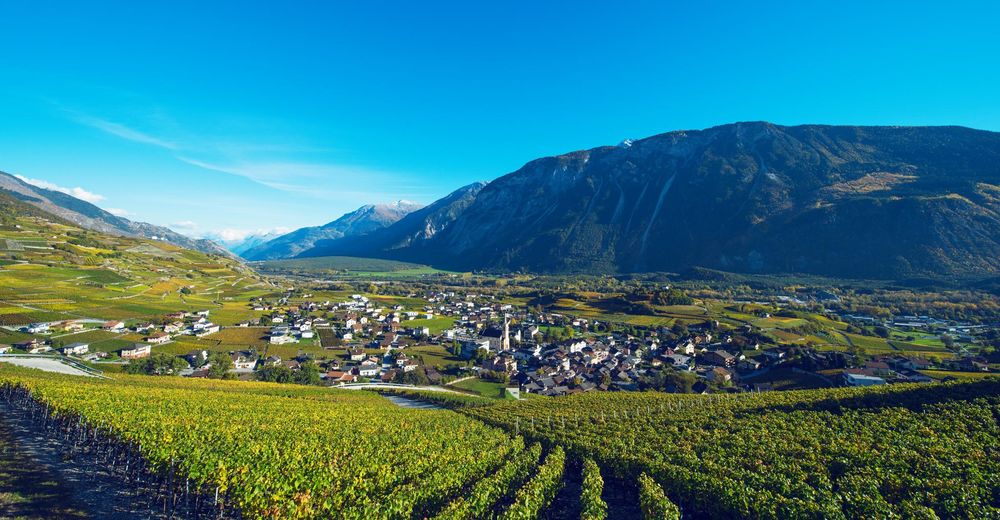
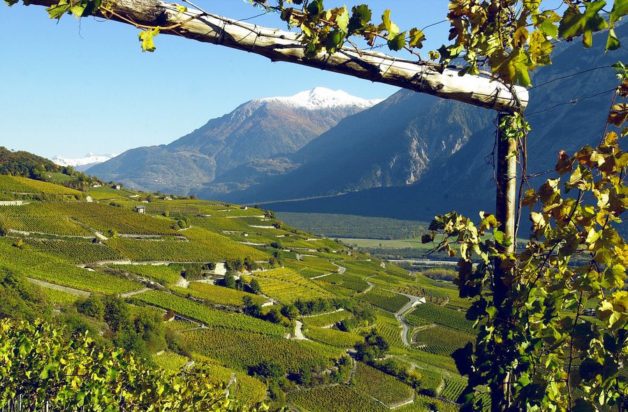
Because of the unstable geology, this stretch of the Rhône has never been tamed. The branching river, its stony islands and the vast pine forests on its southern banks – among the largest in the Alps – form the heart of the Pfyn-Finges Nature Park. This vast reserve, one of Switzerland’s biodiversity hotspots, stretches from the river up to mountaintops and glaciers, taking in the vineyards on the north bank – through which our trail leads.
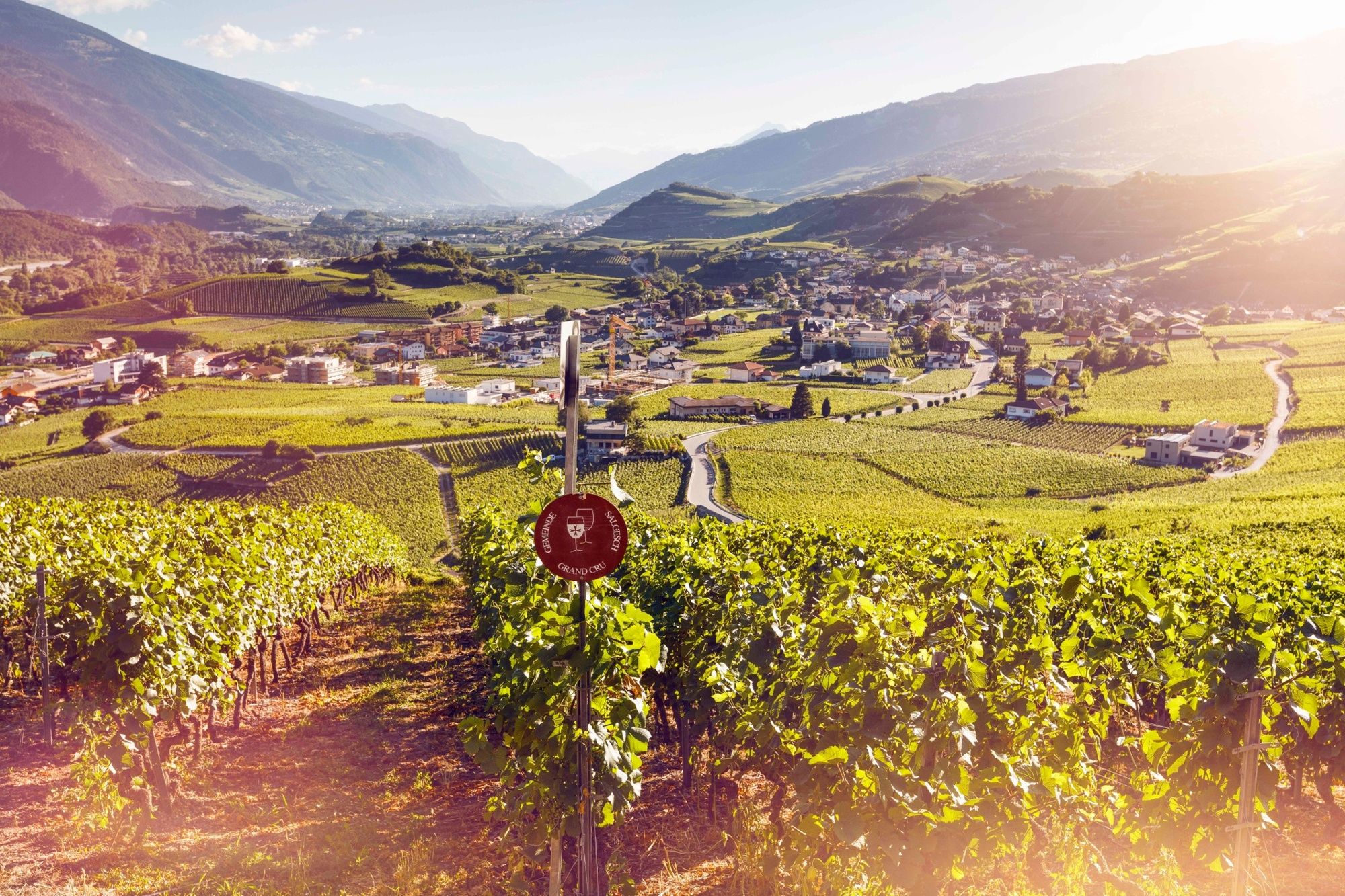
This leg of the Chemin du Vignoble is notable for another reason: it crosses the river Raspille, which marks the boundary between French- and German-speaking Valais. The atmosphere in French-speaking Venthône and Miège is quite different to that in German-speaking Salgesch, Varen and Leuk – which adds to the charm of this hike.
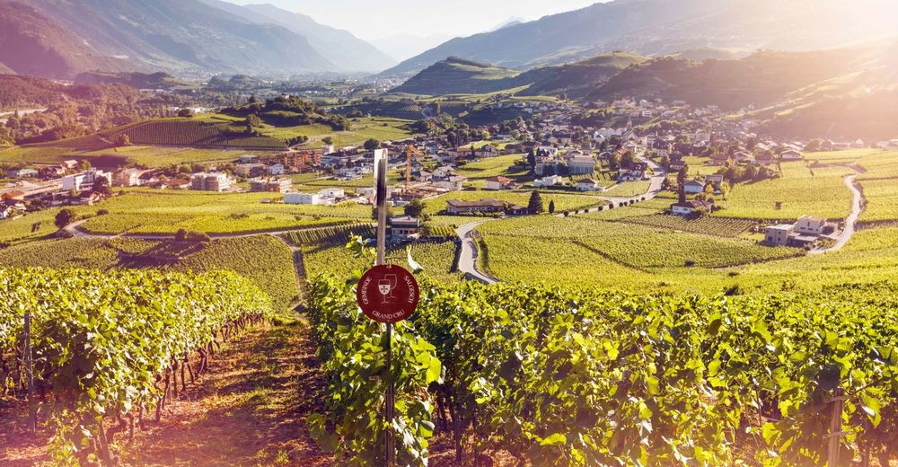
Highlights along the way include the Espace Terroirs in Miège. This innovative visitor centre features an exhibition that explores the way soil and landscape affect vines and wines; there’s also a café-restaurant and a tasting venue with more than 50 wines.
As well as glorious views, the hike promises a rich experience of local history – culminating in Leuk, home to many fine medieval buildings including an impressive castle imaginatively renovated by the leading Swiss architect Mario Botta, now a cultural venue with music, theatre and exhibitions. Leuk is also home to Switzerland’s oldest vine: a Cornalin planted in 1798 in the heart of the village.
Highlights:
Glorious views of the untamed Rhône and vast pine forests of the Pfyn-Finges Nature Park Espace Terroirs in Miège – innovative wine visitor centre Experience of two languages, two cultures Historical village of Leuk, with medieval castle renovated by Mario Botta - Directions
-
The walk begins a short bus ride from Sierre, in the village of Venthône (bus stop «village»). The route is clearly signposted throughout.
In Miège, the Espace Terroirs lies a few metres to the right of the trail in the village centre. This is also the starting point for the «Sentier des Terroirs» (Geology and Grapes Trail), which loops between our route and the Sentier Viticole («Vineyards Trail»). The latter runs from Sierre to Salgesch, downhill from the Chemin du Vignoble, connecting the two sites of the Wine Museum of Valais.
In Varen, it is worth detouring about 200 m south to the hilltop church for a sensational view of the untamed Rhône. This village also has its own charming wine trail, the Pfyfoltruweg («Butterfly Trail»).
In Leuk, allow time to stroll around the village to admire the many historical buildings. On the way out of the village, about 100 m to the right of the trail, the beautifully decorated Ringackerkapelle is one of the finest baroque chapels in Valais.
- Highest point
- 828 m
- Endpoint
-
Leuk, railway station
- Height profile
-
 © outdooractive.com
 - Equipment
-
We recommend:
good footwear clothing suitable for the weather: always carry a waterproof jacket hat or cap sunscreen bottle for water picnic camera binoculars (optional) hiking poles (optional) printout of this hike (click «Print» icon, to download)For certain walks:
Swimwear - Safety instructions
-
Use of the trails and the information on this website is at hikers’ own risk. Local conditions may entail changes to routes. Valais/Wallis Promotion accepts no liability for the accuracy and completeness of information on this website.
For all hikes:
Bring a map. Download full description of this route including large-scale map by clicking on «Print» icon, top right of this page. Use marked trails only, and observe all signposting – for your own safety, to safeguard grazing animals and to avoid disturbing wildlife. Close gates after passing through. Please be considerate to other trail users, and to the plants and animals. Do not leave any waste in nature.For mountain hikes:
Take extra care protecting yourself from the sun at altitude. UV radiation can be exceptionally strong, even in cloudy weather. Plan hike carefully: take into consideration fitness level of each participant, weather forecast and season. Weather conditions can change quickly in the mountains, without warning. Appropriate clothing is therefore essential, along with adequate supplies of food and water. In uncertain weather, turn back in good time.For high-altitude hikes:
Inform others of the route you plan to take. Whenever possible, avoid going alone. Do not venture onto glaciers without a mountain guide. Take note of the warning signs that point out the constant danger in river beds and along watercourses below dams and reservoirs: water levels may rise rapidly without warning. - Tips
-
Especially in autumn, check for local events en route – such as guided walks and tastings, for example in Varen or Salgesch on weekends in September.
- Additional information
- Directions
-
A9 motorway, exit 29 («Sierre-Est»). Take the road towards Randogne, passing through Veyras before reaching Venthône.
- Public transportation
-
Train to Sierre, then change onto bus for Venthône (bus stop «village»). At end of walk, take train from Leuk station. Find full timetable information at sbb.ch
- Parking
-
Small car park north-east of Venthône village centre; larger car park (fee payable) at end of walk at Leuk railway station.

-

-
AuthorThe tour Chemin du Vignoble: Venthône – Leuk (stage 4) is used by outdooractive.com provided.


General info
-
Oberwallis
1872
-
Leuk/Leukerbad
1028
-
Salgesch
283