
- Brief description
-
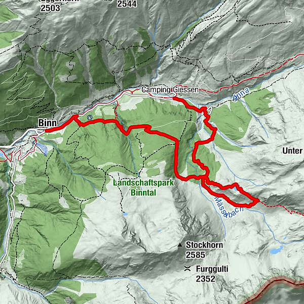
Loop through the Binntal valley, famous for its glorious scenery, wealth of minerals and time-warp historical villages. The gem at the heart of the Binntal Landscape Park.
- Difficulty
-
medium
- Rating
-
- Starting point
-
Imfeld
- Route
-
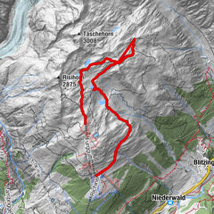
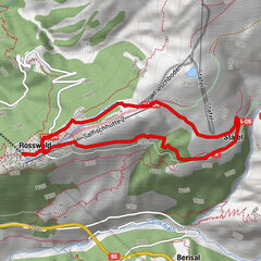
ImfeldFäldRestaurant Imfeld0.0 kmRippje0.0 kmSt. Christophorus0.7 kmFiggerscha0.7 kmZur Brücke9.4 kmSt. Antonius9.4 kmBinn (1,400 m)9.4 km
- Best season
-
JanFebMarAprMayJunJulAugSepOctNovDec
- Description
-
At the heart of the Binntal Landscape Park is the Sleeping Beauty that gave the reserve its name: the Binntal valley. Until just half a century ago, the valley was cut off from the outside world every winter by snow. Construction of a road tunnel in 1965 enabled year-round access, but the valley has retained its timeless appeal.
The Binntal first became famous for its wealth of minerals. More than 200 have been discovered in the valley, of which more than 100 alone in the world-famous Lengenbach mineral quarry. Our hike begins by the fascinating geological trail that leads from the village of Imfeld (also known as Fäld) to the gates of this quarry. Outside, hikers can search for fool’s gold (iron pyrites) in the snow-white dolomite marble.
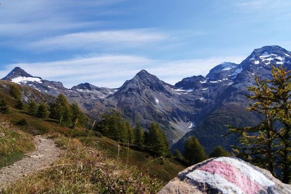
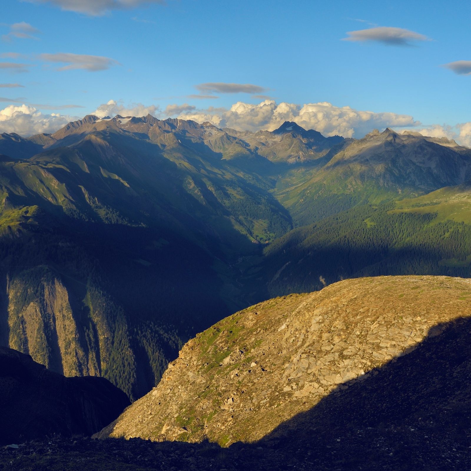
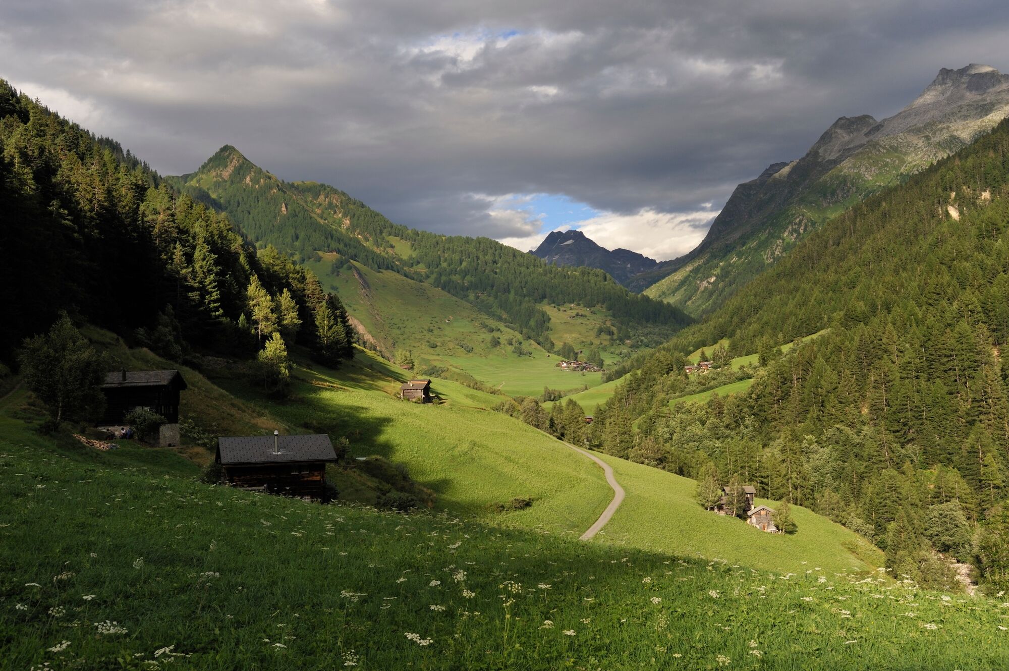
From the quarry, the trail traces a sweeping loop across the slopes on the southern side of the valley, to take in several of the landscapes and ecological habitats that make the park so special. The path first climbs steeply to the idyllic mountain lake of Mässersee, before dropping to the lush meadows of Manibode: a wonderfully peaceful spot with its lattice of streams, reddish boulders and flowering alpenrose, all framed by mountains. The trail then leaves this suspended high valley to traverse fragrant forests of pine on a steady descent to the village of Binn.
The Binntal’s reputation as the “Valley of hidden treasures” is also due to its charming historical villages, beautifully preserved. Binn won the Heimatschutzpreis conservation prize in 1992, while Imfeld was the first place in Switzerland to win the medal of the Archicultura Foundation in 1998 for its harmonious appearance. Binn is home to the valley’s only hotel, the Ofenhorn, a belle epoque gem opened in 1883 and lovingly restored over recent years.
Highlights
Wild scenery of the Binntal Landscape Park: forest, lakes, mountain streams and sweeping views Geological trail, chance to find minerals and crystals Beautifully preserved historical villages - Directions
-
From Imfeld, the route crosses the river Binna to head up to the Lengenbach quarry, initially following the road before diverting along a more direct footpath. The geological trail, by contrast, follows the lane all the way to the quarry. Along the way, hikers can get to know the valley’s rocks with the help of hand lenses and even play a musical instrument of stone.
From the quarry, the trail climbs steadily up to Schäre at an altitude of nearly 2,000m, before following a loop up to the Mässersee lake and the Manibode meadows. Back at Schäre, the route does not return along the ascent path but turns sharp left in order to lead down through the forests to Binn.
- Highest point
- 2,160 m
- Endpoint
-
Binn
- Height profile
-
 © outdooractive.com
 - Equipment
-
We recommend:
good footwear clothing suitable for the weather: always carry a waterproof jacket hat or cap sunscreen bottle for water picnic camera binoculars (optional) hiking poles (optional) printout of this hike (click “Print” icon, to download)For certain walks:
Swimwear - Safety instructions
-
Use of the trails and the information on this website is at hikers’ own risk. Local conditions may entail changes to routes. Valais/Wallis Promotion accepts no liability for the accuracy and completeness of information on this website.
For all hikes:
Bring a map. Download full description of this route including large-scale map by clicking on “Print” icon, top right of this page. Use marked trails only, and observe all signposting – for your own safety, to safeguard grazing animals and to avoid disturbing wildlife. Close gates after passing through. Please be considerate to other trail users, and to the plants and animals. Do not leave any waste in nature.For mountain hikes:
Take extra care protecting yourself from the sun at altitude. UV radiation can be exceptionally strong, even in cloudy weather. Plan hike carefully: take into consideration fitness level of each participant, weather forecast and season. Weather conditions can change quickly in the mountains, without warning. Appropriate clothing is therefore essential, along with adequate supplies of food and water. In uncertain weather, turn back in good time.For high-altitude hikes:
Inform others of the route you plan to take. Whenever possible, avoid going alone. Do not venture onto glaciers without a mountain guide. Take note of the warning signs that point out the constant danger in river beds and along watercourses below dams and reservoirs: water levels may rise rapidly without warning. - Tips
-
Call in at the fascinating Binn regional museum (minerals, archaeology, local history), housed in a former annex of the Hotel Ofenhorn.
- Additional information
- Directions
-
A9 motorway and main road up the Rhône valley to Lax; shortly after, turn right and follows signs for Ernen / Binn / Imfeld. Park at either the start of finish of the walk, and use the Bus Alpin to complete the loop.
- Public transportation
- Parking
-
Large car parks just outside the villages of Binn and Imfeld.
-

-
AuthorThe tour Discovering Binntal Landscape Park: Imfeld – Mässersee – Binn is used by outdooractive.com provided.


General info
-
Aletsch Arena
1471
-
Divedrotal
348
-
Bellwald
88