- Brief description
-
Embark on a hike to the Gibidum reservoir through primeval forests and put your stamina to the test on the stairs.
- Difficulty
-
easy
- Rating
-
- Starting point
-
Blatten bei Naters
- Route
-
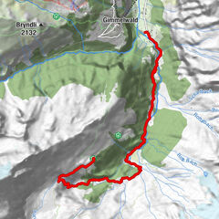
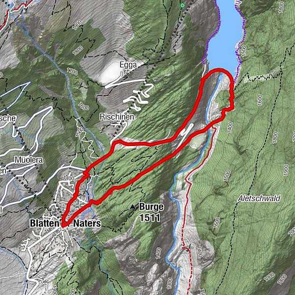
Blatten b. Naters (1,327 m)Belstar0.2 kmRischinen1.0 kmMassa4.6 kmBlatten (1,331 m)4.7 kmBlatten b. Naters (1,327 m)4.7 km
- Best season
-
JanFebMarAprMayJunJulAugSepOctNovDec
- Description
-
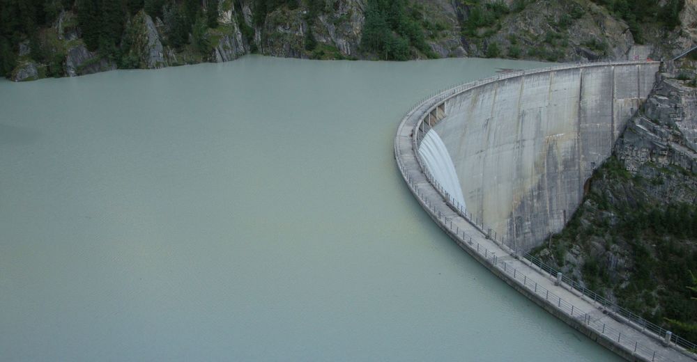
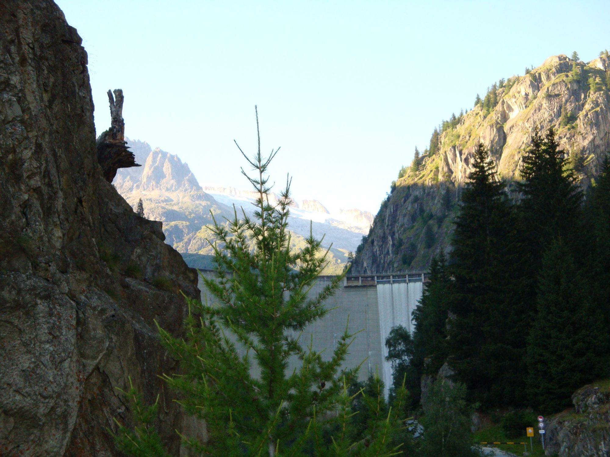
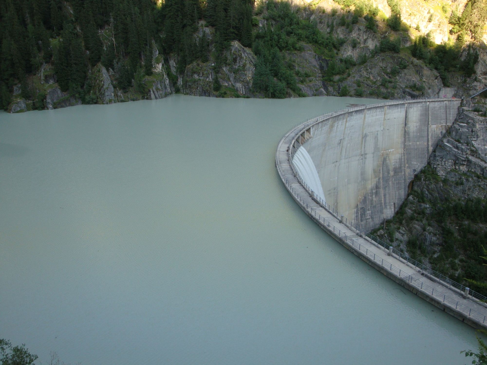
The circular hike first leads to the Gibidum reservoir. The Gibidum reservoir with an area of 21 hectares (about 29 football fields) was completed in 1967 and is fed by the Great Aletsch Glacier. You can access the reservoir via a steel staircase. On the way back, the hike takes you through the mystical Rischinerwald forest. Let your gaze wander and enjoy the peace and quiet.
- Directions
-
The hike starts at the Blatten post office stop near Naters, cable car. Follow the signposts in the direction of the Gibidum reservoir along the road. Cross the dam wall and head downhill until you reach the metal bridge over the Massa. Here the trail leads back in the direction of Blatten bei Naters. At the first bend, branch off onto the hiking trail and hike through the forest to Blatten bei Naters.
Route description
Blatten bei Naters - Gibidum reservoir - Rischinerwald - Blatten bei Naters
- Highest point
- 1,480 m
- Endpoint
-
Blatten bei Naters
- Height profile
-
 © outdooractive.com
 - Equipment
-
Sturdy shoes, clothing suitable for the weather, sun and rain protection, as well as sufficient supplies of food and drinks, should there be no refreshment stops or shopping facilities available or open. Although the trail is very well marked throughout, you should always have a suitable hiking map with you for safety reasons. Take sticks or other aids with you.
- Safety instructions
-
Despite the "impossible to miss" marking of the hiking trails, we recommend for safety reasons to always have an appropriate hiking map with you, so that you can quickly find your way to a safe area in case of a thunderstorm or emergency, for example.
Especially in autumn, you should also be aware that leaves lying on the ground can hide bumps, roots, stones or holes in the path. After storms, trees can still fall over or branches can fall down. Especially in adverse weather conditions, muddy and slippery passages can occur on natural paths. You have to expect this kind of path impairment when you go on a hike.
Not all rocks or precipices are secured with ropes or railings. In some cases surefootedness is required. If you are of the opinion that certain sections of the trail are not passable for you, you should avoid them.
- Tips
-
Guess how many steps it is to the dam wall.
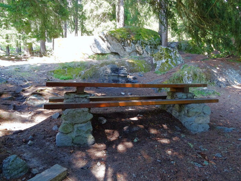
Enjoy the Rischinerwald and have a picnic.
- Additional information
- Directions
-
Arrival by car
From western Switzerland: A9 Lausanne - Vevey, or north-western Switzerland: A12 Bern - Vevey: A9 - Sierre: main road Sierre - Brig
From north-western Switzerland: A6 Berne - Thun - Spiez: main road Spiez - Kandersteg (Lötschberg tunnel car transport) - Goppenstein - Gampel - Brig
From eastern and central Switzerland: Andermatt - Realp (year-round Furka car transport; in summer via Furka Pass) - Oberwald - Brig
From Ticino (in summer): Airolo - Nufenenpass - Ulrichen - Brig
Or via Centovalli - Domodossola - Simplonpass - Brig
From Italy (Aosta, Mt. Blanc Tunnel): Aosta - Grand Saint Bernard tunnel (over the pass in summer) - Martigny: A9 motorway - Sierre: Sierre - Brig main road.
Or via Domodossola - Simplon Pass - Brig
Blatten bei Naters
From Brig you can reach Blatten bei Naters via Naters, then take the cable car to the car-free Belalp.
- Public transportation
- Parking


-

-
AuthorThe tour Circular hike Blatten - Gibidum reservoir - Rischinerwald is used by outdooractive.com provided.


General info
-
Aletsch Arena
1489
-
Brig Simplon
486
-
Blatten-Belalp
185