
- Brief description
-
A panoramic walk across the alpine pastures above Anzère, with the chance to visit working dairies and taste the fresh cheese. Gentle descent back to resort via the Bisse de Sion irrigation channel.
- Difficulty
-
medium
- Rating
-
- Starting point
-
Anzère (gondola station)
- Route
-
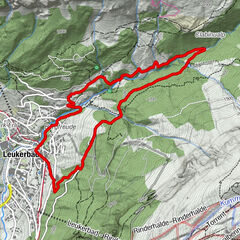
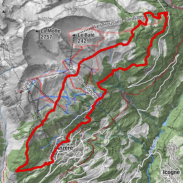
Anzère (1,500 m)0.1 kmLe Got0.7 kmGrenier de Zalan3.4 kmTsalan d'Ayent3.5 kmLes Écuries de Tsalan4.1 kmAlpage de Tsalan-d'Arbaz4.2 kmLe Tsijiri7.0 kmAlpage de Serin7.9 kmLes Rousses (1,775 m)9.3 kmRestaurant des Rousses9.3 kmLes Rousses9.4 kmLes Grillesses13.9 kmProbon14.8 kmLes Bochonès16.1 kmAnzère (1,500 m)16.1 km
- Best season
-
JanFebMarAprMayJunJulAugSepOctNovDec
- Description
-
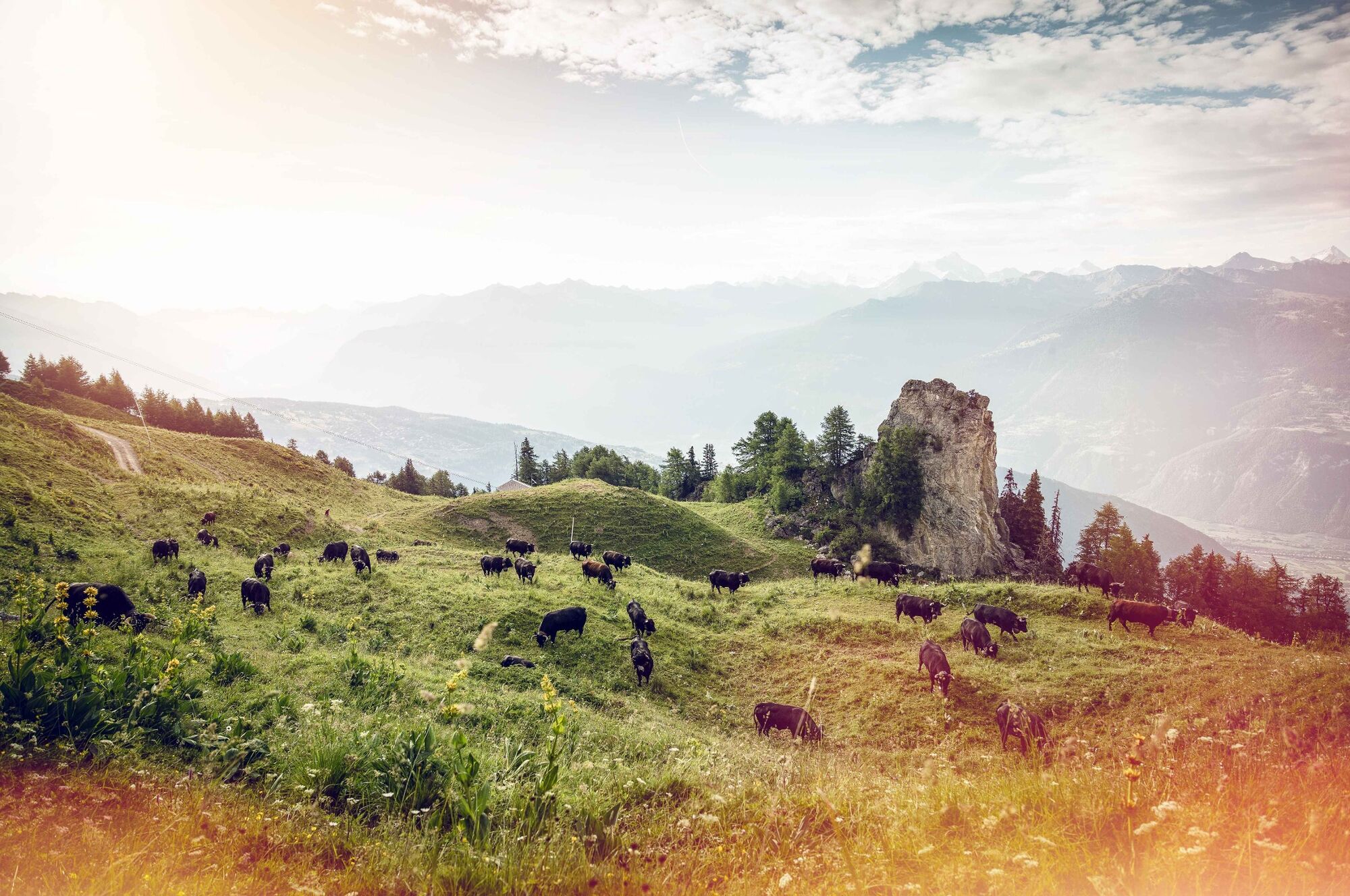
Every summer, herds of cows graze the lush flower-filled alpine pastures on the sunny slopes high above Anzère. And every day, their rich milk is made into dairy products including not just traditional alpine hard cheese but also a much-loved seasonal delicacy: sérac, a soft, low-fat cheese made from the whey.
This panoramic hike takes in three “alpages” or alpine pastures, all with their own herds of cows and dairy operation. Along the way, walkers have the chance to see the herders and cheese-makers at work and of course taste their fresh produce: pure alpine goodness! The hike begins at the gondola car park with a brisk climb of 3 km and 400 vertical metres to La Brune. (Walkers who prefer an easier start can take the gondola to the middle station, and join the trail there.)
The following 7 km of trail cross three of the region’s “alpages”. First is the Alpage de Tsalan d’Arbaz, where Rose-Marie and her team also run a “buvette” restaurant selling a variety of refreshments alongside fresh produce. The trail then continues climbing gently to the Alpage de Duez, before following a flat and easy path to the Alpage de Serin, with its modern dairy – which also welcomes visitors on request.
The return leg of the walk starts off following the Bisse de Sion, a historical irrigation channel built from 1901 to 1903 to carry water from the river La Lienne to the slopes above Sion.
The trail as a whole takes its name from one of the best-loved sporting events of the summer, which follows the same route: the Tour des Alpages. This is the second-most popular mountain race in Valais, in terms of numbers, attracting more than 1,500 participants: not just keen runners but also walkers, Nordic walkers and children.
Highlights
Tour of three “alpages” – meet cheese-makers and taste fresh dairy produce Ever-changing panoramic views of the Rhône valley and the snow-capped summits Bisse de Sion – historical irrigation channel - Directions
-
Begin at the gondola station in Anzère: either hike up to the high pastures via La Brune, or take the gondola to the middle station and start walking from there, joining the main trail just before the Alpage de Tsalan d’Arbaz. A gentle ascent leads to the Alpage de Duez, followed by an easy, gentle descent to the Alpage de Serin. From here, follow the signs down to Les Rousses.
The first part of the return leg follows the Bisse de Sion. This is eventually diverted into underground pipes; follow instead the yellow signs for Les Grillesses, and after that, Anzère.
- Highest point
- 2,075 m
- Endpoint
-
Anzère (gondola station)
- Height profile
-
 © outdooractive.com
 - Equipment
-
We recommend:
good footwear clothing suitable for the weather: always carry a waterproof jacket hat or cap sunscreen bottle for water picnic camera binoculars (optional) hiking poles (optional) printout of this hike (click “Print” icon, top right, to download)For certain walks:
Swimwear - Safety instructions
-
Use of the trails and the information on this website is at hikers’ own risk. Local conditions may entail changes to routes. Valais/Wallis Promotion accepts no liability for the accuracy and completeness of information on this website.
For all hikes:
Bring a map. Download full description of this route including large-scale map by clicking on “Print” icon, top right of this page. Use marked trails only, and observe all signposting – for your own safety, to safeguard grazing animals and to avoid disturbing wildlife. Close gates after passing through. Please be considerate to other trail users, and to the plants and animals. Do not leave any waste in nature.For mountain hikes:
Take extra care protecting yourself from the sun at altitude. UV radiation can be exceptionally strong, even in cloudy weather. Plan hike carefully: take into consideration fitness level of each participant, weather forecast and season. Weather conditions can change quickly in the mountains, without warning. Appropriate clothing is therefore essential, along with adequate supplies of food and water. In uncertain weather, turn back in good time.For high-altitude hikes:
Inform others of the route you plan to take. Whenever possible, avoid going alone. Do not venture onto glaciers without a mountain guide. Take note of the warning signs that point out the constant danger in river beds and along watercourses below dams and reservoirs: water levels may rise rapidly without warning. - Tips
-
If driving up from the Rhône valley, stop en route in Botyre for the entertaining Bisse Museum, housed in a fine 17th-century building.
- Additional information
- Directions
-
A9 motorway, exit 27 (Sion-Est). Follow signs for Savièse/Ayent and then Anzère.
- Public transportation
-
Train to Sion, then postal bus to Anzère. Find full timetable information at www.sbb.ch
- Parking
-
Parking at gondola station. Follow the parking instructions in resort.


-

-
AuthorThe tour Tour des Alpages is used by outdooractive.com provided.


General info
-
Thyon les Collons
1435
-
Anzère/ Valais
903
-
Anzère
184