

- Brief description
-
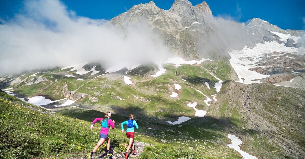
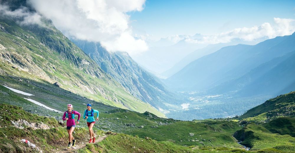
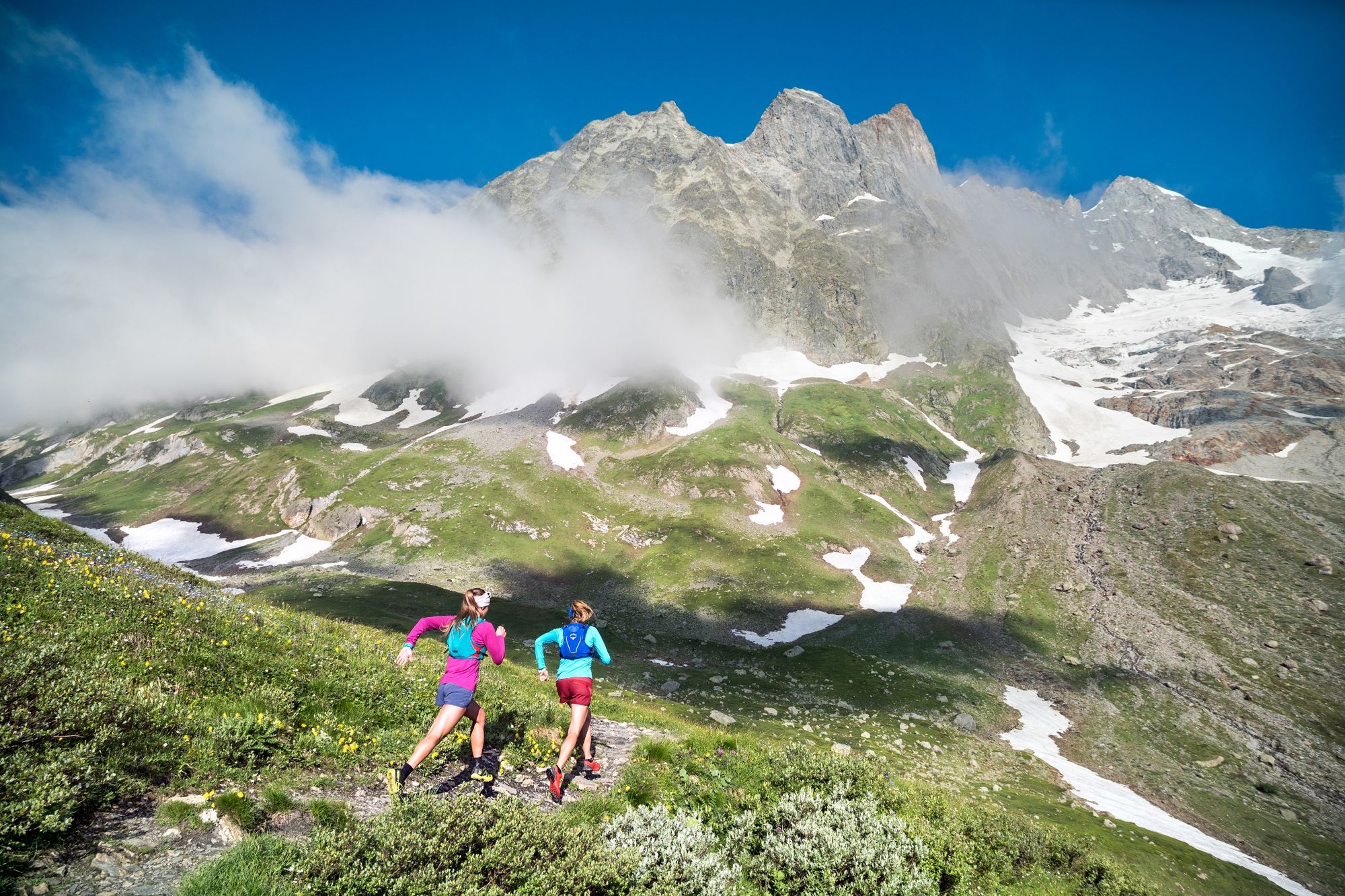
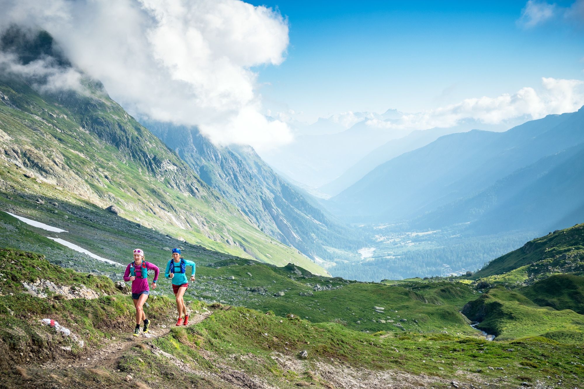
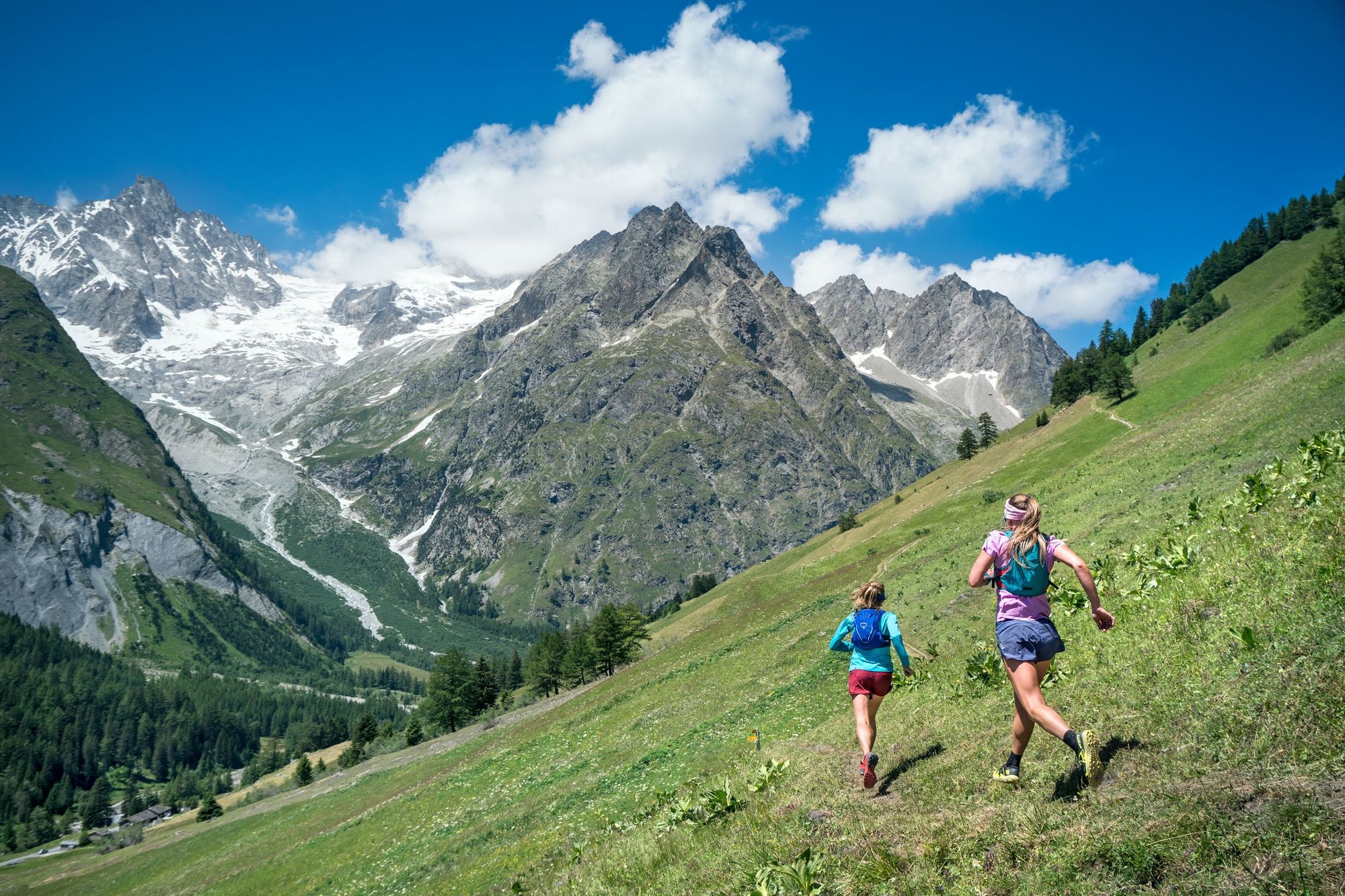
This itinerary in the heart of the Val Ferret offers a breathtaking view of the Italian-Swiss valley and the jagged mountains that overlook it.
- Difficulty
-
medium
- Rating
-
- Starting point
-
La Fouly
- Route
-
La FoulyLe Clou0.4 kmGîte de la Léchère1.4 kmLa Peule (2,071 m)11.4 kmFerret19.2 kmLes Granges20.3 kmLe Clou20.7 kmLa Fouly21.4 km
- Best season
-
JanFebMarAprMayJunJulAugSepOctNovDec
- Description
-
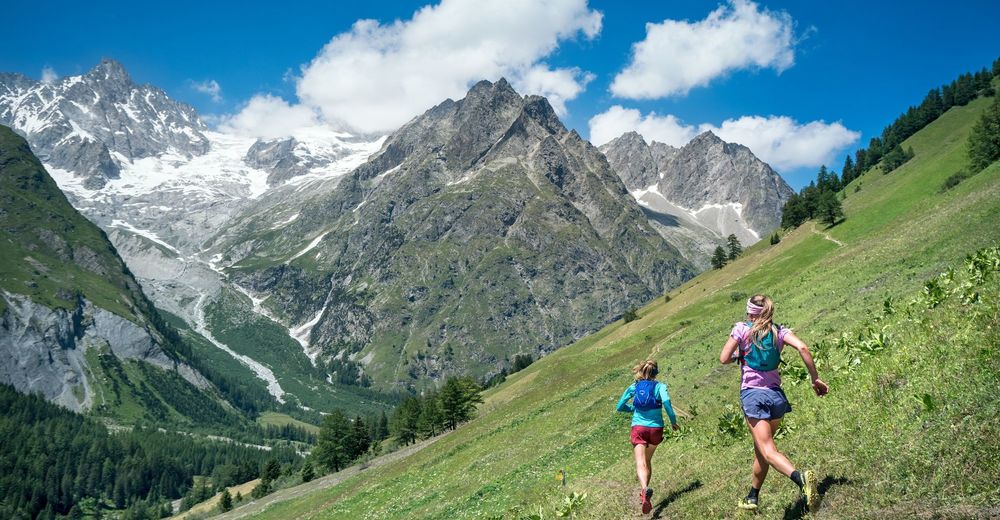
As you exit the village of La Fouly, take the path that goes up to the Petit col Ferret. The path makes a sharp turn at the Gîte de la Léchère and the grassy pastures quickly give way to the rocky world of the Taves du Dolent. Beneath the imposing Mont Dolent, you’ll reach the first pass with a spectacular view of the Val Ferret and the Grandes Jorasses. Cross over to the Italian side and enjoy a run through large expanses of grass before returning to Swiss territory via the Grand Col Ferret. Head down to the alpine pasture of La Peule on the famous Tour du Mont Blanc route. From the hut, follow a short, relatively steep climb before starting your descent towards the valley, where the path crosses numerous bridges to explore both sides of the Dranse.
- Directions
-
From La Fouly, the trail starts gradually uphill toward the Gîte de la Léchère where, making a sharp turn, it continues steadily uphill to Petit Col Ferret which is one way of getting to Italy, while the Grand Col Ferret leads back to Swiss territory. Coming back into Switzerland, the trail heads down to the Alpage de la Peule. A short but steep climb follows, before dropping downtoward the Torrent des Peaux, turning just before Mont Percé. Passing Les Ars Dessus, the trail traverses the grassy hillside known as the Ravines des Ars before descending to Ferret, crossing the river, and following the Dranse de Ferret back to La Fouly.
La Fouly - Léchère - Petit Col Ferret - Grand Col Ferret - Alpage de la Peule - Torrent des Peaux- Les Ars Dessus - Ferret - La Fouly
- Highest point
- 2,557 m
- Endpoint
-
La Fouly
- Height profile
-
 © outdooractive.com
 - Equipment
-
We recommend:
Good footwear Weather-appropriate clothing: always carry a waterproof jacket Hat or peak cap Sunscreen Water bottle Hiking poles - Safety instructions
-
Use of the trails and the information on this website is at your own risk. Local conditions may entail changes to routes. Valais/Wallis Promotion accepts no liability for the accuracy and completeness of information on this website.
For all trails: Use marked trails only, and take note of all signposting – for both your own safety as well as that of grazing animals and to avoid disturbing wildlife. Close gates after passing through. Please treat other trail users, as well as the plants and animals, with respect.For mountain trails:
Take extra care protecting yourself from the sun at high altitudes. UV radiation can be exceptionally strong, even in cloudy weather. Plan your trail carefully: take the fitness level of each participant, weather forecast and season into consideration. Weather conditions can change quickly in the mountains, without warning. Appropriate clothing is therefore essential, along with adequate supplies of food and water. In case of uncertain weather conditions, turn back in good time. Inform others of the route you plan to take. Whenever possible, avoid going alone.Take note of warning signs indicating the constant danger in river beds and along watercourses below dams and reservoirs: water levels may rise rapidly without warning.
- Tips
-
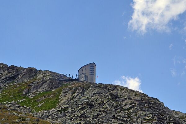
Stop by the Alpage de la Peule for a great espresso and delicious cheese. Open mid-June through mid-September.
- Additional information
- Directions
-
Take the A9 motorway to Martigny, then continue on the Route du Grand-Saint-Bernard towards Orsières. Follow Som-la-Proz, Issert, Branche-d'en-Bas and Prayon before reaching La Fouly and continuing on the Route de Ferret.
- Public transportation
-
Take the train to Martigny, followed by a regional connection to Sembrancher and then another to Orsières, from where a bus runs to Ferret and then La Fouly.
- Parking
-
Parking is available along in Route de Ferret in La Fouly.
- Author
-
The tour Val Ferret from La Fouly is used by outdooractive.com provided.