
- Brief description
-
Change your "hellos" into "Tagwohls" as you cross the border between French and German-speaking Switzerland on this sixth, 19-kilometre, uphill leg.
- Difficulty
-
medium
- Rating
-
- Starting point
-
Zinal
- Route
-
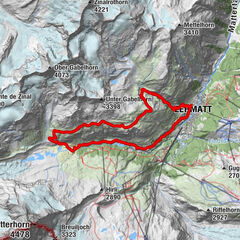
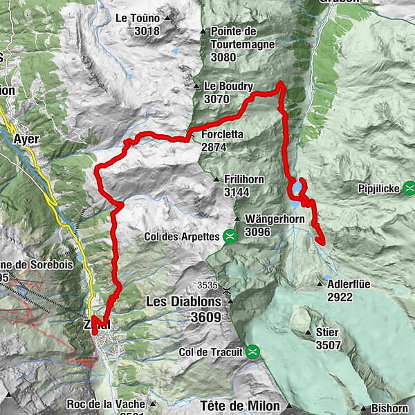
Zinal (1,675 m)0.2 kmPralonzet1.0 kmFurggilti (2,874 m)10.0 kmTurtmannhütte SAC21.7 kmBrunnen21.7 km
- Best season
-
JanFebMarAprMayJunJulAugSepOctNovDec
- Description
-
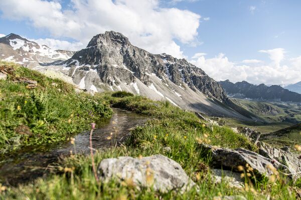
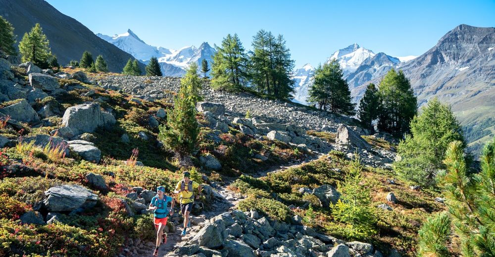
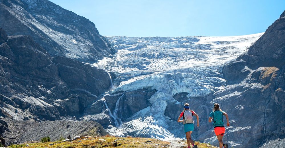
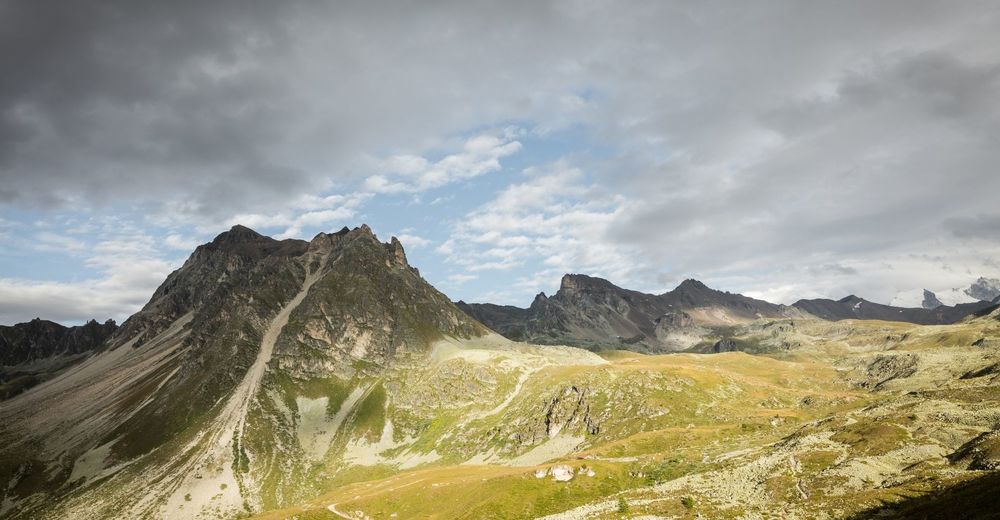
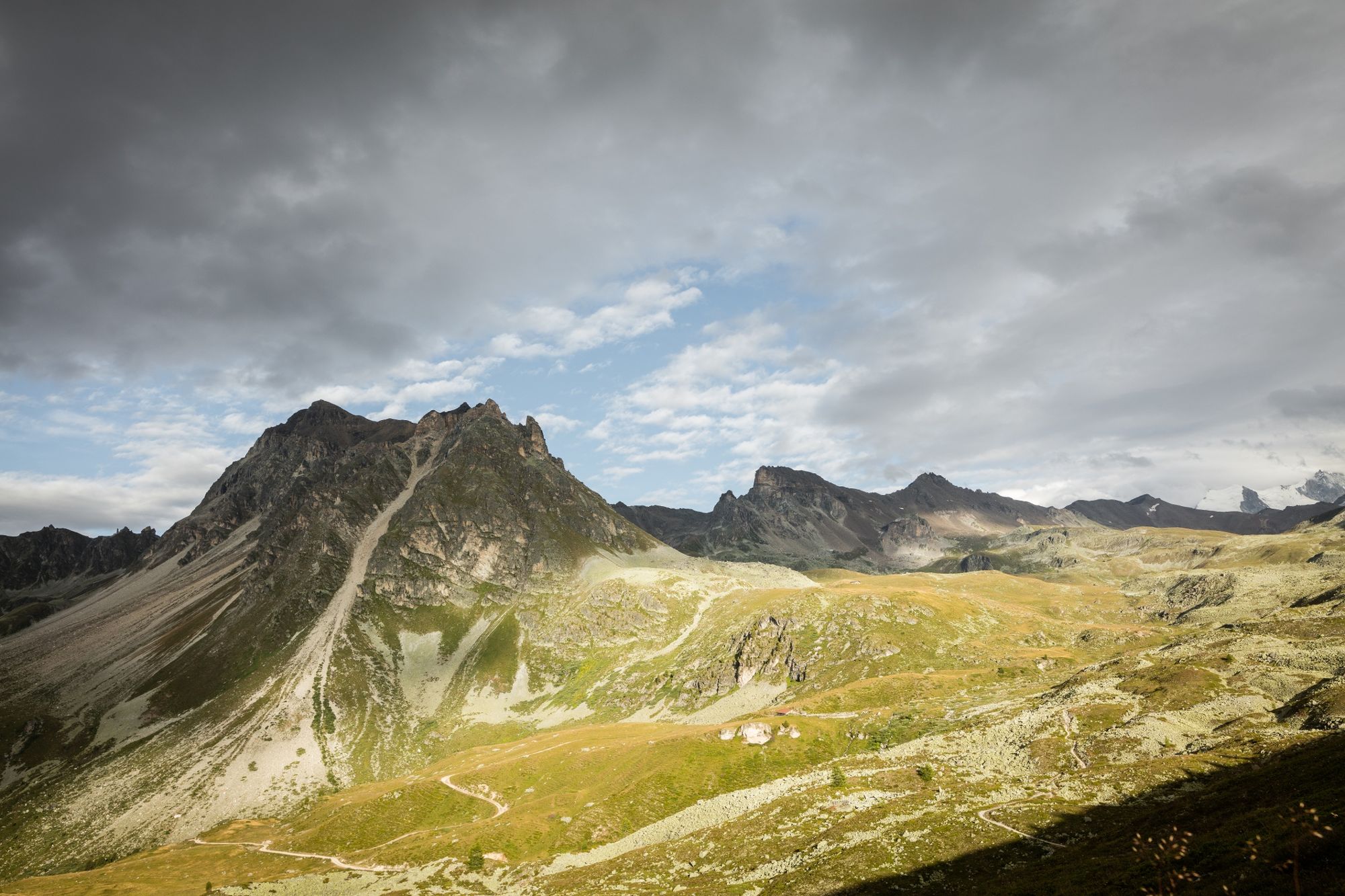
After your night in Zinal, a steep path from the village provides an instant wake-up call. The itinerary follows the famous finish of the Sierre-Zinal mountain race but in the opposite direction. Climb above a larch forest to reach a pleasant, gently sloping single track that takes you to the Tsahélet farm. The path then becomes steeper as it heads for the Forcletta pass, which connects the Zinal and Turtmann valleys. This point is the start of both a change of language and rhythm. After a long ascent, it is now time to start a long descent that takes you to the Turtmannsee before a final ascent to the Turtmann hut at 2,523 m with a stone terrace overlooking the glaciers, the Bishorn, the Weisshorn and other impressive 4,000m peaks in the region.
- Directions
-
Begin your trip with a steep ascent on the path that leaves from the village of Zinal. At every intersection you come across in Chiesso, Les Virons and Tsahélet respectively, make sure you choose the path heading for the Col de la Forcletta. Once on the other side, continue downhill towards Chalte Berg before reaching Lake Turtmann. To reach the Turtmann hut, follow the path that passes below the hut before the last particularly steep climb that takes you to the goal.
Zinal - Le Chiesso - Les Virons - Tsahélet - Col de la Forcletta - Chalte Berg - Turtmannsee - Turtmann Hut
- Highest point
- 2,866 m
- Endpoint
-
Turtmann Hut
- Height profile
-
 © outdooractive.com
 - Equipment
-
We recommend:
Good footwear Weather-appropriate clothing: always carry a waterproof jacket Hat or peak cap Sunscreen Water bottle Hiking poles - Safety instructions
-
Use of the trails and the information on this website is at your own risk. Local conditions may entail changes to routes. Valais/Wallis Promotion accepts no liability for the accuracy and completeness of information on this website.
For all trails:
Use marked trails only, and take note of all signposting – for both your own safety as well as that of grazing animals and to avoid disturbing wildlife. Close gates after passing through. Please treat other trail users, as well as the plants and animals, with respect.For mountain trails:
Take extra care protecting yourself from the sun at high altitudes. UV radiation can be exceptionally strong, even in cloudy weather. Plan your trail carefully: take the fitness level of each participant, weather forecast and season into consideration. Weather conditions can change quickly in the mountains, without warning. Appropriate clothing is therefore essential, along with adequate supplies of food and water. In case of uncertain weather conditions, turn back in good time. Inform others of the route you plan to take. Whenever possible, avoid going alone. Take note of warning signs indicating the constant danger in river beds and along watercourses below dams and reservoirs: water levels may rise rapidly without warning. - Tips
-
If you’re lucky, the hut will be serving it’s famous Black Forest Cake, a well-deserved treat after so a lot of uphill.
- Additional information
- Directions
-
For the 1st Stage Via Valais : Take the A9/E62 motorway to Martigny, then continue on the Grand-Saint-Bernard/route 21 via Sembrancher to Le Châble. It is advisable to use public transport however as this is a multi-leg route that ends in Zermatt.
- Public transportation
-
For the 1st Stage Via Valais : Take the train to Martigny station, then to Le Châble. Take a first gondola lift between Le Châble and Verbier, then a second one from Verbier to Les Ruinettes in order to get to the start of the trail.
- Parking
-
For the 1st Stage Via Valais : 240 free parking spaces are available at the Le Châble Aerial Cableway station for a maximum of 10 days.


- Author
-
The tour Via Valais Zinal - Turtmann Hut (Stage 6) is used by outdooractive.com provided.


General info
-
Oberwallis
114
-
Sierre Anniviers
43
-
Zinal
21