- Brief description
-
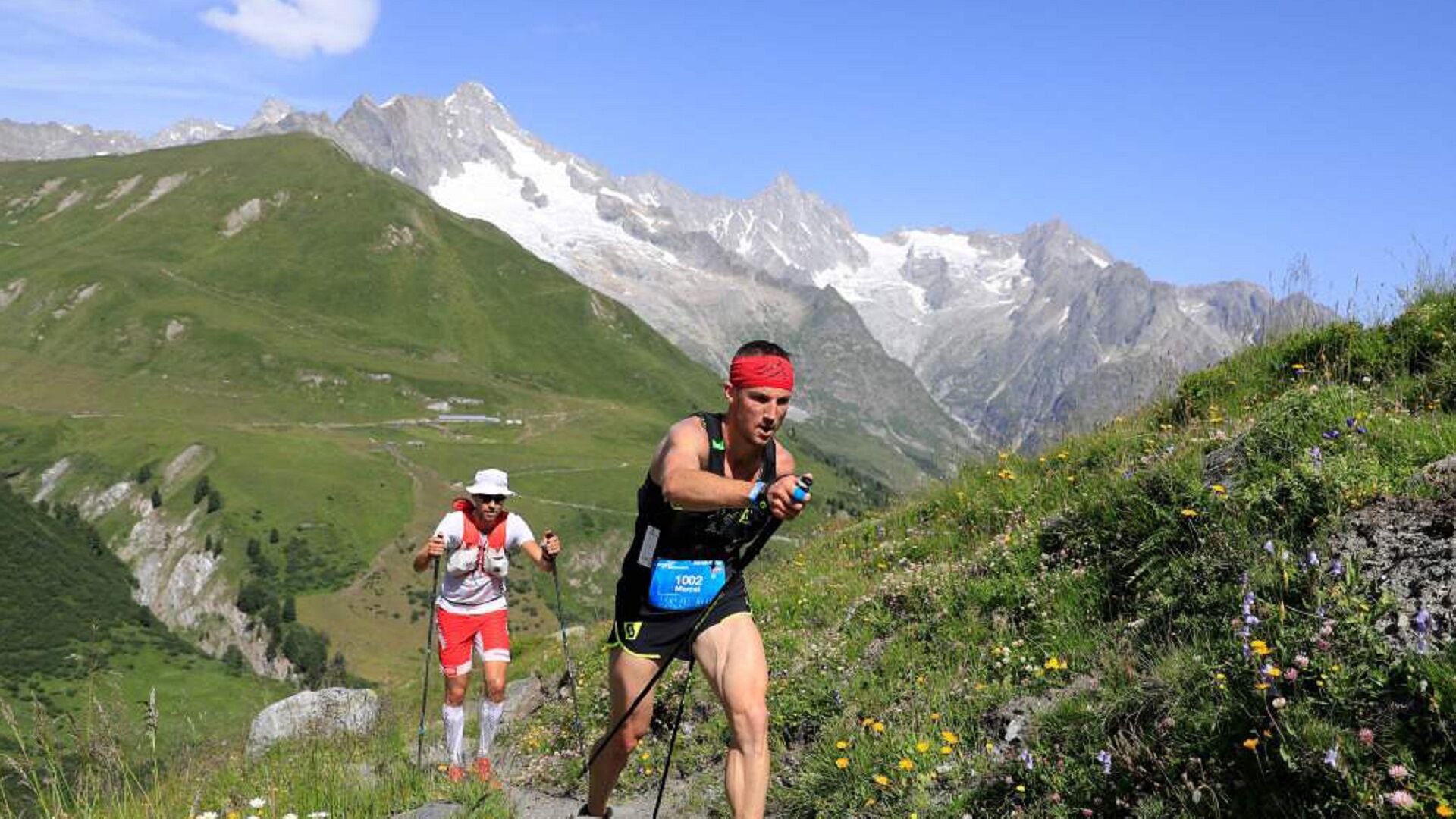
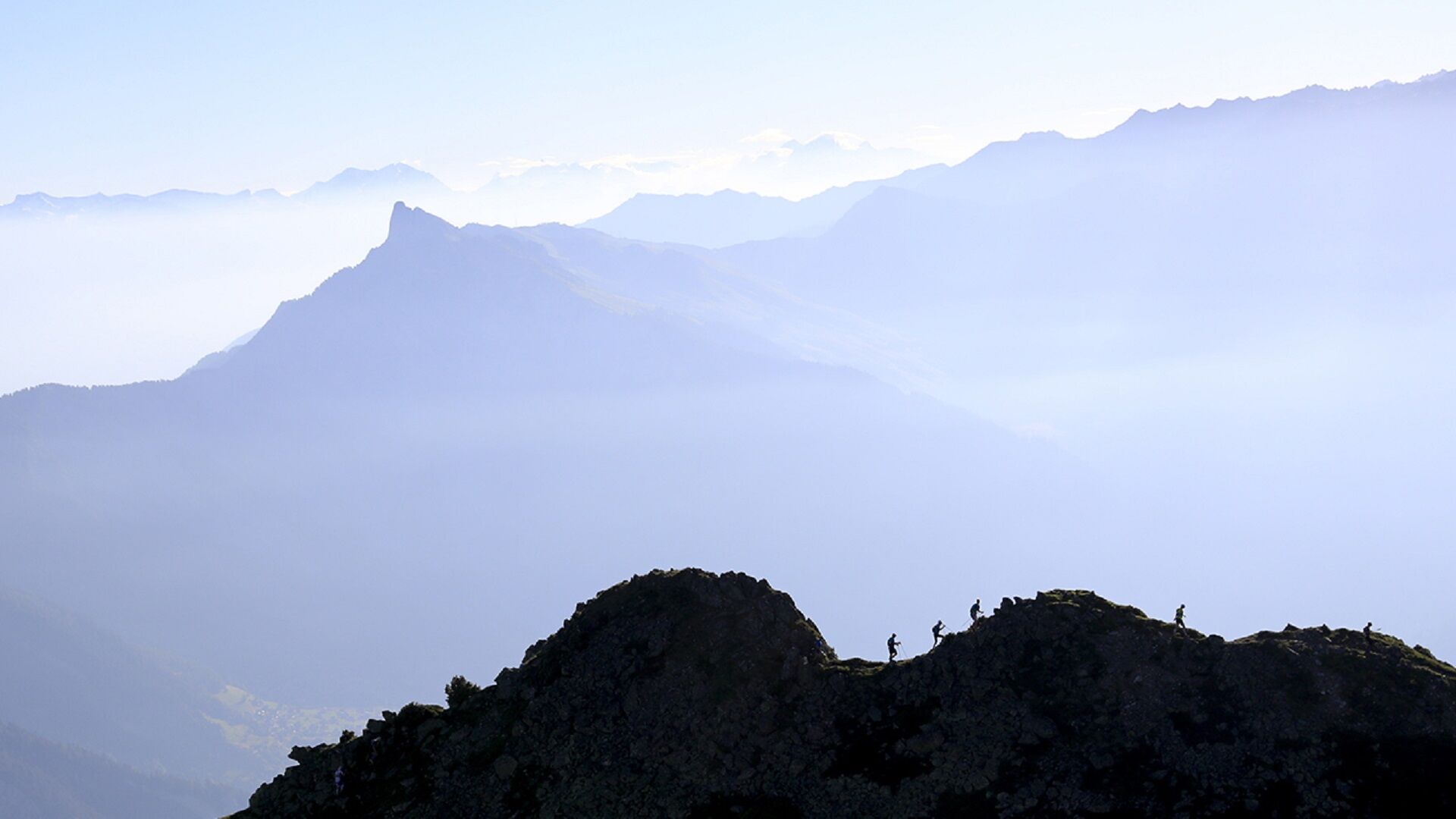
The great trail of the Swiss Alps, the X-Alpine will make you discover the most beautiful viewpoints of the region by cumulating a positive height difference of 8'400m. This new route is resolutely alpine and is a real challenge for experienced trailers.
- Difficulty
-
difficult
- Rating
-
- Starting point
-
Verbier
- Route
-
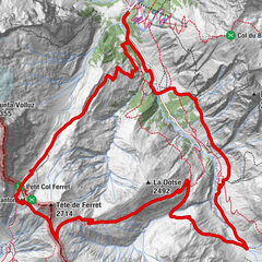
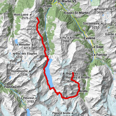
Verbier (1,490 m)0.1 kmPatier1.5 kmSaint Christophe2.9 kmCries7.8 kmGrotte9.9 kmSommet de Contô10.1 kmEtiez10.8 kmFond de Contô11.2 kmLes Moulins11.5 kmMaison Murith11.5 kmPontet de la Meunière11.5 kmMeunière des Moulins11.6 kmMaison Blanche11.6 kmChamprateu11.6 kmSommet du Biollay11.7 kmChampanet11.7 kmPessote11.7 kmSavu11.8 kmLa Colô11.9 kmFaray12.3 kmLes 3 Dranses12.5 kmVers la Tour12.5 kmPont de Bagnes12.5 kmGrand Place12.5 kmSouste12.5 kmRière Ville12.5 kmSembrancher12.5 kmMaison Luder12.6 kmHôtel National12.6 kmDerrière les Granges12.6 kmSommet de Ville12.7 kmGrange à Body12.7 kmCleusuit Devant12.7 kmRière les Puces12.7 kmCreuse12.8 kmTête de la Chaux13.0 kmChamp de l'Ouraz13.9 kmChampcortay d'en Bas14.2 kmLes Biolles14.4 kmFond du Creux14.4 kmVers la Croix14.5 kmLa Garde14.5 kmCreuland14.5 kmRière les Maisons14.6 kmLes Grevets14.7 kmLes Fieudzes14.7 kmValettes14.7 kmCaret14.8 kmLa Dent (1,640 m)17.9 kmProcari18.1 kmCatogne (1,810 m)19.1 kmMont Regard (1,850 m)19.2 kmLes Waillaz19.5 kmPlan de la Chaux19.9 kmDerrière la Tournelle20.5 kmLe Catogne (2,598 m)22.5 kmChampex-Lac26.6 kmArpette29.4 kmCabane d'Orny (2,831 m)35.0 kmPrayon46.0 kmL'Amône47.7 kmEdelweiss48.9 kmAuberge de la Fouly49.0 kmAuberge des Glaciers49.1 kmLa Fouly49.1 kmFerret52.6 kmRistorante Hotel Italia62.6 kmPlan Jupiter62.8 kmGreat St Bernard Hospice63.4 kmHôtel de l'Hospice63.5 kmBourg-Saint-Pierre (1,632 m)77.4 kmEglise Saint-Pierre77.5 kmAuberge Au Petit Vélan77.6 kmBivouac Napoléon78.8 kmCreux du Mâ81.5 kmCabane de Mille (2,473 m)90.0 kmLourtier101.8 kmLa Ruine101.8 kmLes Morgnes102.2 kmBaya102.4 kmPierra Besse103.0 kmLa Chaux (2,273 m)107.6 kmLa Chaux 2107.7 kmLe Dahu108.0 kmClambin112.5 kmMédran113.9 kmVerbier (1,490 m)114.4 km
- Best season
-
JanFebMarAprMayJunJulAugSepOctNovDec
- Description
-
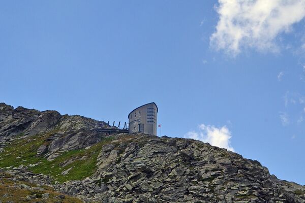
Starting from Verbier, reach the summit of the Catogne to be rewarded with a spectacular view! Head down to Champex-Lac for a well-earned night’s rest. The next day, head for the Cabane d’Orny and then on to La Fouly, before starting the climb up the legendary Great St Bernard Pass to spend the night beside the lake. When you wake up, head down to Bourg-St-Pierre via the Toules dam before climbing up to the Cabane de Mille for your final stop. On the fourth day, head back down to the village of Lourtier to tackle the so-called “Wall”, with an ascent of 1,212m, before finally returning to Verbier.
- Directions
-
The line joins the three valleys of the Drance and thus symbolizes a link between these geographical entities. Two big climbs add to the beginning of the route, passing successively to the summit of Catogne (2'598m) with a breathtaking panorama, then to the Orny hut (2'826m), on the edge of the glacier of the same name. From La Fouly, the route is unchanged and heads towards the Fenêtre and Grand-St-Bernard passes . A few passages in picturesque villages will allow you to regain your strength to cross the last passes and the last ascent to La Chaux. Relatively technical and quite steep, this last one has a positive difference in height of nearly 1'200m. At the summit, the game is almost won: final effort trying to lengthen the stride along the bisse before plunging down to the finish. While the first ones will admire the Combins massif, the main part of the pack will have already accumulated many hours just by the light of the headlamps and will thus benefit from a magical atmosphere where stars and headlamps mix their light.
www.trailvsb.com
- Highest point
- 2,820 m
- Endpoint
-
Verbier
- Height profile
-
 © outdooractive.com
 - Tips
-
Special offers trail 2020
Bourg-St-Pierre
Hotel Bivouac Napoléon
Room with Spa, single:CHF 62.30 / double 104.60 Motel double CHF 84.60 / triple CHF 105.90
Buffet breakfast CHF 14.- per pers.+41 (0)27 787 11 62, info@bivouac.ch, www.bivouac.ch
Chandonne/Liddes
Rural house
CHF 25.- per pers., bed linen and charges included, from 20th June to 5th July+41 (0)77 441 14 76, chrimeilid@bluewin.ch, www.chandonne.ch
La Fouly
Maya-Joie, l'Auberge
CHF 40.- with halfboard in rooms of 2 or 4 persons instead of CHF 72.-
Available from 24th May to 5th July for trailers discovering the route and also on 6th and 7th July
+41 (0)27 565 56 30, contact@mayajoie.ch, www.mayajoie.ch
Camping des Glaciers
Runner discount : 10% (except renting)
+41 (0)27 783 18 26, info@camping-glaciers.ch, www.camping-glaciers.ch
Trail and hiking courses 2020
Discover the route thanks to the Verbier St-Bernard trail training courses organized in collaboration with Jules-Henri Gabioud: http://www.trailvsb.com/fr/Reconnaissance/Stage-de-preparation-TVSB!
- Additional information
- Directions
-
Exit the motorway at Martigny.
Follow the direction Grand-St-Bernard until Sembrancher then follow the direction Le Chable/ Verbier until Verbier.
- Public transportation


- Author
-
The tour Trail Verbier St-Bernard is used by outdooractive.com provided.