- Brief description
-
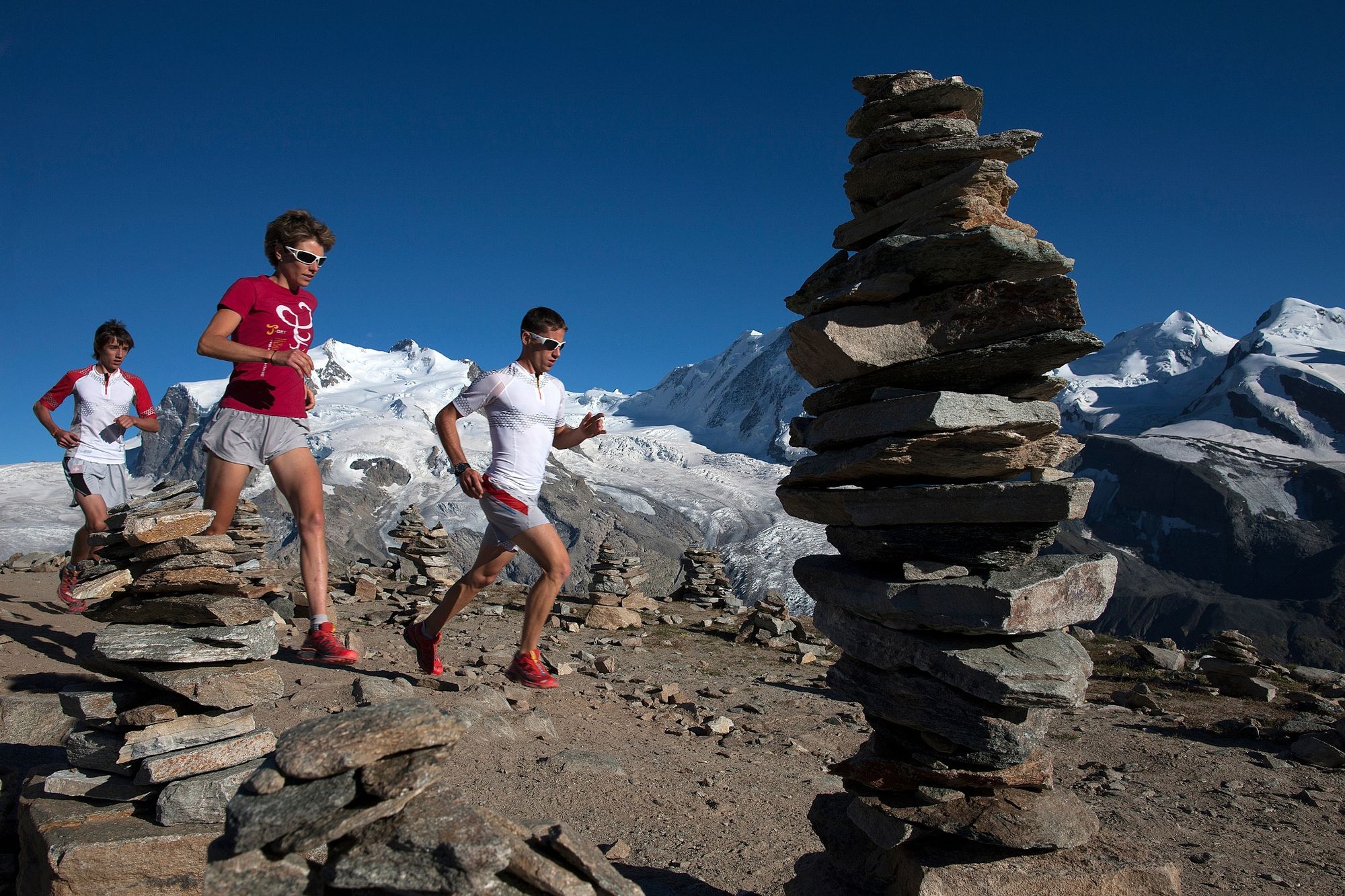
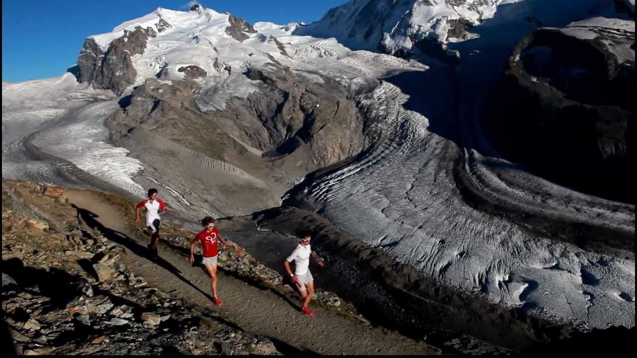
This race pushes the fittest and toughest endurance athletes to the limit: 49 km long, 3,600 vertical metres of ascent and descent, and plenty of challenging terrain. A contest without mercy for diehard runners.
- Difficulty
-
difficult
- Rating
-
- Starting point
-
Zermatt (1,620 m)
- Route
-
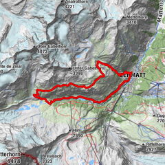
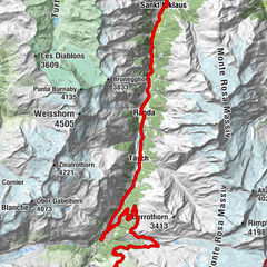
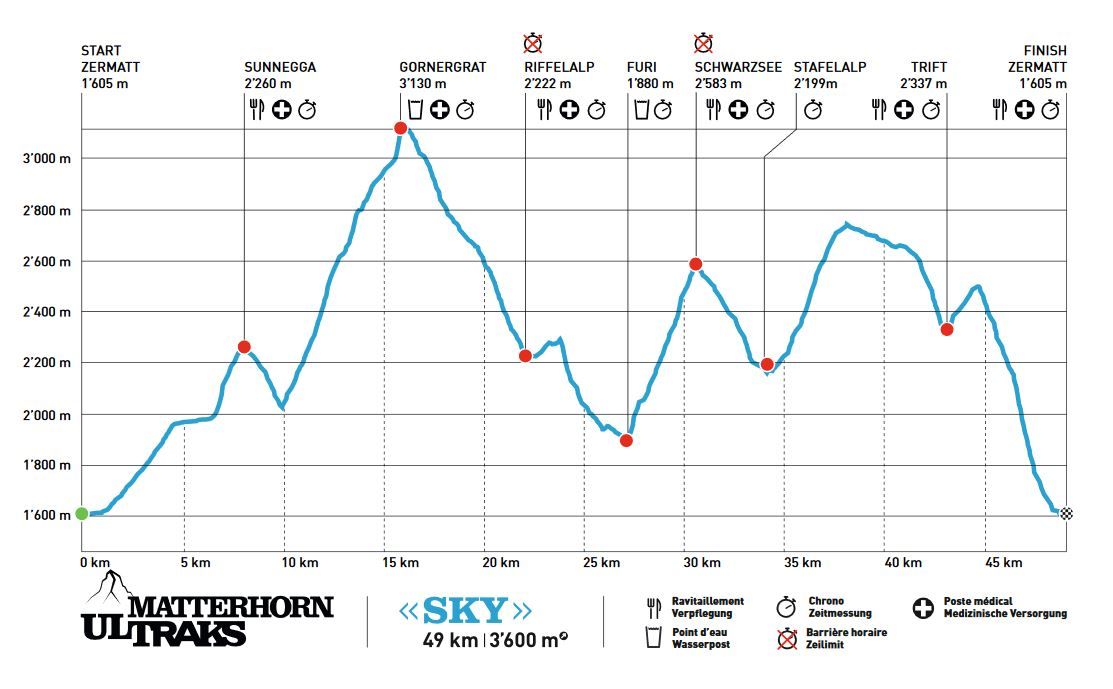
Zermatt (1,608 m)Kirche St. Mauritius0.4 kmOthmar’s Skihütte3.5 kmSunegga (2,277 m)7.8 kmEggen (2,177 m)8.8 kmZe Gassen (2,051 m)9.5 kmGornergrat (3,100 m)16.0 kmVis-à-vis16.2 kmKapelle Gornergrat16.2 kmGornergrat (3,090 m)16.2 kmGornergrat16.4 kmKapelle Riffelberg Bruder Klaus20.0 kmRiffelalp (2,222 m)22.0 kmFuri27.0 kmSchwarzsee paradise30.9 kmSchwarzsee (2,588 m)30.9 kmStafelalp33.7 kmZmuttbachfall35.5 kmBerggasthaus Trift (2,337 m)43.4 kmZermatt (1,608 m)49.7 km
- Best season
-
JanFebMarAprMayJunJulAugSepOctNovDec
- Description
-
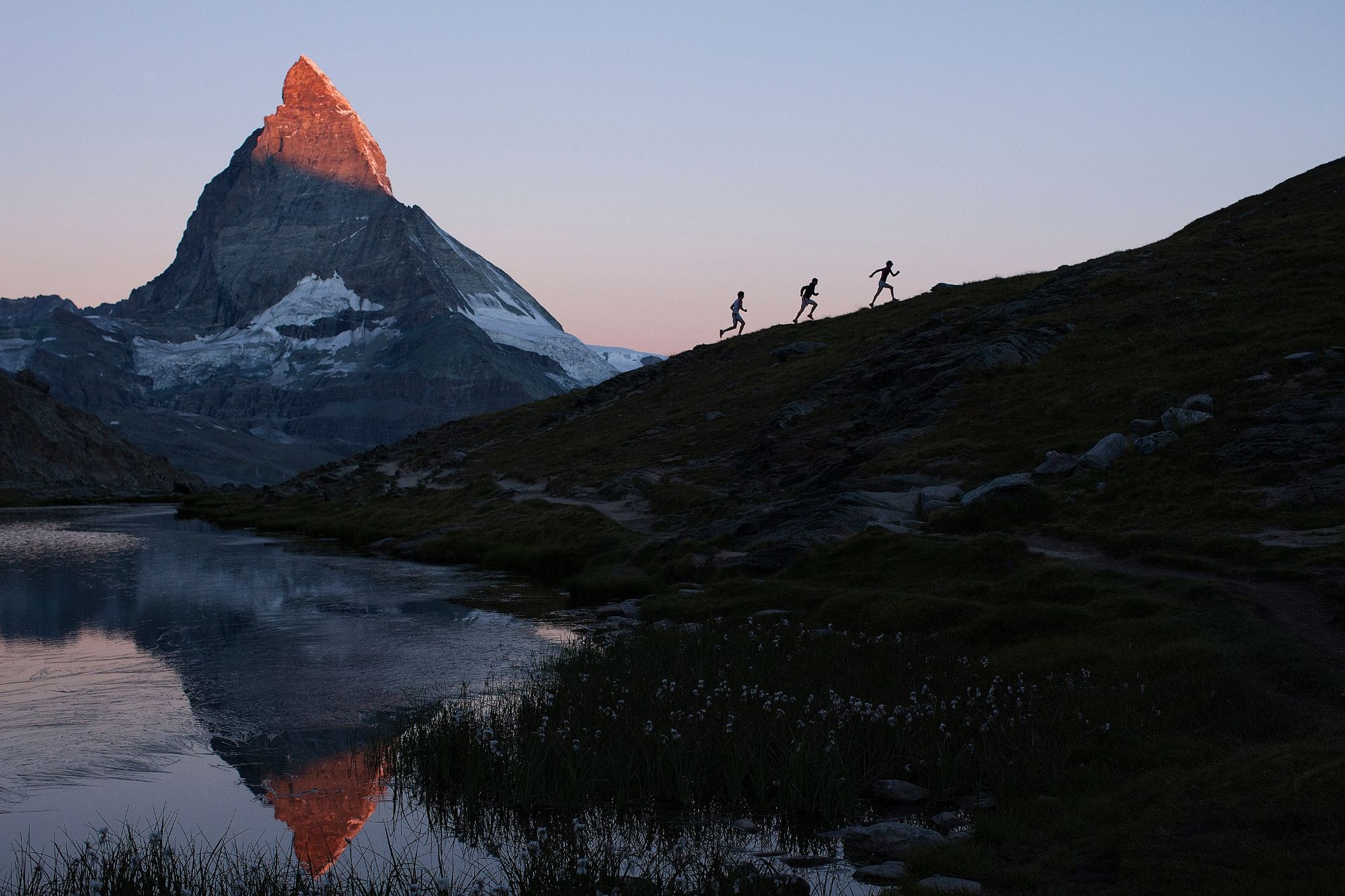
The Matterhorn Ultraks Trail races have taken place every August since 2012. The routes are devised so that non-runners also enjoy an impressive spectacle and can cheer on the competitors.
Circuit around the Zermatt region For spectators: exciting viewpoints at Sunnegga, Gornergrat, Riffelalp, Schwarzsee For spectators: lift access (packages for friends of runners) Option to help as a volunteer
The Sky course follows a breathtaking route with extended open stretches as well as high summits. It’s an ideal course for athletes who can run fast on a technically challenging course complete with a gruelling climb up to 3,100 m on the Gornergrat. Only a true champion can master this circuit, the cult course of the Matterhorn Ultraks Trail contest. - Directions
-
Zermatt - Ried - oberer Höhenweg - Sunnegga - Gornergrat - Riffelalp - Furi - Schwarzsee - Stafel - Trift - Schweifinen - Zermatt
Distance: 49 km
D+ 3,600 and D- 3,600 - Highest point
- 3,125 m
- Endpoint
-
Zermatt (1,620 m)
- Height profile
-
 © outdooractive.com
 - Equipment
-
No compulsory equipment specifications are set by the organising committee.
Recommended:
Suitable footwear Hiking poles (optional) Clothing suitable for the weather (always carry a waterproof and long-sleeved shirt) Mobile phone Survival blanketRefreshment stations are located along the route.
- Safety instructions
- Additional information
- Directions
-
Zermatt is car-free. Private vehicles are permitted only as far as Täsch (5 km before Zermatt). The Täsch–Zermatt road is closed to the public.
Onward travel to Zermatt is either by private taxi or shuttle train. Trains depart every 20 minutes; the journey takes about 12 minutes, and ends at the Bahnhofplatz in Zermatt. - Public transportation
-
By train to the Matterhorn village: 3½ hours from Zürich airport or 4 hours from Geneva airport. Change at Visp onto the Matterhorn Gotthard Bahn (Matterhorn Gotthard Railway). From Visp, the railway leads through the Mattertal valley past idyllic small villages to Zermatt.
Zermatt is also the start and finish point for the world-famous Glacier Express panoramic train journey (Zermatt to St. Moritz or Davos). - Parking
-
Täsch has car parks with both covered and open-air parking – e.g. at the Matterhorn Terminal or privately operated facilities.
Onward travel: see “Getting there”.
- Author
-
The tour Matterhorn Ultraks Trail "Sky" is used by outdooractive.com provided.
General info
-
Unterwallis
74
-
Mattertal
34
-
Zermatt
14