
- Brief description
-
The Matterhorn, the ultimate mountain… This trail explores its many facets: its physical origins, its stories and legends, its very essence.
- Difficulty
-
medium
- Rating
-
- Starting point
-
Schwarzsee (2,583 m)
- Route
-
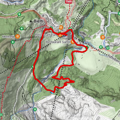
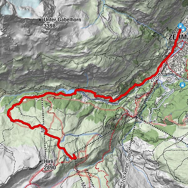
Schwarzsee paradise0.1 kmSchwarzsee (2,588 m)0.1 kmStafelalp3.2 kmStafel (2,139 m)3.5 kmBiel3.9 kmZmutt5.9 kmRestaurant Jägerstube5.9 kmKirche St. Mauritius9.2 kmZermatt (1,608 m)9.3 km
- Best season
-
JanFebMarAprMayJunJulAugSepOctNovDec
- Description
-
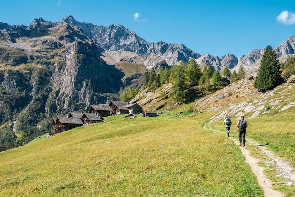
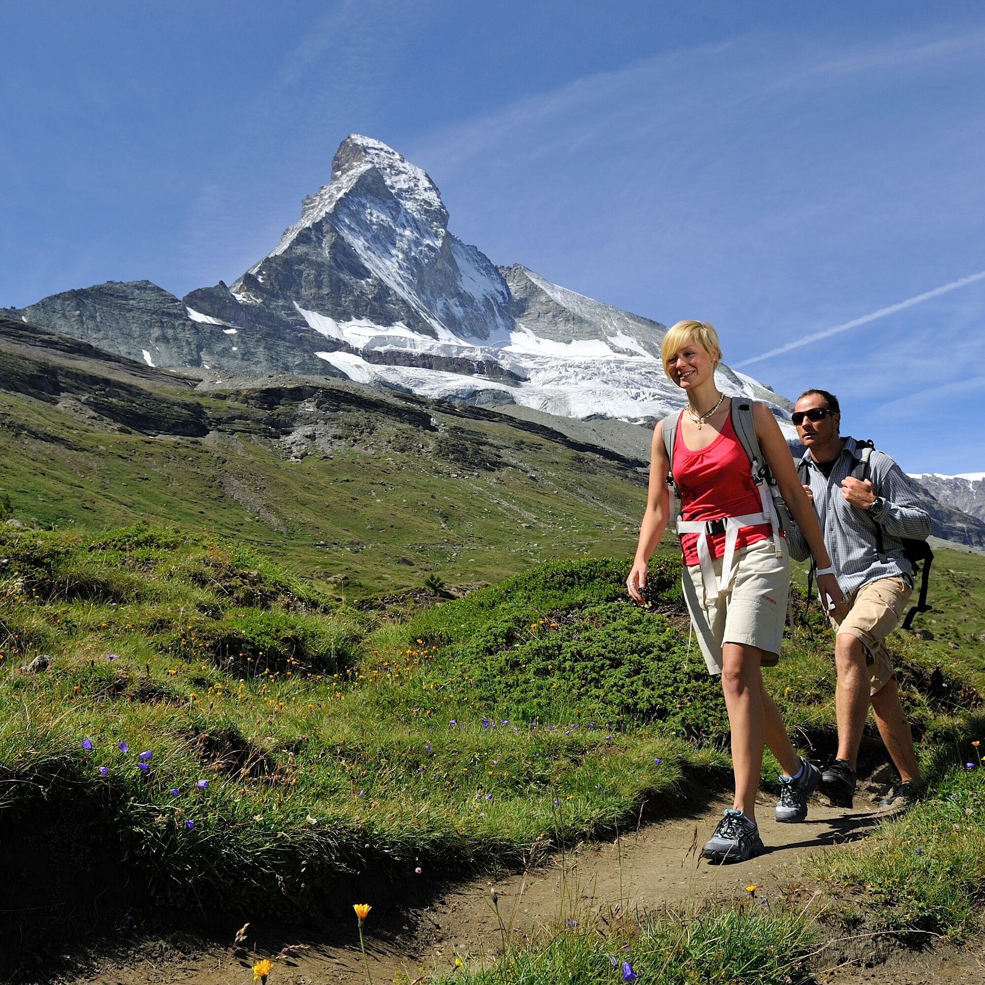
All kinds of stories are told about the Matterhorn: folk talks, legends, amusing anecdotes… This trail, which presents the world-famous mountain from quite close up, features a series of information panels that cover many different aspects of the iconic peak.
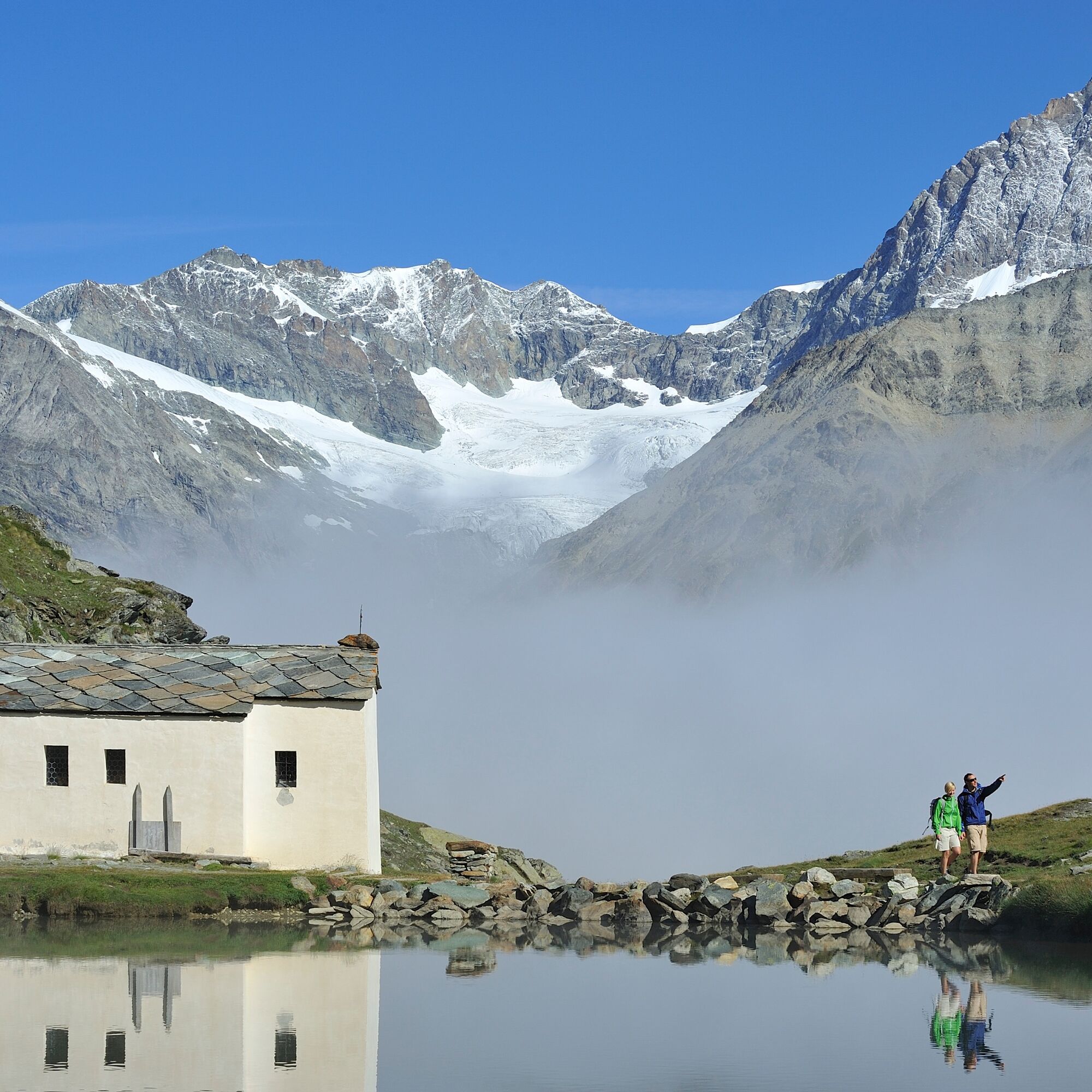
Idyllic chapels at Schwarzsee and in Zmutt Good view of the north face of the Matterhorn Information panels in German, English, French, Japanese
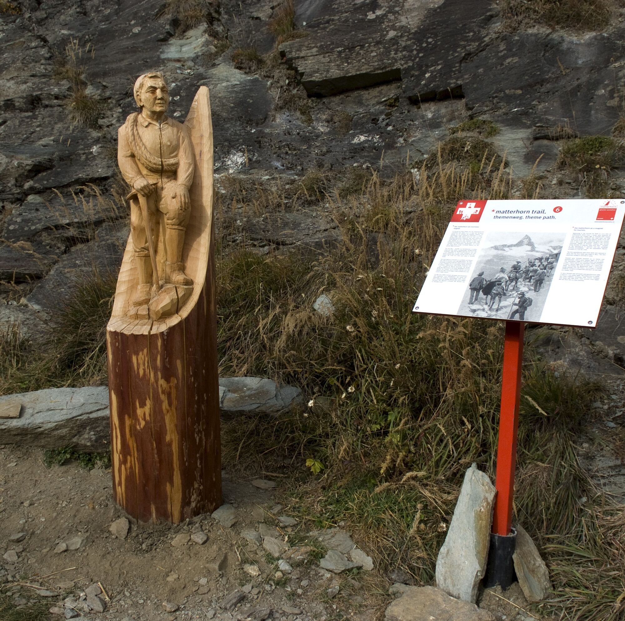
Did you know that the Matterhorn was made by giants from Valtournenche? Or that there were once plans to build a lift to the summit of the Matterhorn (see literature note)? Carved wooden sculptures beautifully depict different themes and stories. - Directions
-
Schwarzsee - Stafelalp - Zmutt - Zermatt (station)
(Hiking time in reverse direction: approx. 3h 45)
- Highest point
- 2,582 m
- Endpoint
-
Zermatt (1,620 m)
- Height profile
-
 © outdooractive.com
 - Equipment
-
We recommend:
Good footwear Hiking poles (optional) Clothing suitable for the weather (always carry a waterproof) - Safety instructions
-
Plan every mountain tour carefully and adapt to participants’ fitness level as well as the weather and season.
Weather conditions can change quickly in the mountains. Appropriate clothing is therefore essential, along with adequate supplies of food and water. In uncertain weather, turn back in good time.
Inform others of planned route, and whenever possible avoid going alone.
Do not leave the marked routes; do not venture onto glaciers without a mountain guide.
Please be considerate to other walkers and to plants and animals.
Take note of the warning signs drawing attention to the constant danger in river beds and along watercourses below dams and reservoirs. - Tips
-
Anyone who prefers a more challenging hike can extend the trail. This sportier version of the Matterhorn Trail is a breathtaking high-altitude hike in high alpine and rocky terrain along the Hirligrat in the direction of the Hörnli Hut. To take this additional athletic route, follow the signs in the direction of the Hörnli Hut. Shortly before the Hörnli Hut, the path turns right and leads down the north side of the Matterhorn to Stafelalp. Additional time 2h 17 – total time to Zermatt 3h 55 with additional path.
- Additional information
- Directions
-
Zermatt is car-free. Private vehicles are permitted only as far as Täsch (5 km before Zermatt). The Täsch–Zermatt road is closed to the public.
Onward travel to Zermatt is either by private taxi or shuttle train. Trains depart every 20 minutes; the journey takes about 12 minutes, and ends at the Bahnhofplatz in Zermatt. - Public transportation
-
By train to the Matterhorn village: 3½ hours from Zürich airport or 4 hours from Geneva airport. Change at Visp onto the Matterhorn Gotthard Bahn (Matterhorn Gotthard Railway). From Visp, the railway leads through the Mattertal valley past idyllic small villages to Zermatt.
Zermatt is also the start and finish point for the world-famous Glacier Express panoramic train journey (Zermatt to St. Moritz or Davos). - Parking
-
Täsch has car parks with both covered and open-air parking – e.g. at the Matterhorn Terminal or privately operated facilities.
Onward travel: see “Getting there”.
- Author
-
The tour Matterhorn Trail (Nr. 29) is used by outdooractive.com provided.


General info
-
Unterwallis
1208
-
Mattertal
555
-
Zermatt
155