- Brief description
-
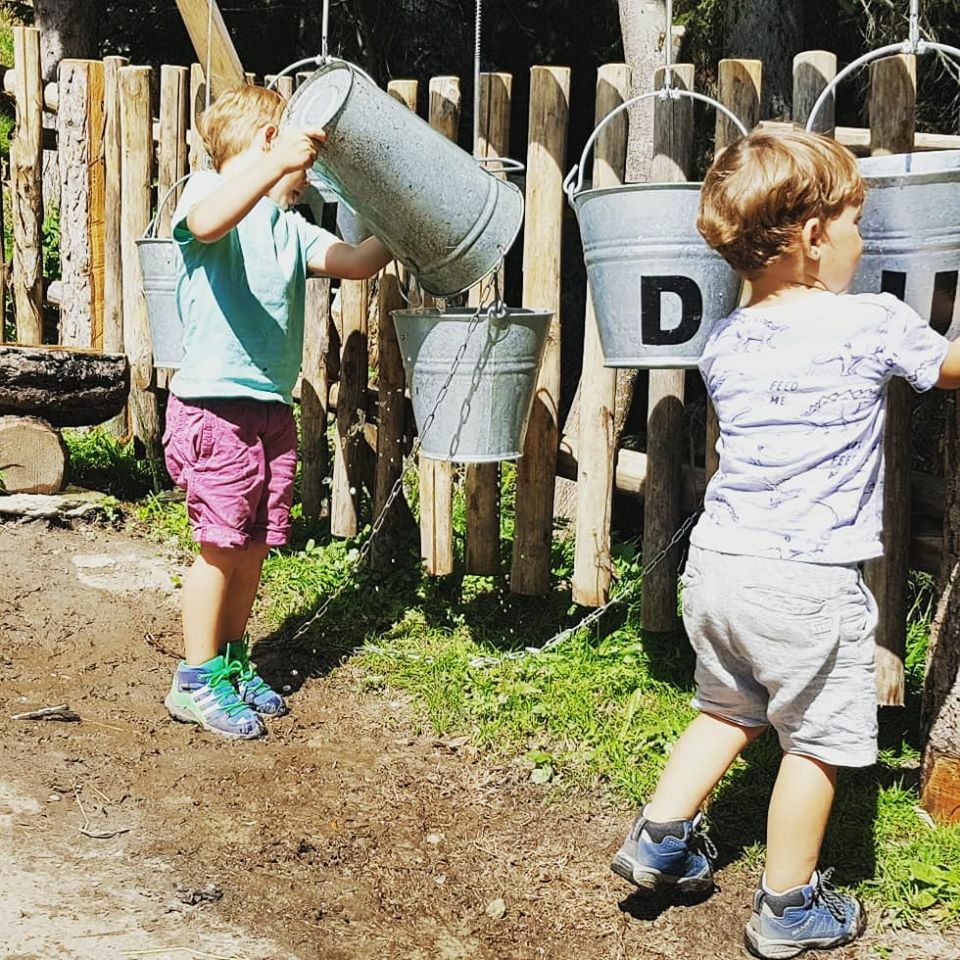
This themed trail takes you on the trail of the witch Vero and discovers her home in the Blindtal valley.
- Difficulty
-
easy
- Rating
-
- Starting point
-
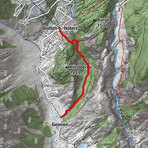
Blatten bei Naters (1330 m)
- Route
-
Blatten b. Naters (1,327 m)0.0 kmGeimen2.2 km
- Best season
-
JanFebMarAprMayJunJulAugSepOctNovDec
- Description
-
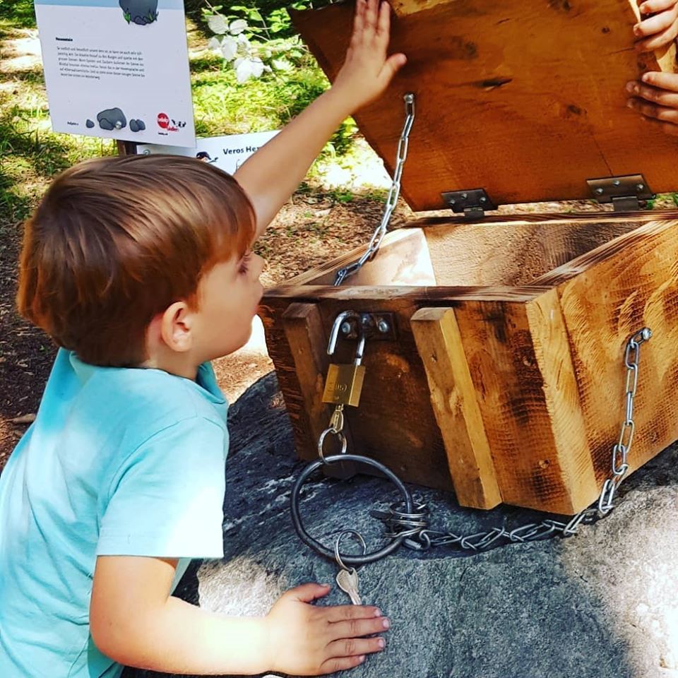
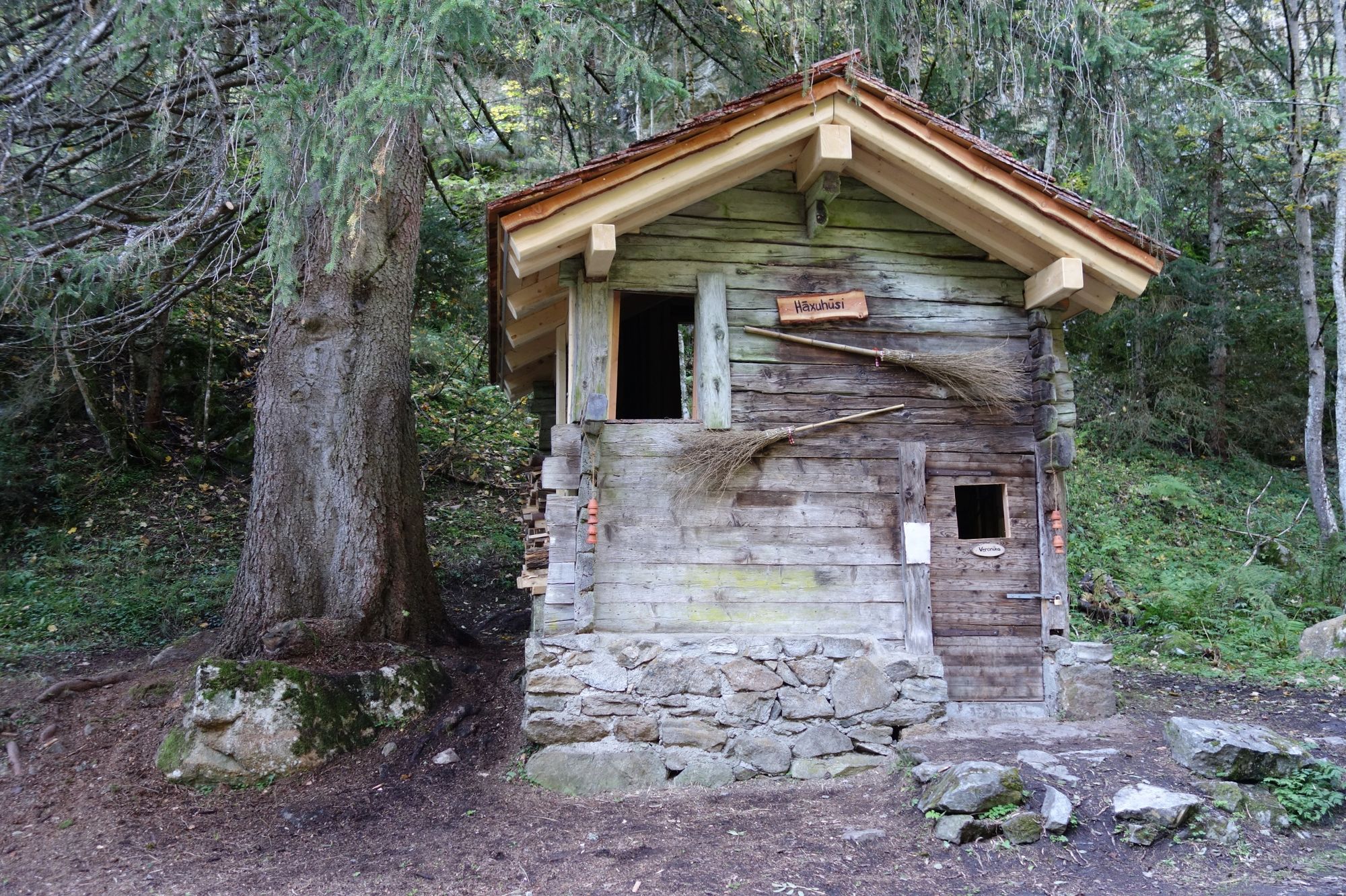
In the bewitched Blindtal, an entirely adventurous spot between Naters and Blatten, Vero the little Belalp witch lives with her friends and the forest inhabitants. A themed trail awaits the whole family here, where bewitched tasks have to be solved to find out the magic spell.
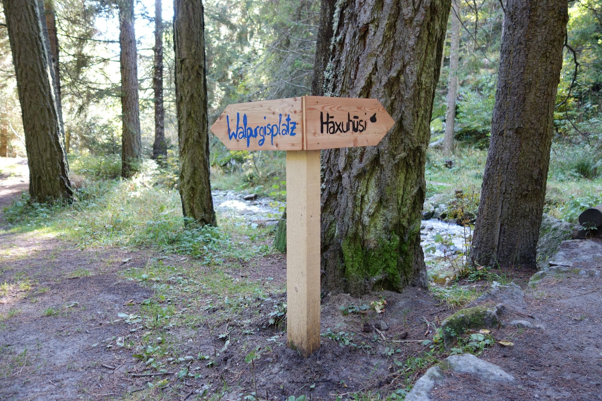
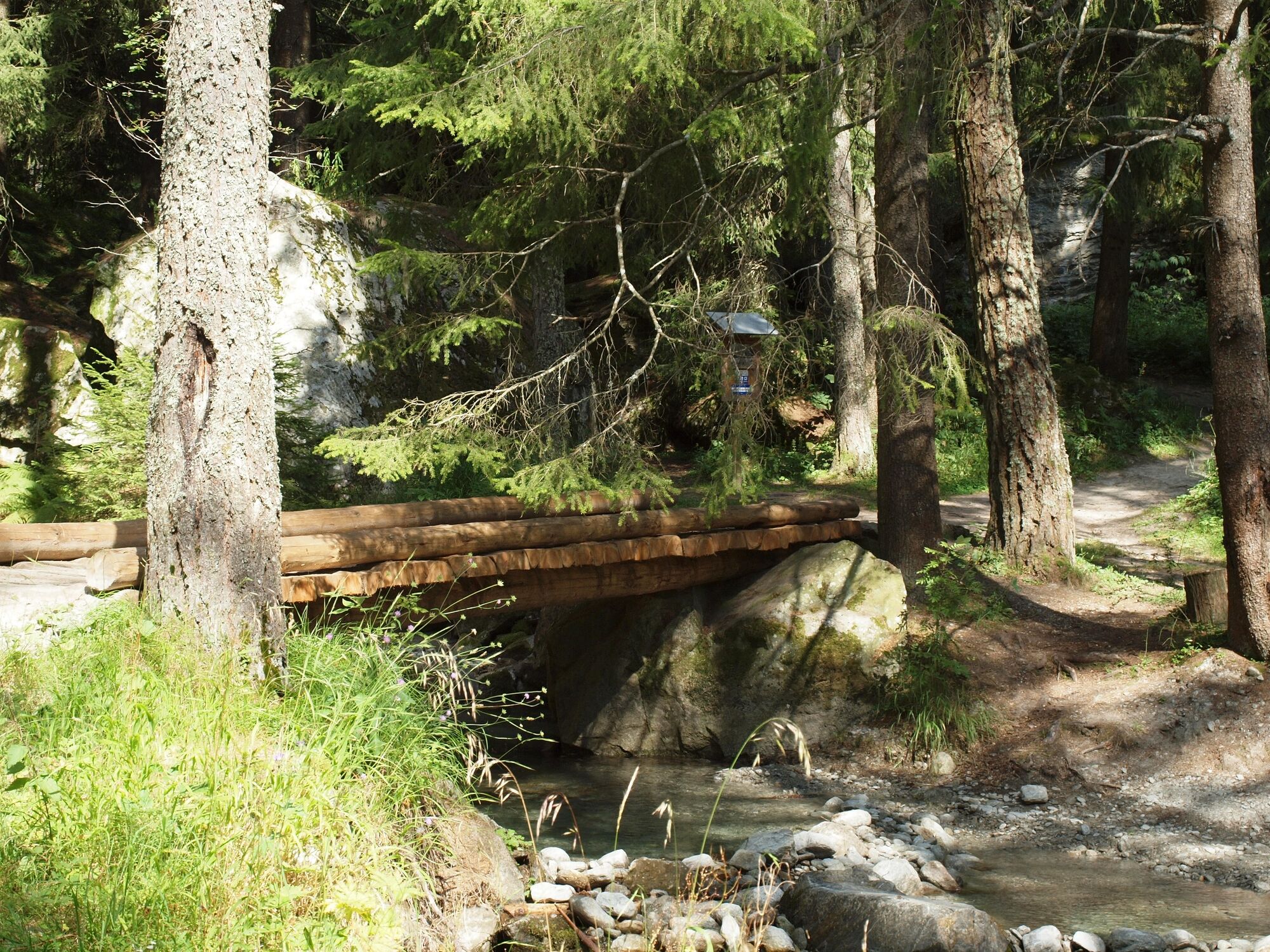
The bewitching adventure for young and old starts in Blatten near Naters and first the telescope must be set correctly to find the way to Vero's witch shower. The path then leads down into the Blindtal valley and has a variety of tasks in store. But there is also recreation in the Blindtal: how about cooling off your feet in the Bruchji? Of course, the physical well-being should not be neglected in the Blindtal: Have a picnic or a barbecue at one of the available barbecue sites.
You can get the documents for Vero's Hexenweg at the tourist office in Blatten or here.
- Directions
-
The hike starts in Blatten near Naters and first leads to the information pavilion. After locating Vero's witch's kingdom with the telescope, the trail continues in the direction of Blindtal and then to Geimen.
Blatten - Blindtal - Geimen
- Highest point
- 1,323 m
- Endpoint
-
Geimen (1044 m)
- Height profile
-
 © outdooractive.com
 - Equipment
-
Sturdy shoes, clothing suitable for the weather, sun and rain protection, as well as sufficient supplies of food and drinks, should there be no refreshment stops or shopping facilities available or open. Although the trail is very well marked throughout, you should always have a suitable hiking map with you for safety reasons. Take sticks or other aids with you.
- Safety instructions
-
Despite the "impossible to miss" marking of the hiking trails, we recommend for safety reasons to always have an appropriate hiking map with you, so that you can quickly find a safe area in case of a thunderstorm or emergency, for example.
Especially in autumn, you should also be aware that leaves lying on the ground can hide bumps, roots, stones or holes in the path. After storms, trees can still fall over or branches can fall down. Especially in adverse weather conditions, muddy and slippery passages can occur on natural paths. You have to expect this kind of path obstruction when you go on a hike.
Not all rocks or precipices are secured with ropes or railings. In some cases surefootedness is required. If you think that certain sections of the trail are not passable for you, you should avoid them.
- Tips
-
- Barbecue areas invite you to linger and grill.
- This hike is also suitable on hot summer days, as it is mostly in the forest
- Discover the glacial mills of the Ice Age
- Additional information
- Directions
-
Arrival by car
From western Switzerland: A9 Lausanne - Vevey, or north-western Switzerland: A12 Bern - Vevey: A9 - Sierre: main road Sierre - Brig
From north-western Switzerland: A6 Berne - Thun - Spiez: main road Spiez - Kandersteg (Lötschberg tunnel car transport) - Goppenstein - Gampel - Brig
From eastern and central Switzerland: Andermatt - Realp (year-round Furka car transport; in summer via Furka Pass) - Oberwald - Brig
From Ticino (in summer): Airolo - Nufenenpass - Ulrichen - Brig
Or via Centovalli - Domodossola - Simplonpass - Brig
From Italy (Aosta, Mt. Blanc Tunnel): Aosta - Grand Saint Bernard tunnel (over the pass in summer) - Martigny: A9 motorway - Sierre: Sierre - Brig main road.
Or via Domodossola - Simplon Pass - Brig
Blatten bei Naters
From Brig you can reach Blatten bei Naters via Naters, then take the cable car to the car-free Belalp.
- Public transportation


-

-
AuthorThe tour Veros Witch's Path (Theme Trail) is used by outdooractive.com provided.


General info
-
Aletsch Arena
1489
-
Brig Simplon
486
-
Blatten-Belalp
185