
- Brief description
-
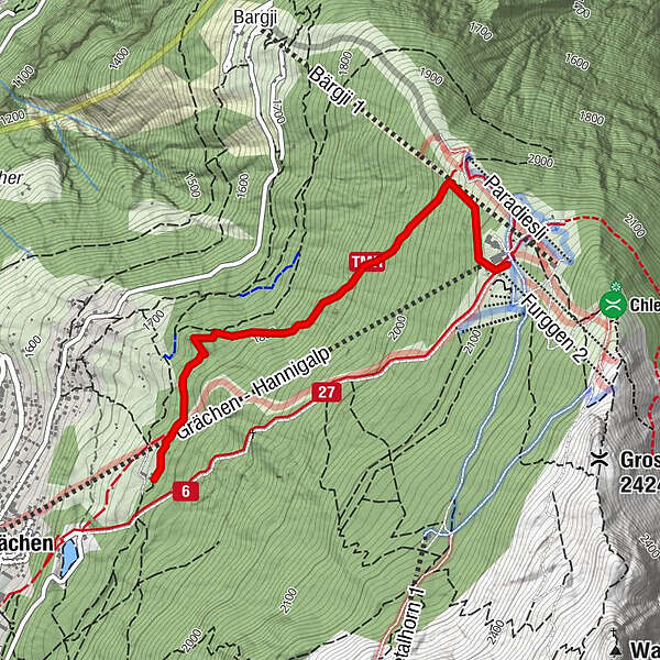
A fairly demanding snowshoe tour from Alpe Äpnet passing through snowy landscapes and the larch forest of Grächen, the high point of the the Hannigalp Trail. You’ll be rewarded for the climb once you reach the end.
- Difficulty
-
medium
- Rating
-
- Starting point
-
Alpe Äpnet
- Best season
-
AugSepOctNovDecJanFebMarAprMayJunJul
- Description
-
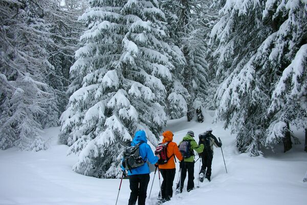
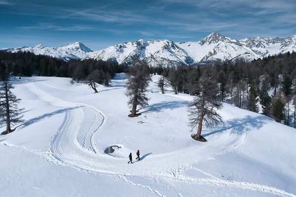
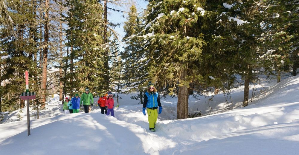
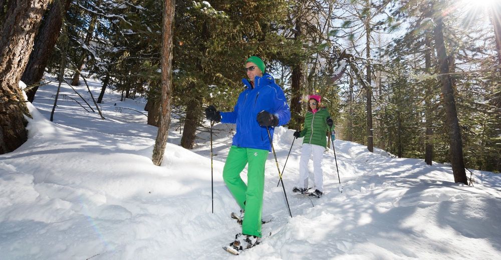
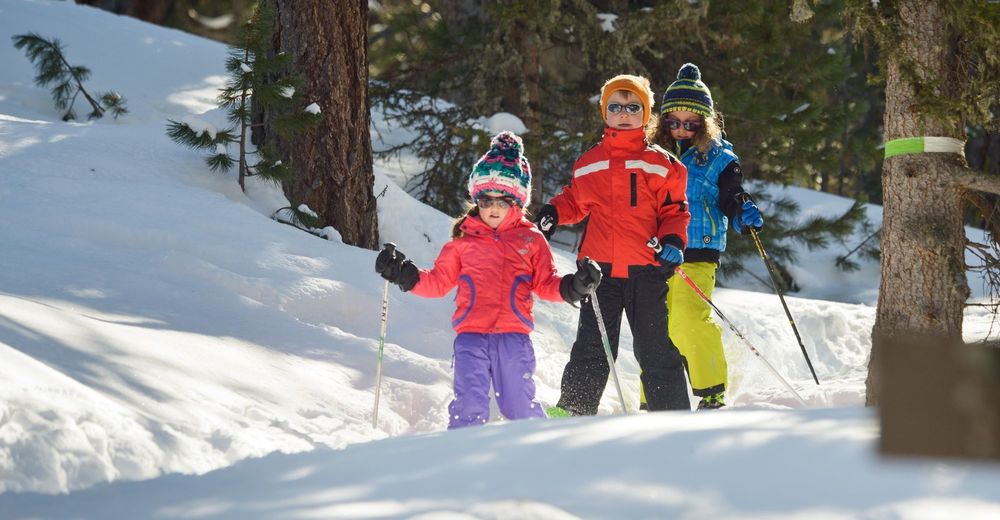
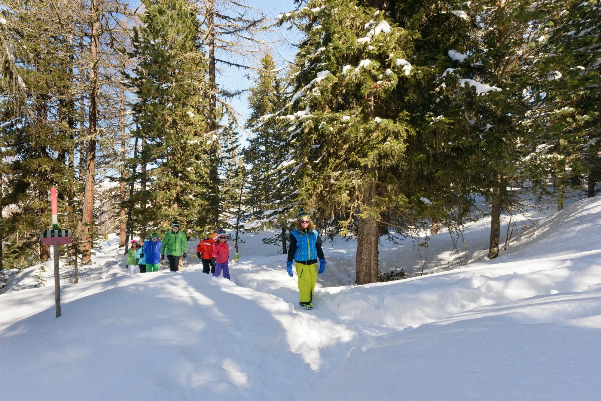
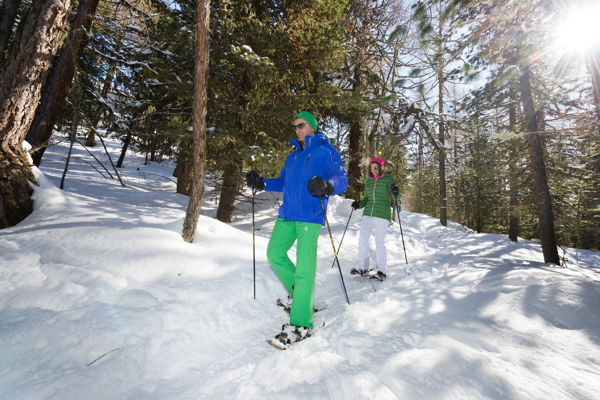
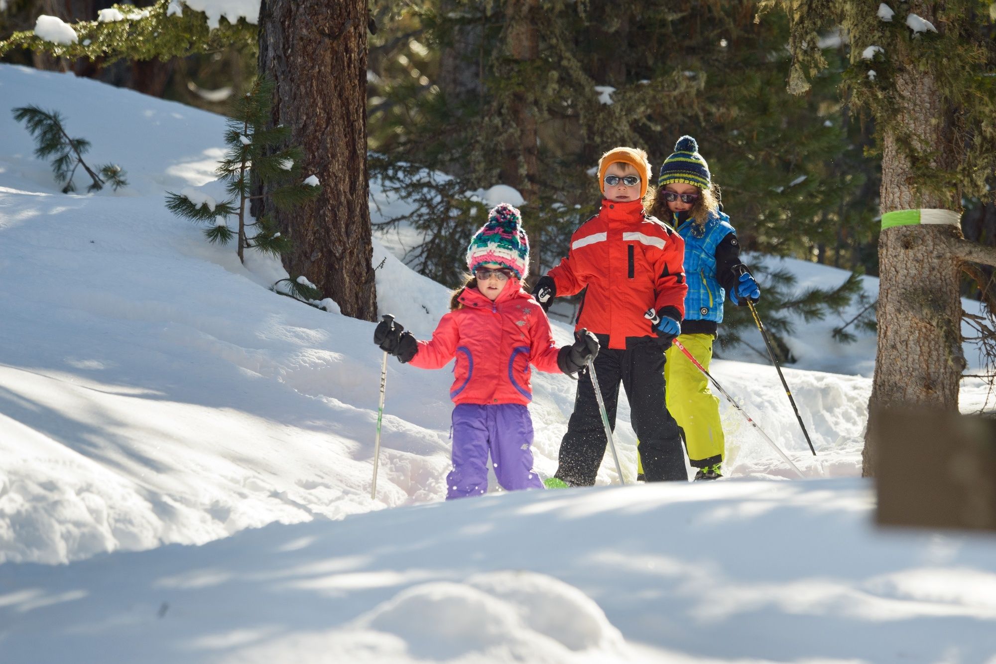
In summer, the cattle graze on the idyllic pastures of Alpe Äpnet, filling up on juicy alpine grass and fresh herbs. However, even in winter, when the cows are no longer up there, it’s still a picturesque location. Make sure you get your fill of this energy before starting the Hannigalp Trail, which begins on open terrain before heading into the snow-capped larch forest. Be sure to pace yourself, because the trail starts to climb again after the first section on level ground. Which makes sense, as the route ends on Hannigalp at 2,114 metres above sea level. Enjoy the tranquillity and look forward to a culinary reward on the panoramic terrace at the heart of the Hannigalp ski area. Even though you’ll spend most of the hike in the forest, you’ll get regular opportunities to enjoy the magnificent Alpine panorama, including the Weisshorn.
- Directions
-
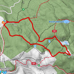
Hike from Grächen to Alpe Äpnet, then strap on your snowshoes and cross the ski slope along the edge of the forest. Shortly afterwards you’ll head into the romantic wintry forest of Grächen and take the path towards Hannigalp. The return journey follows the same route. Those looking for a more leisurely hike can take the Fairy Tale Cable Car back to Grächen.
- Highest point
- 2,114 m
- Endpoint
-
Hannigalp
- Height profile
-
 © outdooractive.com
 - Equipment
-
We recommend:
Good, waterproof footwear Snowshoes hiking poles clothing suitable for the weather: always carry a waterproof jacket hat or cap sunscreen bottle for water, picnic camera printout of this hike (click “Print” icon, top right, to download) - Safety instructions
-
Use of the snowshoe trails and the information on this website is at hikers’ own risk. Local conditions may entail changes to routes. Valais/Wallis Promotion accepts no liability for the accuracy and completeness of information on this website.
Bring a map. Download full description of this route including large-scale map by clicking on “Print” icon, top right of this page. Use marked trails only, and observe all signposting – for your own safety, to safeguard grazing animals and to avoid disturbing wildlife. Please be considerate to other trail users, and to the plants and animals. Do not leave any waste in nature. Take extra care protecting yourself from the sun at altitude. UV radiation can be exceptionally strong, even in cloudy weather. Plan hike carefully: take into consideration fitness level of each participant, weather forecast and season. Inform others of planned route, and whenever possible, avoid going alone. Weather conditions can change quickly in the mountains, without warning. Appropriate clothing is therefore essential, along with adequate supplies of food and water. In uncertain weather, turn back in good time. Do not venture onto glaciers without a mountain guide. Take note of the warning signs that point out the constant danger, especially the danger of avalanches. - Tips
-
Grächen forest is at its best under fresh snow, when the snowshoe hike becomes a truly unique and unforgettable experience.
- Additional information
- Directions
-
Motorway A9 direction Visp. Main road direction Saas-Fee / Zermatt junction Grächen.
- Public transportation
-
Accessible by train and bus. From Visp or St. Niklaus train station, take the bus to Grächen.
- Parking
-
Grächen is partially car-free. Two parking garages are available at the entrance of the village.
- Author
-
The tour Alpe Äpnet – Hannigalp-Trail is used by outdooractive.com provided.


General info
-
Oberwallis
194
-
Moosalpregion
112
-
Grächen - St. Niklaus
32