
- Brief description
-
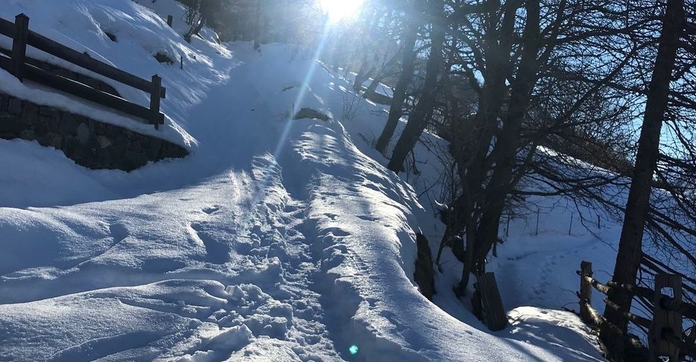
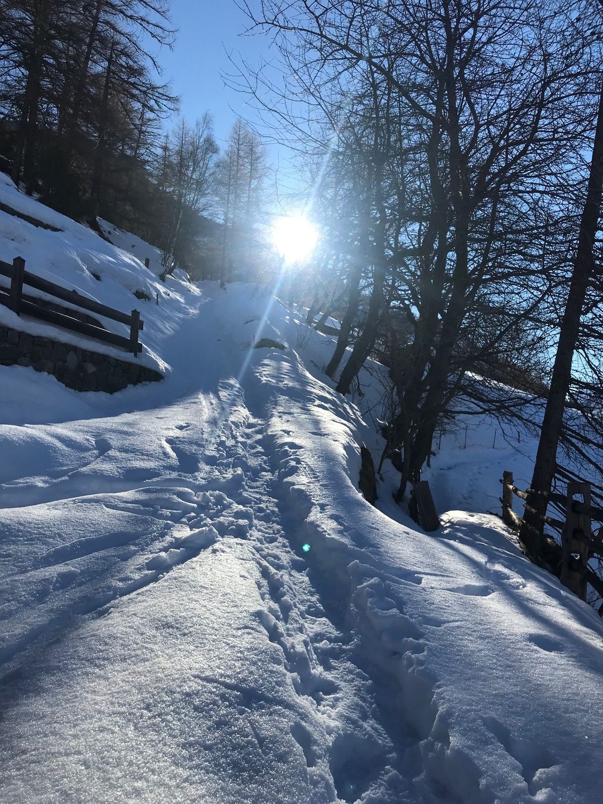
The Waldegga Trail in Gspon is special for many reasons, including the pure sunshine, enchanting views and all-round relaxation in a snow-capped winter forest. Although above all, it's still possible to hike it when many other snowshoe tours are no longer feasible.
- Difficulty
-
medium
- Rating
-
- Starting point
-
Gspon
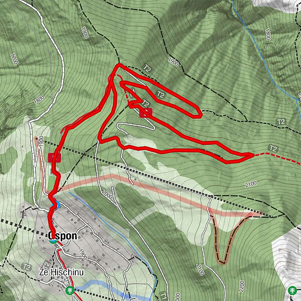
- Route
-
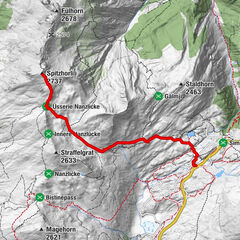
GsponAlpenblickZe Hischinu
- Best season
-
AugSepOctNovDecJanFebMarAprMayJunJul
- Description
-
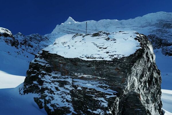
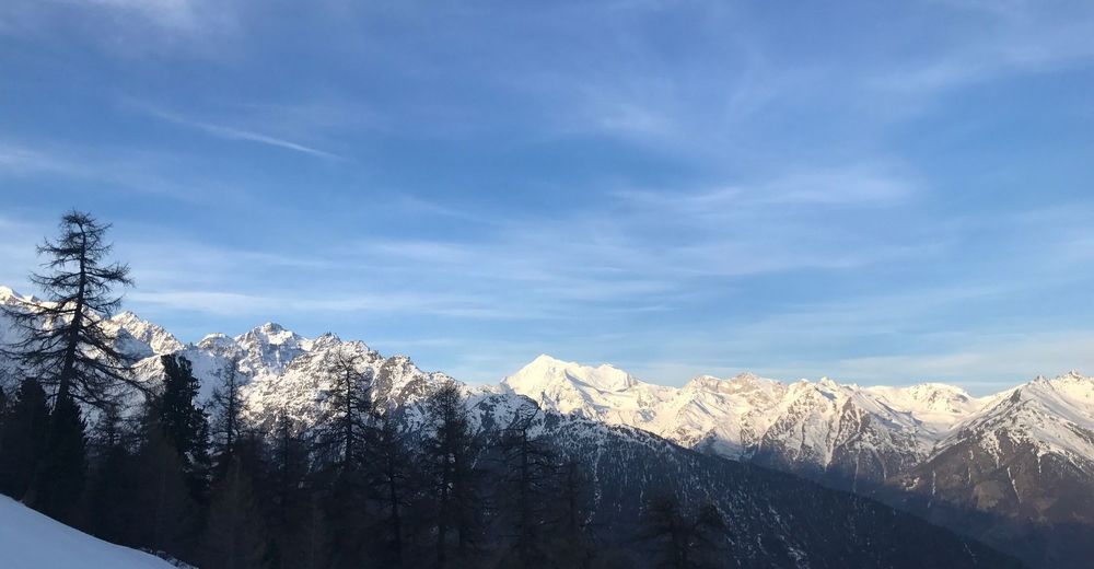
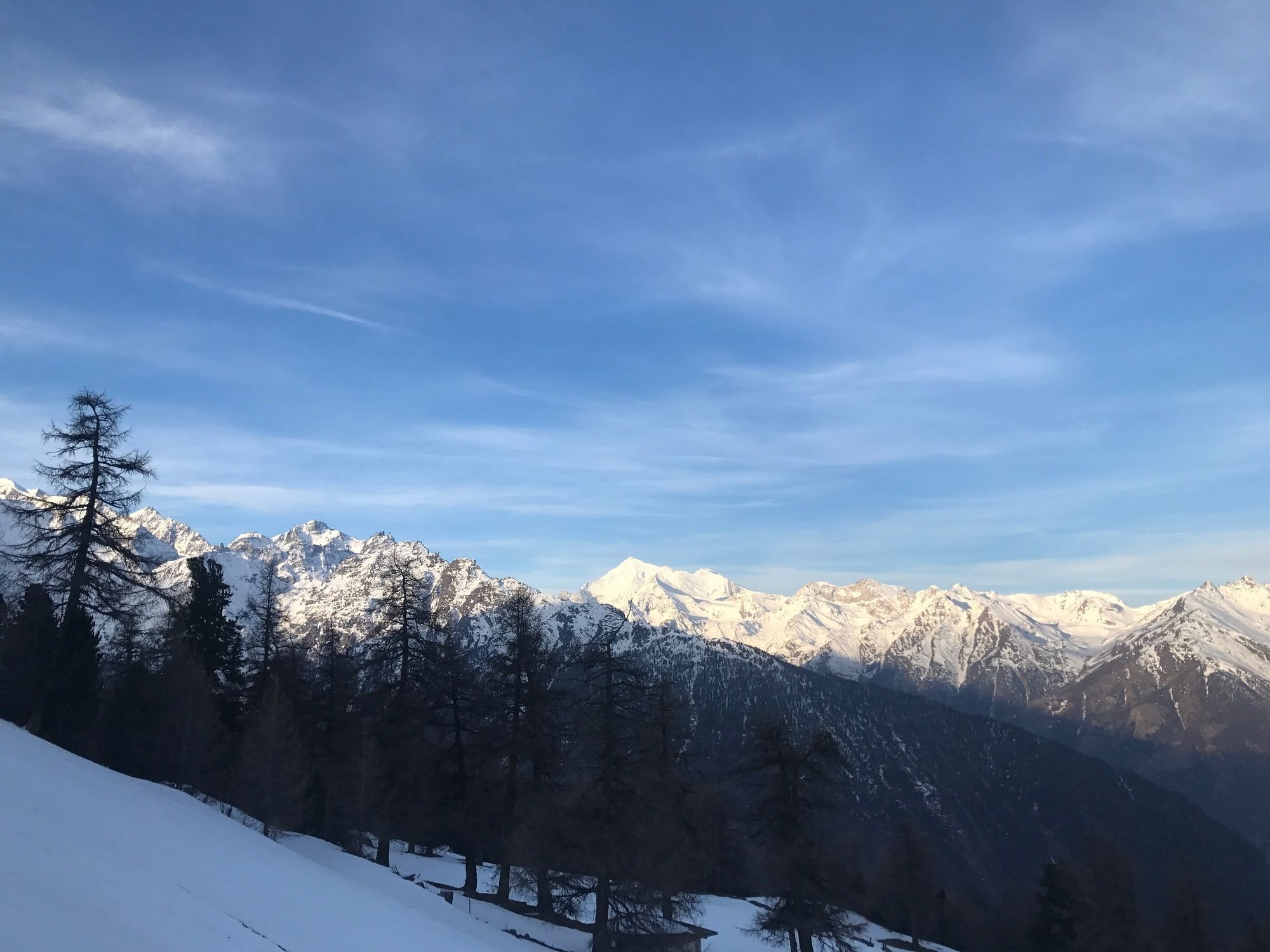
On the Waldegga Trail in Gspon ob Staldenried you’ll follow in the footsteps of football legend Ottmar Hitzfeld, who lent his name to the highest football stadium in Europe, situated at around 2,000m above sea level. This is a fairly steep trail, and is therefore aimed at snowshoe hikers who have experience on similar terrain and are in good physical condition. Once you’ve passed the Waldegga ski lift, the high-altitude hike takes you through a stone pine and larch forest towards Sädolti, with the peaks of the Bietschhorn, Aletschorn and Finsteraarhorn visible in the distance. The trail then continues up to Seewjini, where the forest becomes sparser. Eagle-eyed snowshoe hikers might even catch a glimpse of a wood grouse. Later on you can watch the ski pros tearing down the slopes before heading back down to the football stadium and the cable car station.
- Directions
-
The Waldegga Trail begins at the mountain station of the Staldenried-Gspon cable car, then leads past the Ottmar Hitzfeld Arena and the Waldegg ski lift before entering the forest. From there, it continues towards Waldegga, Sädolti and Seewjini. A little further on, beneath Scheidbodo and near the Gspon ski lift, the trail heads downhill back to the football stadium and along the road until it reaches the departure point.
- Highest point
- 2,036 m
- Endpoint
-
Gspon
- Height profile
-
 © outdooractive.com
 - Equipment
-
We recommend:
Good, waterproof footwear Snowshoes hiking poles clothing suitable for the weather: always carry a waterproof jacket hat or cap sunscreen bottle for water, picnic camera printout of this hike (click “Print” icon, top right, to download) - Safety instructions
-
Use of the snowshoe trails and the information on this website is at hikers’ own risk. Local conditions may entail changes to routes. Valais/Wallis Promotion accepts no liability for the accuracy and completeness of information on this website.
Bring a map. Download full description of this route including large-scale map by clicking on “Print” icon, top right of this page. Use marked trails only, and observe all signposting – for your own safety, to safeguard grazing animals and to avoid disturbing wildlife. Please be considerate to other trail users, and to the plants and animals. Do not leave any waste in nature. Take extra care protecting yourself from the sun at altitude. UV radiation can be exceptionally strong, even in cloudy weather. Plan hike carefully: take into consideration fitness level of each participant, weather forecast and season. Inform others of planned route, and whenever possible, avoid going alone. Weather conditions can change quickly in the mountains, without warning. Appropriate clothing is therefore essential, along with adequate supplies of food and water. In uncertain weather, turn back in good time. Do not venture onto glaciers without a mountain guide. Take note of the warning signs that point out the constant danger, especially the danger of avalanches. - Tips
-
This particularly sunny route is recommended in mid-winter as well as in early spring, when many other snowshoe trails are no longer accessible.
- Additional information
- Directions
-
Motorway A9 direction Visp. Main road direction Saas-Fee / Zermatt junction Staldenried.
- Public transportation
-
Accessible by train and bus. From Visp station to Staldenried and by cable car to Gspon.
- Parking
-
Parkings in Stalden or Staldenried.

-

-
AuthorThe tour Waldegga Trail is used by outdooractive.com provided.


General info
-
Oberwallis
194
-
Rund um Visp
111
-
Staldenried - Gspon
32