


- Brief description
-
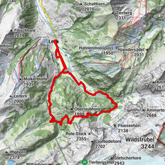
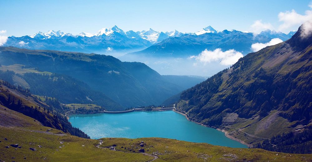
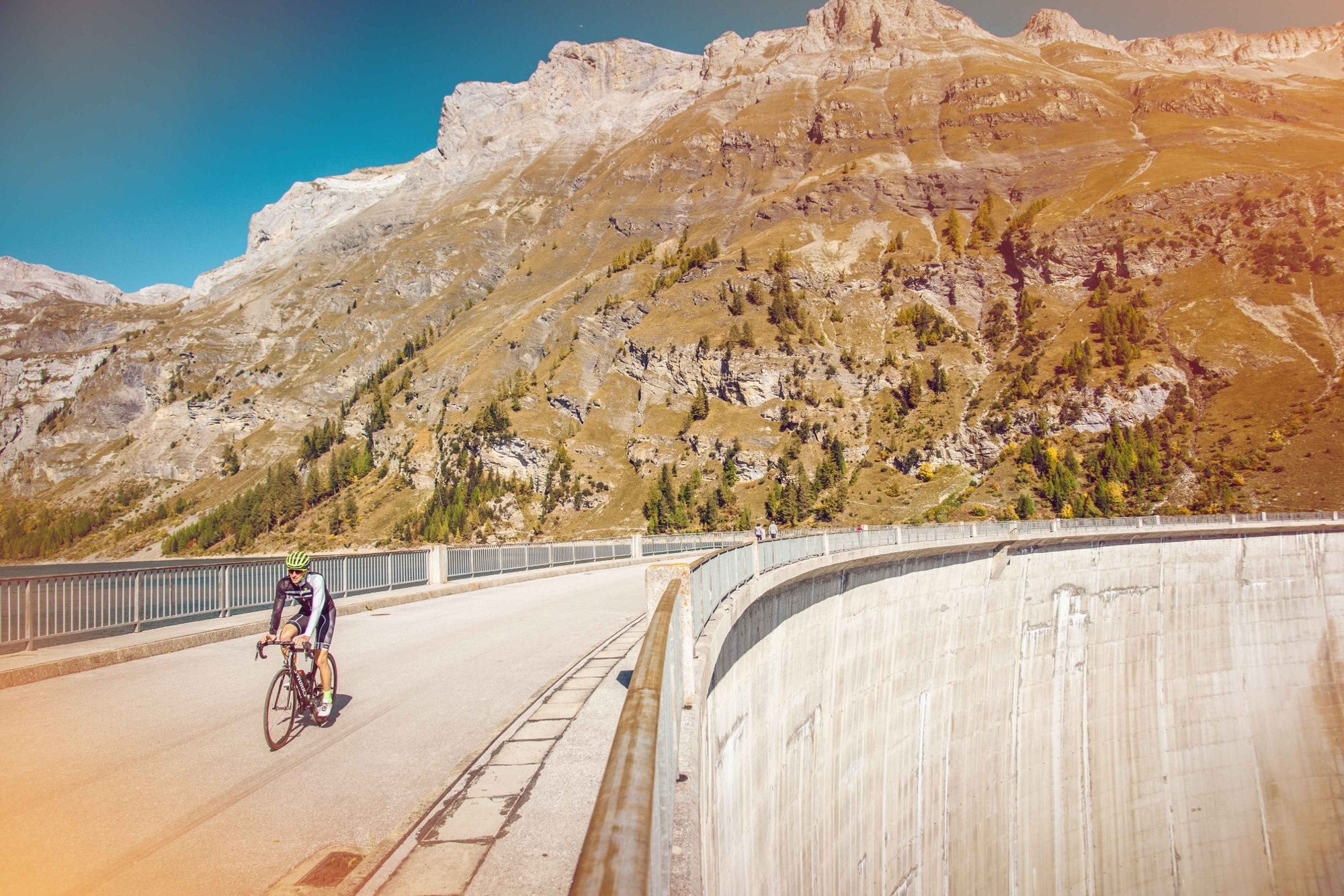
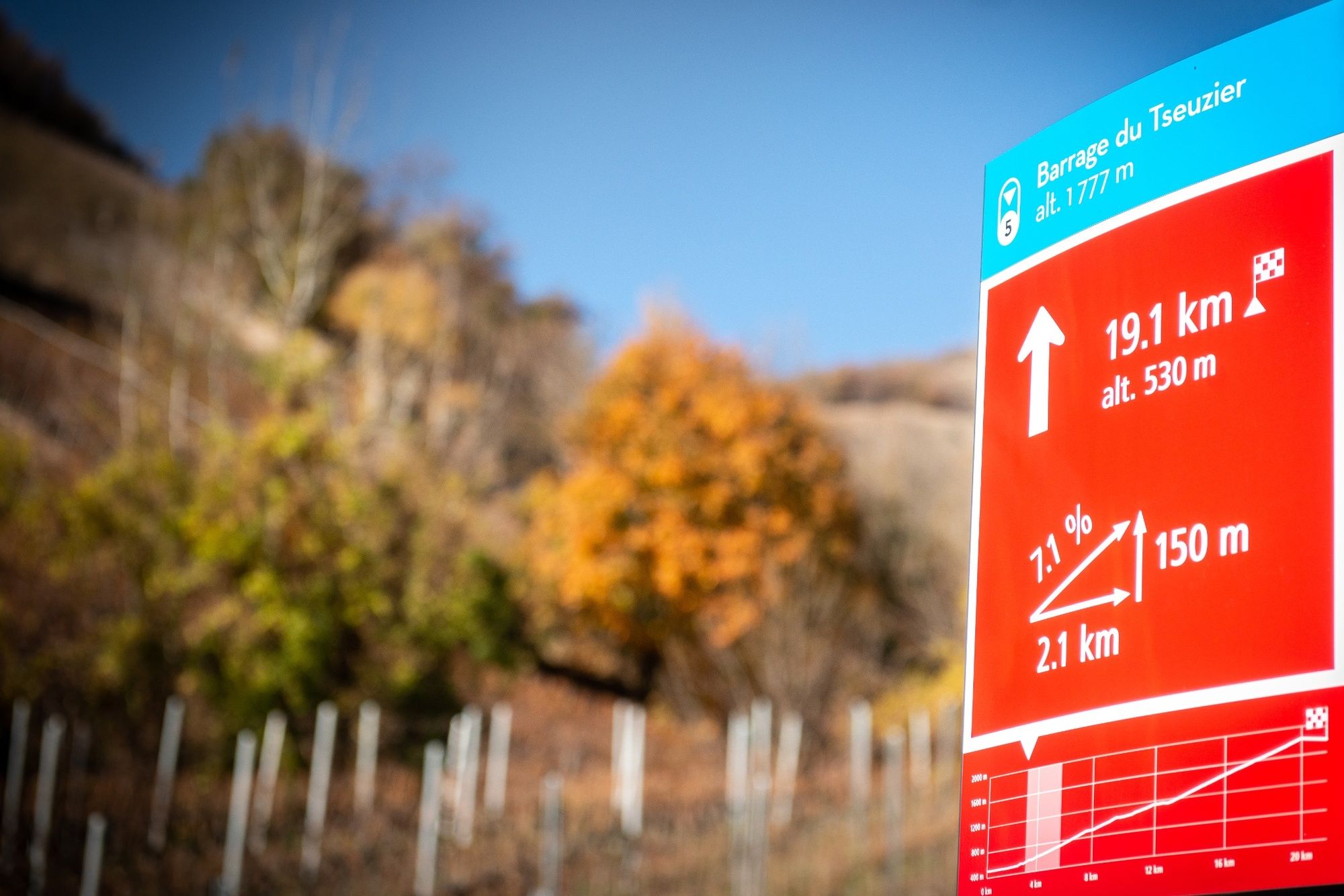
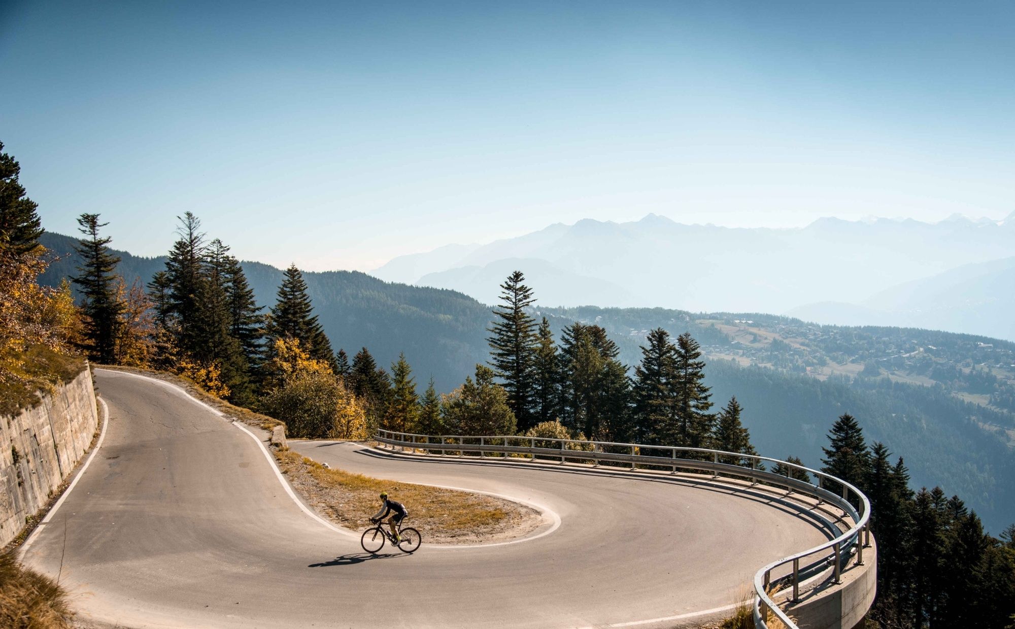
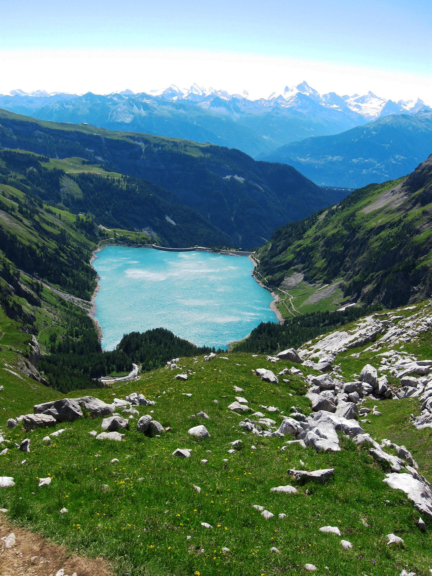
The climb to Tseuzier Dam, which rises to 1777 metres of altitude, starts in Sion and is about 22 kilometres long. From the Valais vineyards to the lake of Tseuzier, this itinerary offers a panoramic view that is breathtaking at every moment .Along the whole climb, special signs have been erected to mark the route.
- Difficulty
-
difficult
- Rating
-
- Starting point
-
Bramois
- Route
-
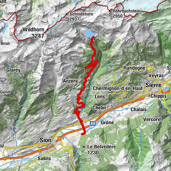
Uvrier1.6 kmSaint-Léonard (498 m)2.0 kmLormey4.2 kmLe château (997 m)8.0 kmLa Place (Ayent)8.2 kmSaxonne (Ayent)9.3 kmBotyre (Ayent)9.3 kmSt-Romain (Ayent)9.9 kmLuc (Ayent)10.1 kmFortunau (Ayent)10.4 kmLes Routesses10.6 kmLes Fugesses12.0 kmLes Rousses20.3 kmLac de Tseuzier21.9 km
- Best season
-
JanFebMarAprMayJunJulAugSepOctNovDec
- Description
-
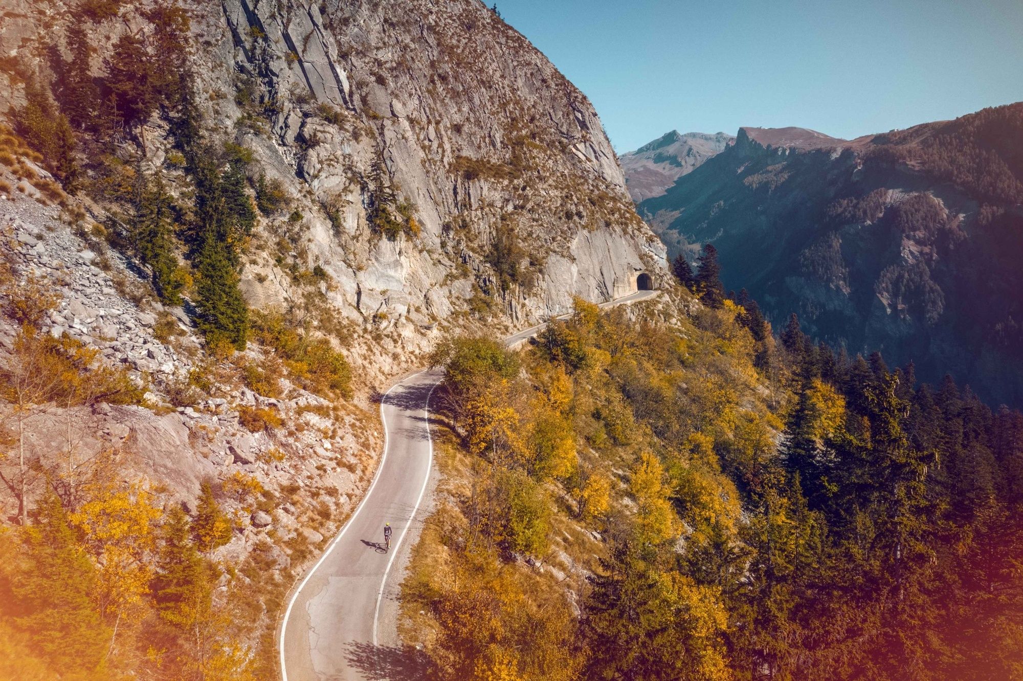
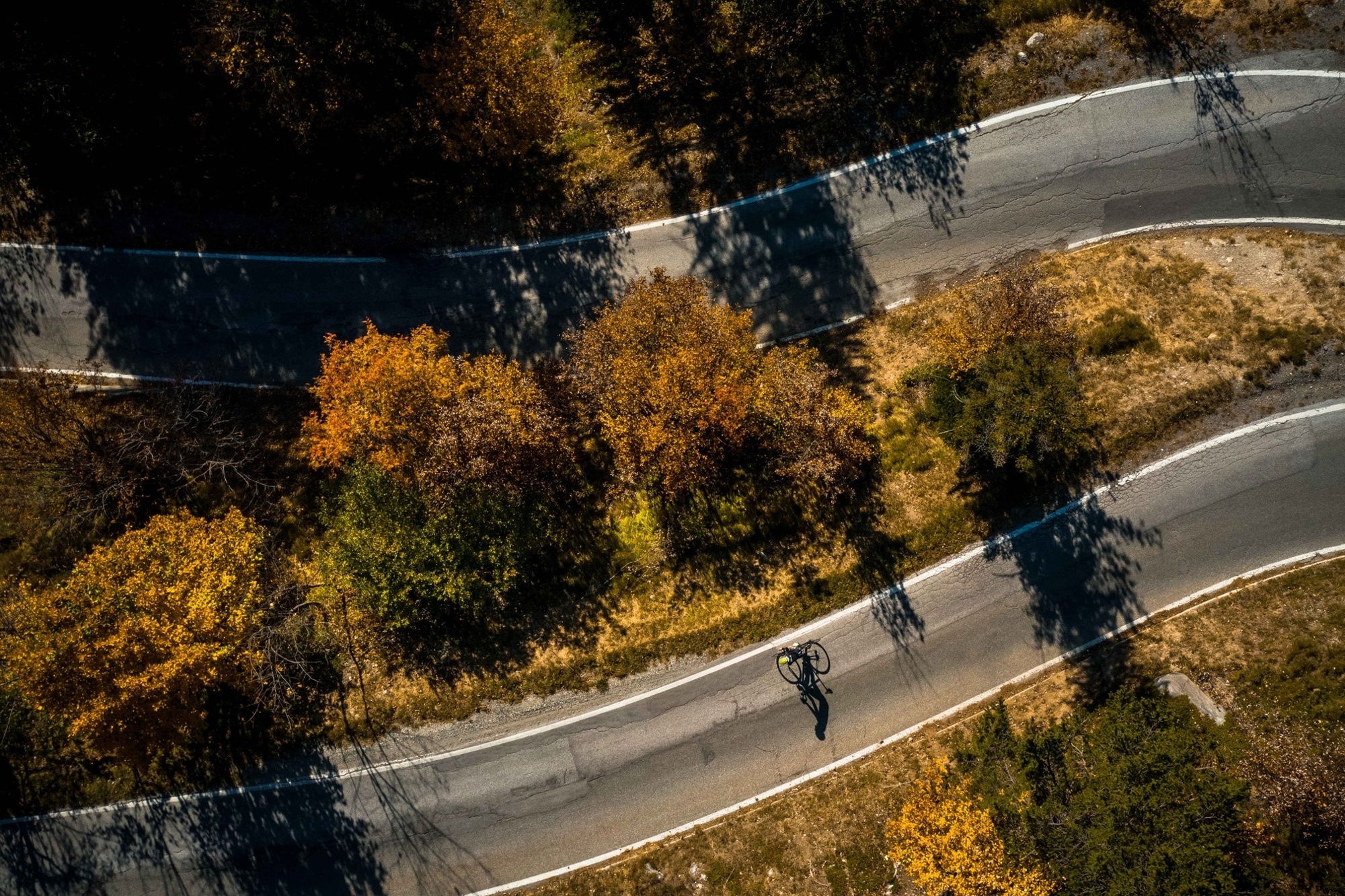
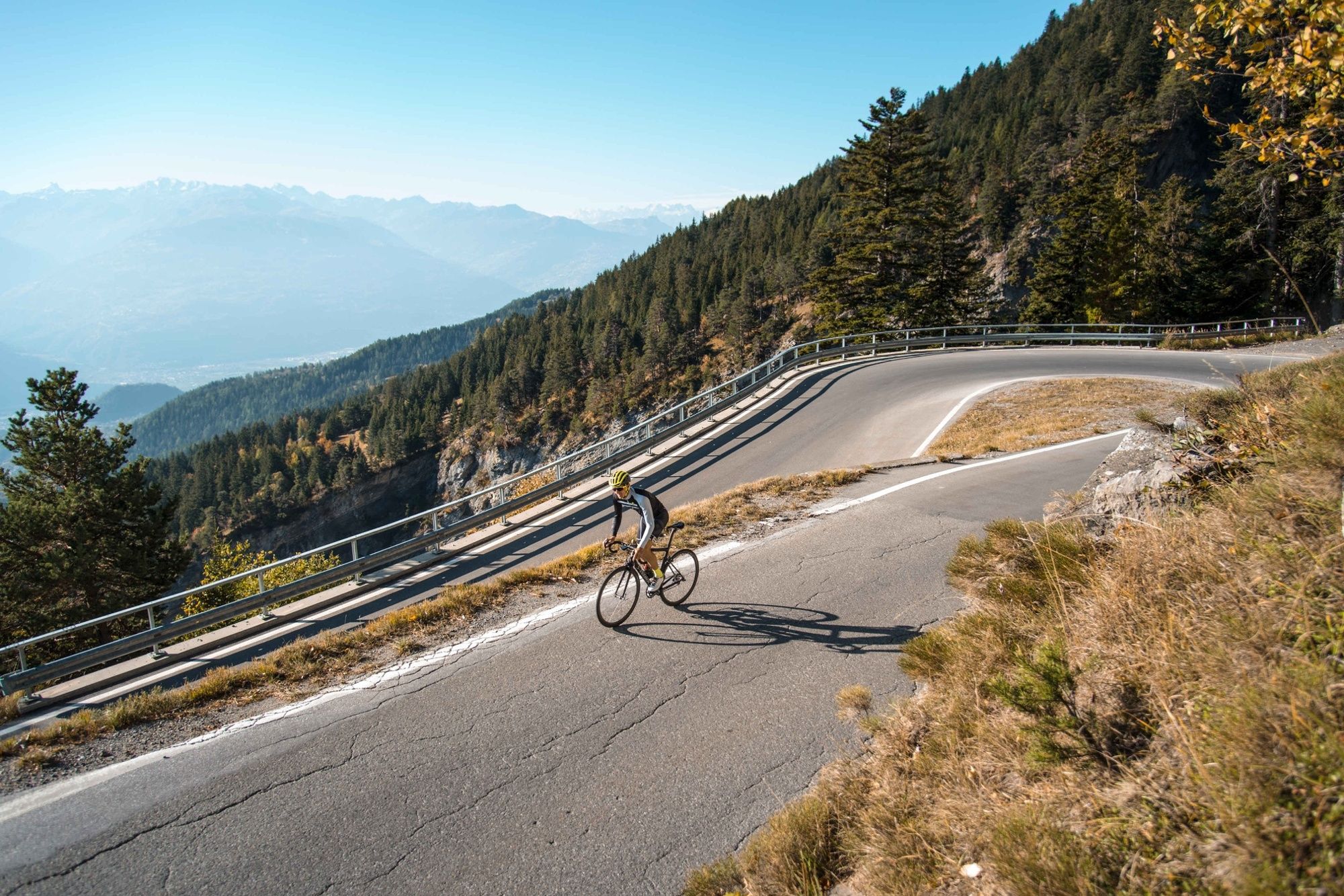
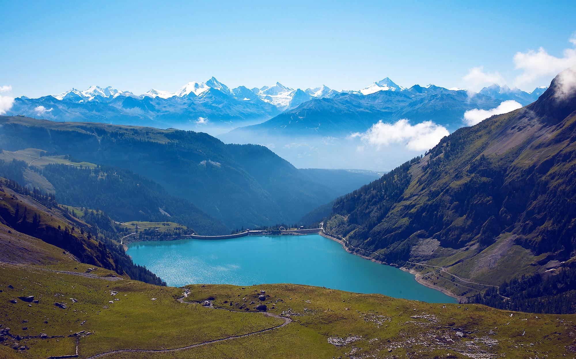
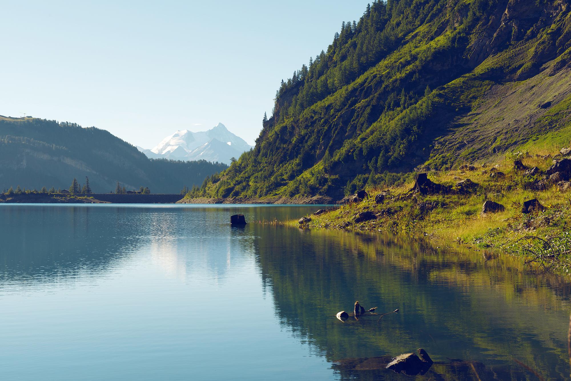
The municipality of St-Léonard, where the climb to the Tseuzier dam begins, is home to the largest underground lake in Europe. The first kilometres wind through the vineyards of the Combe de Voos, where you climb little by little above the valley until the village of Botyre. The road then climbs to Liène on a mostly steady incline through a forest, with a few bends where the trees clear and you can admire the view over the high peaks on the opposite side of the Rhone valley. The climb continues with a few switchbacks towards Tseuzier Lake where you can see the reflection of the peaks that surround it.
- Directions
-
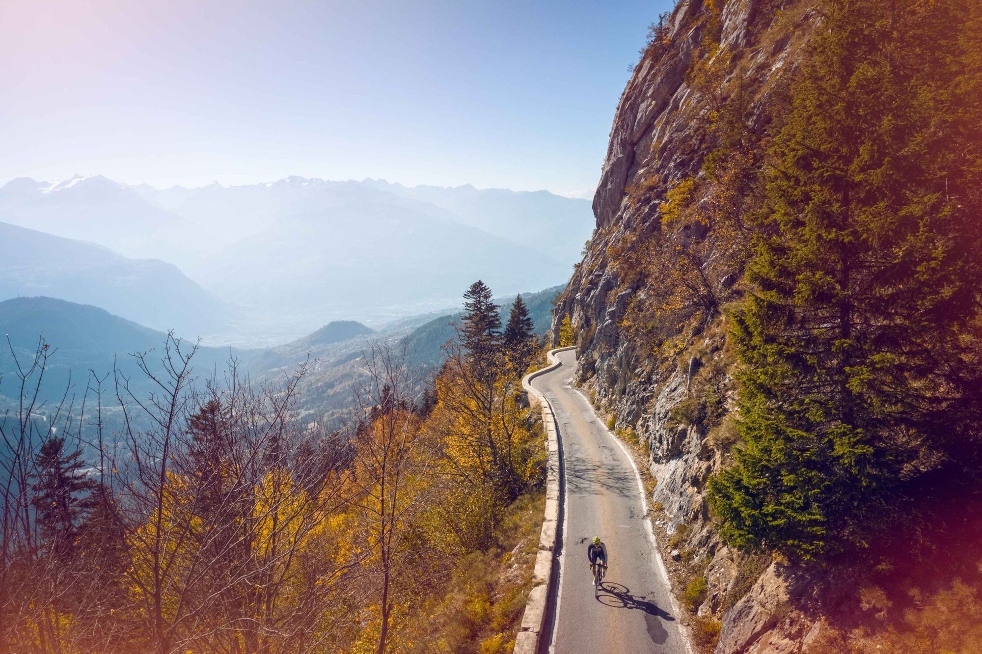
The itinerary begins at Bramois and takes you to St-Léonard, at the other side of the valley. Leaving this village, you first cross exceptional vineyards dotted here and there by fig trees and rose bushes. It is not rare to hear cicadas singing in the summer, giving these first few kilometres of climbing the sensation of being in Provence. From Botyre, the landscape changes, becoming more mountainous as the road gradually becomes narrower. Take advantage of the panoramic view over the highest peaks of the Valais as the road gradually climbs to one of the few dams located on the right bank of the Rhone river. On arriving at the summit, the clear waters of Tseuzier Lake are sufficient to comfort even the most exhausted cyclist, and the view over the Rawil Pass that we can see at the end of the valley is enough to forget the all the effort spent climbing from Bramois.
- Highest point
- 1,779 m
- Endpoint
-
Tseuzier Dam
- Height profile
-
 © outdooractive.com
 - Equipment
-
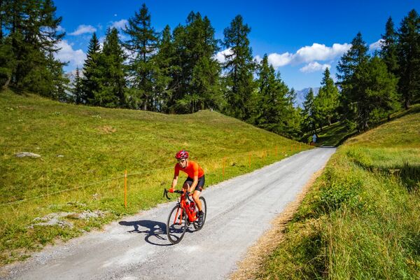
We recommend: bike in excellent working order, helmet, gloves and bell, clothing suitable for the weather (always carry a waterproof), food and drink.
- Safety instructions
-
Strictly respect the Swiss traffic rules. Please note that you are running the tour at your own risk and all liability is refused. Please be considerate to plants and animals. For your own safety, wear an helmet every time you ride a bike. Emergency numbers: 144 Ambulance / 117 Police / 1414 Helicopter Rescue (Rega).
- Tips
-
Visit the largest underground lake in Europe in St-Léonard.
- Additional information
- Directions
-
From Lausanne : Take the motorway A9 and take the exit 27 (Sion-Est). Continue on the right and follow the signs to "Bramois".
From Brig/Visp : Take the motorway A9 until the exit 27 (Sion-Est). After the exit, turn left and follow the signs to "Bramois".
- Public transportation
-
Frequent train connections to Sion or Sierre, then take the Bus to Bramois (or Uvrier).
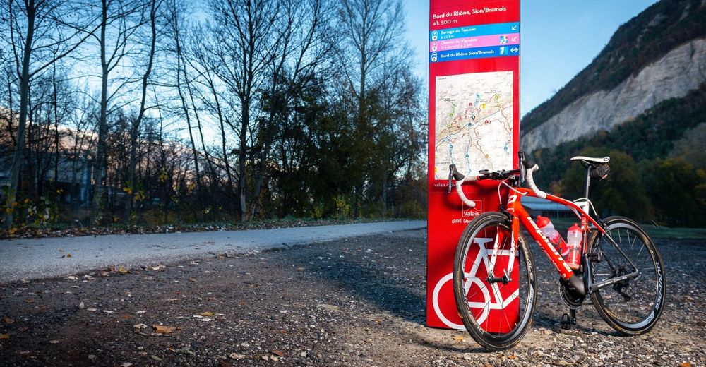
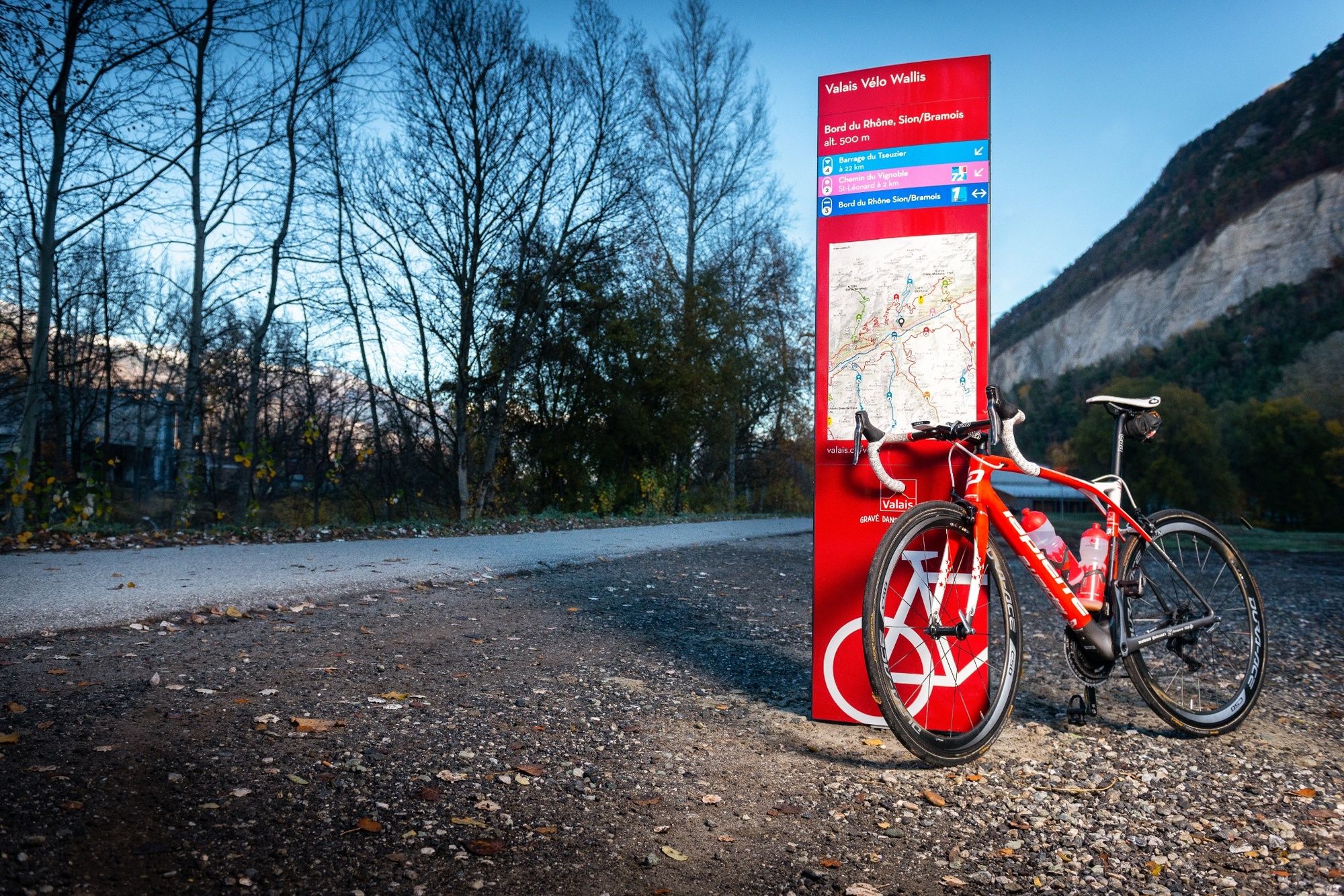
The itinerary begins near the "Terrain des Peupliers" (football field), in the "Berges du Rhône" road.
- Parking
-
Parking available at the village of Bramois. Follow the local car park indications.
The itinerary begins near the "Terrain des Peupliers" (football field), in the "Berges du Rhône" road.
- Author
-
The tour Tseuzier – Trophy of the Dams is used by outdooractive.com provided.


General info
-
Thyon les Collons
118
-
Anzère/ Valais
83
-
Anzère
29