


- Brief description
-
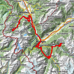
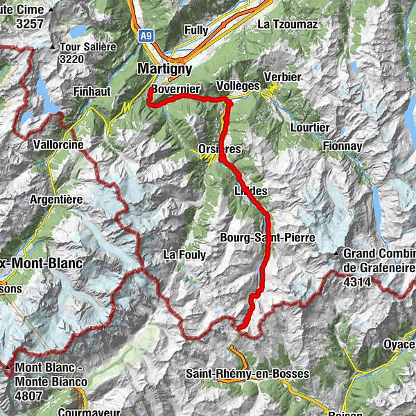
Starting from Martigny, you first start climbing up the valley towards Sembrancher, then to Orsières without much difficulty. The real ascent starts in the Val d’Entremont until Bourg-St-Pierre and then to the Grand-St-Bernard pass.
- Difficulty
-
difficult
- Rating
-
- Starting point
-
Martigny
- Route
-
Martigny-CroixMartigny-Croix0.2 kmPied du Château1.2 kmLe Brocard1.3 kmLe Borgeaud2.4 kmLes Valettes3.4 kmBovernier (613 m)4.1 kmBovernier (613 m)4.5 kmTunnel de la Monnaie7.2 kmPierra Gargantua7.4 kmLes Marais8.3 kmPlanches d'en Bas8.4 kmGué8.6 kmAnatolian Kebab & Tacos8.9 kmLa Prairie8.9 kmSommet des Partié9.1 kmLa Gravenne9.2 kmBiolin Raccard9.2 kmHôpital9.4 kmPied de Ville9.4 kmArbeyeux9.5 kmFond de Ville9.5 kmSembrancher9.6 kmGrand Place9.7 kmPont de Bagnes9.7 kmVers la Tour9.7 kmLes 3 Dranses9.7 kmVerger Biollay10.1 kmPré de Foire10.1 kmSommet du Biollay10.1 kmPessote10.2 kmChampanet10.2 kmMeunière des Moulins10.3 kmChamprateu10.3 kmPontet de la Meunière10.3 kmMaison Blanche10.3 kmMaison Murith10.3 kmLes Moulins10.4 kmPoya du Pont10.5 kmBeccaroz10.7 kmCiterne10.9 kmLes Rives10.9 kmCombayon11.4 kmChamp du Fou11.4 kmMermaz11.8 kmFontana Rossa12.0 kmPreillet12.3 kmCrételet12.5 kmSous la Chapelle12.5 kmDevant la Chapelle12.5 kmChapelle de Chamoille12.5 kmComba12.7 kmChamoille (Sembrancher)12.8 kmVers la Piscine13.1 kmChamoille d'Orsières13.5 kmOrsières16.8 kmFontaine Dessous (Liddes)21.0 kmRive Haute (Liddes)22.1 kmFontaine Dessus (Liddes)22.4 kmLa Channe23.9 kmEglise de St-Georges24.4 kmLiddes24.4 kmDranse (Liddes)24.5 kmChapelle de St. Etienne25.0 kmPalasuit25.4 kmBivouac Napoléon29.2 kmHôtel Restaurant du Crêt29.7 kmHôtel du Vieux Moulin30.0 kmBourg-Saint-Pierre (1,632 m)30.0 kmHôtel de l'Hospice42.0 kmGreat St Bernard Hospice42.0 km
- Best season
-
JanFebMarAprMayJunJulAugSepOctNovDec
- Description
-
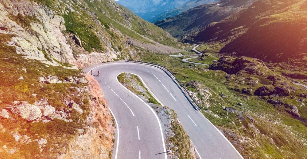
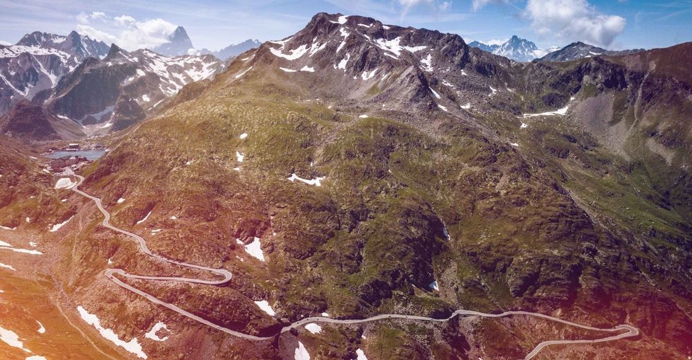
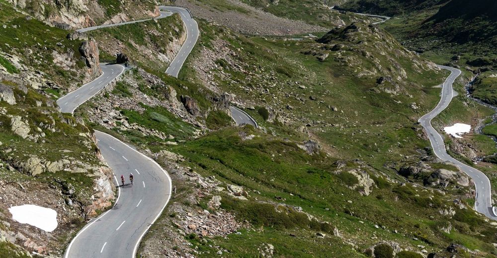
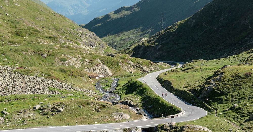
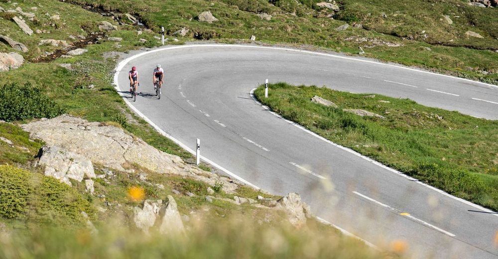
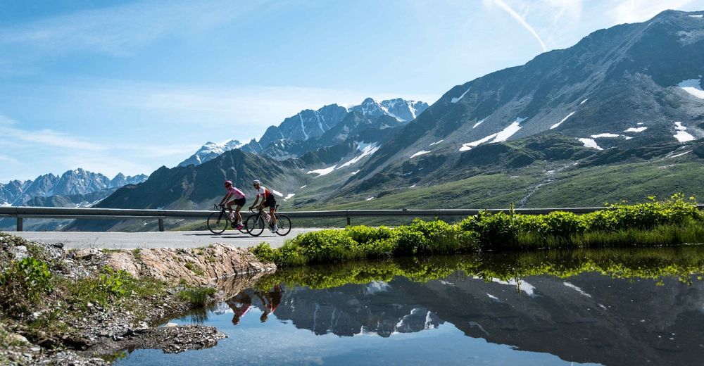
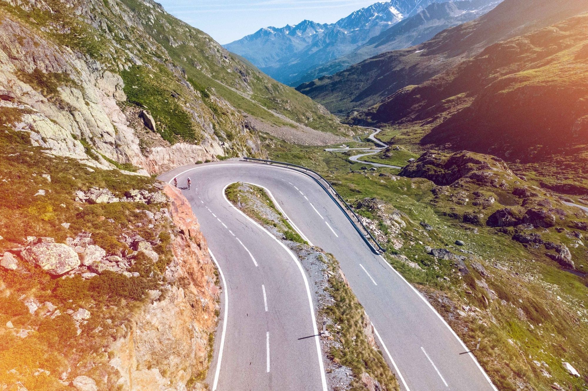
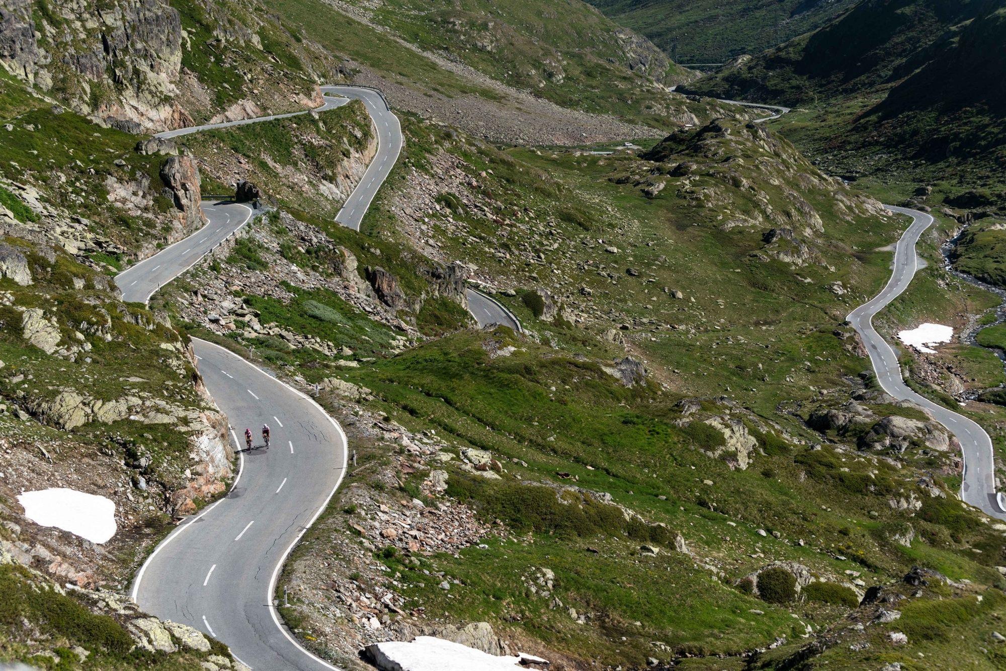
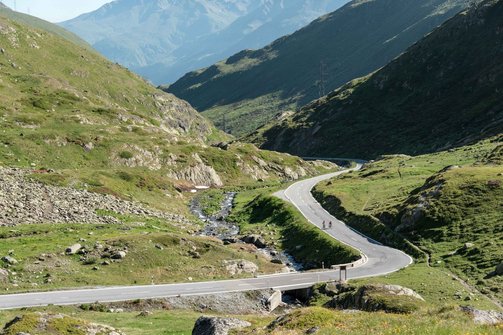
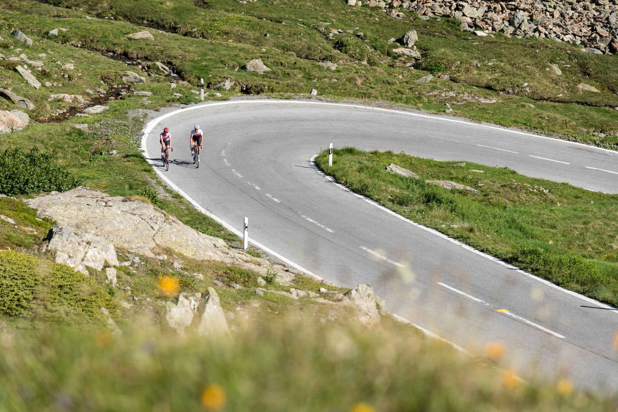
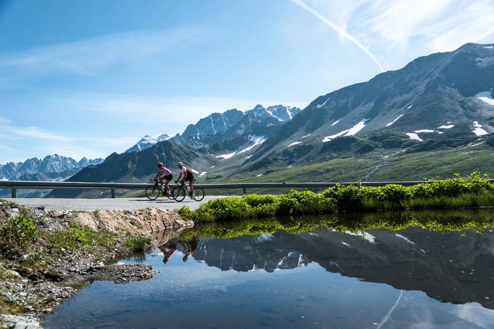
From Martigny to Orsières the slope is quite mild, giving you a nice gentle warm-up during the first few kilometres. Leaving the Val Ferret to your right, you begin your climb up the Val d’Entremont and things begin to get serious! The slope gets steeper but remains steady as you cross the villages of Liddes and Bourg-St-Pierre on this road to Italy. You will discover Mont Rogneux and the peaks of the Combins in full panorama as you climb in the midst of alpine meadows. Shortly after Bourg-St-Pierre, you ride through several kilometres of galleries before the road splits to the right up towards the Col du Grand-St-Bernard. The last kilometres are difficult but are surrounded by incredibly beautiful Alpine scenery.
- Directions
-
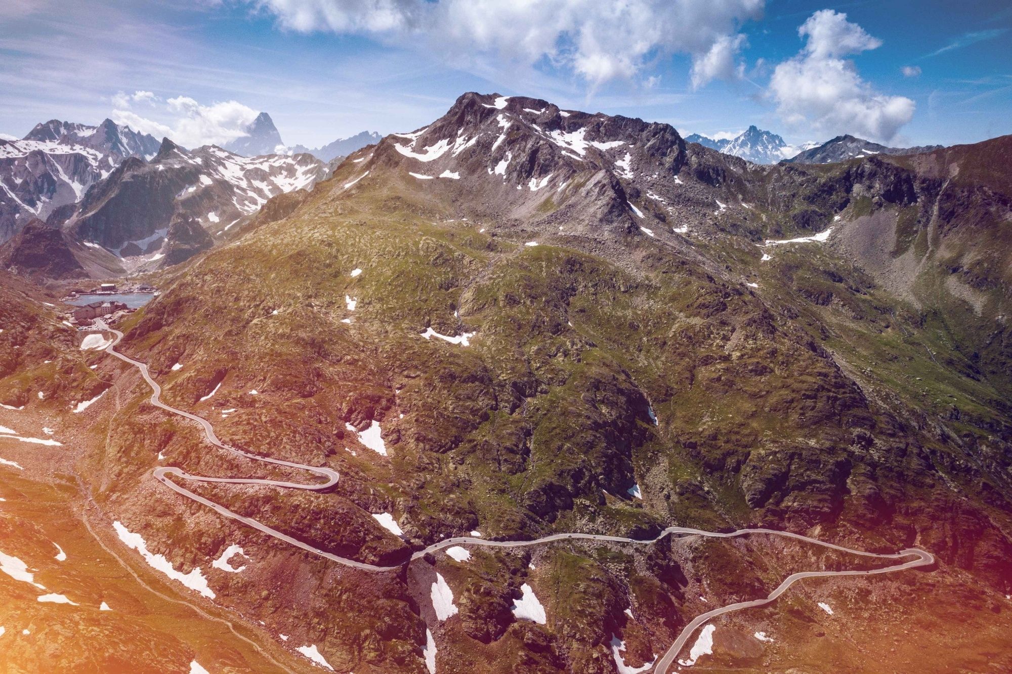
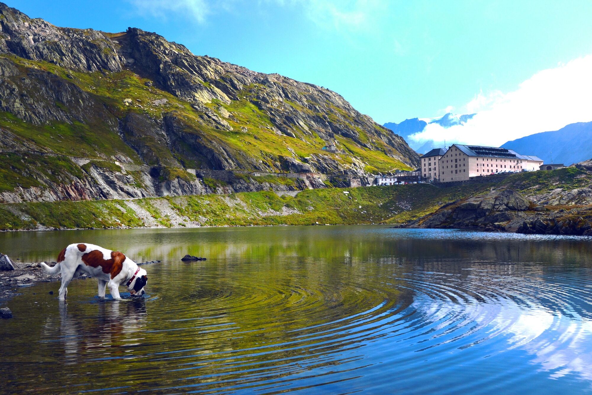
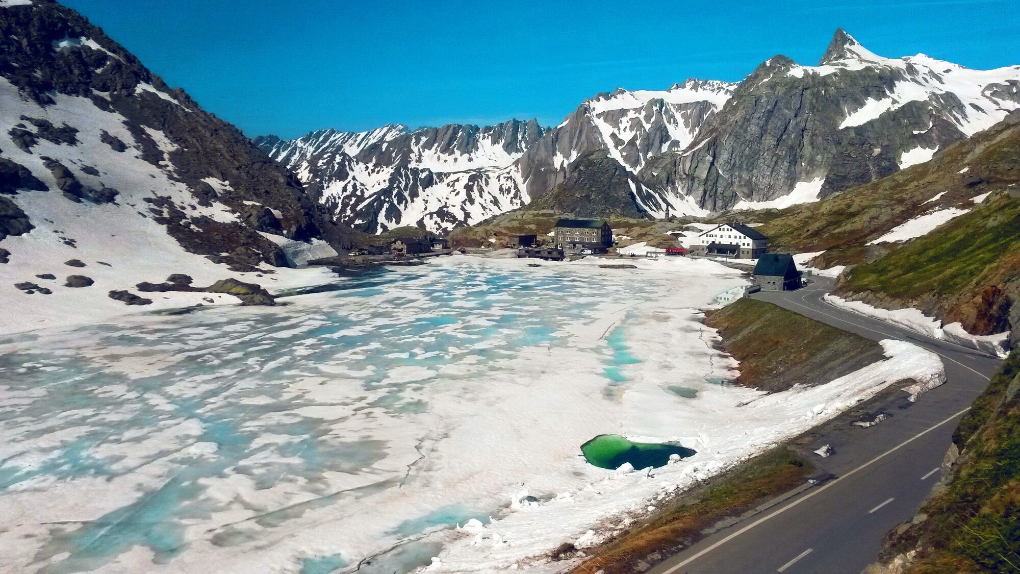
Once you leave Martigny behind, the road opens wide over gentle slopes. At the junction at the beginning of the Val de Bagnes, take the road to Italy on the right towards Orsières which climbs along the Dranse river. The beginning of the Val d’Entremont coincides with the increase in difficulty of the climb, allowing you to quickly gain altitude until Liddes. A section less steep through the village allows you to recover a bit before you attack the following climb to Bourg-St-Pierre, the last village in Switzerland before the Italian border. After riding through the galleries on the road leading to the Grand-St-Bernard tunnel, the road heads off to the right and the last six kilometres brings you to the summit of the pass. The scenery is grandiose, and at the summit the refuge and little lake make this crossing between Switzerland and Italy one of the most beautiful passes in the Alps!
- Highest point
- 2,465 m
- Endpoint
-
Grand St Bernard Pass
- Height profile
-
 © outdooractive.com
 - Equipment
-
We recommend: bike in excellent working order, helmet, gloves and bell, clothing suitable for the weather (always carry a waterproof), food and drink.
- Safety instructions
-
Strictly respect the Swiss traffic rules. Please note that you are running the tour at your own risk and all liability is refused. Please be considerate to plants and animals. For your own safety, wear an helmet every time you ride a bike. Emergency numbers: 144 Ambulance / 117 Police / 1414 Helicopter Rescue (Rega).
- Tips
-
The St. Bernard Dogs of the Barry Foundaition pass the summer months on the Great St. Bernard Pass. From July to August, the Barry Foundation gives visitors to the Great St Bernard pass the opportunity to accompany the hospice dogs on a 1½ hour hike.
- Additional information
- Directions
-
Take the A9 Motorway exit E27 autoroute Martigny/Grand St. Bernard. At the roundabout, follow signs towards Col de la Forclaz / Chamonix (France)
- Public transportation
-
Arrive in Martigny by train from all Swiss towns and cities (SBB) or by the regional trains Railway Mont-Blanc & St-Bernard Express.
- Parking
-
Parking de la Porte d’Octodure at motorway exit. Follow the car-park routeing in Martigny.
- Author
-
The tour Grand St Bernard Pass – Legendary Mountain Passes is used by outdooractive.com provided.


General info
-
Unterwallis
83
-
Pays du Saint-Bernard
20
-
Orsières
16