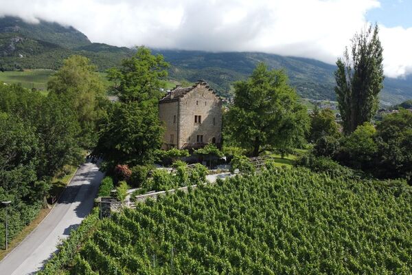


- Brief description
-
Set off from Bramois to discover Val d’Hérens with an initial climb to the village of St-Martin, followed by a short descent to Evolène and Les Haudères.
- Difficulty
-
difficult
- Rating
-
- Starting point
-
Bramois
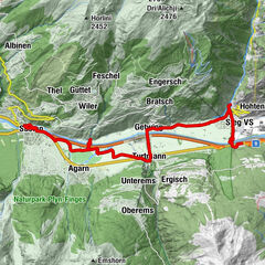
- Route
-
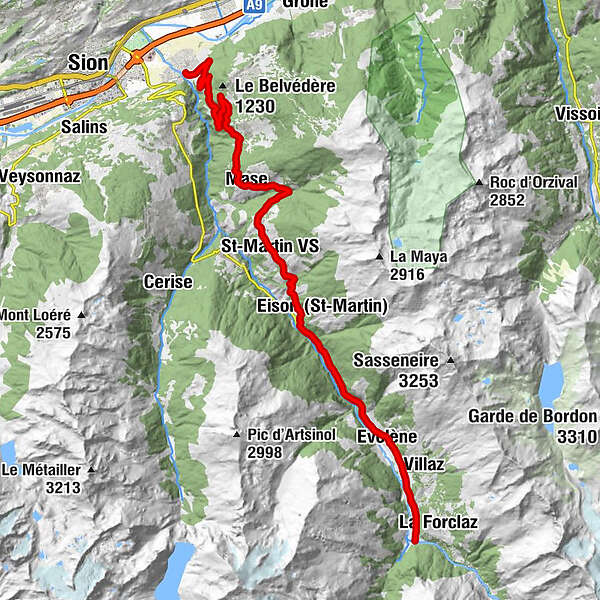
BrämisBornouet6.7 kmLes Barmes7.1 kmFontany7.8 kmVernamiège8.0 kmLes Prixes8.2 kmMase (1,345 m)10.2 kmLe Vieux Bourg10.2 kmLes Pérys10.9 kmSuen (St-Martin)13.6 kmSt-Martin VS (1,411 m)14.6 kmÉglise Saint-Martin14.8 kmTrogne (St-Martin) (1,478 m)15.5 kmLiez (St-Martin)16.5 kmPraz-Jean17.9 kmLa Villette19.7 kmEvolène (1,371 m)23.6 kmLa Fauchère (1,386 m)24.6 kmLa Confraric25.0 kmLa Tour VS25.6 kmBevernec25.6 kmMolignon26.4 kmLes Haudères (1,454 m)27.2 kmCafé-Restaurant la Cordée27.3 km
- Best season
-
JanFebMarAprMayJunJulAugSepOctNovDec
- Description
-
The ascent towards Val d’Hérens is a must when visiting Valais. It not only lets you discover a wild valley – famous for its breed of cattle – but also takes you through a number of typical villages where the rich local dialect is spoken. Starting from Bramois and passing through the village of St-Martin, this climb through the valley lets you appreciate the beauty of the varied landscapes changing with every passing kilometre. After the climb, a steeper road takes you down to Evolène, through which the famous Grand Raid mountain bike race passes. In the heart of Val d’Hérens, the last part of the route takes you to Les Haudères, a picturesque village dominated by Arolla and the Ferpècle Dam.
- Directions
-
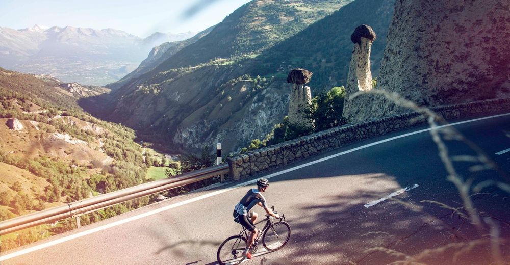
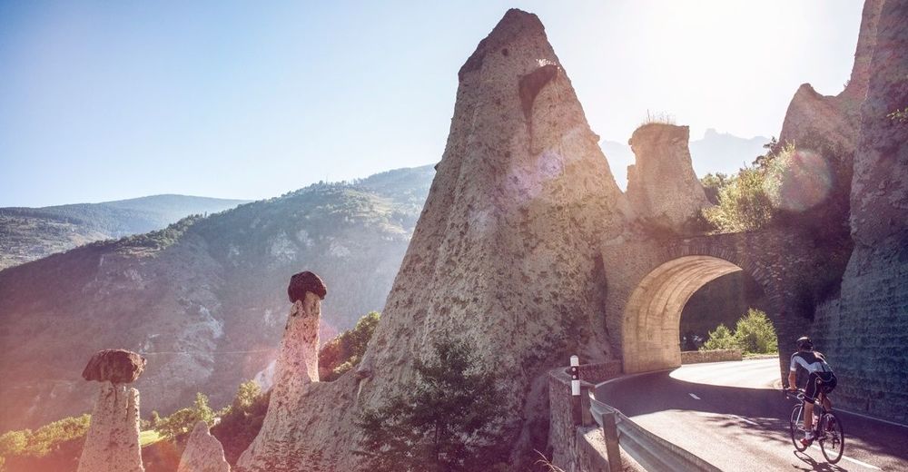
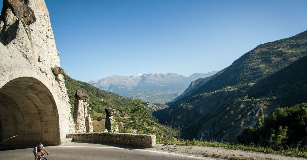
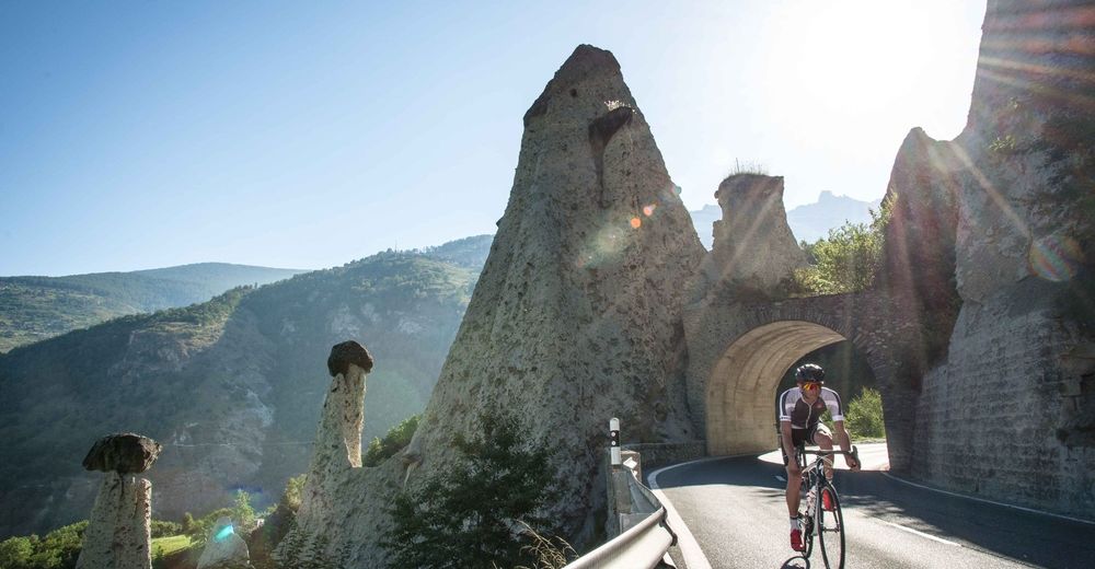
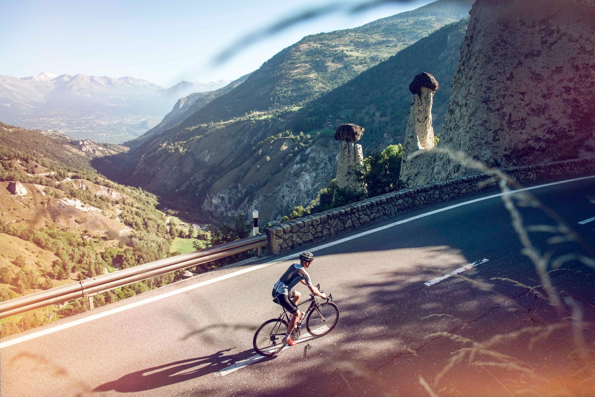
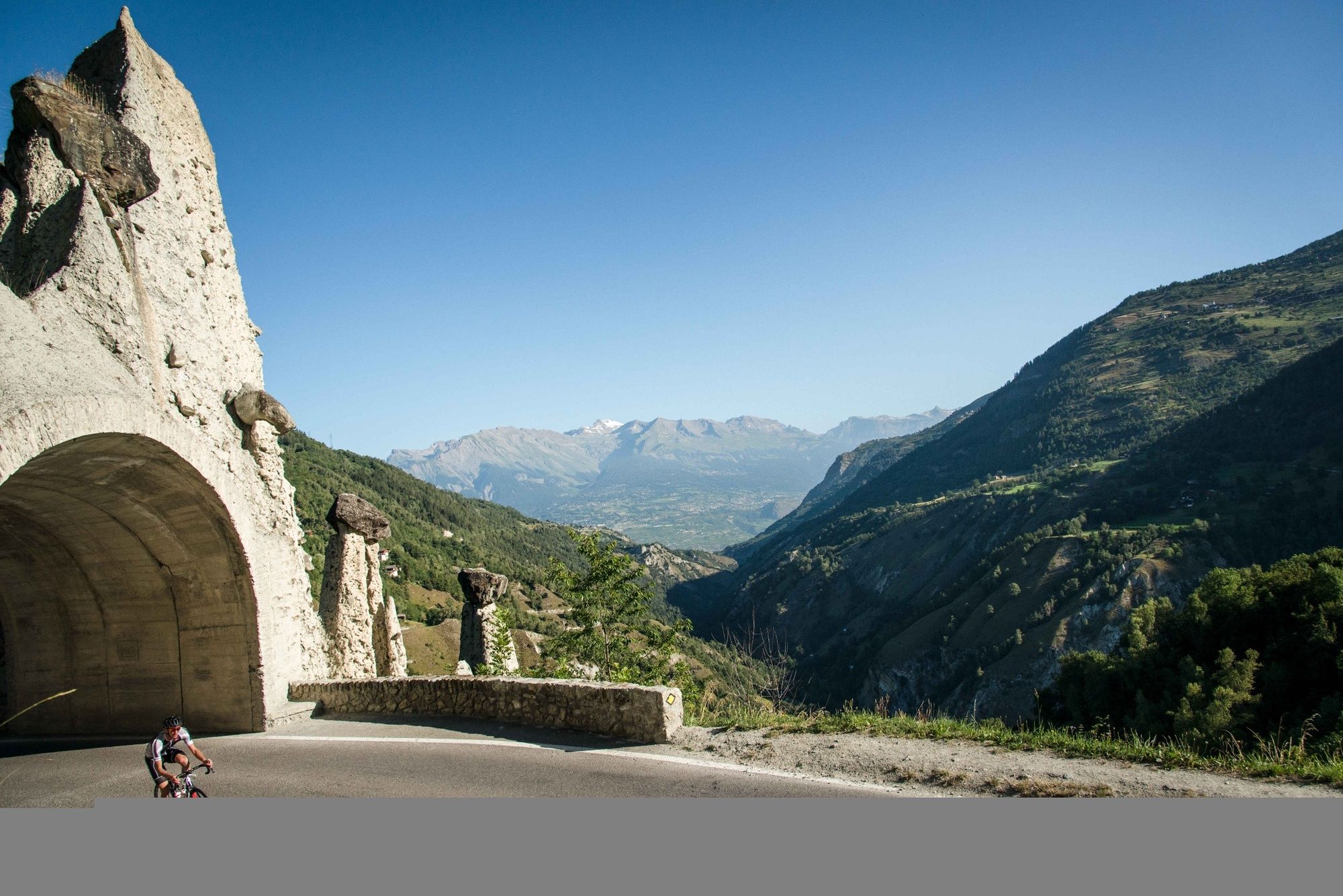
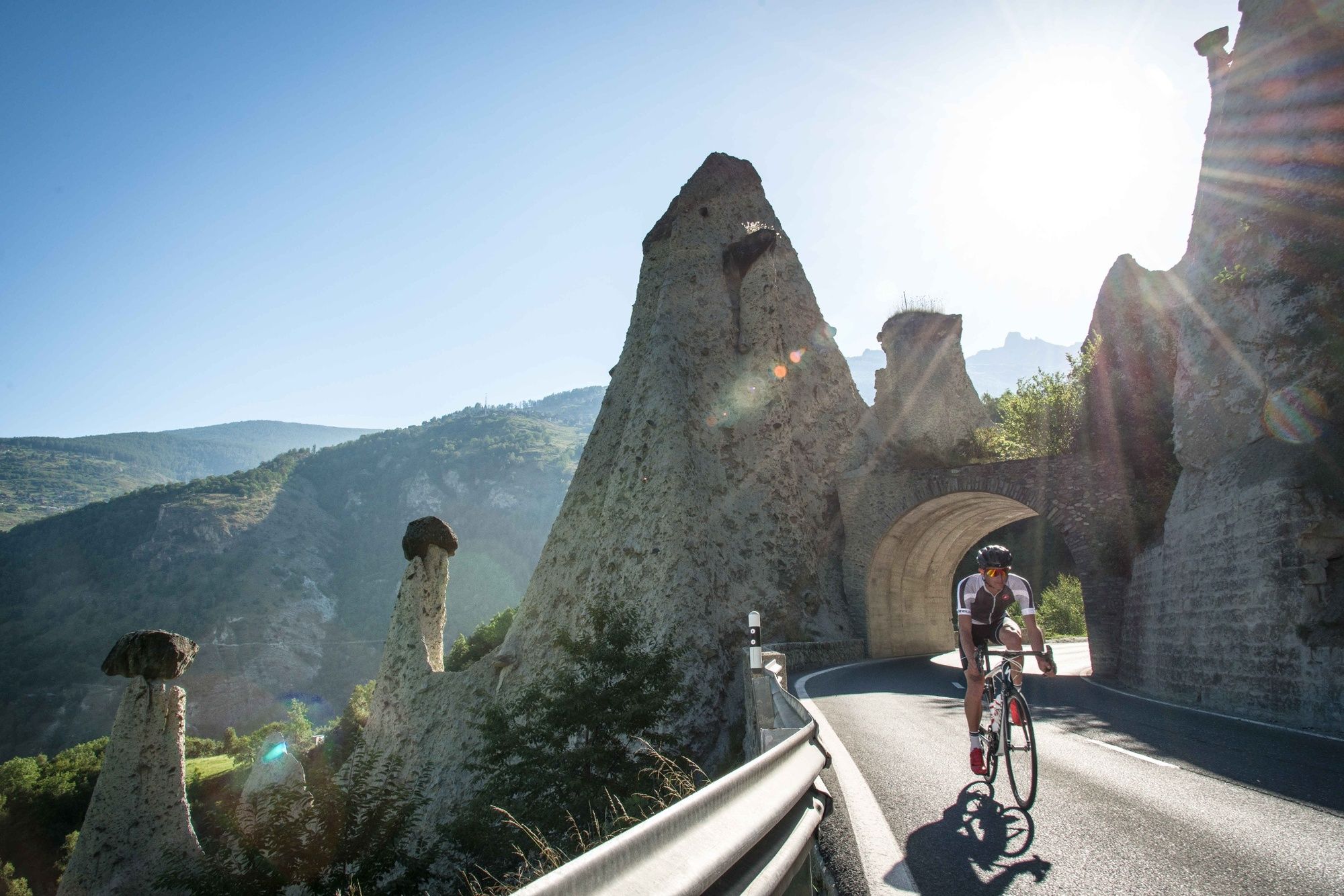
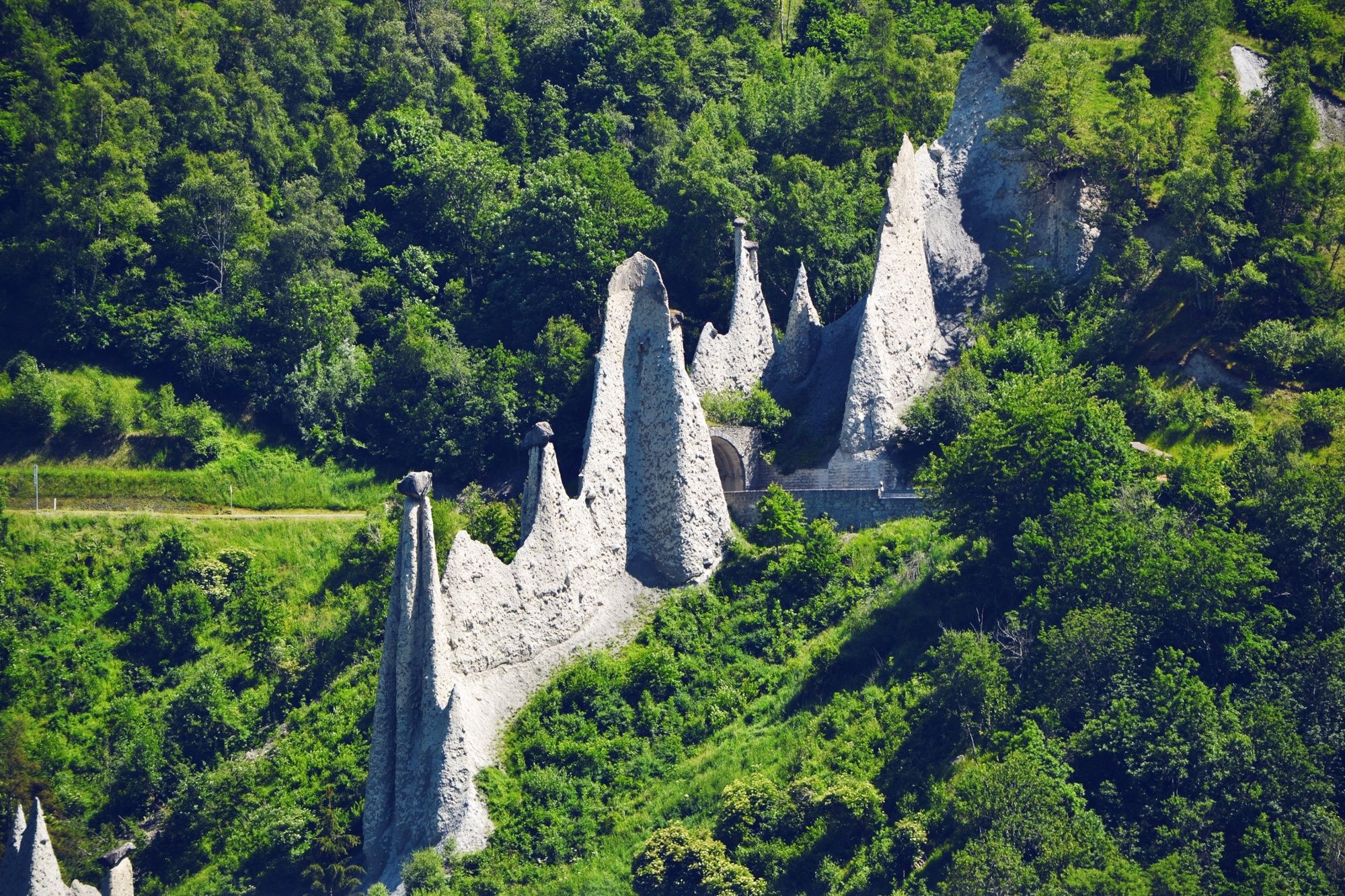
The first 11 kilometres between Bramois and St-Martin are covered on a relatively steep, wide road. You’ll get the chance to catch your breath over a 4-kilometre, level section as you enjoy a view of the famous Euseigne pyramids rising up on the other side of the valley. After a steep downhill section through the fields, you’ll rejoin the road towards Evolène. The landscape opens out again into a wider valley and the gradient becomes much less challenging. You are in the very heart of Val d’Hérens, one of the most beautiful valleys in the region! On arrival in Les Haudères, more adventurous cyclists can continue in the direction of Arolla to the right or Ferpècle to the left.
- Highest point
- 1,451 m
- Endpoint
-
Les Haudères
- Height profile
-
 © outdooractive.com
 - Equipment
-
We recommend: bike in excellent working order, helmet, gloves and bell, clothing suitable for the weather (always carry a waterproof), food and drink.
- Safety instructions
-
Strictly respect the Swiss traffic rules. Please note that you are running the tour at your own risk and all liability is refused. Please be considerate to plants and animals. For your own safety, wear a helmet every time you ride a bike. Emergency numbers: 144 Ambulance / 117 Police / 1414 Helicopter Rescue (Rega).
- Tips
-
This is not the most direct route to Les Haudères, but it avoids the busy road between Sion and Vex.
- Additional information
- Directions
-
From the A9 motorway, take exit 27 (Sion-Est) and follow the signs to Bramois.
- Public transportation
-
Take the SBB train towards Sion. From there, the regional bus will take you to Bramois village.
- Parking
-
Free parking spaces are available beside the football stadium and tennis courts in Bramois.

- Author
-
The tour Val d'Hérens - Scenic & side valleys is used by outdooractive.com provided.


General info
-
Unterwallis
83
-
St-Martin / Wallis
59
-
Hérémence
18