
- Brief description
-
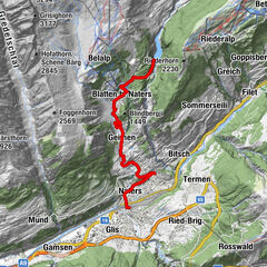
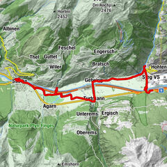
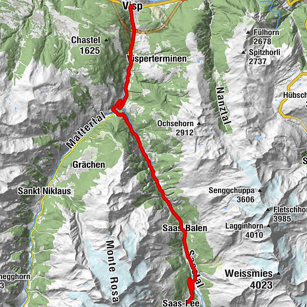
Starting out from Visp, you follow the same road that leads to the Mattmark dam as far as the village of Saas-Grund. Turning off to the right, three kilometres of continual climbing brings you to the village of Saas-Fee, whose streets are reserved exclusively for pedestrians and electric vehicles.
- Difficulty
-
medium
- Rating
-
- Starting point
-
Visp train station
- Route
-
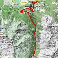
Visp (658 m)0.3 kmWildi1.3 kmStundhüs Sefinot2.7 kmNeubrück4.6 kmMilachru5.2 kmAckersand5.7 kmAckersand5.8 kmHohlgässi7.8 kmStalden VS7.9 kmIllas9.2 kmEisten13.5 kmTirbelwang (1,200 m)14.7 kmNiedergut18.8 kmEnzian19.5 kmLehn19.5 kmZum kostbaren Blut19.5 kmBurg19.5 kmDorf19.5 kmSaas-Balen19.5 kmHollerbiel19.6 kmLittle India19.6 kmAntoniuskapelle21.2 kmSaas-Grund22.2 kmWalliser Stube22.3 kmTenne22.6 kmSankt Bartholomäus22.9 kmSchliechte25.4 kmWildi25.6 kmHogiblätt26.2 km
- Best season
-
JanFebMarAprMayJunJulAugSepOctNovDec
- Description
-
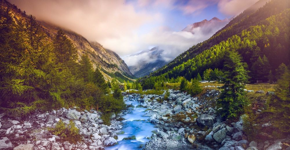
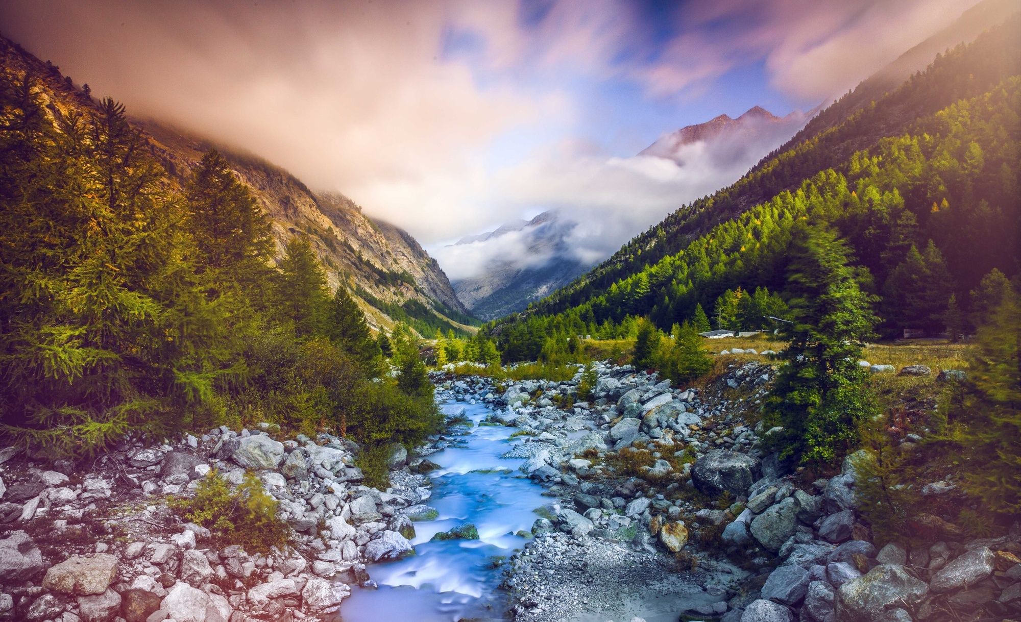
Starting out from Visp, the first few kilometres of the route are fairly gentle and let you get warmed up before the real ascent, which starts shortly before you reach the village of Stalden. You then turn off to the left in the direction of Saas-Fee, leaving the valley leading to Zermatt on your right. The next few kilometres until you reach Saas-Grund are winding and relatively steep. Here, you make a final change of direction before tackling the last few strenuous kilometres to Saas-Fee. This quiet, car-free resort offers breathtaking, panoramic views of several mountain peaks over 4000 metres in height: Dom, Nadelhorn, Täschhorn, Alphubel, Allalinhorn...
- Directions
-
From Visp, begin with a warm-up by following the river Vispa. On the road leading to the famous resorts of Zermatt and Saas-Fee, you pass through the village of Stalden before turning off to the left and entering the Saastal valley. There is a steady climb up to Saas-Balen. You can now relax your leg muscles until you reach Saas-Almagell by way of Saas-Grund, before attacking the final, steeper climb up to Saas-Fee. The view of the high valley leading to the Mattmark dam down below is magical. On arrival in Saas-Fee, follow the route as far as the Mittaghorn cable car station and enjoy the fantastic backdrop provided by the high summits all around.
- Highest point
- 1,805 m
- Endpoint
-
Saas Fee
- Height profile
-
 © outdooractive.com
 - Equipment
-
We recommend: bike in excellent working order, helmet, gloves and bell, clothing suitable for the weather (always carry a waterproof), food and drink.
- Safety instructions
-
Strictly respect the Swiss traffic rules. Please note that you are running the tour at your own risk and all liability is refused. Please be considerate to plants and animals. For your own safety, wear an helmet every time you ride a bike.Emergency numbers: 144 Ambulance / 117 Police / 1414 Helicopter Rescue (Rega).
- Tips
-
Take a ride on the world’s highest funicular railway, up to "Mittelallalin” !
- Additional information
- Directions
-
Take the cantonal road number 9 from Brig or Sierre to Visp.
- Public transportation
-
Frequent train connections from all over Switzerland via the Lötschberg tunnel or the Simplon line to Visp.
- Parking
-
Underground parking at Visp train station. Follow the car park routeing in Visp.
- Author
-
The tour Saas-Fee - Scenic & side valleys is used by outdooractive.com provided.


General info
-
Oberwallis
120
-
Saastal
23
-
Staldenried - Gspon
6