


- Brief description
-
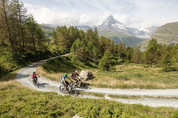
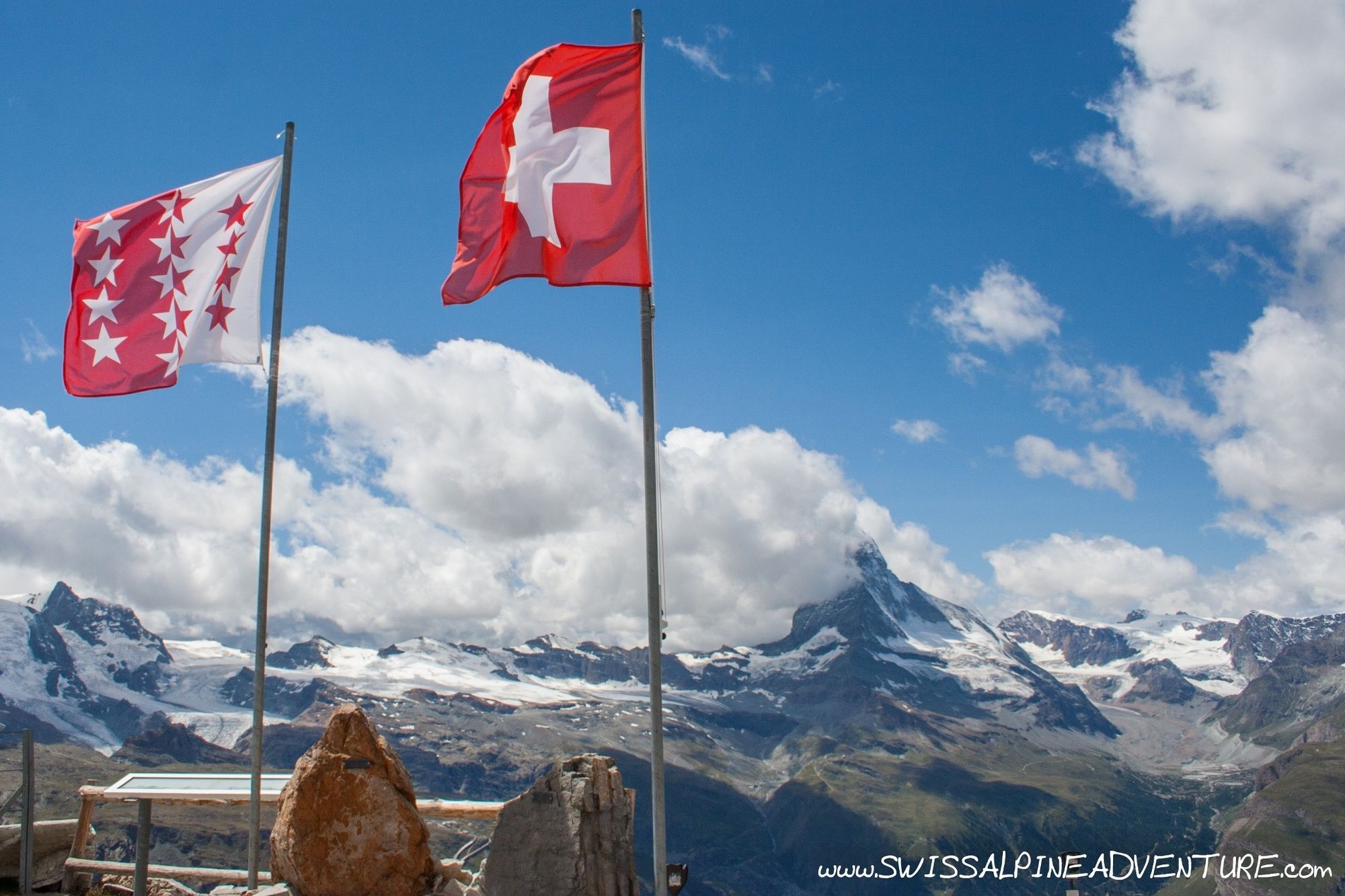
Rothorn is a little less touristy than Gornergrat, but still offers some stunning views of the Matterhorn and some great trails too.
- Difficulty
-
medium
- Rating
-
- Starting point
-
Unterrothorn, Zermatt
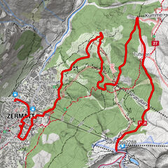
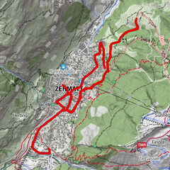
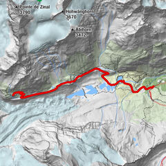
- Route
-
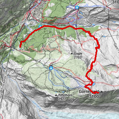
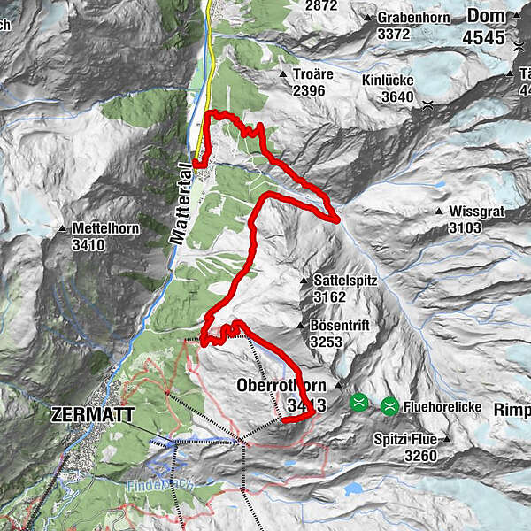
Matterhorn5.6 kmOttafe (2,205 m)10.5 kmTäschalp Restaurant & Lodge10.5 kmRestaurant Walliserkanne16.6 kmTäsch (1,449 m)16.6 km
- Best season
-
JanFebMarAprMayJunJulAugSepOctNovDec
- Description
-
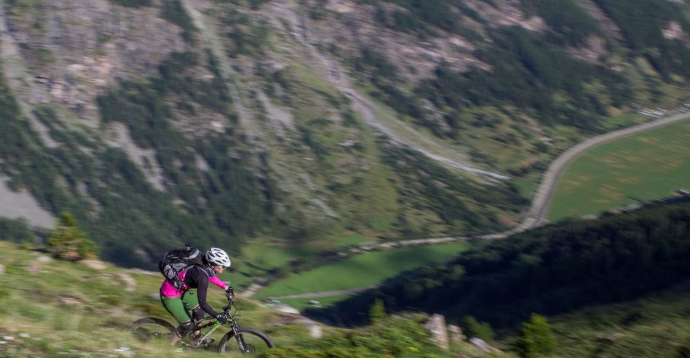
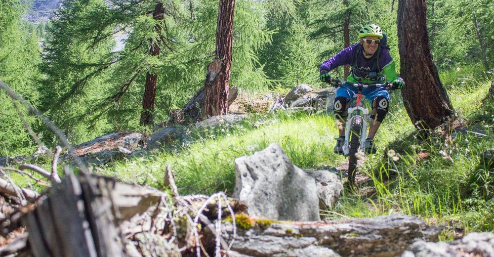
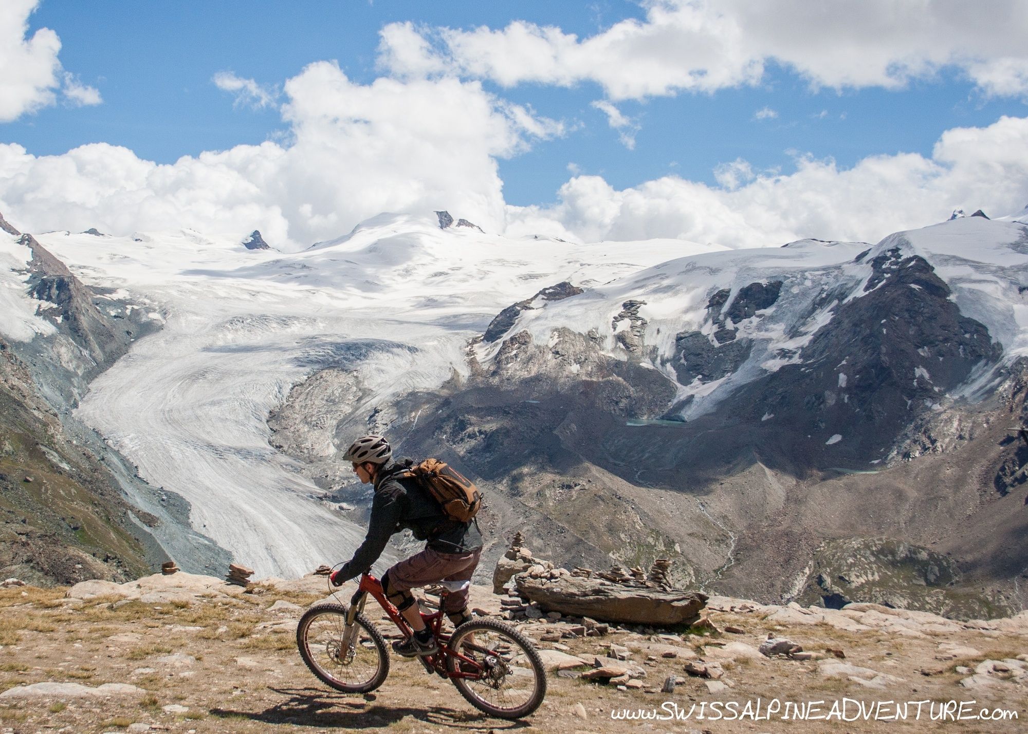
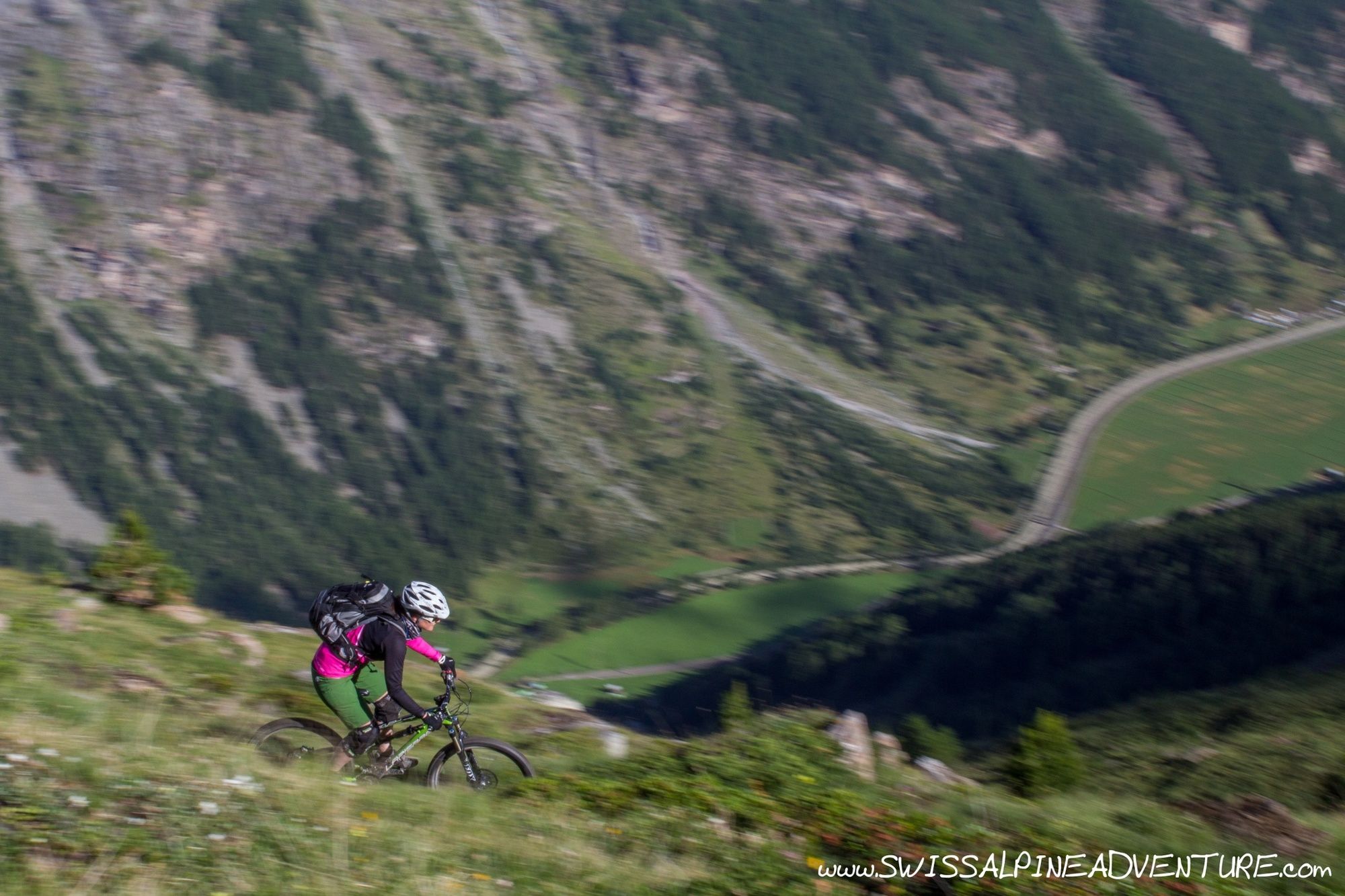
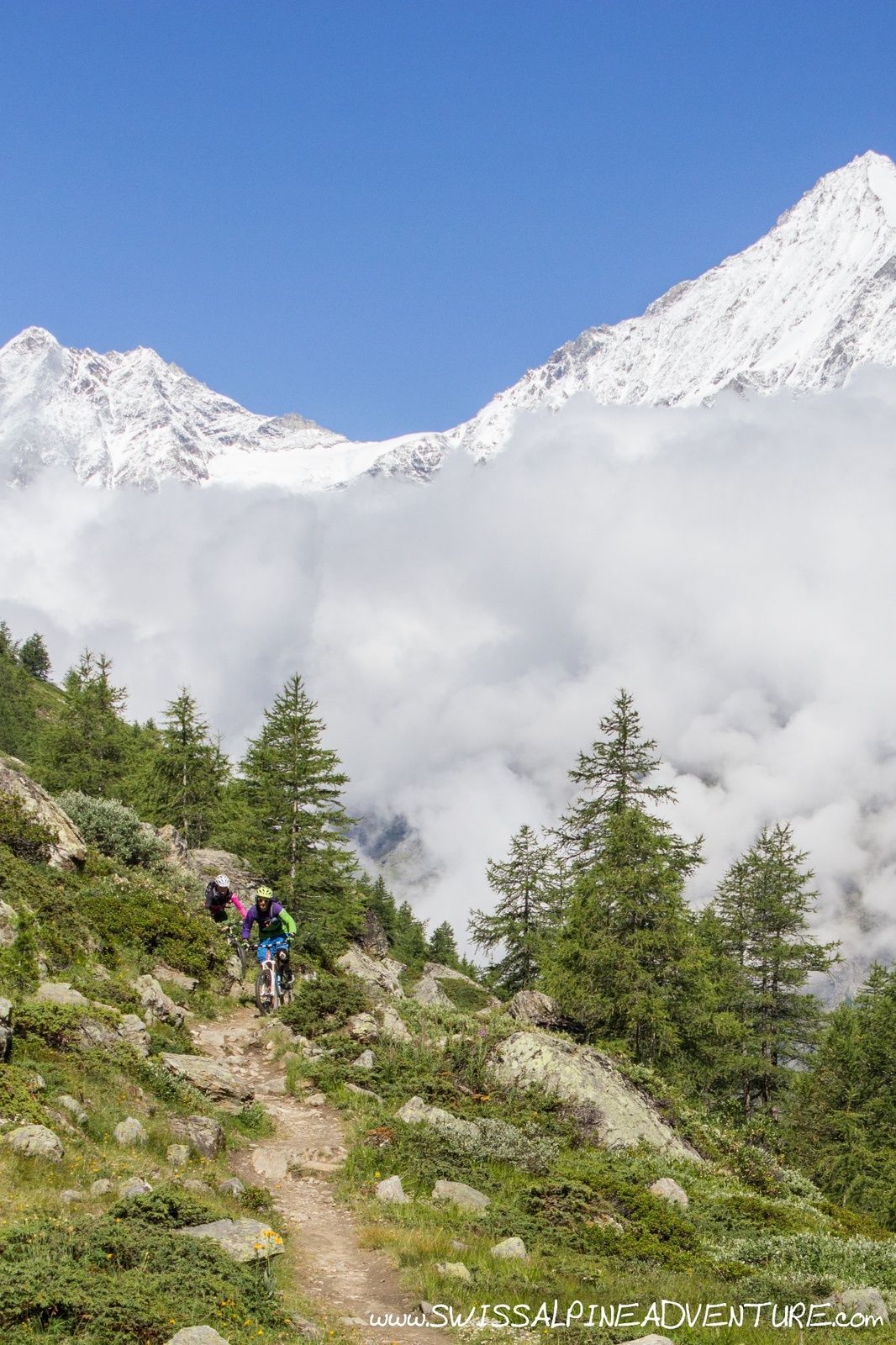
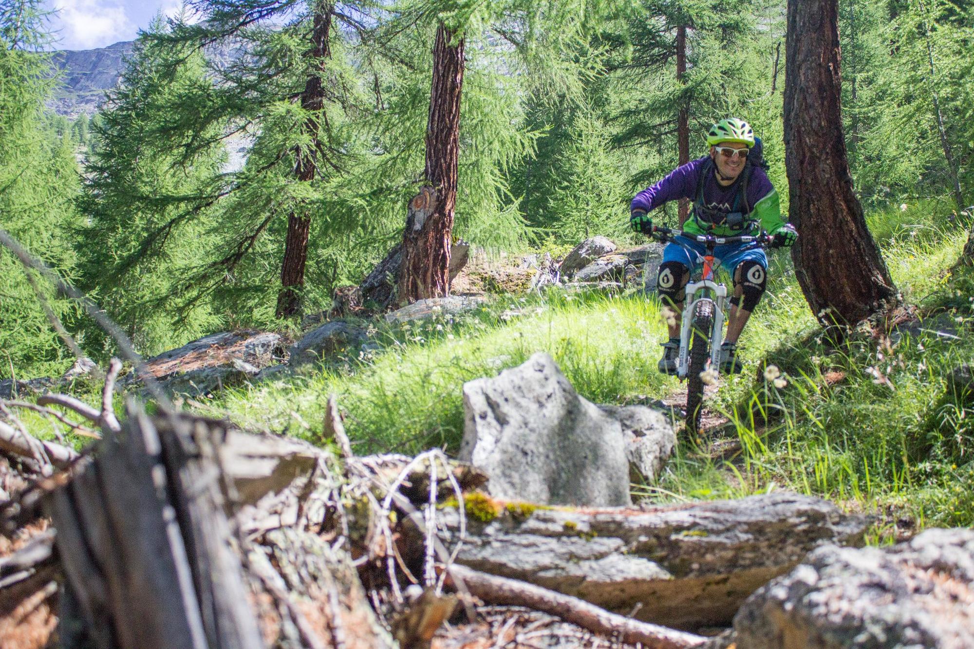
There are spectacular views of the Matterhorn and the Findel glacier from Unter Rothorn. Its well worth taking a break to enjoy the view before getting on the bike. As you leave Zermatt behind and head down the Matter valley the views of Weisshorn and the back of Zinal Rothorn more than make up for leaving the Matterhorn behind.
- Directions
-
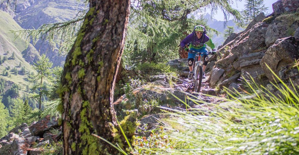
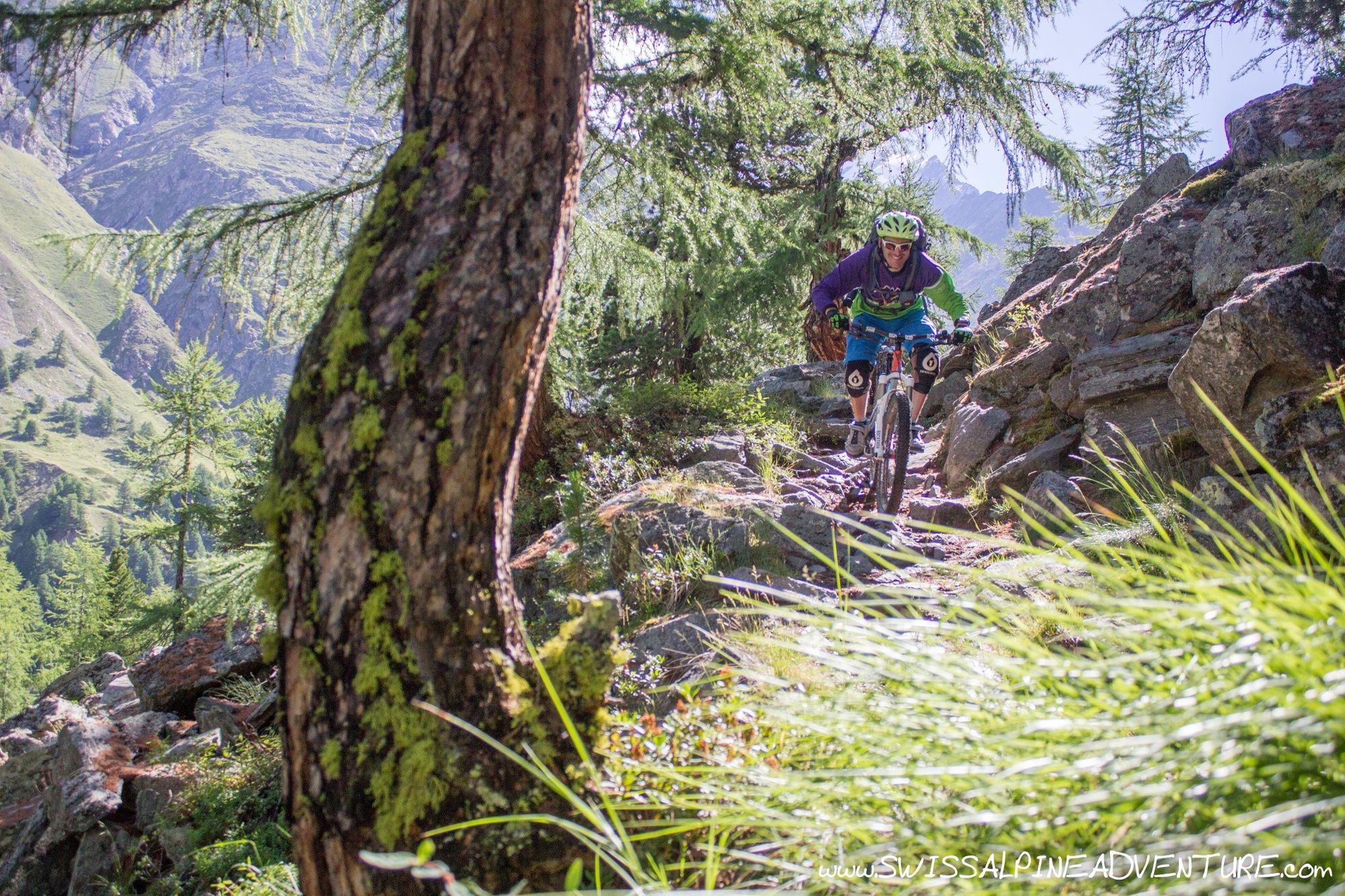
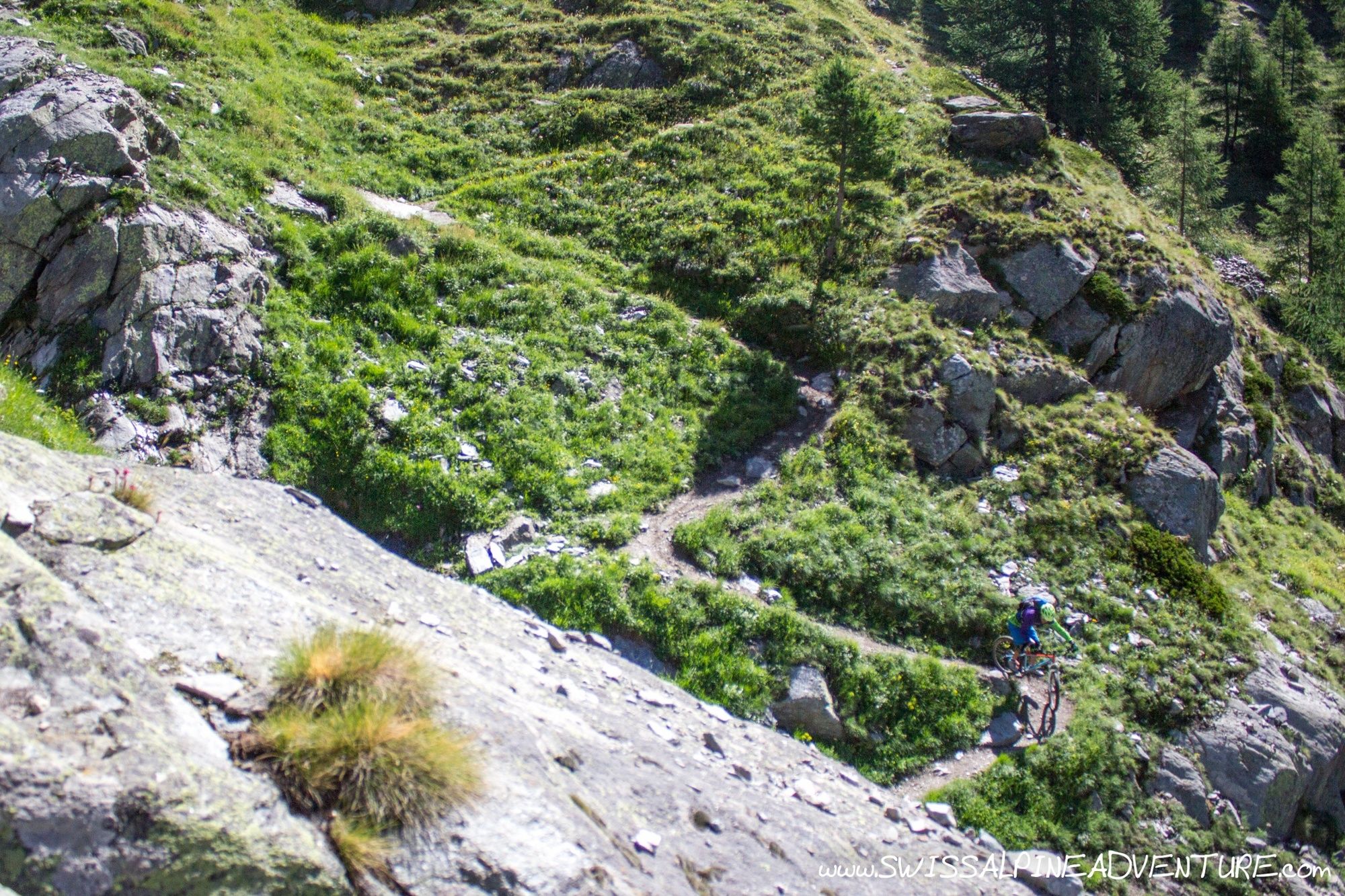
From the restaurant at Unter Rothorn take the fire road to the east that drops down behind the mountain to Furgii. At Furgi take a left and after a short distance the fireroad turns into singletrail. This singletrail has some quite fast and flowing sections to start with but gets a little more technical with some interesting switchbacks and some blocked up rocky sections. Keep following the obvious singletrack until it rejoins a fireroad again by the little village of Turteren.
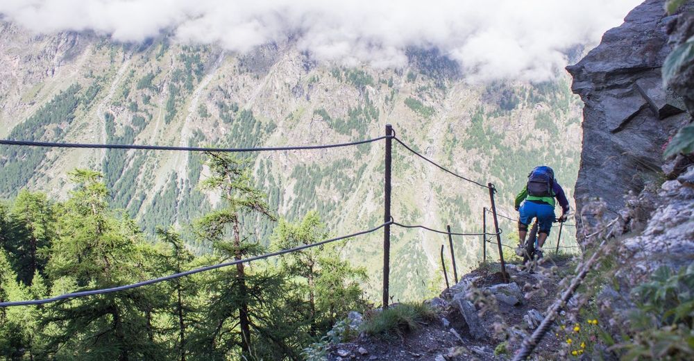
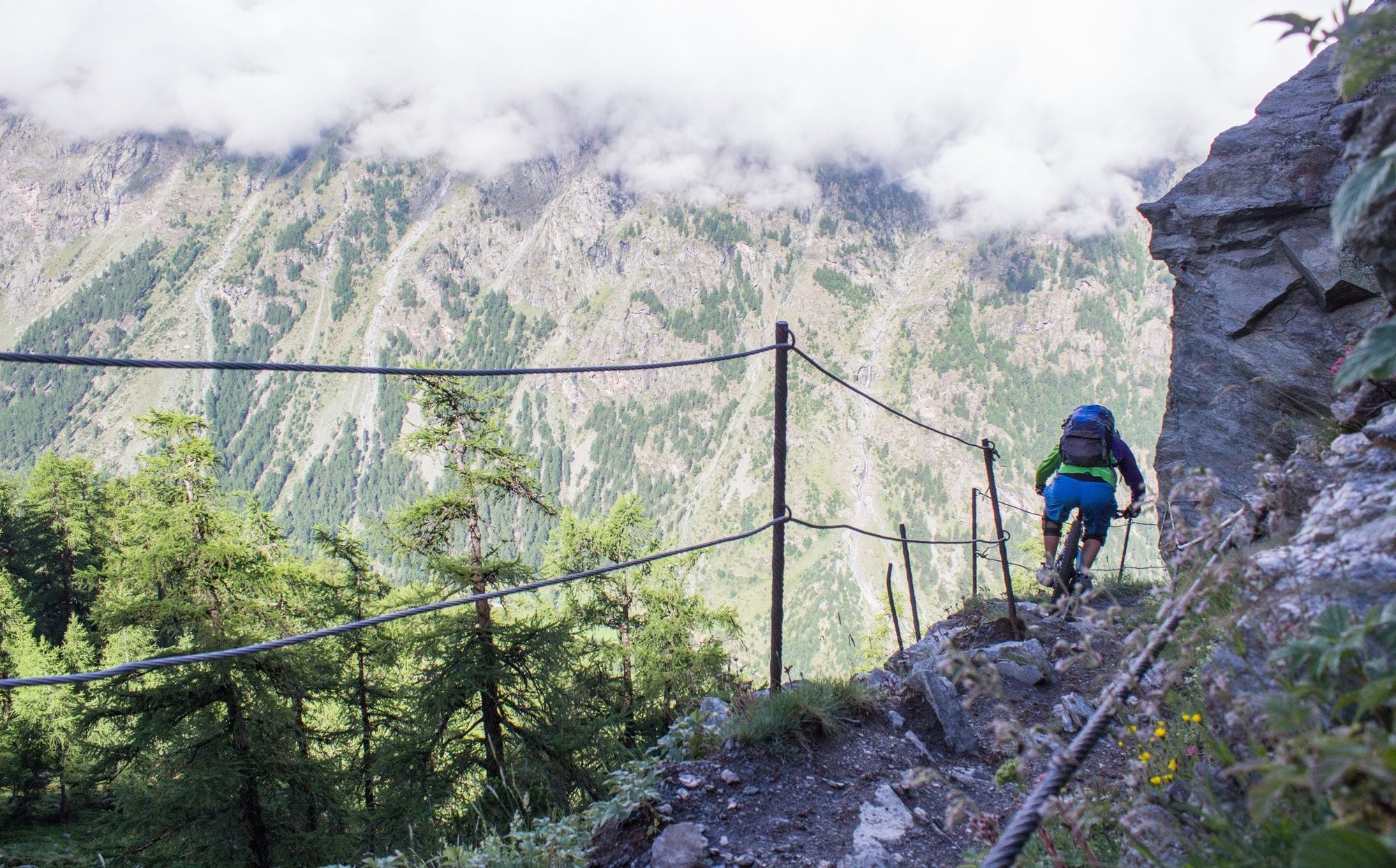
Turn right as you get to this fire road to join the Europaweg. After a short climb the trail starts to descend and get a little more technical. There is one heavily exposed section of trail with a wire on the outside. For the majority of people it is probably wiser to get off and walk for this short section as any mistake could be fatal.
Keep following the trail as it traverses around the mountain to Täschalp where it is worth while visiting the Europaweg Hut for some refreshments.
After leaving the hut travel a short distance down the road and take the singletrail climbing to the right. After a short climb the trail begins to traverse around the mountain again before taking a rather steep and direct line to the valley floor in Täsch.
- Highest point
- 3,076 m
- Endpoint
-
Täsch
- Height profile
-
 © outdooractive.com
 - Equipment
-
An "All Mountain" or "Enduro" bike is recommended for this tour.
- Safety instructions
-
There are some severly exposed sections of trail on the Europaweg.
- Tips
-
This tour combines well with an overnight in the Mountain Hotel at Fluealp where you can get an overnight stay with evening meal for as little as 79CHF!
- Additional information
- Directions
-
From Bern take the A6 (From Zurich A4/A14/A2/A8) exit for Kandersteg. In Kandersteg put your car on the train to Goppenstein and follow signposts for Visp. In Visp follow signposting for Täsch/Zermatt. The Sunnegga/Rothorn lift station is about 400m from the train station. Take the road down the side of the Gornergrat station that runs perpendicular to the Bahnhofplatz. At the end of the road cross the river and turn left.
- Public transportation
-
There are two connections to Zermatt from Visp per hour (08 and 41 minutes past the hour). The Sunnegga/Rothorn lift station is about 400m from the train station. Take the road down the side of the Gornergrat station that runs perpendicular to the Bahnhofplatz. At the end of the road cross the river and turn left.
- Parking
-
There is a large carpark in the Matterhorn Terminal Täsch. You will need to take the train from Täsch to Zermatt.

-

-
AuthorThe tour Europaweg is used by outdooractive.com provided.


Surfaces
General info
-
Oberwallis
211
-
Mattertal
62
-
Täsch
37