- Brief description
-
A great introduction to Walliser single trails.
- Difficulty
-
medium
- Rating
-
- Starting point
-
Belalp, Top of Cablecar
- Route
-
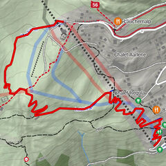
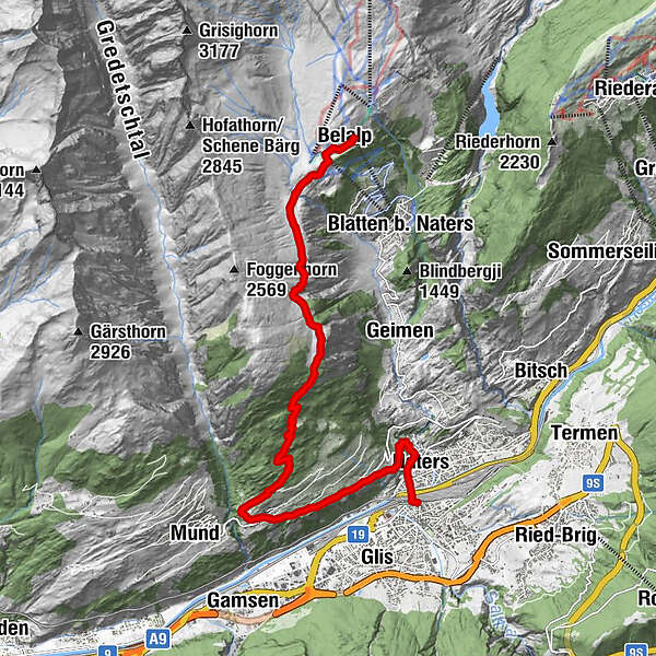
Restaurant BergstationBelalp (2,096 m)0.0 kmBelalp (2,094 m)0.2 kmHamilton Lodge0.6 kmPizzeria Chalet Sepp0.6 kmBäll (2,010 m)1.0 kmNessel (2,010 m)4.4 kmMaria zum Schnee4.4 kmChittumatte (1,635 m)6.2 kmBirgisch9.1 kmBirgisch (1,093 m)9.2 kmSchlüocht10.3 kmEiholz10.9 kmNaters (673 m)12.5 kmBrig (691 m)13.3 kmBrig Bahnhofplatz (690 m)13.4 kmBrigue (678 m)13.4 km
- Best season
-
JanFebMarAprMayJunJulAugSepOctNovDec
- Description
-
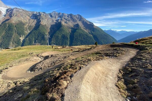
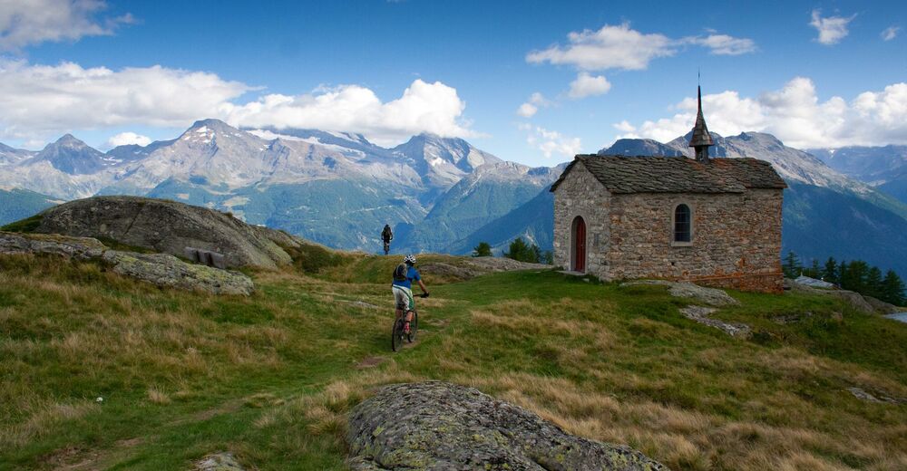
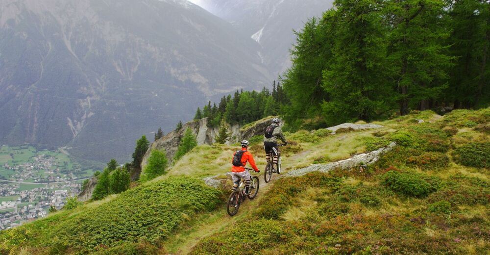
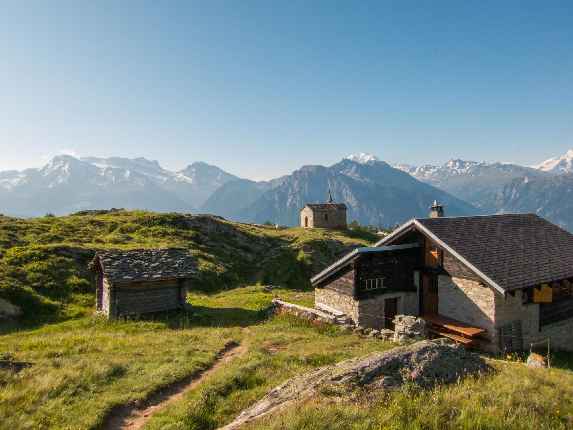
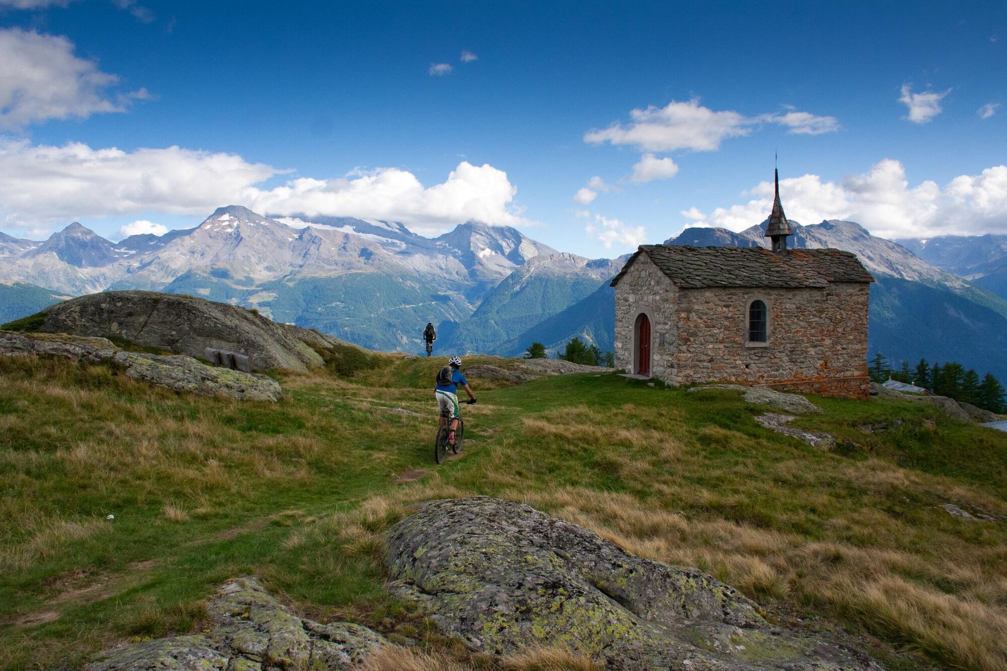
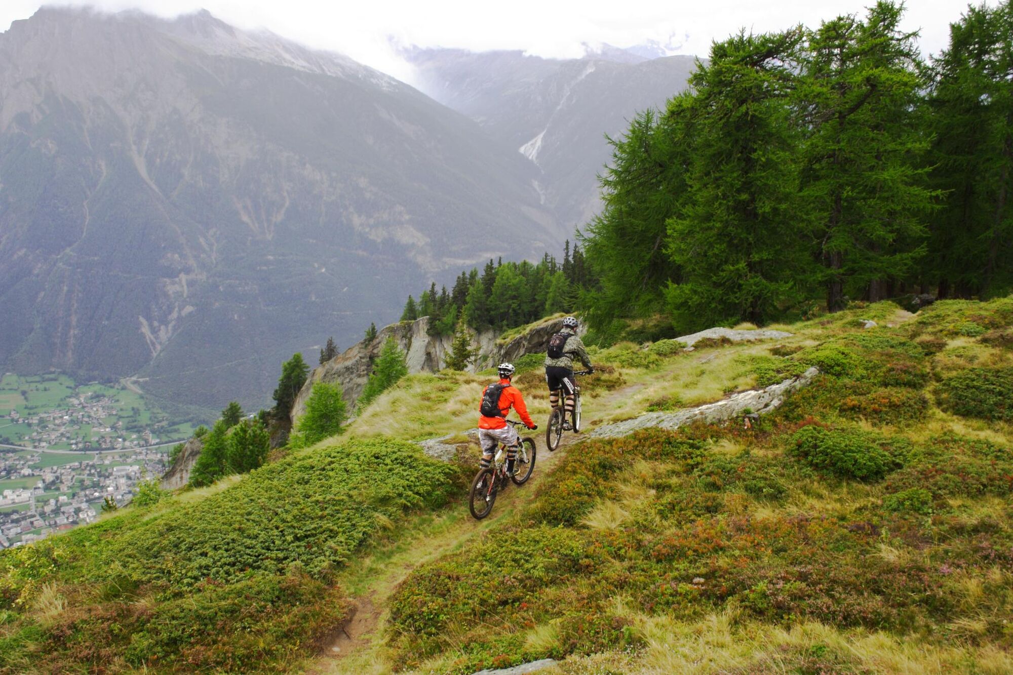
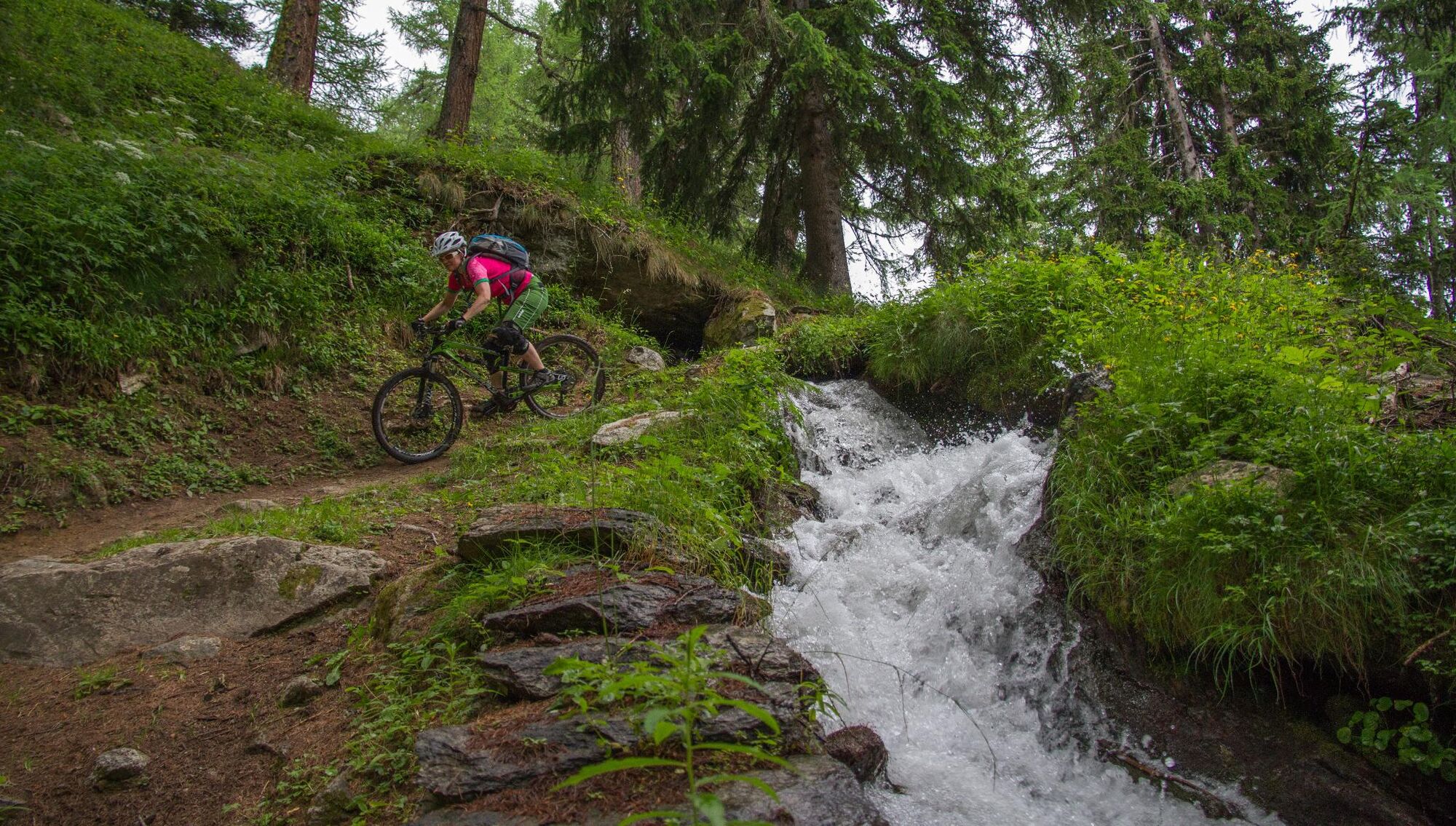
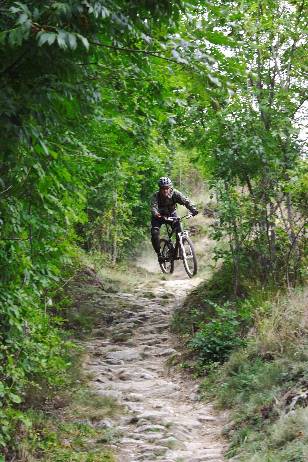
The Belalp trail offers beautiful views over the Aletsch Glacier, and many of the Walliser 4000m mountains but also excites with 1300m of single trail descent in one go the whole way to the valley in Brig. This route from Belalp to Brig via Biel and Birgish is a really good mix of fast flowy woodland trail easy enough to give an intermediate level rider a good taste of technical riding but challenging enough to ensure the more advanced riders will have a huge grin on their faces at the bottom.
- Directions
-
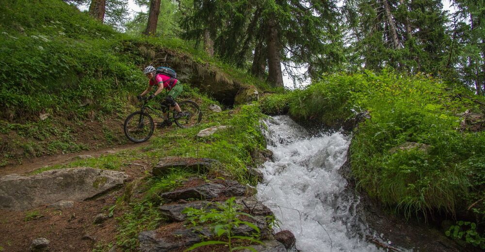
From the cable car station turn left and follow the paved road towards the small village at Bel(Bäll on the singletrail map), from Bel you veer right on a grassy fire road following signs for Nessel. After crossing a stream the fire road starts to fade away and turns into singletrail.
The trail climbs gently with towards Nessel contouring around the hillside. Once the trail stops contouring and opens up on a plateau crossing a field make sure to stop and look back for great views of the Aletsch glacier. The trail continues quite flat but nice and flowy to a small church. After the church it drops into the woods and starts the long descent to Birgish.
As you drop into the woods keep following the main trail, at one point you will drop onto a fire road which you will just cross and drop into the trail again on the other side. Just above Birgish there is a junction with one trail going slightly uphill to the right and another one veering left downhill across a field. Stay left and follow signs for Naters.Once you get to Birgish, follow the yellow hiking route signs for Brig until you rejoin the road. Descend the road for a few kilometers until you see a rocky fireroad/trail descending to the right. take this trail to Naters where you can cross the river back to the train station at Brig.
- Highest point
- 2,093 m
- Endpoint
-
Brig Train Station
- Height profile
-
 © outdooractive.com
 - Equipment
-
An "All Mountain" or "Enduro" bike is best suited for this trail.
- Safety instructions
-
There is no severe exposure on this trail, but it does have some rocky and moderately steep sections. It is suitable for good intermediate level mountain bikers and up.
- Tips
-
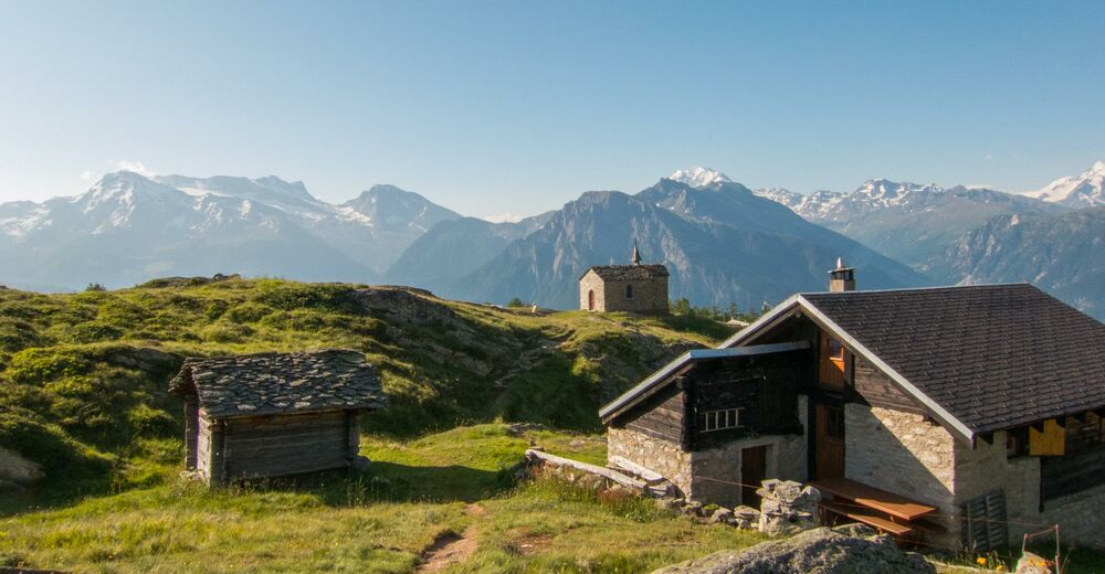
There is a beautiful picnic spot with a view on the Aletsch Glacier just before Nessel.
- Additional information
- Directions
-
Take the Lötschberg car train from Kandersteg to Goppenstein if coming from Bern area. If coming from Geneva direction take the A9 towards Brig or if coming from Zurich in Summer it is possible to take the A4/A2 to Göschenen and then drive over the Furkapass to Brig. If coming by car it is advisable to park in Brig and take the Post Auto to Blatten where you can get the cablecar to Belalp.
- Public transportation
- Parking
-
Parking is available at the train station in Brig or at the valley station in Blatten.
-

-
AuthorThe tour Belalp is used by outdooractive.com provided.


Surfaces
General info
-
Aletsch Arena
129
-
Brig Simplon
52
-
Blatten-Belalp
14