
- Brief description
-
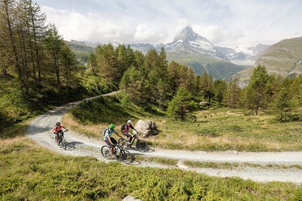
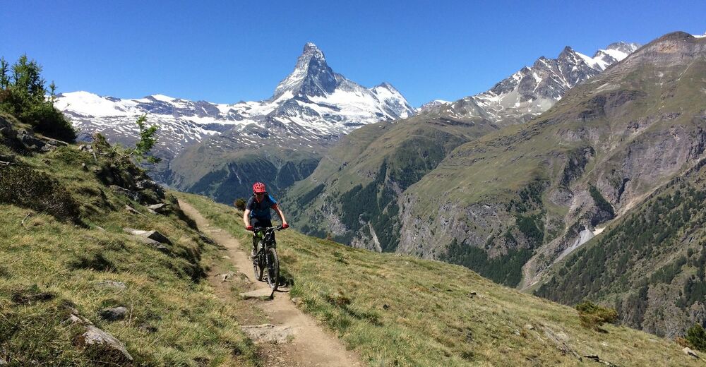
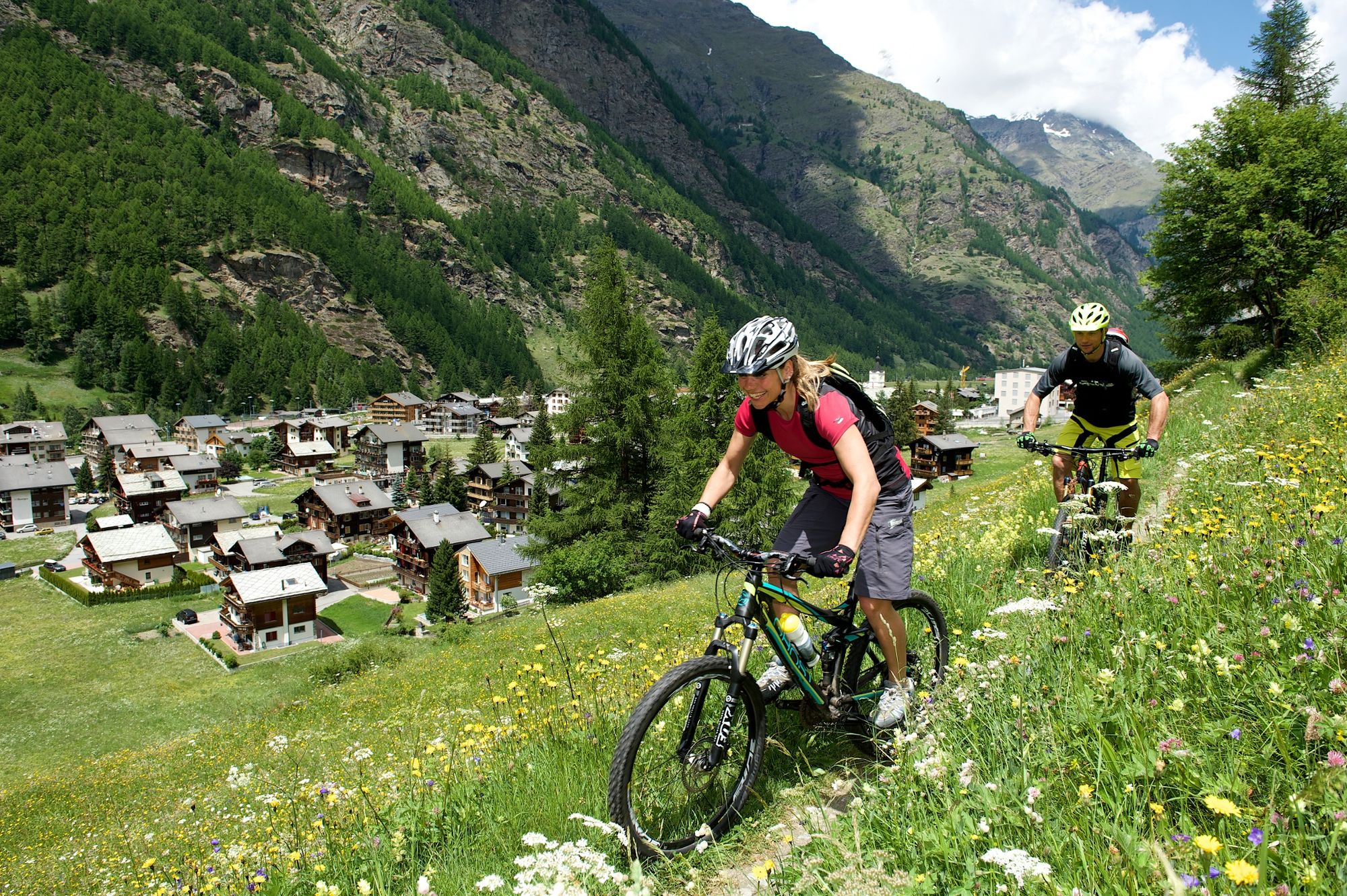
This route is for experienced mountain bikers. The trail is relatively easy to start with, but quickly becomes challenging. You’ll be rewarded with cool single trails and incredible views of the mountains.
- Difficulty
-
difficult
- Rating
-
- Starting point
-
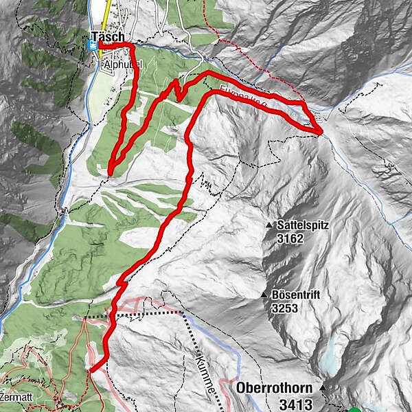
Tufteren (2,215 m)
- Route
-
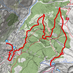
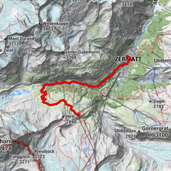
Tufternhütte (2,216 m)Tufteren (2,215 m)Matterhorn1.4 kmOttafe (2,205 m)6.3 kmTäschalp Restaurant & Lodge6.3 kmEggenstadel7.7 kmBlasbode8.9 kmTäsch (1,449 m)12.5 kmRestaurant Walliserkanne12.6 km
- Best season
-
JanFebMarAprMayJunJulAugSepOctNovDec
- Description
-
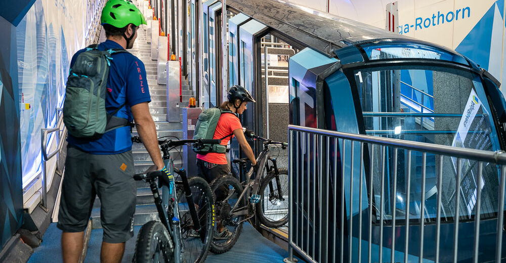
From Sunnegga a flat road takes you to the Tufterenalp, where the tour starts.
At Tufteren, the trail continues over the famous Europaweg. On the Höhenweg heading towards Täschalp, there are some sections when you'll need to pedal a bit. Some points on the Europaweg are also exposed and it is recommended that you get off your bike and push.
Some of the tour is on the road, from Täschalp to where it branches off on the single trail to Blasboden. At the branch there is stream and a barbecue area for a final break before the descent to Täsch.
Alternative: If you get tired sooner, you can decide to do “less” and branch off straight to Blasboden, avoiding the strenuous loop across the Täschalp.
- Directions
-
Tufteren - Europaweg - Täschalp - Blasboden - Täsch
- Highest point
- 2,347 m
- Endpoint
-
Täsch (1,450 m)
- Height profile
-
 © outdooractive.com
 - Equipment
-
We recommend:
Bike in excellent working order Helmet, gloves and (trail) bell Repair kit in case of any defects Clothing suitable for the weather (always carry a waterproof) Food and drink - Safety instructions
-
Always wear gloves and a helmet. Use marked bike trails and routes only, and observe all signposting. Please close gates after passing through. Please be considerate to walkers and to plants and animals. As a rule, walkers have priority. When planning, take into account participants’ fitness level and ability: some routes lead above 3,000 metres. All riding is at one’s own risk.
Tip: “Be searchable”. Equip yourself with an additional RECCO rescue reflector*. Whether summer or winter. Available in our Online-Shop or our information desk. *The additional reflector does not replace an avalanche beacon.
- Tips
-
The Tufternkumme from Rothorn is a suitable single trail highlight before joining the Europaweg trail.
- Additional information
- Directions
-
Zermatt is car-free. Private vehicles are permitted only as far as Täsch (5 km before Zermatt). The Täsch–Zermatt road is closed to the public.
Onward travel to Zermatt is either by private taxi or shuttle train. Trains depart every 20 minutes; the journey takes about 12 minutes, and ends at the Bahnhofplatz in Zermatt.
- Public transportation
-
By train to the Matterhorn village: 3½ hours from Zürich airport or 4 hours from Geneva airport. Change at Visp onto the Matterhorn Gotthard Bahn (Matterhorn Gotthard Railway). From Visp, the railway leads through the Mattertal valley past idyllic small villages to Zermatt.
Zermatt is also the start and finish point for the world-famous Glacier Express panoramic train journey (Zermatt to St. Moritz or Davos).
- Parking
-
Täsch has car parks with both covered and open-air parking – e.g. at the Matterhorn Terminal or privately operated facilities.
Onward travel: see “Getting there”.


- Author
-
The tour Tufteren–Europaweg–Täsch Bike Tour (Nr. 4) is used by outdooractive.com provided.


General info
-
Oberwallis
211
-
Mattertal
62
-
Täsch
37