


- Brief description
-
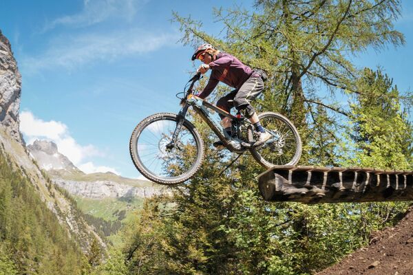
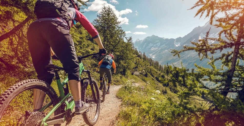
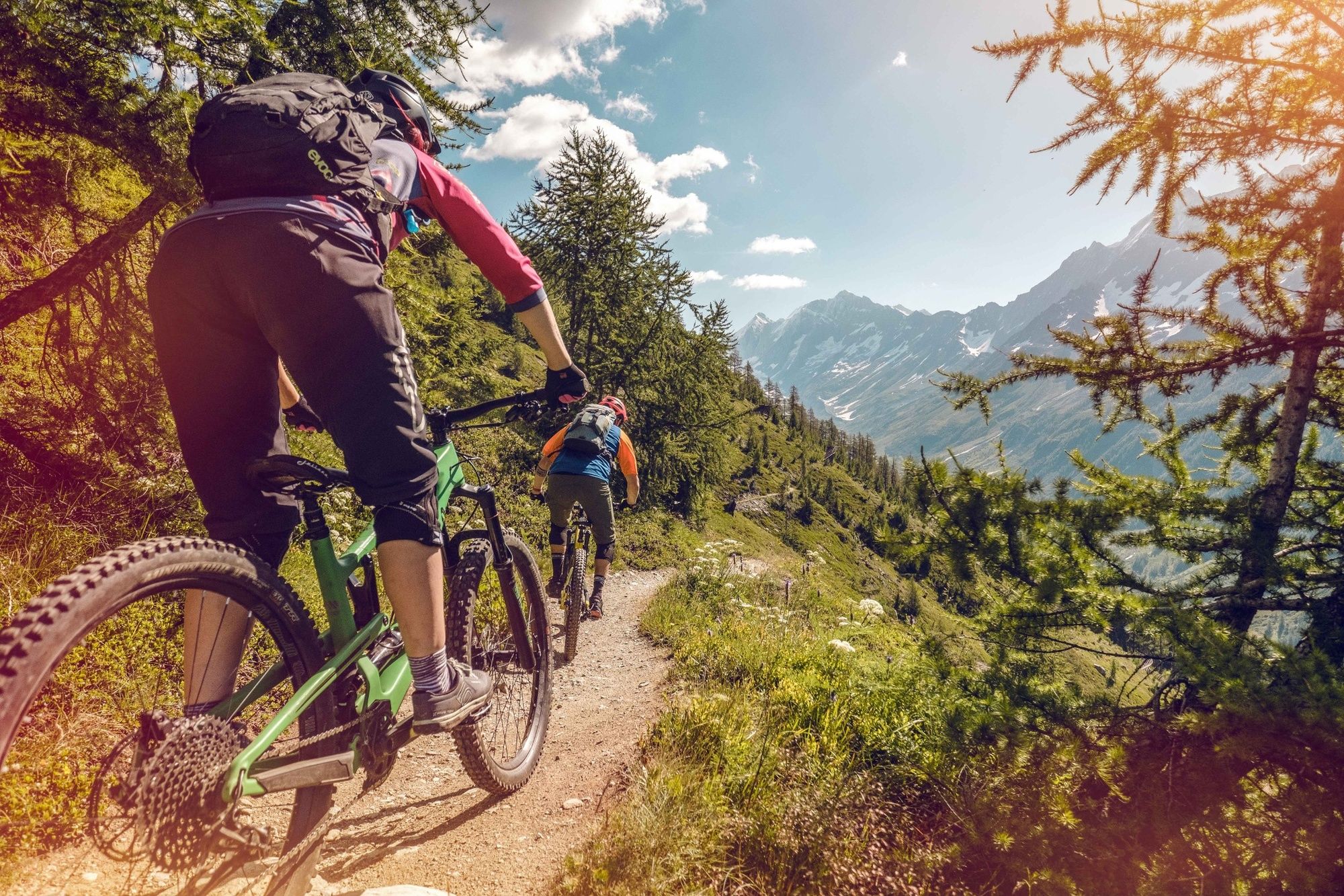
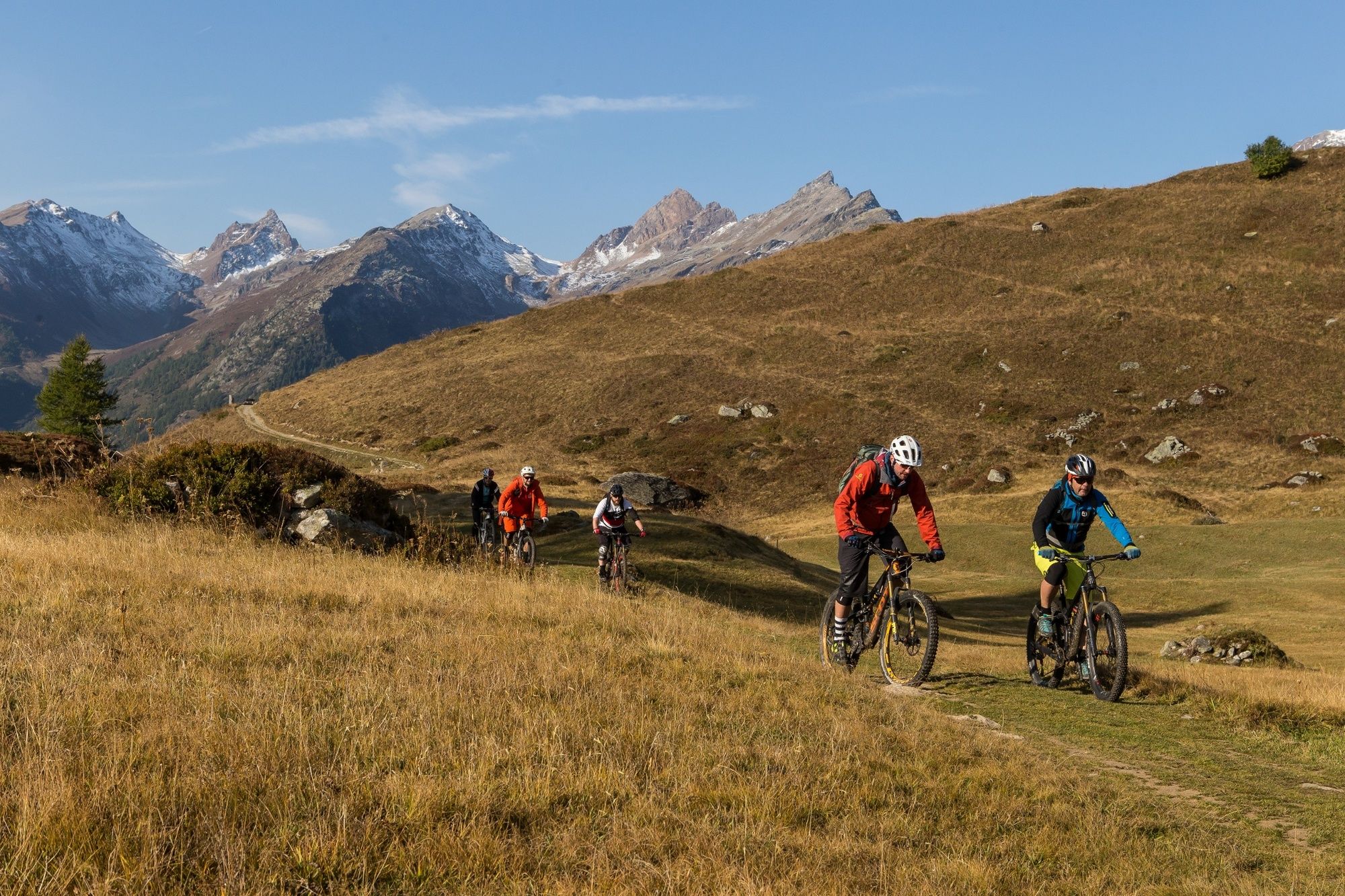
Suitable for beginners as well as experienced mountain bikers, this route offers an attractive and scenic descent – but is neither a flow trail nor a downhill track.
- Difficulty
-
medium
- Rating
-
- Starting point
-
Lauchernalp
- Route
-
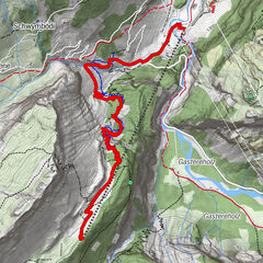
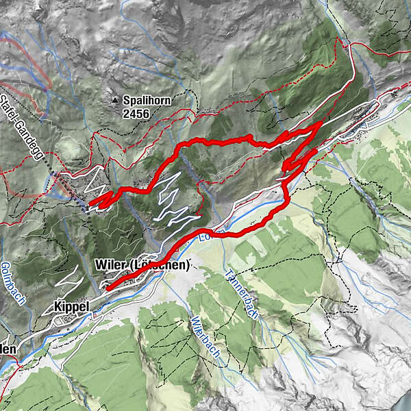
ZudiliNetzbord2.1 kmWeissenried3.4 kmBlatten (Lötschen)4.3 kmNest- und Bietschhorn6.2 kmRied6.2 kmWeestenmattu7.4 kmWiler (Lötschen) (1,419 m)8.8 kmLonza8.9 kmSporting9.2 km
- Best season
-
JanFebMarAprMayJunJulAugSepOctNovDec
- Description
-
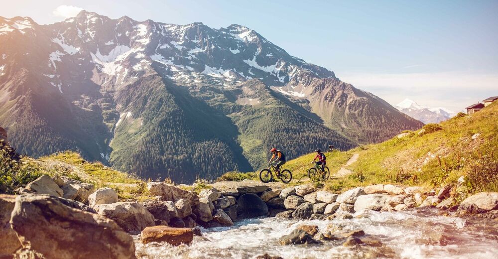
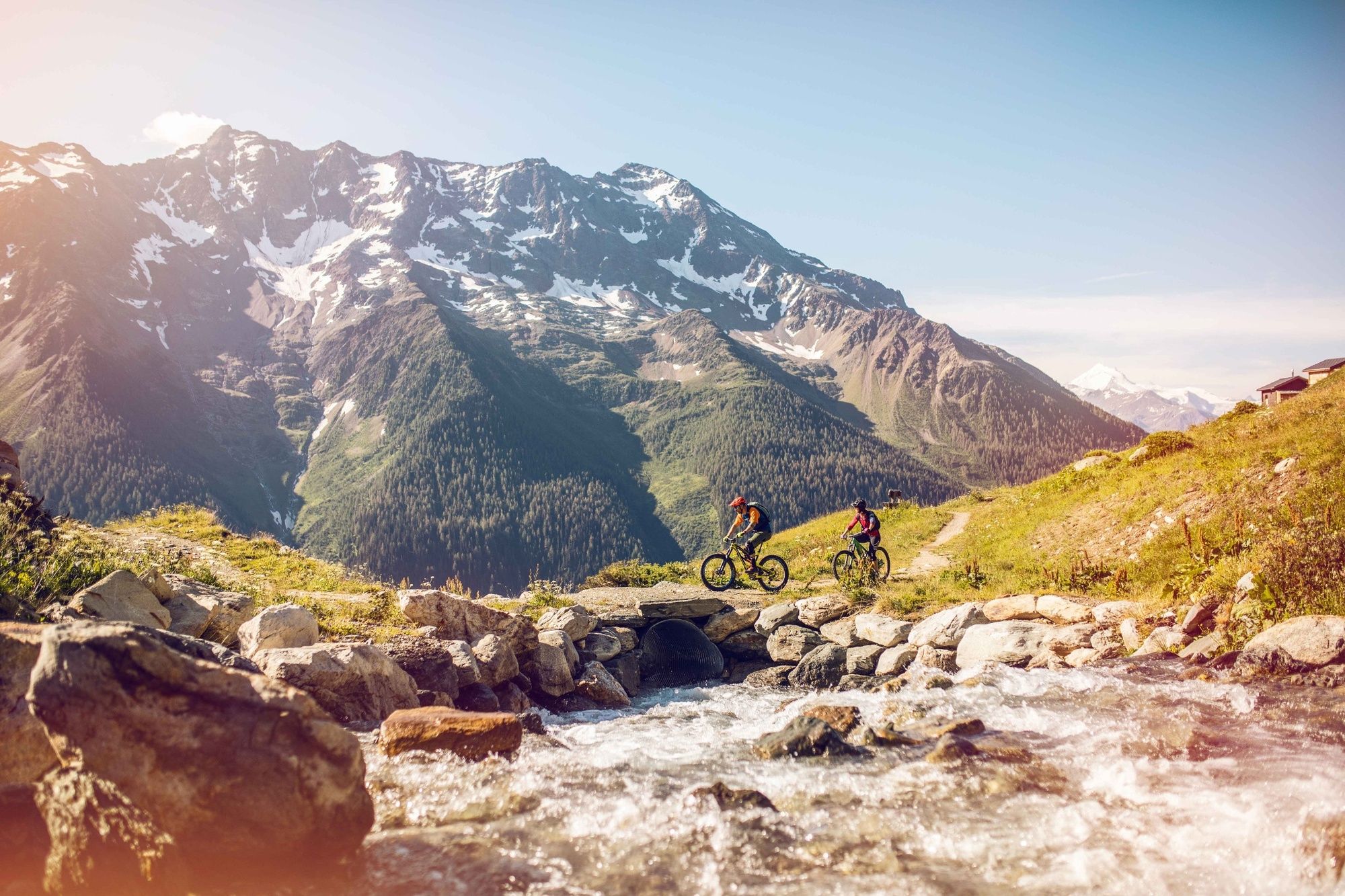
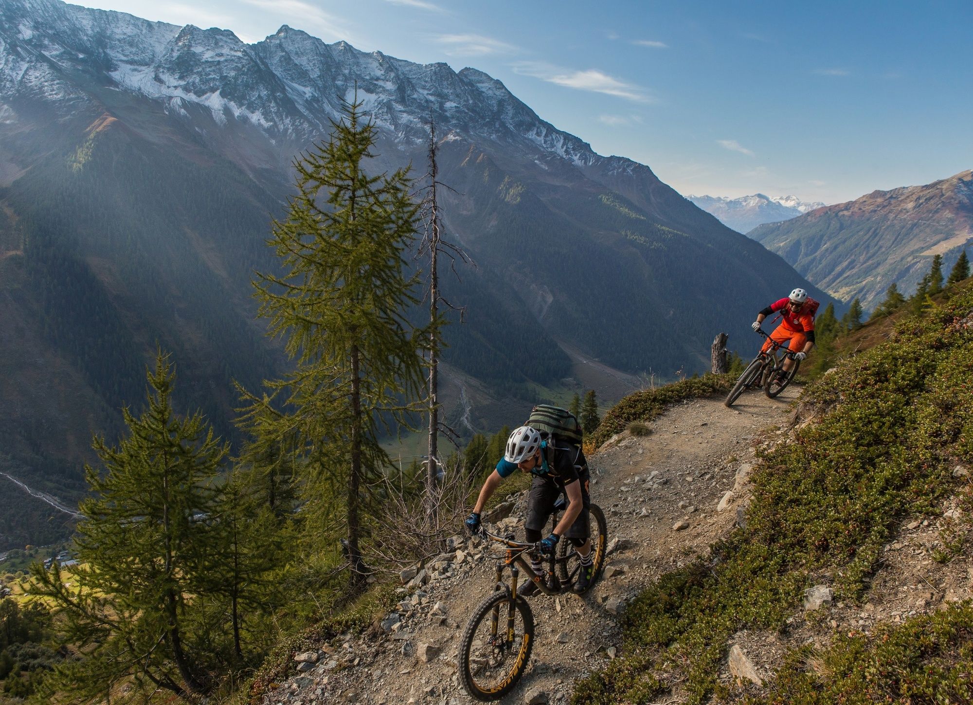
This route from Lauchernalp to Wiler is suitable for all mountain bikers, from beginner to expert. A Singletrail winds down to the height of Weissenried, and then continues down to Ried. You finally reach Wiler, along the Lonza River. Riders enjoy fine views of the Breithorn, one of the dramatic peaks of the Lötschental.
- Directions
-
Lauchernalp is located on the south-facing slopes of the Lötschental and offers glorious views of the mountains that frame the valley. This is the starting point for the Breithorn Trail, accessible by cable car. From here, the route leads eastwards to the village of Fischbiel before a steady climb of about one kilometer to Netzbord: the start of the descent. The route winds down to the little village of Weissenried, further up the Lötschental, where you enjoy magnificent views of the Breithorn and the whole valley. Take time to visit the chapel dedicated to St George, built in 1787. Then climb back on your bike to continue along the route towards the village of Ried, before following the river Lonza as far as the base station of the cable car in Wiler.
- Highest point
- 1,946 m
- Endpoint
-
Wiler
- Height profile
-
 © outdooractive.com
 - Equipment
-
We recommend: a bike in excellent working order, a helmet, gloves and a bell, clothing suitable for the weather (always carry a waterproof), food and drink.
- Safety instructions
-
Use marked bike trails and routes only, making sure you observe all signposting. Kindly close gates after passing through. Please be considerate to walkers, as well as to plants and animals. As a rule, walkers have priority. When planning, take into account participants’ fitness level and ability. All riding is at one’s own risk.
- Tips
-
You can ride the Breithorntrail several times, get to know the route and have even more fun.
- Additional information
- Directions
-
From Goppenstein drive up the Lötschental valley, through the villages of Ferden and Kippel to Wiler and the base station of the cable car.
- Public transportation
-
Postal bus every hour from Gampel/Steg via Goppenstein to Wiler. Descend at bus stop “Wiler, Talstation” by the cable car station.
- Parking
-
Parking available (outdoor and indoor) at the valley station of the cable car; fee payable.
- Author
-
The tour Breithorn Bike is used by outdooractive.com provided.


General info
-
Oberwallis
213
-
Lötschental
120
-
Wiler
38