
- Brief description
-
This route leads you across the alpine pastures above the resort of Anzère, offering exceptional panoramic views of the most beautiful peaks in Valais.
- Difficulty
-
medium
- Rating
-
- Starting point
-
Anzère
- Route
-
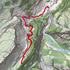
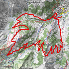
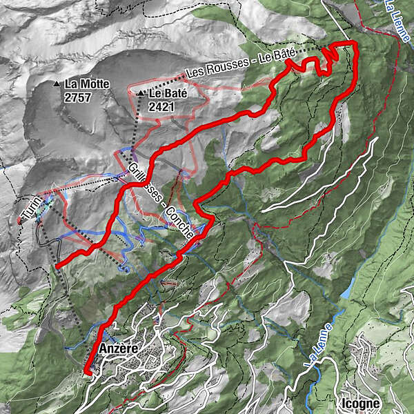
Alpage de Tsalan-d'Arbaz0.8 kmLes Écuries de Tsalan0.9 kmLe Tsijiri3.7 kmAlpage de Serin4.6 kmLes Rousses (1,775 m)6.4 kmRestaurant des Rousses6.4 kmLes Rousses6.5 kmLes Grillesses10.9 kmAudey11.4 kmTable de pique-nique12.6 kmLes Bochonès12.8 kmAnzère (1,500 m)12.8 km
- Best season
-
JanFebMarAprMayJunJulAugSepOctNovDec
- Description
-
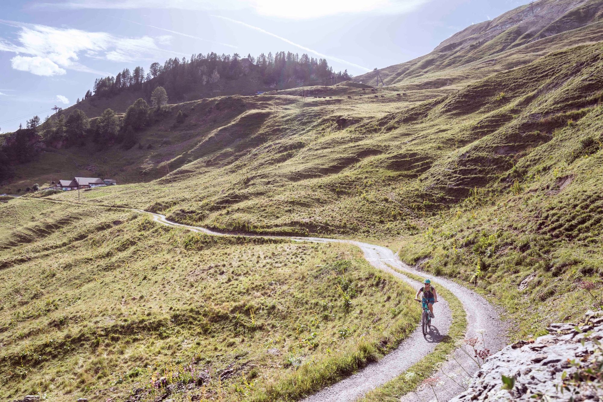
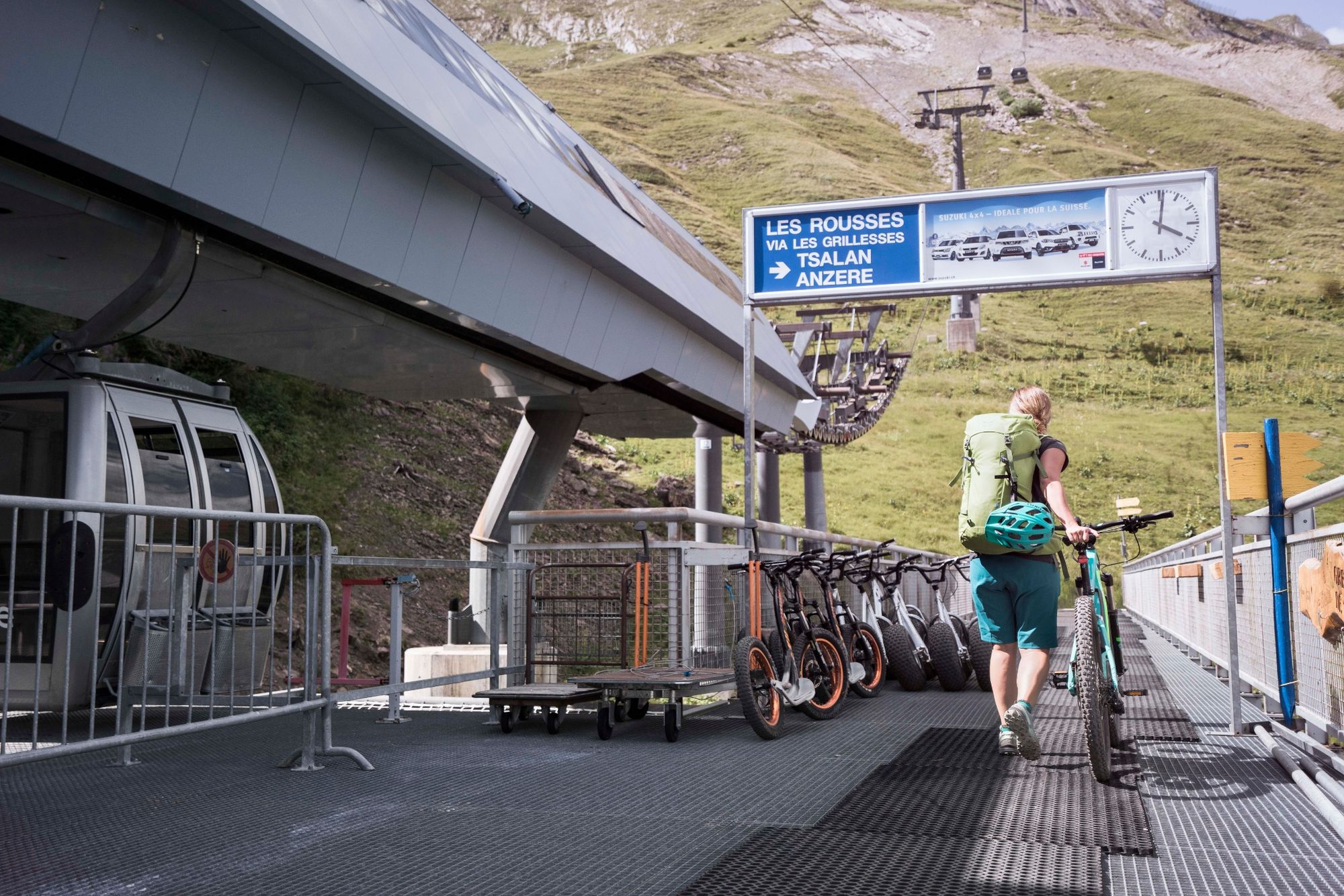
Your trip begins at the gondola station in Anzère with the easiest stage: a gondola ride up to the middle station. From here, you ride across the alpine pastures above the resort of Anzère; along the way, you will no doubt see herds of cows of the famous Herens breed. At Les Rousses, you reach the road up to the Tseuzier dam, which you follow downhill. When you arrive above Pracombère, a farming hamlet of old wooden buildings, you take the unpaved road to the right which climbs up to the Bisse de Sion. You then follow the course of this historical irrigation channel until you reach the hamlet of Les Grillesses, before riding along the Route des Luys back to the starting point.
- Directions
-
Before mounting your mountain bike, take the gondola from Anzère up to the middle station. The ride starts here with a gentle descent to the Tsalan alpine pastures, where you can stop at Rosemarie’s café for refreshments and enjoy the spectacular panoramic views. Continue to the alpine pastures of Duex and Serin, where you can watch the sparring of cows of the local Herens breed, known for their feisty temperament. You then descend to Les Rousses, where you meet the road up to the Tseuzier dam; follow the road downhill as far as Pracombère. Just above this charming hamlet of historical farmhouses and barns, take the unsurfaced road that leads up to the Bisse de Sion. Follow the route of this irrigation channel as far as the hamlet of Les Griellesses, then continue along the Route des Luys as far as the base station of the gondola.
- Highest point
- 2,075 m
- Endpoint
-
Anzère
- Height profile
-
 © outdooractive.com
 - Equipment
-
We recommend: bike in excellent working order, helmet, gloves and bell, clothing suitable for the weather (always carry a waterproof), food and drink.
- Safety instructions
-
Use marked bike trails and routes only, and observe all signposting. Please close gates after passing
through. Please be considerate to walkers and to plants and animals. As a rule, walkers have priority. When planning, take into account participants’ fitness level and ability. All riding is at one’s own risk.
- Tips
-
Stop en route to taste local specialities and enjoy fine views of the sparkling 4,000-metre peaks of Valais.
- Additional information
- Directions
-
A9 motorway to Sion Est (exit 27), then follow signs for Ayent/Anzère.
- Public transportation
-
PostBus from Sion to Anzère. (Note that there is also a bus stop at Les Rousses, along the ride.)
- Parking
-
Parking available at various locations in the resort of Anzère.

- Author
-
The tour Alpage Tour is used by outdooractive.com provided.


General info
-
Thyon les Collons
181
-
Anzère/ Valais
102
-
Anzère
19