
- Brief description
-
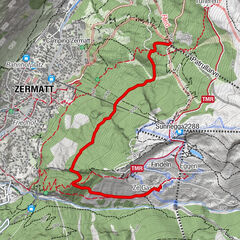
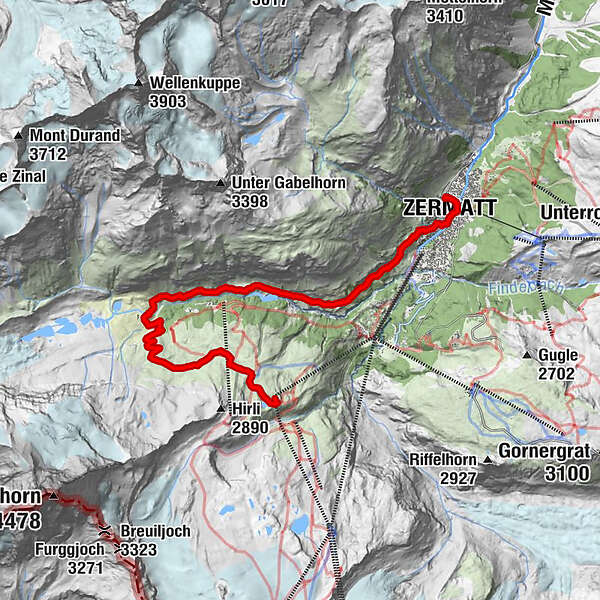
This route from Schwarzsee via Kalbermatten and Zmutt to Zermatt is a surprisingly winding single-track trail. There are some extreme sections towards the end, so it's a route that's only suitable for mountain bikers with a head for heights.
- Difficulty
-
difficult
- Rating
-
- Starting point
-
Schwarzsee (2'583 m)
- Route
-
Schwarzsee paradise0.1 kmSchwarzsee (2,588 m)0.1 kmZmutt8.5 kmKirche St. Mauritius11.7 kmZermatt (1,608 m)12.1 kmZermatt GGB12.5 km
- Best season
-
JanFebMarAprMayJunJulAugSepOctNovDec
- Description
-
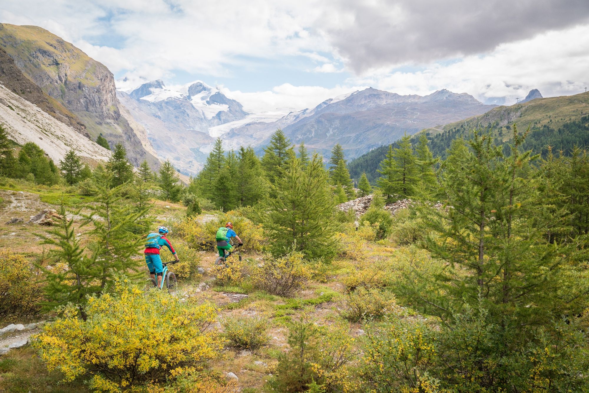
The Matterhorn Express takes you up to Schwarzsee. From here, a gravel track takes you below the Matterhorn to Stafel (power plant) and over the Zmuttbach river to the other side of the valley. The single trail fun starts at this point.
The beginning of the bike trail is relatively flat and easy. There is only one short, tough climb.
When you reach the hamlet of Zmutt, the bike trail then leads onto the Yoyo Trail. There are some sharp corners here and towards the end, a few metres of ascent. Overall, this bike trail is very varied. Single trail experience is an advantage.
- Directions
-
Schwarzsee - Stafel - Chalbermatten - Zmutt - Herbrigg - Bodmen - Zermatt Station
- Highest point
- 2,582 m
- Endpoint
-
Zermatt (1'620 m)
- Height profile
-
 © outdooractive.com
 - Equipment
-
We recommend:
Bike in excellent working order Helmet, gloves and (trail) bell Repair kit in case of any defects Clothing suitable for the weather (always carry a waterproof) Food and drink - Safety instructions
-
Always wear gloves and a helmet. Use marked bike trails and routes only, and observe all signposting. Please close gates after passing through. Please be considerate to walkers and to plants and animals. As a rule, walkers have priority. When planning, take into account participants’ fitness level and ability: some routes lead above 3,000 metres. All riding is at one’s own risk.
Tip: “Be searchable”. Equip yourself with an additional RECCO rescue reflector*. Whether summer or winter. Available in our Online-Shop or our information desk. *The additional reflector does not replace an avalanche beacon.
- Tips
-
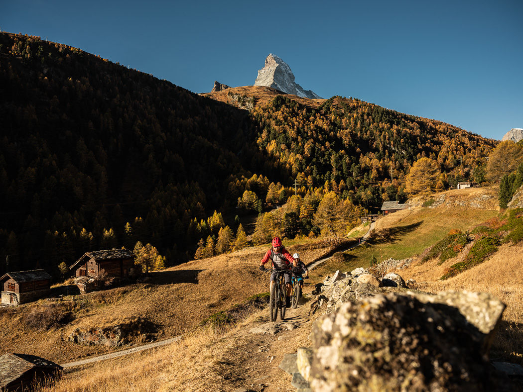
After a few flowy kilometres you reach the hamlet of Zmutt, where a short stop at one of the two restaurants is recommended if you want to indulge yourself culinarily.
- Additional information
- Directions
-
Zermatt is car-free. Private vehicles are permitted only as far as Täsch (5 km before Zermatt). The Täsch–Zermatt road is closed to the public.
Onward travel to Zermatt is either by private taxi or shuttle train. Trains depart every 20 minutes; the journey takes about 12 minutes, and ends at the Bahnhofplatz in Zermatt.
- Public transportation
-
By train to the Matterhorn village: 3½ hours from Zürich airport or 4 hours from Geneva airport. Change at Visp onto the Matterhorn Gotthard Bahn (Matterhorn Gotthard Railway). From Visp, the railway leads through the Mattertal valley past idyllic small villages to Zermatt.
Zermatt is also the start and finish point for the world-famous Glacier Express panoramic train journey (Zermatt to St. Moritz or Davos).
- Parking
-
Täsch has car parks with both covered and open-air parking – e.g. at the Matterhorn Terminal or privately operated facilities.
Onward travel: see “Getting there”.


- Author
-
The tour Kalbermatten-YoYo Bike Tour (Nr. 3) is used by outdooractive.com provided.
Surfaces
General info
-
Unterwallis
143
-
Mattertal
62
-
Zermatt
35