
- Brief description
-
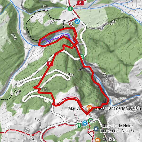
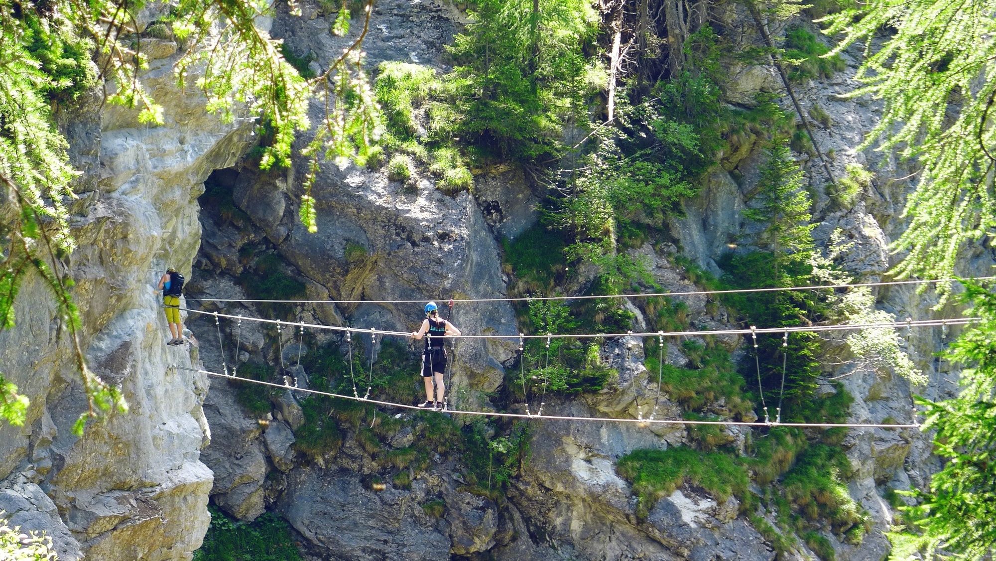
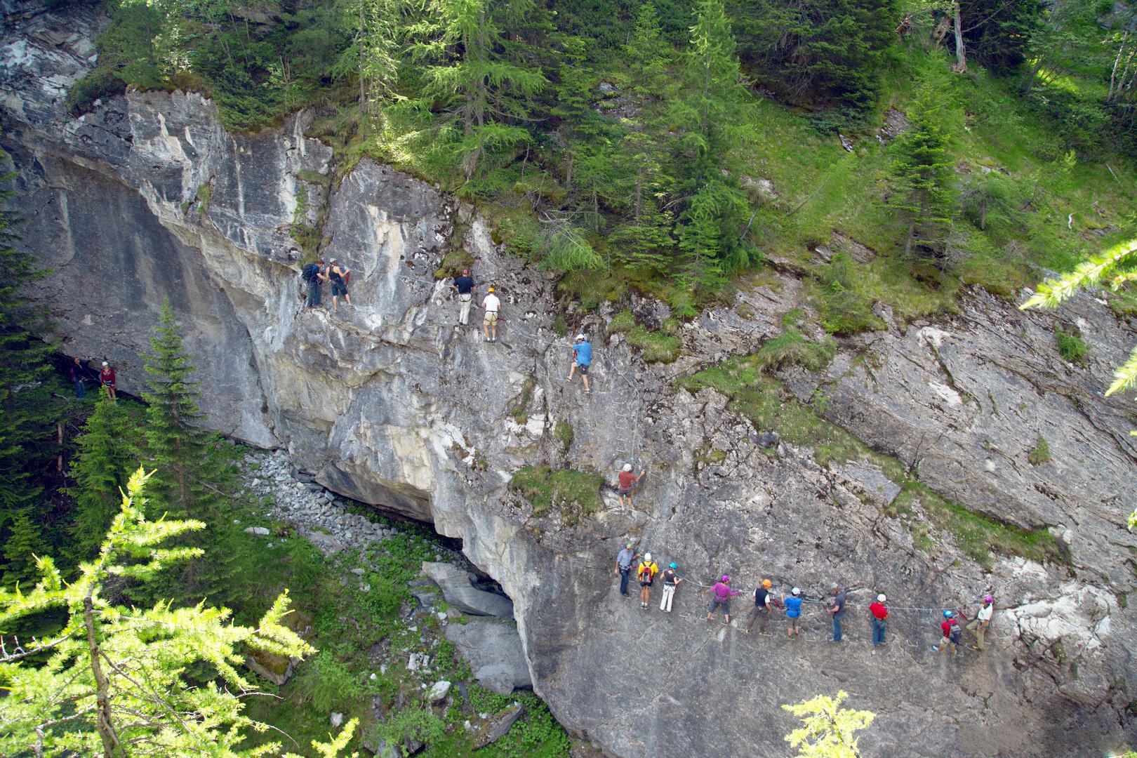
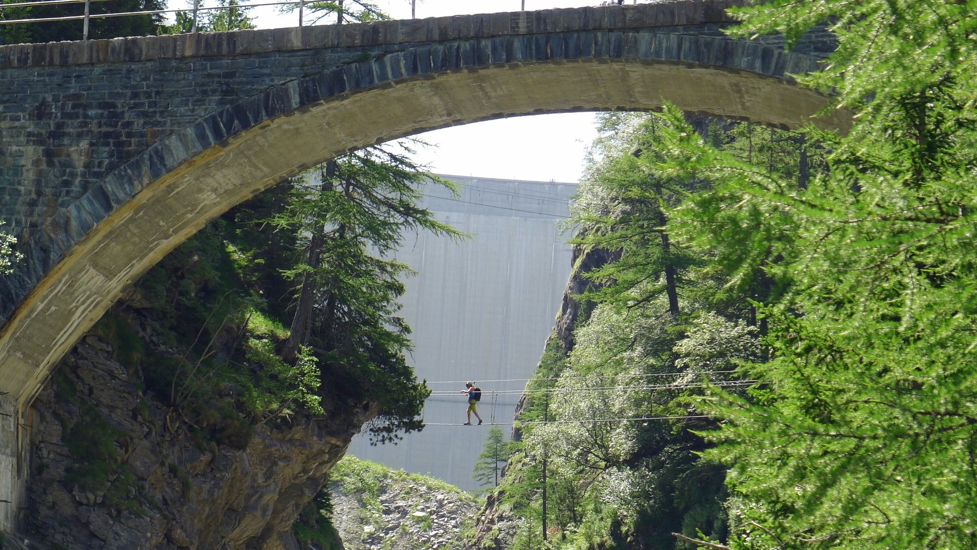
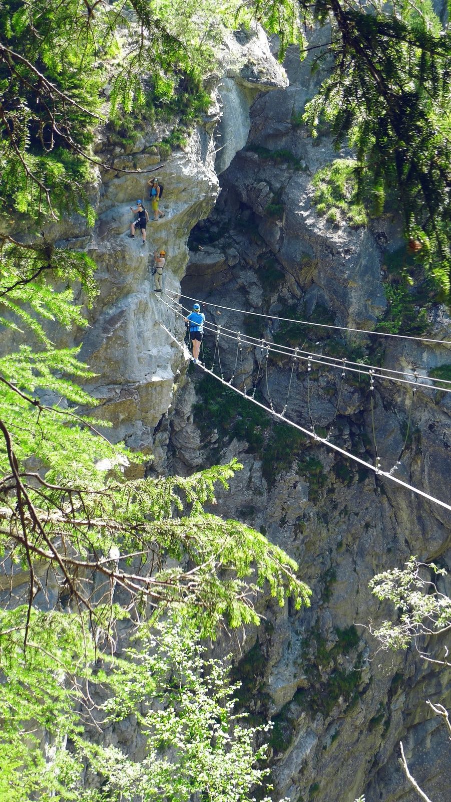
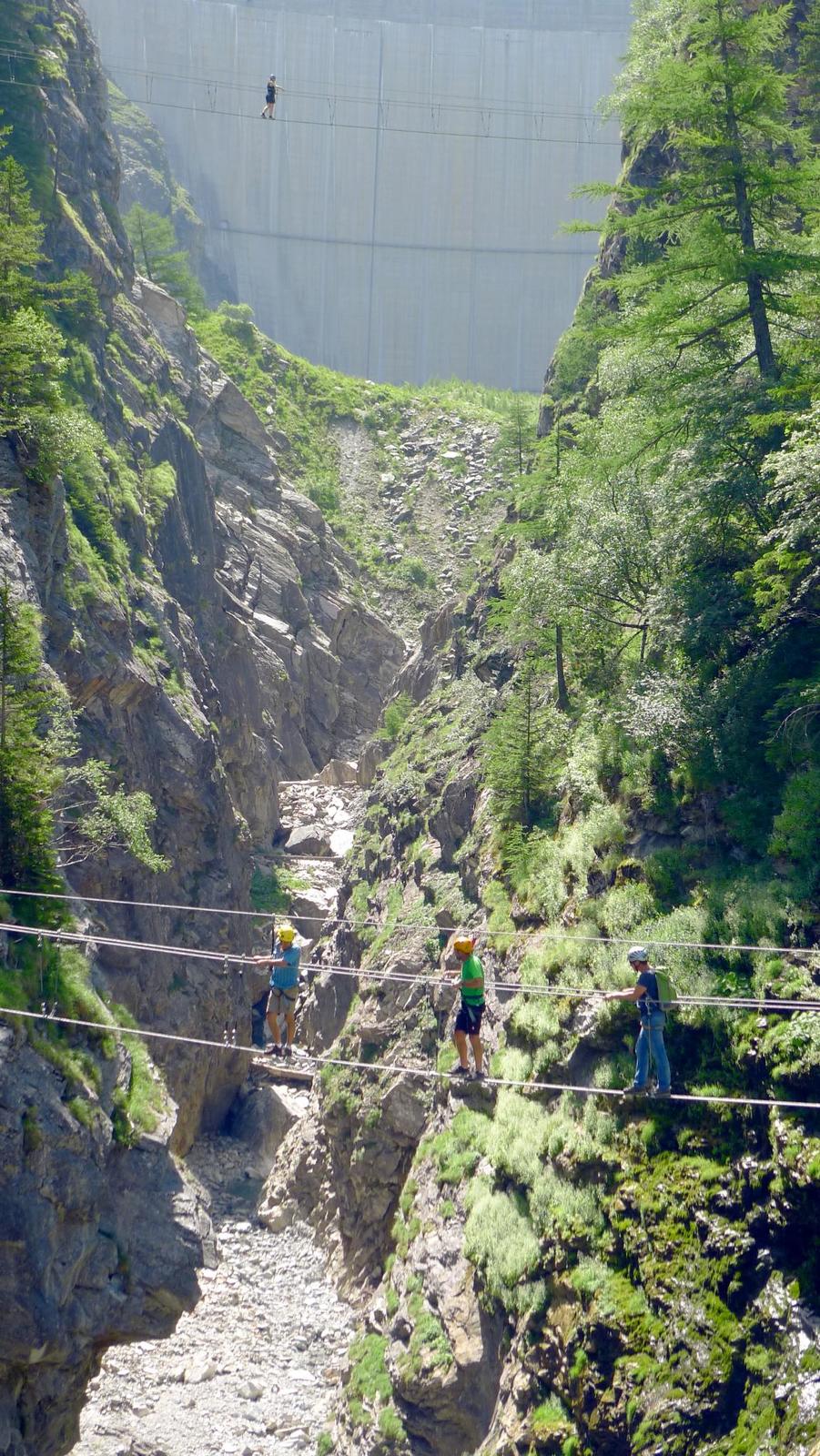
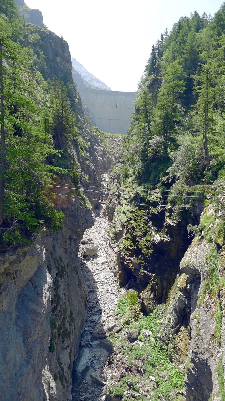
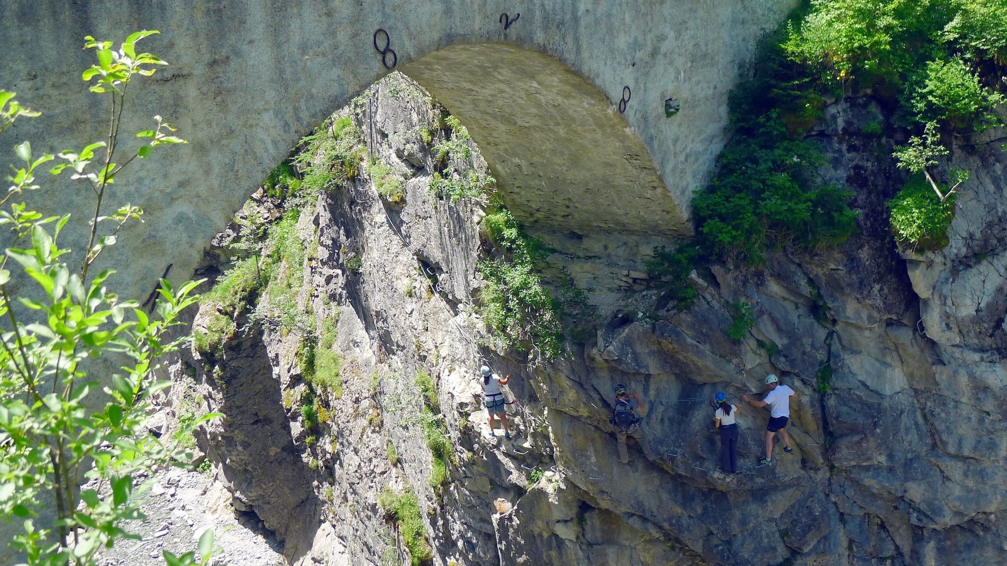
This via ferrata crosses the deep gorges of Dranse from the Mauvoisin dam. The first part (Saxifrage) is accessible to everyone. The second part called Tichodrome (equivalent to the Eurasian Crag Martin), is suitable for athletic climbers.
- Difficulty
-
mediumDifficulty level C
- Rating
-
- Starting point
-
Parking Hôtel de Mauvoisin
- Route
-
Restaurant de Mauvoisin0.0 kmMauvoisin0.1 km
- Best season
-
JanFebMarAprMayJunJulAugSepOctNovDec
- Description
-
The distance between the steps of the first part has been reduced in order to make the via ferrata feasible for kids from 8 years. The via ferrata is arranged at a maximum height of 25 meters above the Dranse river. In order not to disturb the breeding season of the different birds in the gorge, the via ferrata opens on 1st July at the earliest.
- Directions
-
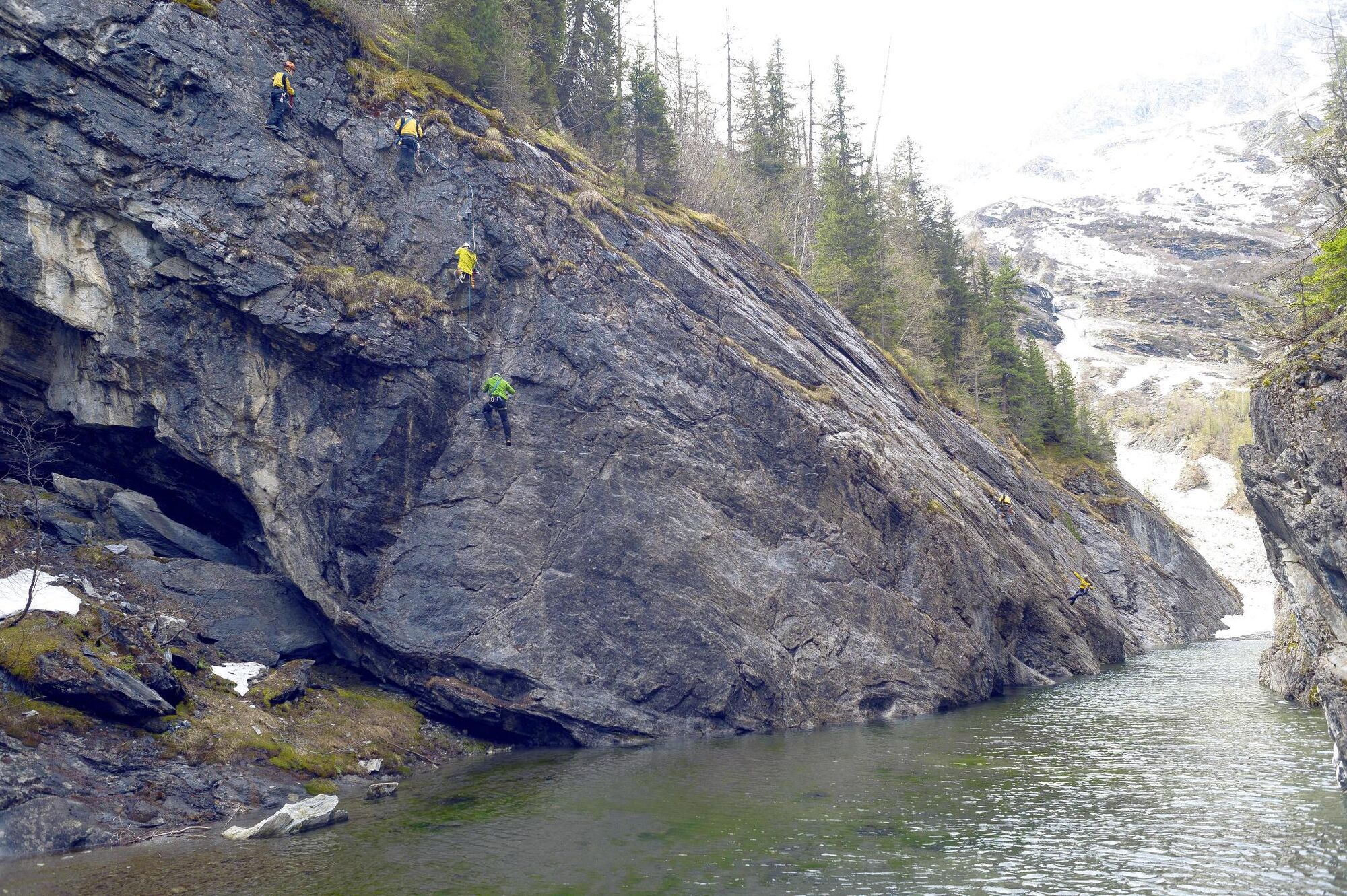
From the car park of the Hôtel de Mauvoisin, follow the path to “La Vacheresse”; from here, walk along the River Dranse a short distance to reach the start of the via ferrata. The first part, “Saxifrage”, is regarded as easy and is suitable for children from age 8. It consists of various obstacles such as a 15-metre suspension footbridge across the Dranse. The second part, “Tichodrome”, is regarded as more difficult and is longer. After crossing the Dranse twice more, you exit the via ferrata just in front of the Hôtel de Mauvoisin.
- Highest point
- 1,842 m
- Endpoint
-
Parking Hôtel de Mauvoisin
- Exposition
- Height profile
-
 © outdooractive.com
 - Equipment
-
All climbers must wear a harness. Because of the risk of falling rocks along the route, a helmet is also essential. Ensure you have sturdy footwear and appropriate clothing, and bring a small rucksack with water and a snack. A suitable pair of gloves will protect your fingers and knuckles from grazes.
- Safety instructions
-
Weather conditions: before setting off to tackle a via ferrata, it is important to check the weather forecast. Bad conditions can make climbing dangerous – particularly in stormy weather.
Rockfalls: because of the risk of falling rocks – usually caused by climbers higher up or by animals – all climbers are strongly advised to wear a helmet.
Safety: always leave sufficient distance between yourself and the climber ahead. There should never be more than one person between two anchor points.
- Additional information
- Directions
-
Highway A9 to Martigny. Take the cantonal road 21 direction to Sembrancher and then the "Route de la Vallée" which leads you to the Val de Bagnes. The dam is situated at the end of the valley.
- Public transportation
-
Regional trains from Martigny to Le Châble. From there, take the bus to the Mauvoisin dam.
- Parking
-
Parking Hôtel de Mauvoisin
- Author
-
The tour Via Ferrata in the Mauvoisin gorge is used by outdooractive.com provided.


General info
-
Unterwallis
20
-
Verbier
4