
- Brief description
-
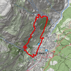
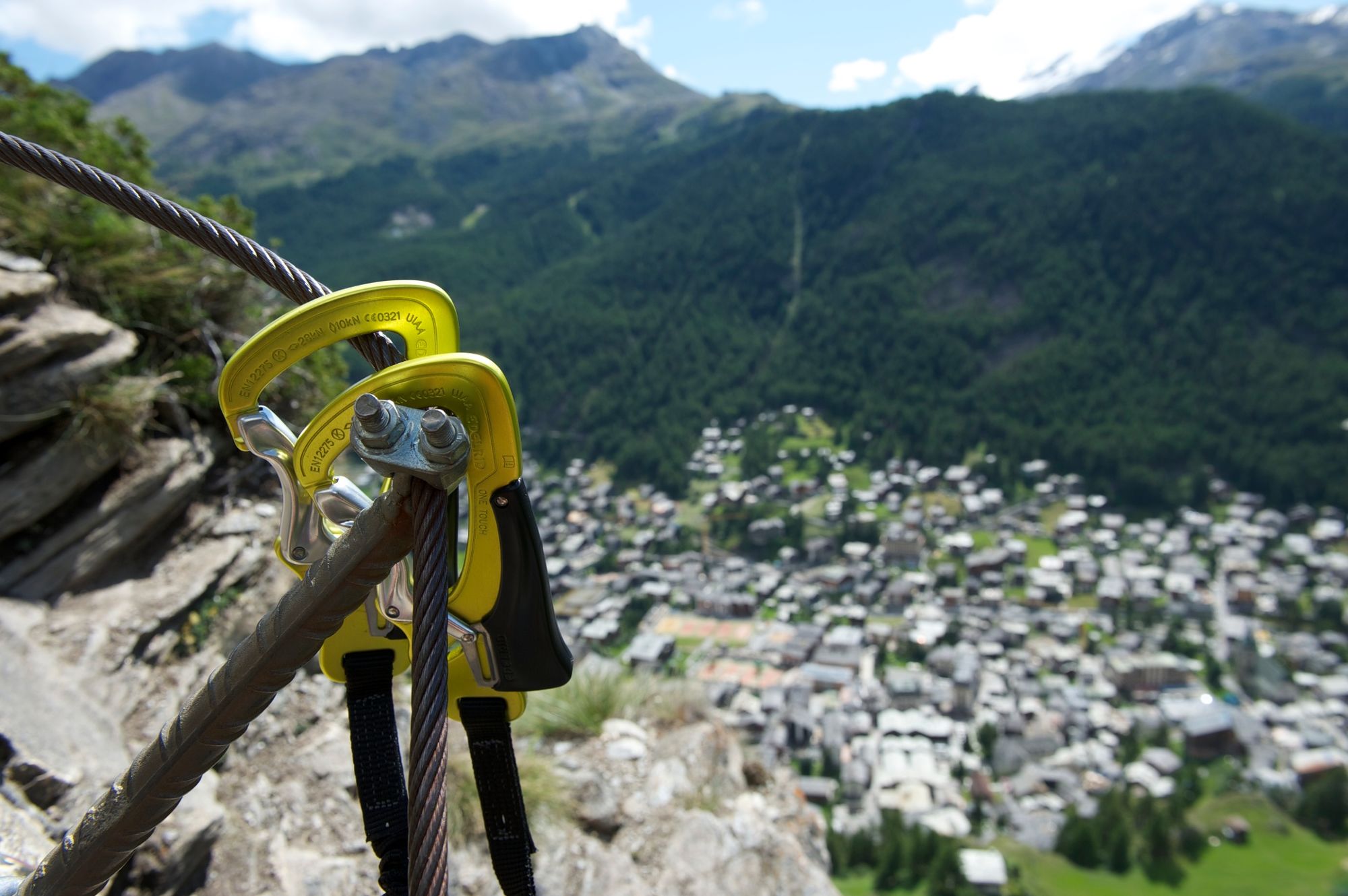
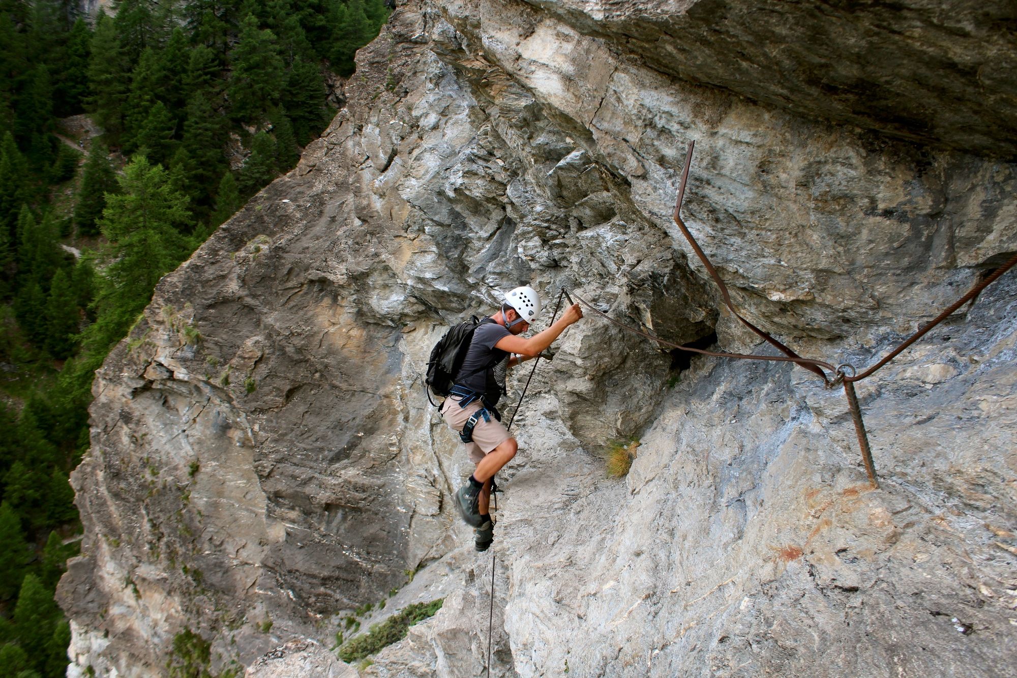
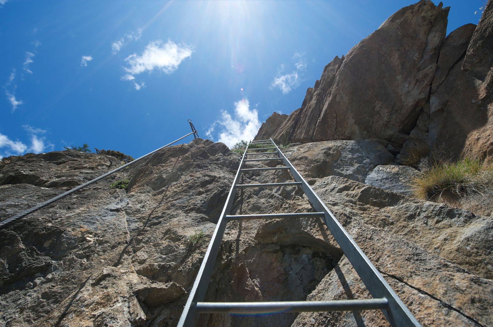
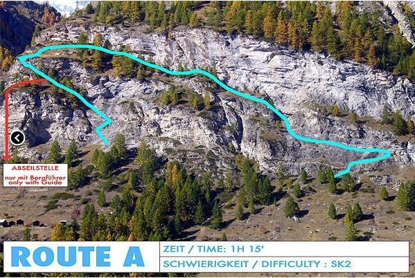
The via ferrata Schweifinen (fixed-cable climb) leads high above the roofs of Zermatt. The three sections – A, B and C – require different levels of ability. Route A is suitable for families with children from the age of 10.
- Difficulty
-
easyDifficulty level B
- Rating
-
- Starting point
-
Zermatt (1,620 m)
- Route
-
Zermatt (1,608 m)0.3 km
- Best season
-
JanFebMarAprMayJunJulAugSepOctNovDec
- Description
-
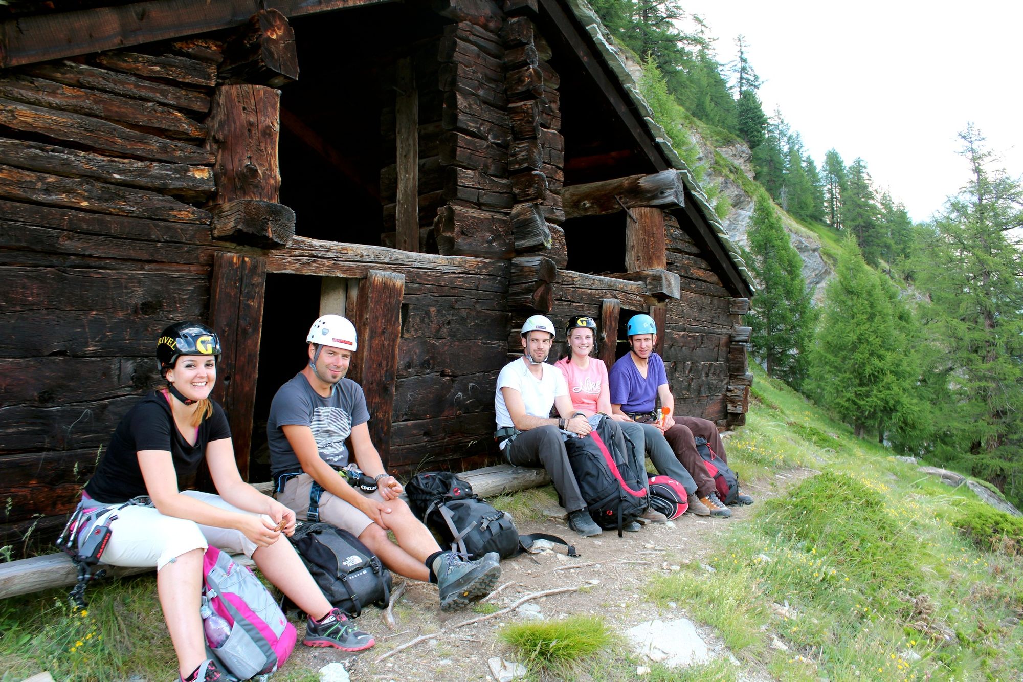
An information panel shows the way to the start of the via ferrata on the Turuwang. Walking time from the railway station to the entry point: approx. 30 minutes. The via ferrata in Zermatt requires agility, a good head for heights and a sure foot. After the first section, there’s an ideal spot for a picnic. Close by is the Beresina hut.
Exposed sections above the Triftbach river Edelweiss at eye level Appropriate for families with children from age 10Beresina hut
This recalls the era of the Napoleonic wars. Valais had been occupied by Napoleon in 1799, and each municipality was required to provide a young man to enrol for combat in Russia. In Zermatt no one came forward, so a tempting offer was made: whoever signed up for military service would receive, on return from the Russian campaign, the stable with a lush pasture up on the Turuwang. At last a young man volunteered. At the battle of Beresina about 1,000 Swiss lost their lives, and the young man from Zermatt never came home. - Directions
-
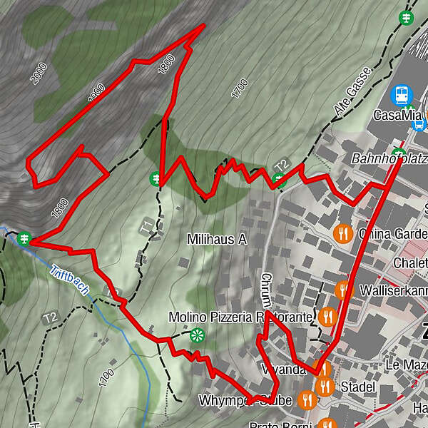
Access: From Zermatt station, follow the Bahnhofstrasse. Just after the office from the Zermatters, turn right onto the path leading to Edelweiss and Trift. Climb out of the village, up towards the Triftschlucht gorge. Before the path reaches the bridge over the Triftbach river, turn right onto the trail leading to the start of the via ferrata (approx. 30 minutes).
Descent: After completing the via ferrata, follow the path back to Zermatt (approx. 20 min).
The map shows the access and return paths as well as the via ferrata itself. - Highest point
- 1,894 m
- Endpoint
-
Zermatt (1,620 m)
- Exposition
- Height profile
-
 © outdooractive.com
 - Equipment
-
We recommend:
Strong, suitable footwear Clothing suitable for the weather Climbing harness, helmet and via ferrata set Food and drinkImportant! A good head for heights, a sure foot and mountain experience are all needed
- Safety instructions
-
Plan excursion carefully and adapt to participants’ fitness level as well as the weather and season. Do not attempt to climb via ferrata in stormy weather. Use a full safety-compliant equipment set. Take careful account of participants’ ability. Via ferrata can also be climbed with a mountain guide. Maintain sufficient distance from other climbers. Use abseil site only with a mountain guide.
Note: Take note of the weather. On a via ferrata with metal elements, a storm can be deadly.
If you have any questions about the status, please contact the Zermatters directly: +41 (0)27 966 24 66Tip: “Be searchable”. Equip yourself with an additional RECCO rescue reflector*. Whether summer or winter. Available in our Online-Shop or our information desk.
*The additional reflector does not replace an avalanche beacon. - Tips
-
The Beresina hut with its view of the village is suitable for the first break to catch your breath.
- Directions
-
Zermatt is car-free. Private vehicles are permitted only as far as Täsch (5 km before Zermatt). The Täsch–Zermatt road is closed to the public.
Onward travel to Zermatt is either by private taxi or shuttle train. Trains depart every 20 minutes; the journey takes about 12 minutes, and ends at the Bahnhofplatz in Zermatt. - Public transportation
-
By train to the Matterhorn village: 3½ hours from Zürich airport or 4 hours from Geneva airport. Change at Visp onto the Matterhorn Gotthard Bahn (Matterhorn Gotthard Railway). From Visp, the railway leads through the Mattertal valley past idyllic small villages to Zermatt.
Zermatt is also the start and finish point for the world-famous Glacier Express panoramic train journey (Zermatt to St. Moritz or Davos). - Parking
-
Täsch has car parks with both covered and open-air parking – e.g. at the Matterhorn Terminal or privately operated facilities.
Onward travel: see “Getting there”.
- Author
-
The tour Via ferrata Schweifinen - Route A is used by outdooractive.com provided.

General info
-
Oberwallis
38
-
Mattertal
12
-
Zermatt
5