
- Brief description
-
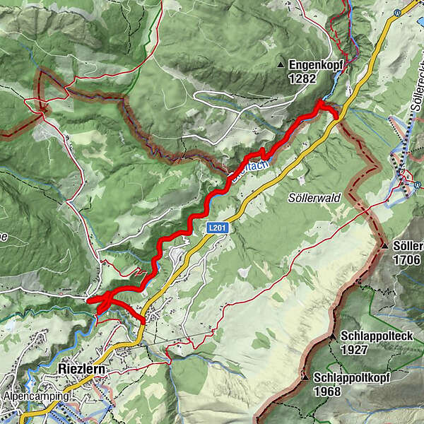
Pleasantly fresh hike from Riezlern along the Breitach. The ascent of the Breitachklamm is of course the icing on the cake of the tour! One-way regulation Breitachklamm: Currently only entry via the valley ticket office in Tiefenbach is possible.
- Difficulty
-
easy
- Rating
-
- Starting point
-
Riezlern
- Route
-
Waldhaus3.4 km
- Best season
-
JanFebMarAprMayJunJulAugSepOctNovDec
- Description
-
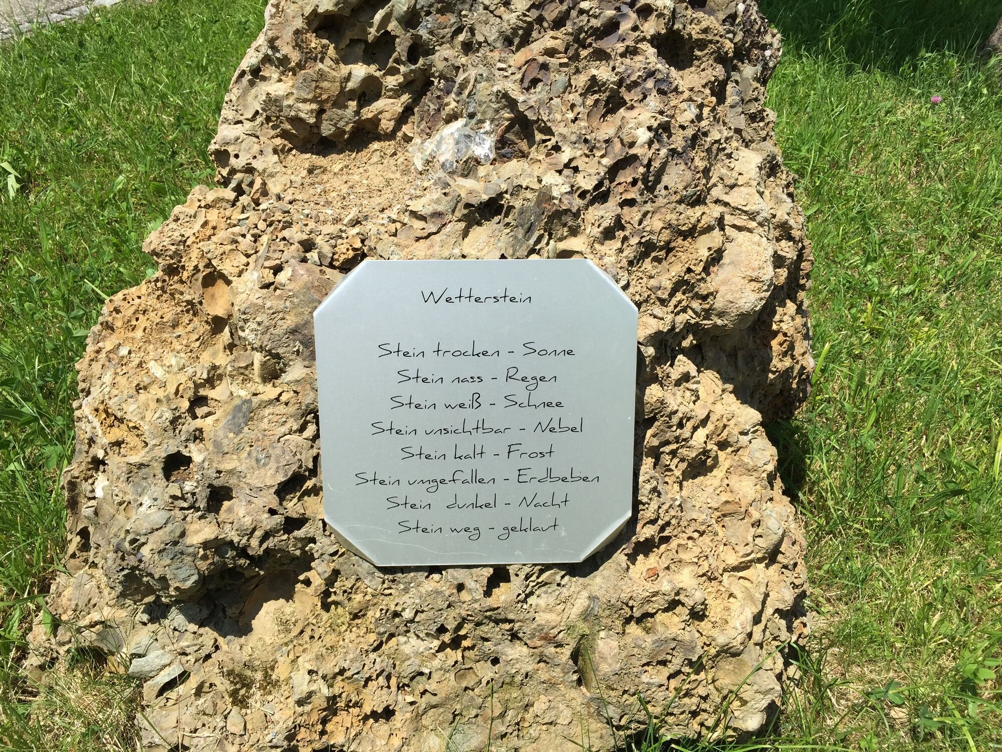
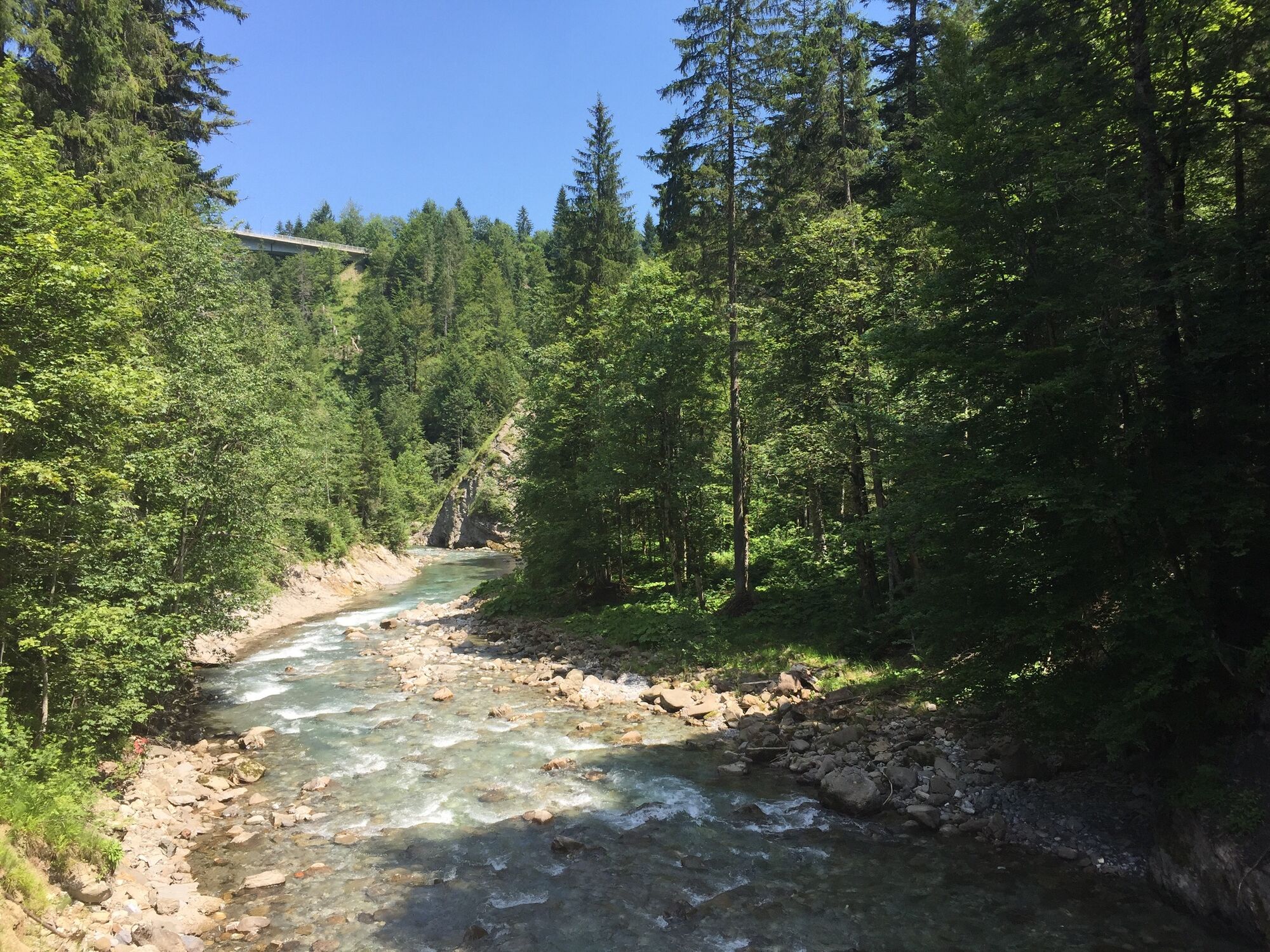
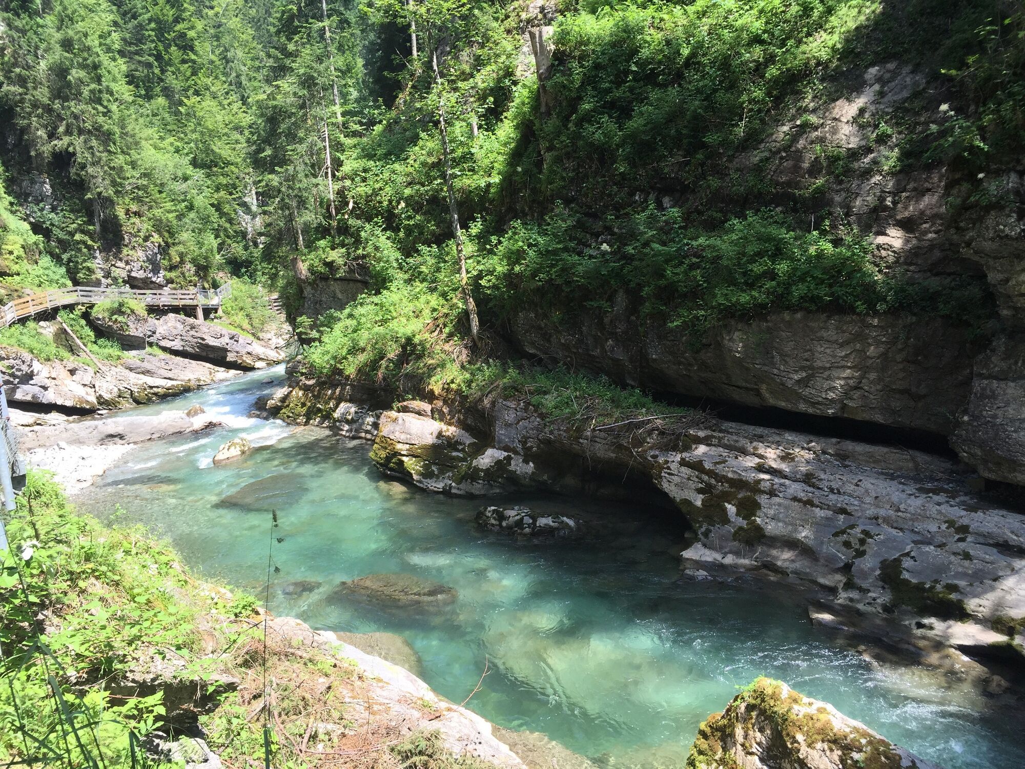
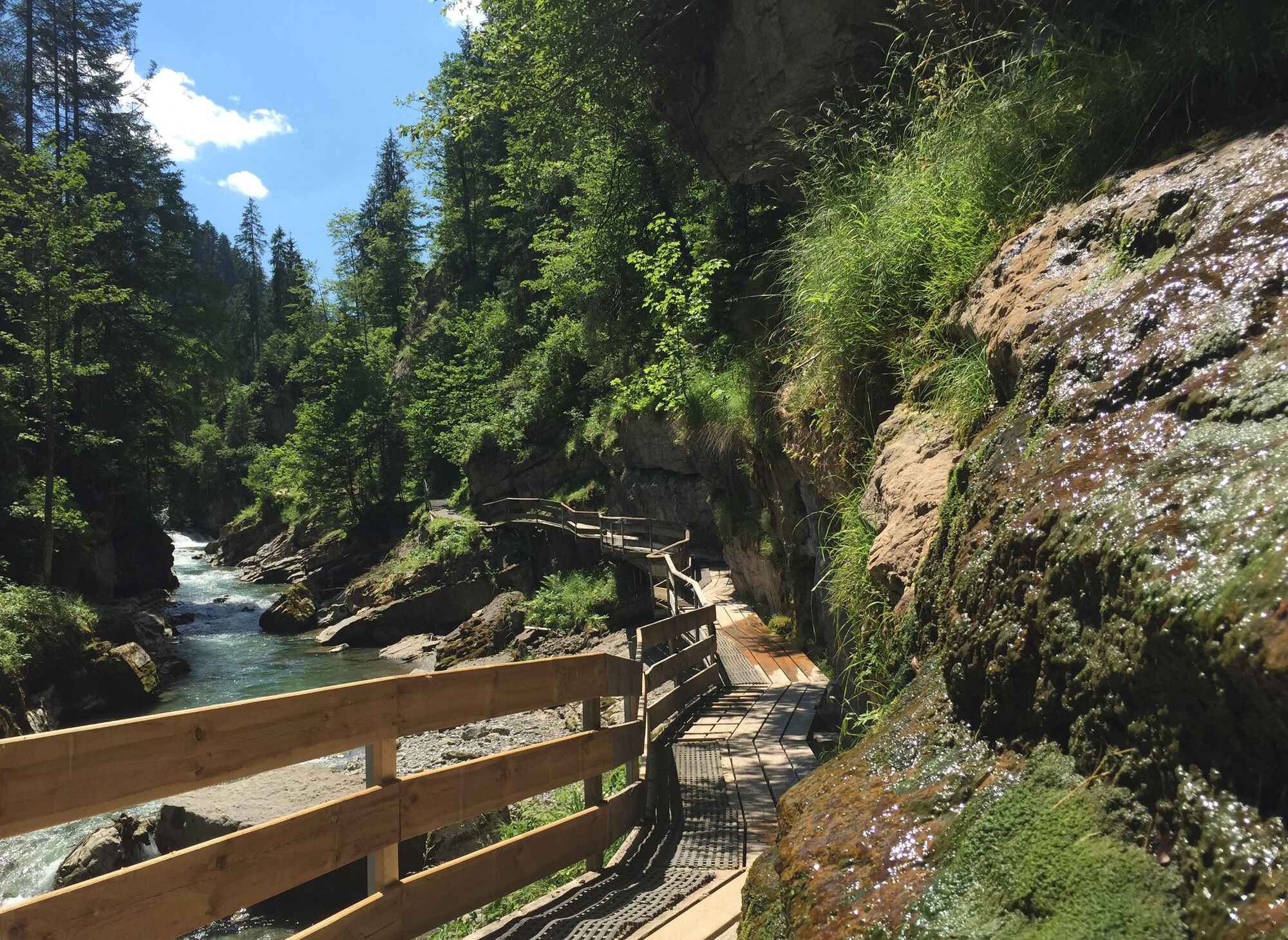
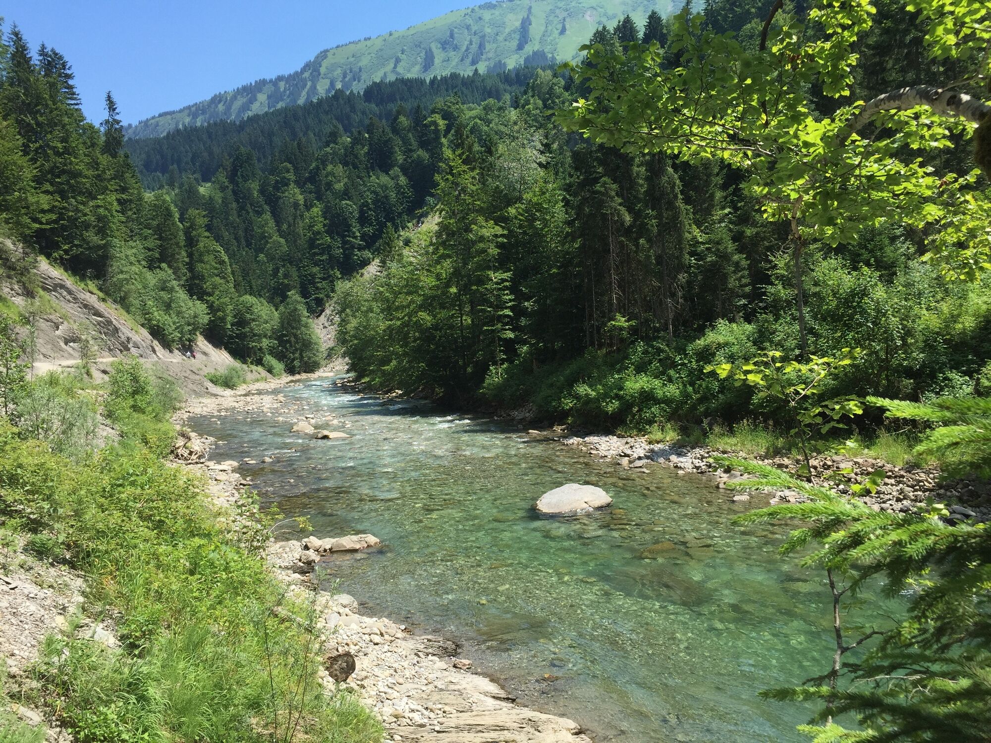
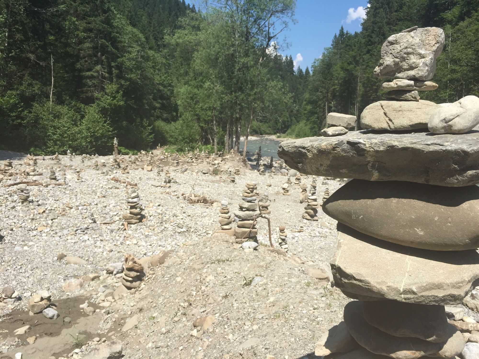
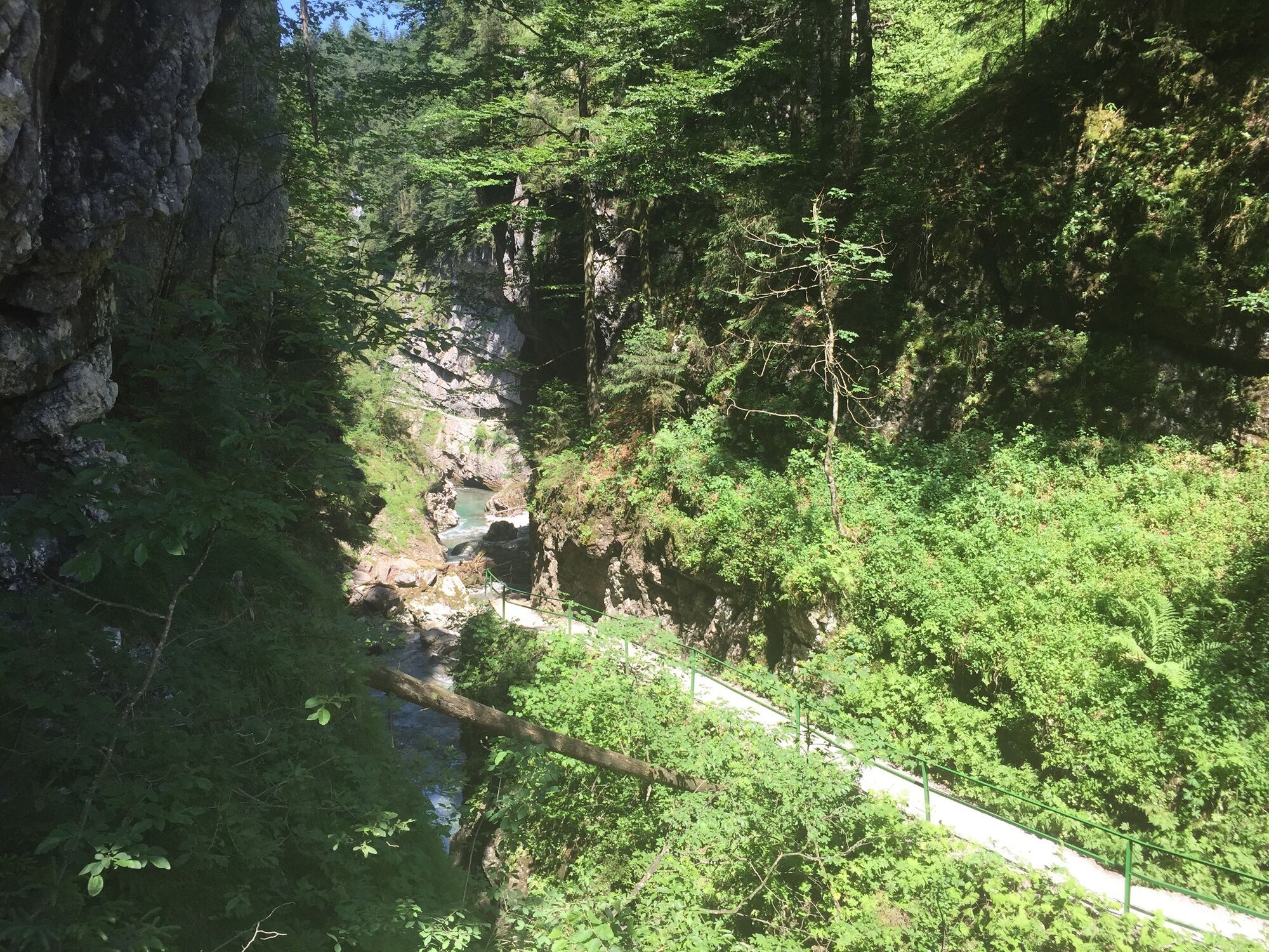
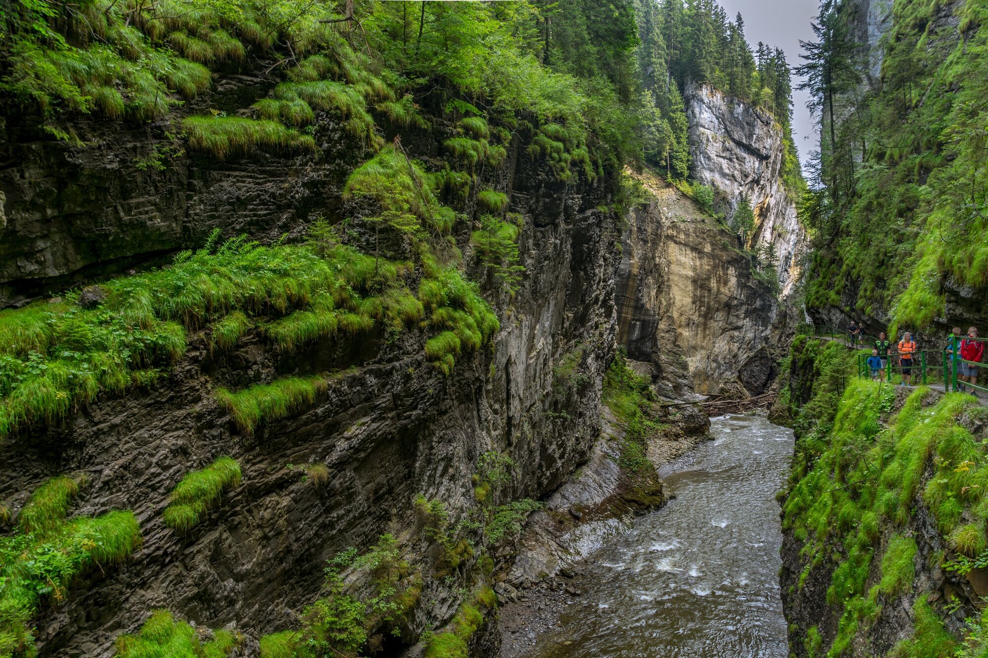
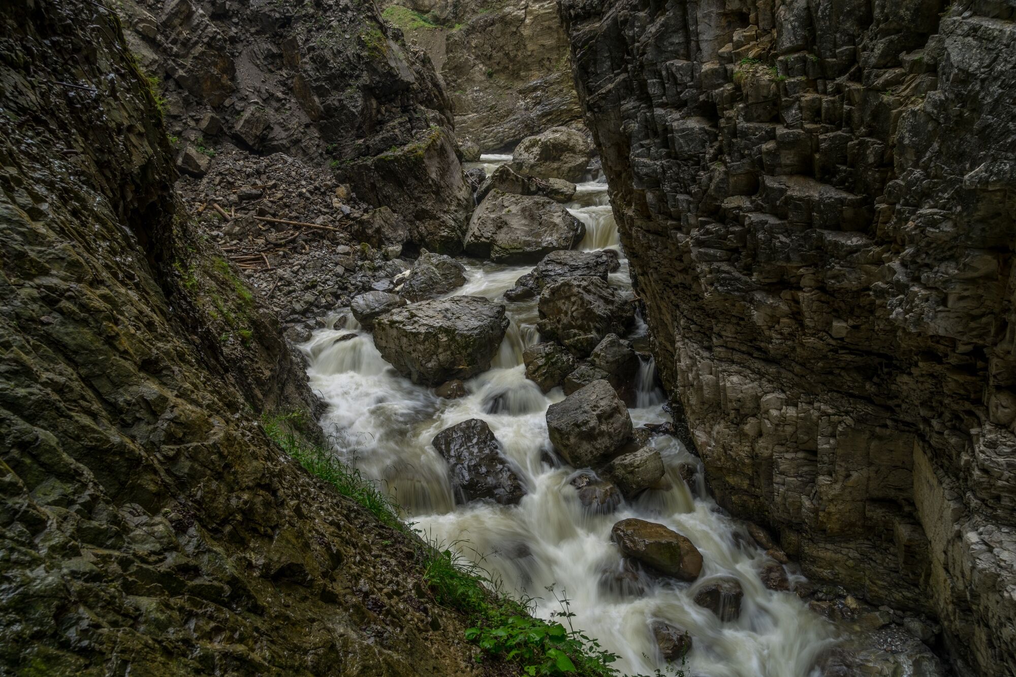
All around us water is running down the rocks, gurgles in tiny rivers across the hiking trail into the Breitach. It seems as if one could watch the Breitach unify with its many small and larger side creeks in order to plummet through the gorge some meters further down. Occasionally you can walk down from the trail to the river's gravel bed, take a sip of cool water, build small cairns out of the pebble stones or stretch your feet into the clear water. Highly recommended: a visit to the gorge "Breitachklamm". Be a testimony of how the once calm water plummets down untamedly between narrow cliffs.
- Directions
-
Diagonally across from the casino at the starting point, we turn off the main street into Leo-Müller-Straße. Now we follow the signs to Breitach (Waldhaus) on the Fellhornweg (junction to the left). Behind the small horse farm we turn onto a small path that leads us down into the gorge. After the bridge we keep to the right and now always follow the Breitach. Wooden footbridges, gravel and forest paths attached to the rock lead past the forest house. After about 15 minutes we reach the state border at a bridge and hike through green, shady mixed forests to the entrance of the Breitachklamm. After a few steps we reach the bridge, where we can follow the signs to Breitachklamm with the destination Tiefenbach. But we climb up a steep gravel path to the Walserschanze and let the Walserbus bring us back to the starting point. Alternatively, you can start directly at the Walserschanz and take the bus from Tiefenbus back to the Kleinwalsertal.
- Highest point
- 1,072 m
- Endpoint
-
Riezlern
- Height profile
-

- Equipment
-
Hiking shoes, weatherproof clothing and hiking sticks recommended
- Safety instructions
- Tips
-
Bring a picnic and have a seat a one of the (gravel)benches by the riverside! Possibly you will not find refreshment stops on the route (Thursdays the Waldhaus is closed). The Inn Walserschanz is currently out of service.
- Additional information
-
How do you consciously experience nature?
Nature is so much more than the backdrop for unforgettable mountain experiences. It is a habitat for animals and plants. It provides drinking water and supplies us with high quality food. Not only does it provide valuable raw materials such as wood, it also protects against avalanches and mudslides and regulates the climate. It is up to us to support nature in everything that it does for us. One thing is certain, together we can achieve more:
Smart in NATURE
CONSCIOUS together
EXPERIENCE foresight
Smart in NATURE
Take a deep breath and recharge your batteries, be outside and feel free. When we enjoy nature, we are guests in the living room of shy animals and rare plants. If you behave smart, they will be happy to share their living space with you in the future too.
Stay on paths and marked routes
If you follow the marked paths and routes, you are sure to come to new favorite places. In this way you also respect protected areas, because many animals and plants need special protection. Especially in winter, any disturbance unnecessarily costs the wild animals the strength they need to survive.
Avoiding twilight times
Standing on a mountain at sunrise is a special experience. The morning and evening hours are also the time when most wild animals are in search of food. If they are disturbed, they get stressed. If it cannot be avoided, please stay on the marked path, do not use a bright headlamp and enjoy the silence.
Stay clean & take rubbish with you
It goes without saying: You take rubbish with you again, on the mountain and in the valley. Please also organic waste, because it is composted much more slowly at altitude. You can dispose of the rubbish properly at home or in your accommodation - please remember that there are no rubbish bins in public spaces in Kleinwalsertal.
On the natural toilet
If you are looking for a quiet place, please be at least 50 m away from water. Bury excrement or cover it with a large stone. Use fallen leaves or recycled toilet paper and put the paper back in the trash bag.
On tour with a dog
Are you always in control of your four-legged partner, even if he gets his nose for marmots, deer or other wild animals? You are both on the safe side on a leash. Keep dogs on a short leash near grazing cattle. If an attack by a grazing animal is foreseeable: leash off immediately. There are numerous dog stations in the valley for the disposal of dog bags. The farmers and alpine farmers thank you because manure in meadows and fields contaminates the feed and makes grazing cattle sick.
CONSCIOUS to each other
Consideration for other athletes and those looking for relaxation
Everyone loves to enjoy a special piece of earth for themselves. But most of the time we are not traveling alone. No problem, because there is enough space. Allow time, open the way in an accommodating manner, provide support when someone needs help and always give a smile. So nothing stands in the way of friendly cooperation and relaxed enjoyment of nature.
Appreciating the preservation of the cultural landscape
Alpine landscapes are touching with their contrast: Imposing peaks and natural forests alternate with gentle valleys, well-tended meadows and pastures. In the Kleinwalsertal too, this delightful landscape at three altitudes is no coincidence, but the result of an interplay of natural and cultural landscapes. Behind this is the work of farmers, alpine and forestry as well as hunters. With their work, they ensure that the attractiveness of the recreation and leisure area and the diversity of species are preserved. We already say thank you if we stay on the marked trails and enjoy regional products.
EXPERIENCE farsighted
Safe on tour - for you and others
Whether on a ski or snowshoe tour in winter or on a mountain tour in summer, anyone who is out and about in alpine terrain has to be well prepared. This includes careful information and tour planning as well as the right equipment. Correctly assessing alpine dangers requires a lot of knowledge and experience. Why not learn from professionals and go on tour with one of the experienced guides?
- Directions
-
Most routes from Germany lead to Ulm before carrying on along the A7. Take the Allgäu junction over a section of the A980 to the Waltenhofen junction, then take the 4- lane B19 via Sonthofen and Oberstdorf to Kleinwalsertal. From Austria (Vorarlberg) and Switzerland you reach the Kleinwalsertal via the Bregenzerwald (Hittisau) – Riedbergpass – Fischen – Oberstdorf. From Tyrol the fastest route is over the A7 to Kempten carrying on along the B19 direction Oberstdorf. A motorway vignette is not required to reach the valley.
- Public transportation
- Parking
-
Paid parking spaces are located near the starting point. Parking along the main road is not permitted.


- Author
-
The tour Breitachklamm is used by outdooractive.com provided.