
- Brief description
-
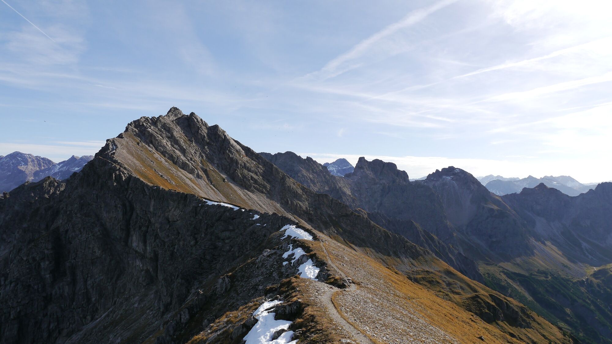
High alpine ridge hike through jagged rocks – three peaks in one day. From the Kanzelwand calbe car via the Hammerspitzen and Hochgehrenspitze to the Fiderepasshütte and descent to the valley (only for experienced).
- Difficulty
-
difficult
- Rating
-
- Starting point
-
Riezlern
- Route
-
Panoramarestaurant (1,956 m)Zwerenalpbahn0.0 kmKanzelwand (2,059 m)0.6 kmHochgehrenspitze (2,251 m)2.6 kmFiderepasshütte3.6 kmFluchtalpe6.3 kmInnere Wiesalpe7.5 kmUntere Wiesalpe7.7 kmSchwendle9.1 kmMittelberg (1,215 m)9.4 kmBödmen9.8 km
- Best season
-
JanFebMarAprMayJunJulAugSepOctNovDec
- Description
-
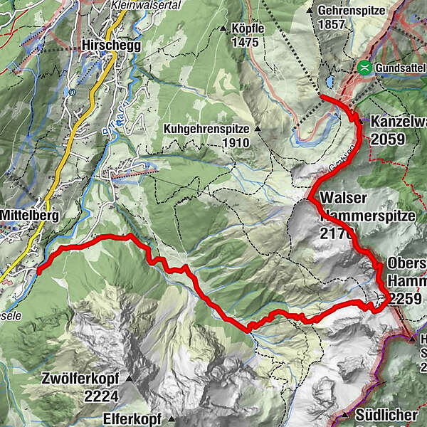
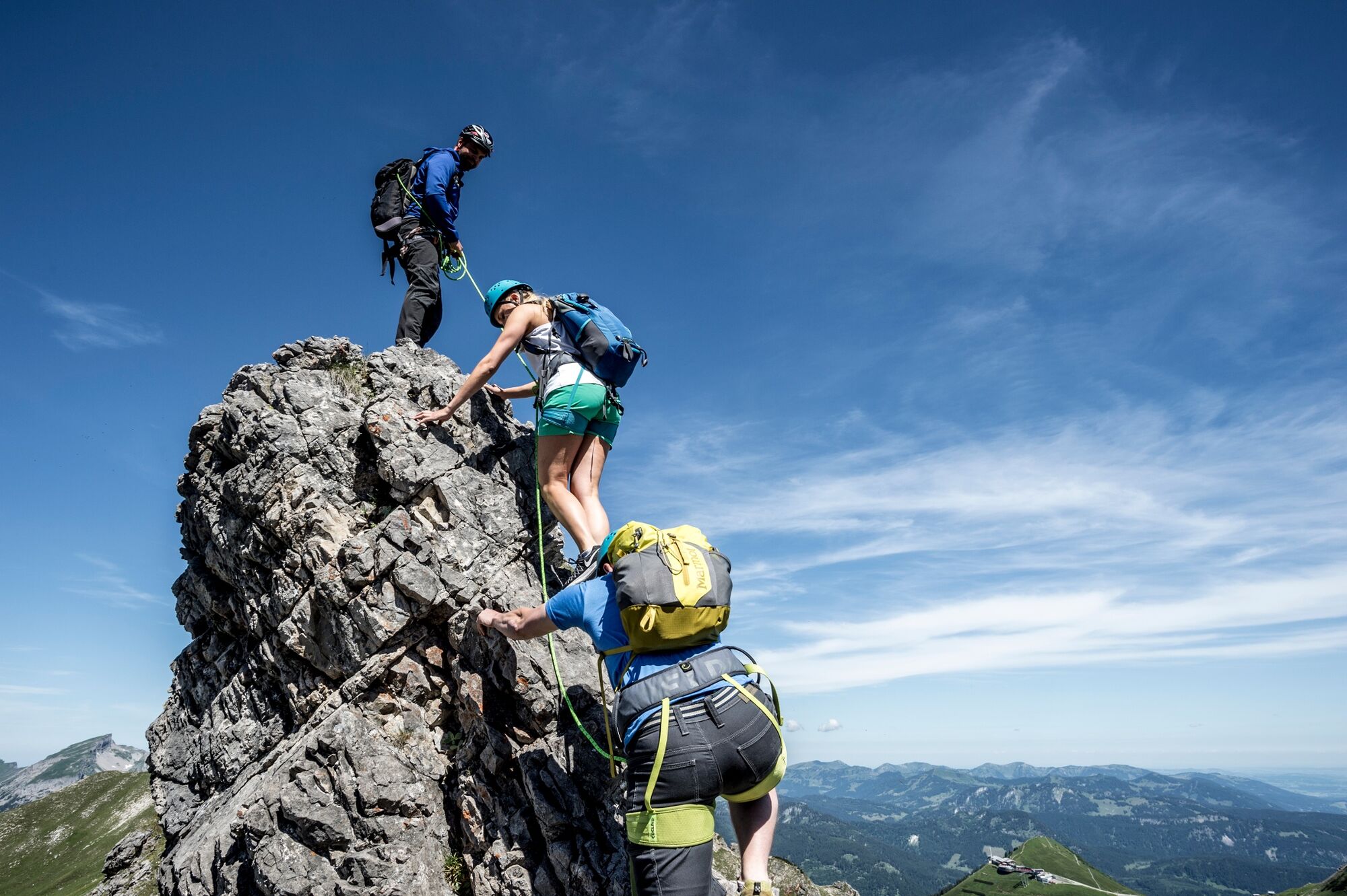
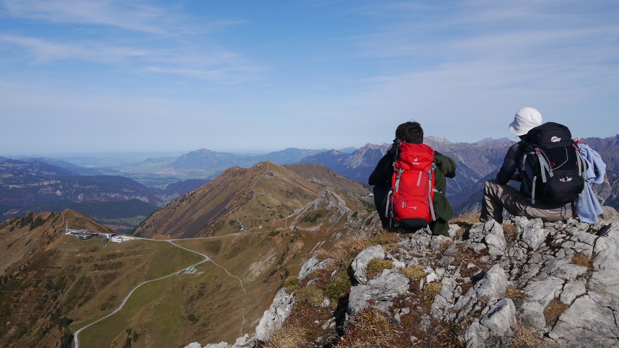
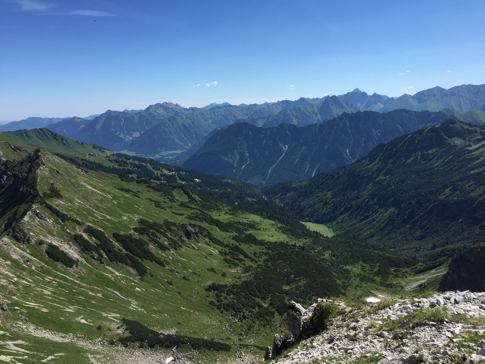
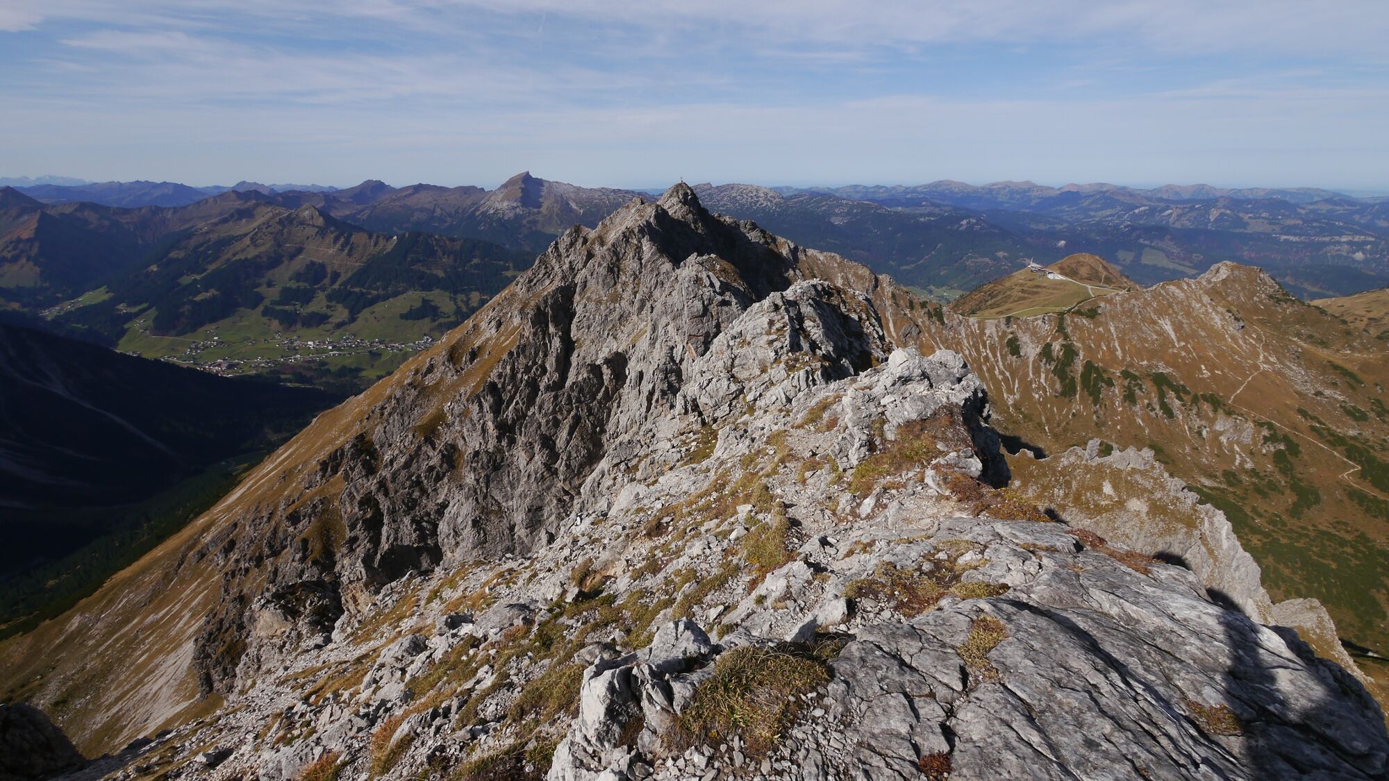
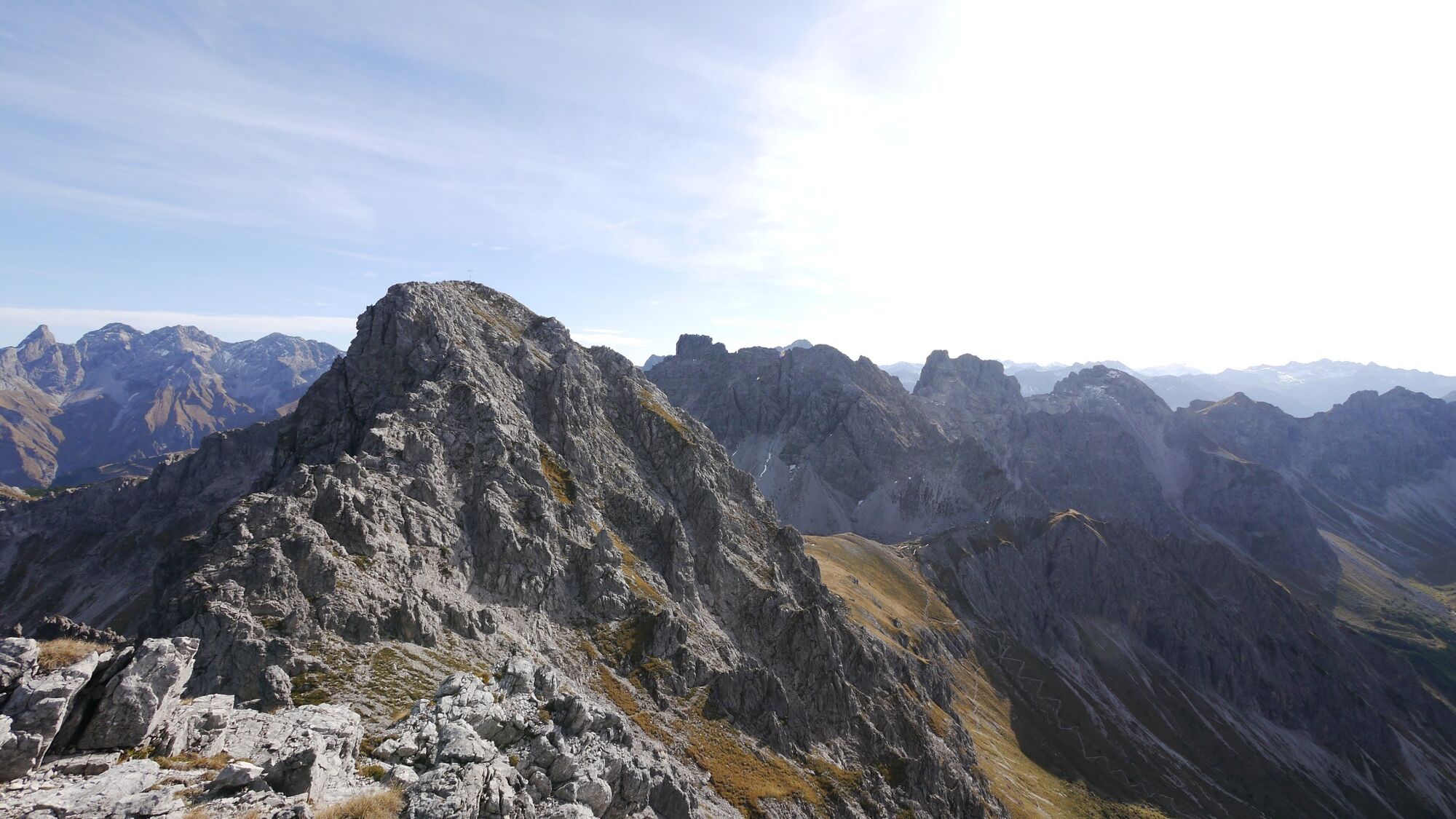
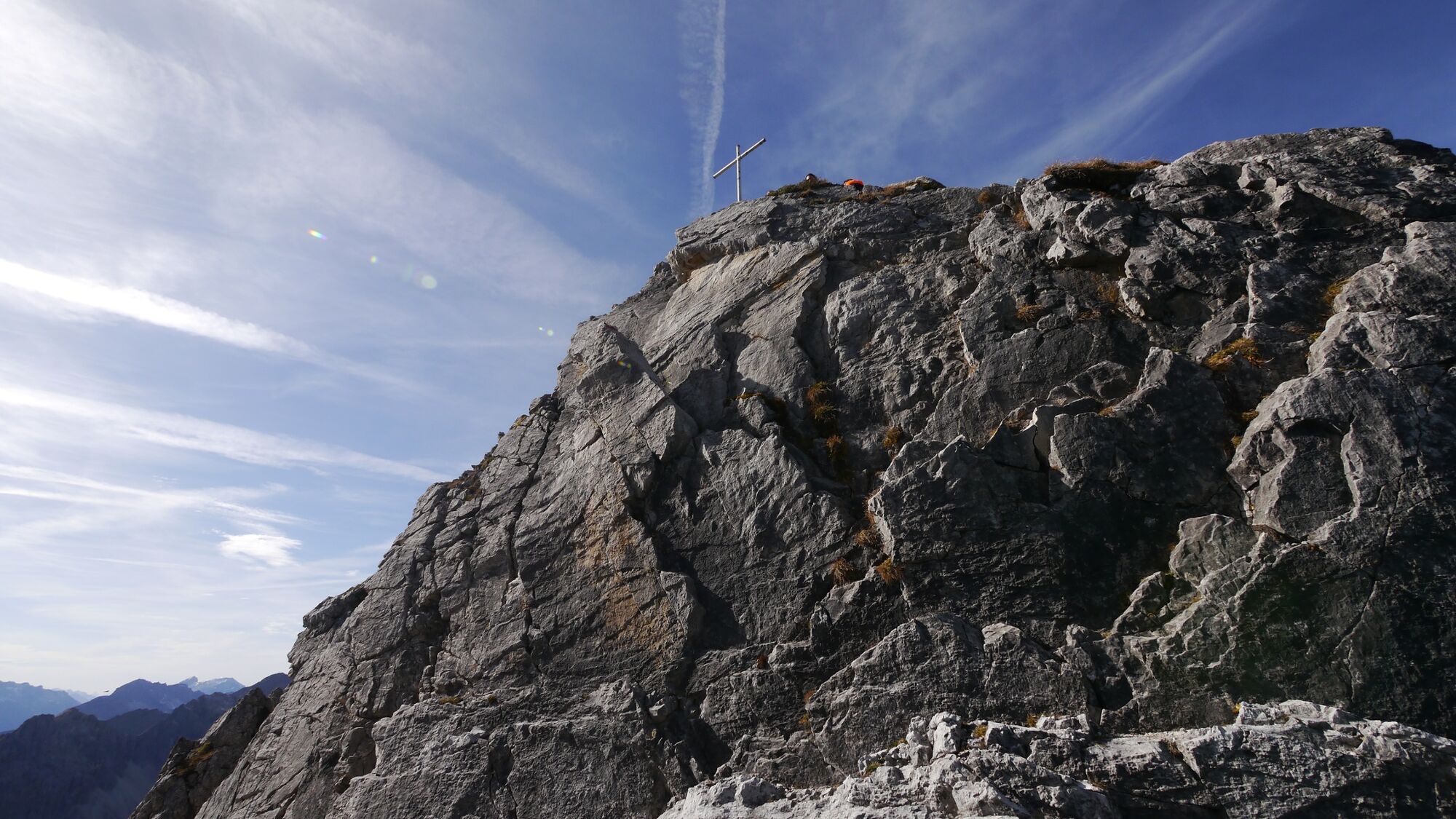
During this tour you climb three peaks: The Walser Hammerspitze, the Hochgehrenspitze and the Oberstdorfer Hammerspitze. Over a jagged, craggy ridge, right at the Austrian-German border, the trail leads you from Kanzelwand lift to the Fiderepasshütte. The first longer ascent may therefore be overcome quite easily by the lift (chargeable). The partially exposed path over the ridge is however only recommended for very sure-footed hikers free from giddiness.
- Directions
-
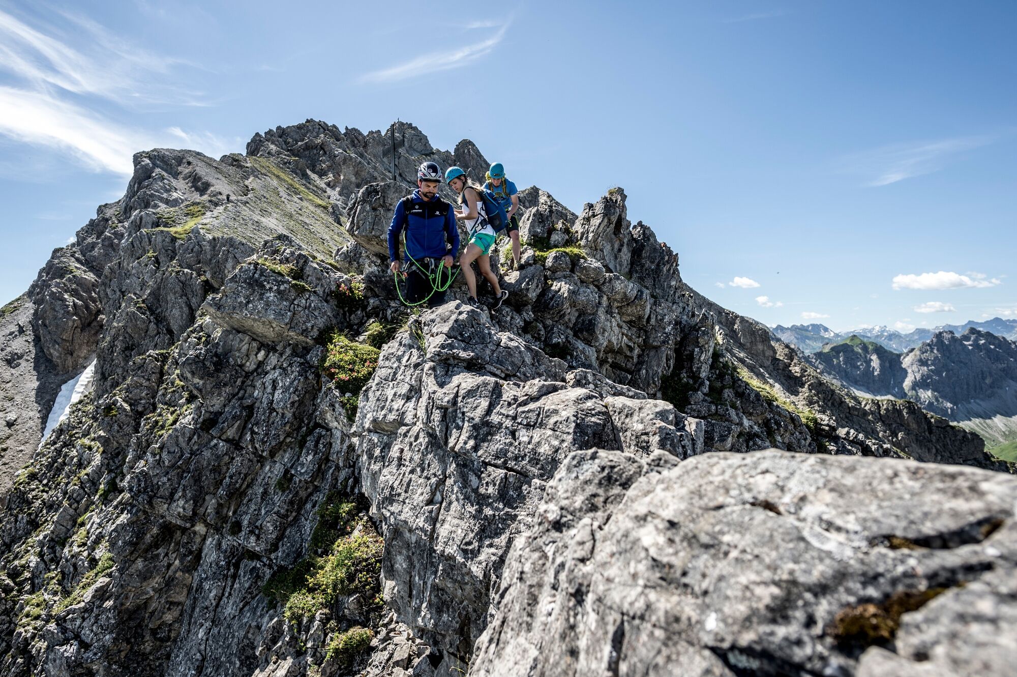
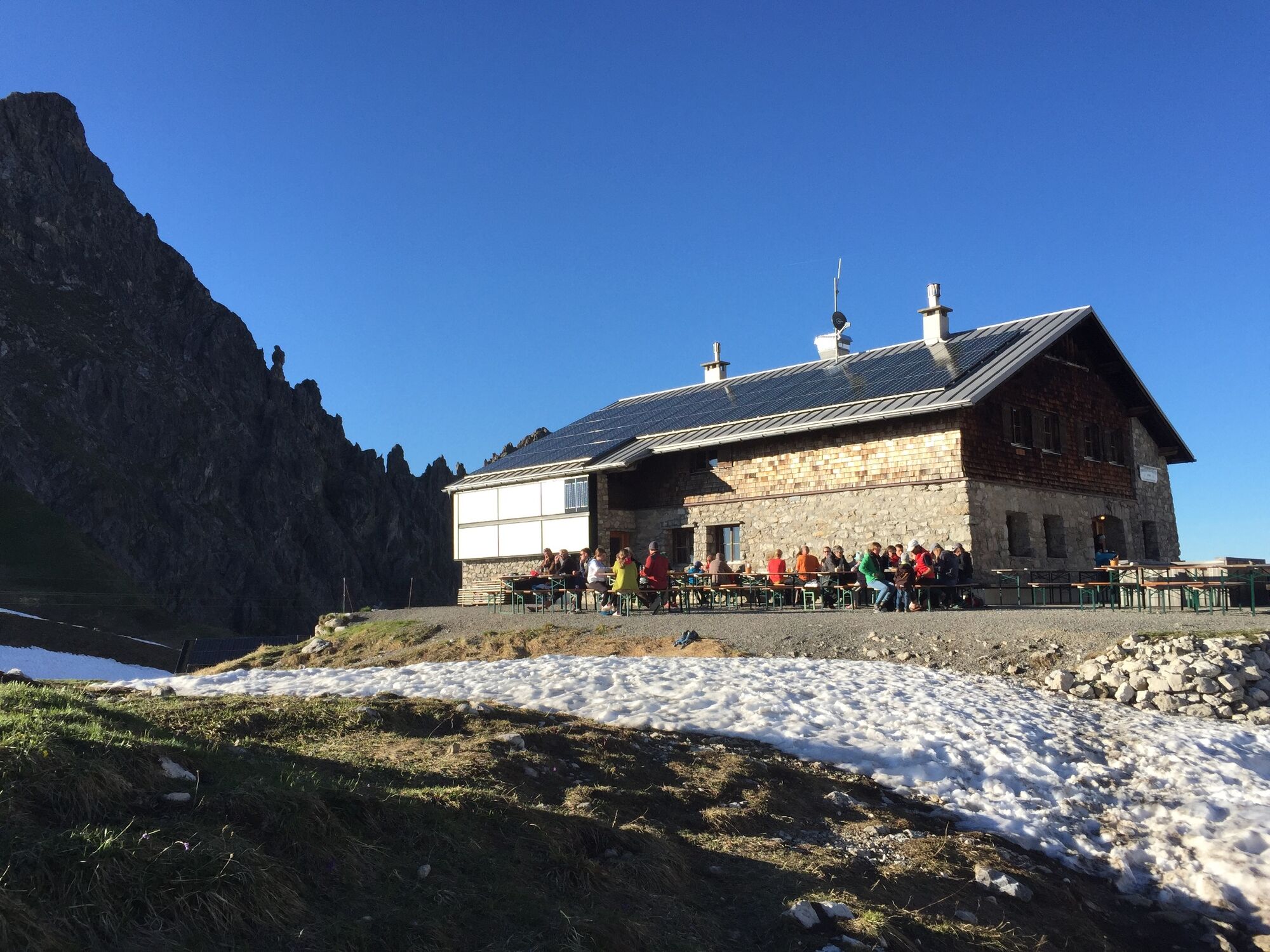
Ascent with the Kanzelwandbahn to almost 2,000m. From the top station you first head towards the Kanzelwand summit and the via ferrata. However, you follow the path straight on and finally turn right onto the ridge to the Austrian Hammerspitze (2,170 m), which can be reached in about an hour. After a break, follow the ridge which say "Nur für Geübte“ (“for experts only") to the second summit, the Hochgehrenspitze. After about half an hour through rugged terrain you reach the summit. From here the path becomes more demanding and requires easy climbing, but there are fixed ropes available. After some up and down, partially exposed and on brittle rock, you reach the German Hammerspitze and finally the key point: a 11 meter high wall. Here you have to rappel or climb down secured (III). The Fiderepasshütte is not far from here. Here you have several options: You can stay overnight on the DAV hut and do the Mindelheimer via ferrata the next day. Alternatively, and with good stamina, you can also take the via ferrata immediately. For a one day tour, you can descend directly via the Fluchtalpe Wildental and Höfle and take the bus back to Riezlern
- Highest point
- 2,238 m
- Endpoint
-
Mittelberg
- Height profile
-

- Equipment
-
Sturdy shoes and functional clothing as well as weather proof clothes, backpack with food supplies. Security equipment with mountaineering harness and rope. Helmet recommended.
- Safety instructions
- Tips
-
Additional information: The Walser and Oberstdorfer Hammerspitze are also called "Schüsser".
- Additional information
-
How do you consciously experience nature?
Nature is so much more than the backdrop for unforgettable mountain experiences. It is a habitat for animals and plants. It provides drinking water and supplies us with high quality food. Not only does it provide valuable raw materials such as wood, it also protects against avalanches and mudslides and regulates the climate. It is up to us to support nature in everything that it does for us. One thing is certain, together we can achieve more:
Smart in NATURE
CONSCIOUS together
EXPERIENCE foresight
Smart in NATURE
Take a deep breath and recharge your batteries, be outside and feel free. When we enjoy nature, we are guests in the living room of shy animals and rare plants. If you behave smart, they will be happy to share their living space with you in the future too.
Stay on paths and marked routes
If you follow the marked paths and routes, you are sure to come to new favorite places. In this way you also respect protected areas, because many animals and plants need special protection. Especially in winter, any disturbance unnecessarily costs the wild animals the strength they need to survive.
Avoiding twilight times
Standing on a mountain at sunrise is a special experience. The morning and evening hours are also the time when most wild animals are in search of food. If they are disturbed, they get stressed. If it cannot be avoided, please stay on the marked path, do not use a bright headlamp and enjoy the silence.
Stay clean & take rubbish with you
It goes without saying: You take rubbish with you again, on the mountain and in the valley. Please also organic waste, because it is composted much more slowly at altitude. You can dispose of the rubbish properly at home or in your accommodation - please remember that there are no rubbish bins in public spaces in Kleinwalsertal.
On the natural toilet
If you are looking for a quiet place, please be at least 50 m away from water. Bury excrement or cover it with a large stone. Use fallen leaves or recycled toilet paper and put the paper back in the trash bag.
On tour with a dog
Are you always in control of your four-legged partner, even if he gets his nose for marmots, deer or other wild animals? You are both on the safe side on a leash. Keep dogs on a short leash near grazing cattle. If an attack by a grazing animal is foreseeable: leash off immediately. There are numerous dog stations in the valley for the disposal of dog bags. The farmers and alpine farmers thank you because manure in meadows and fields contaminates the feed and makes grazing cattle sick.
CONSCIOUS to each other
Consideration for other athletes and those looking for relaxation
Everyone loves to enjoy a special piece of earth for themselves. But most of the time we are not traveling alone. No problem, because there is enough space. Allow time, open the way in an accommodating manner, provide support when someone needs help and always give a smile. So nothing stands in the way of friendly cooperation and relaxed enjoyment of nature.
Appreciating the preservation of the cultural landscape
Alpine landscapes are touching with their contrast: Imposing peaks and natural forests alternate with gentle valleys, well-tended meadows and pastures. In the Kleinwalsertal too, this delightful landscape at three altitudes is no coincidence, but the result of an interplay of natural and cultural landscapes. Behind this is the work of farmers, alpine and forestry as well as hunters. With their work, they ensure that the attractiveness of the recreation and leisure area and the diversity of species are preserved. We already say thank you if we stay on the marked trails and enjoy regional products.
EXPERIENCE farsighted
Safe on tour - for you and others
Whether on a ski or snowshoe tour in winter or on a mountain tour in summer, anyone who is out and about in alpine terrain has to be well prepared. This includes careful information and tour planning as well as the right equipment. Correctly assessing alpine dangers requires a lot of knowledge and experience. Why not learn from professionals and go on tour with one of the experienced guides?
- Arrival
-
The Kleinwalsertal valley is located in the north-east of the Austrian state of Vorarlberg and can only be reached by road via Oberstdorf (Germany/Bayern). The main part of Austria can only be reached directly by foot or by taking a detour via Allgäu. You do not need an autobahn badge to drive into the valley. Please ensure that you have suitable tyres in winter. In Austria, winter tyres (min. 4mm, M S) are obligatory on snow-covered roads from 1 November to 15 April.
- Public transportation
- Parking
-
A parking area (fee required) is located right at the starting point, at the bottom of the Kanzelwand lift.


- Author
-
The tour 3 summit tour from the Kanzelwand to the Fiderepass is used by outdooractive.com provided.