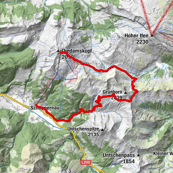
Diedamskopf - Schwarzwasser Hütte

Logo Diedamskopf - Schwarzwasser Hütte
Tour data
15.8km
834 - 2,017m
Distance
318hm
Ascent
06:00h
 
Duration
Rating
Technique
Fitness
Landscape
Experience
Starting point

Bergstation Diedamskopf

Route
Panoramarestaurant
Diedamskopfbahn Bergstation (2,090 m)
0.0 km
Schwarzwasserhütte
5.2 km
Neuhornbach Alpe
9.3 km
Üntschele
13.3 km
St. Philippus & Jakobus
14.8 km
Schoppernau (852 m)
14.9 km
Zum Fraaanz Restaurant
15.0 km
Schrannen-Hof
15.5 km
Diedamskopfbahn Talstation (850 m)
15.7 km


Highest point
2,017 m

Rest/Retreat

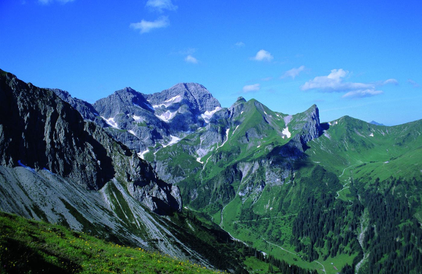
Panoramarestaurant am Berg, Schwarzwassehütte, Neuhornbachhaus, Breitenalpe, Kiosk Mittelstation.

Ticket material

Au-Schoppernau Tourismus


3,5
Overall rating

5

50

%

4

0

%

3

0

%

2

50

%

1

0

%

GPS Downloads
  • GPX GPS Exchange Format (XML)
  • KML Google Earth, Google Maps
QR Download Codes for Mobile Phones

Trail conditions

Asphalt
Gravel
Meadow
Forest
Rock
Exposed
Other tours in the regions

Popular tours in the area

Glatthorn

medium Hiking
6.49km | 507hm | 02:30h

Hiking around the lake Spullersee

easy Hiking
5.58km | 183hm | 01:56h

Around Lake Formarin

difficult Hiking
3.79km | 84hm | 02:06h

Faschina | Rund um's Zafernhorn

medium Hiking
10.09km | 634hm | 04:15h