Damüls Fontanella I Türtschalpe und Alpe Unterdamüls

Logo Damüls Fontanella I Türtschalpe und Alpe Unterdamüls
Tour data
12.13km
1,163 - 1,780m
Distance
686hm
449hm
Ascent
03:00h
 
Duration
Brief description

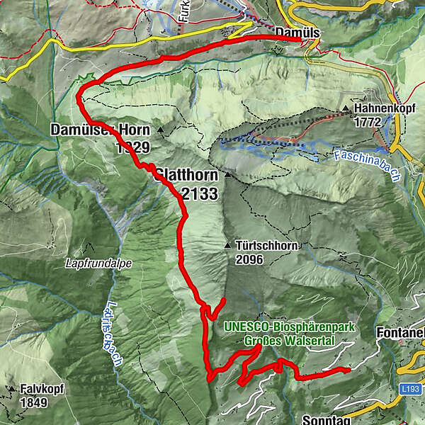
Fontanella - Türtschalpe - Alpe Unterdamüls - Kirchdorf Damüls

Difficulty
medium
Rating
Technique
Fitness
Landscape
Experience
Route
Gadastatt
2.0 km
Türtschalpe (1,641 m)
4.2 km
Türtschalpe
4.4 km
Alpe Unterdamüls
9.1 km
Damüls (1,423 m)
12.0 km

Highest point
1,780 m
Endpoint

Damüls Kirchdorf

Height profile

Author

Overall rating

5

0

%

4

0

%

3

0

%

2

0

%

1

0

%

Error
An error has occurred. Please try again.
Thank you for your review

Rating has been deleted

GPS Downloads
  • GPX GPS Exchange Format (XML)
  • KML Google Earth, Google Maps
QR Download Codes for Mobile Phones

General info

Refreshment stop

Popular tours in the area

Glatthorn

medium Hiking
6.49km | 507hm | 02:30h

Hiking around the lake Spullersee

easy Hiking
5.58km | 183hm | 01:56h

Damüls | Sünserspitze with Sünsersee

medium Hiking
8.12km | 405hm | 03:10h

Faschina | Rund um's Zafernhorn

medium Hiking
10.09km | 634hm | 04:15h