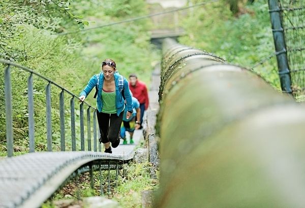
© Montafon Tourismus - Markus Gmeiner - Julia Mangeng

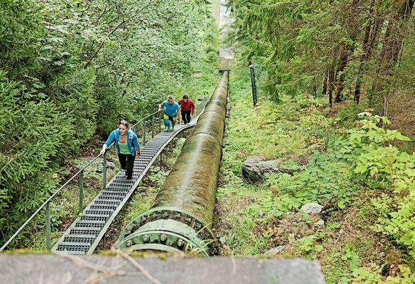
© Montafon Tourismus - Markus Gmeiner - Julia Mangeng

© Mein Montafon

- Difficulty
-
medium
- Rating
-
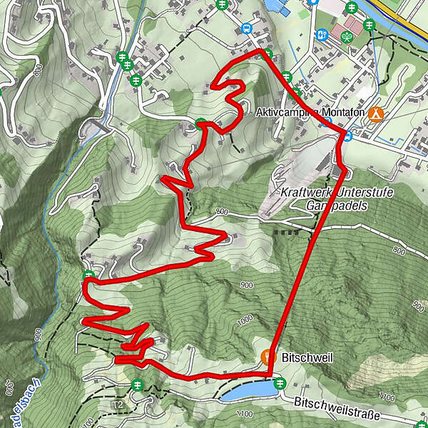
- Route
-
Bitschweil0.5 km
- Best season
-
JanFebMarAprMayJunJulAugSepOctNovDec
- Highest point
- 1,066 m
- Endpoint
-
Jausenstation Bitschweil bzw. Tschagguns Gampadelswerk
- Height profile
-

-

-
AuthorThe tour Aquastiege Tschagguns is used by outdooractive.com provided.
GPS Downloads


General info
Refreshment stop
Other tours in the regions
-
Montafon
1382
-
Schruns - Tschagguns
553