


- Brief description
-
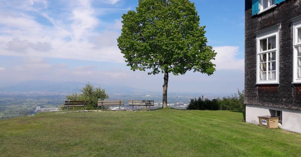
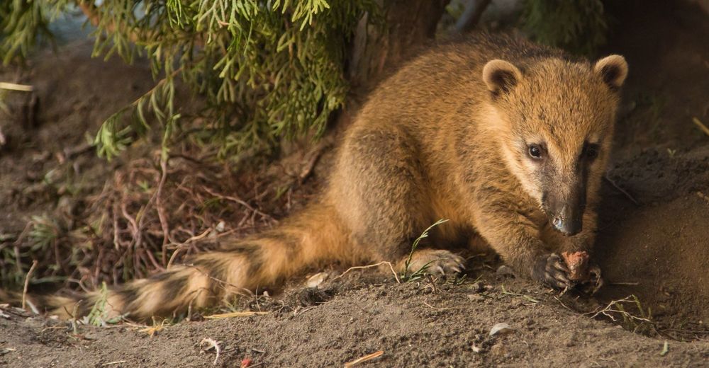
The Maria Bildstein pilgrimage destination is considered one of the most beautiful vantage points in Vorarlberg with views across the Rhine Valley that extend as far as the Swiss Alps. The walk through Doppelmayr Zoo to Bildstein is an ideal way for families to spend time together while enjoying nature. Hikers and walkers can reward themselves with refreshing drinks and a breathtaking view at the end.
- Difficulty
-
medium
- Rating
-
- Starting point
-
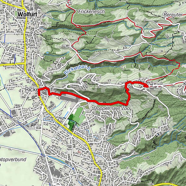
Bus stop Wolfurt Rickenbach
- Route
-
Roma Dolce Vita0.0 kmRickenbach0.1 kmKapelle Rickenbach, Hl. Anna0.1 kmHaus Lin0.1 kmBildstein2.0 kmWallfahrtskirche Maria Bildstein2.1 kmTraube2.1 km
- Best season
-
JanFebMarAprMayJunJulAugSepOctNovDec
- Description
-
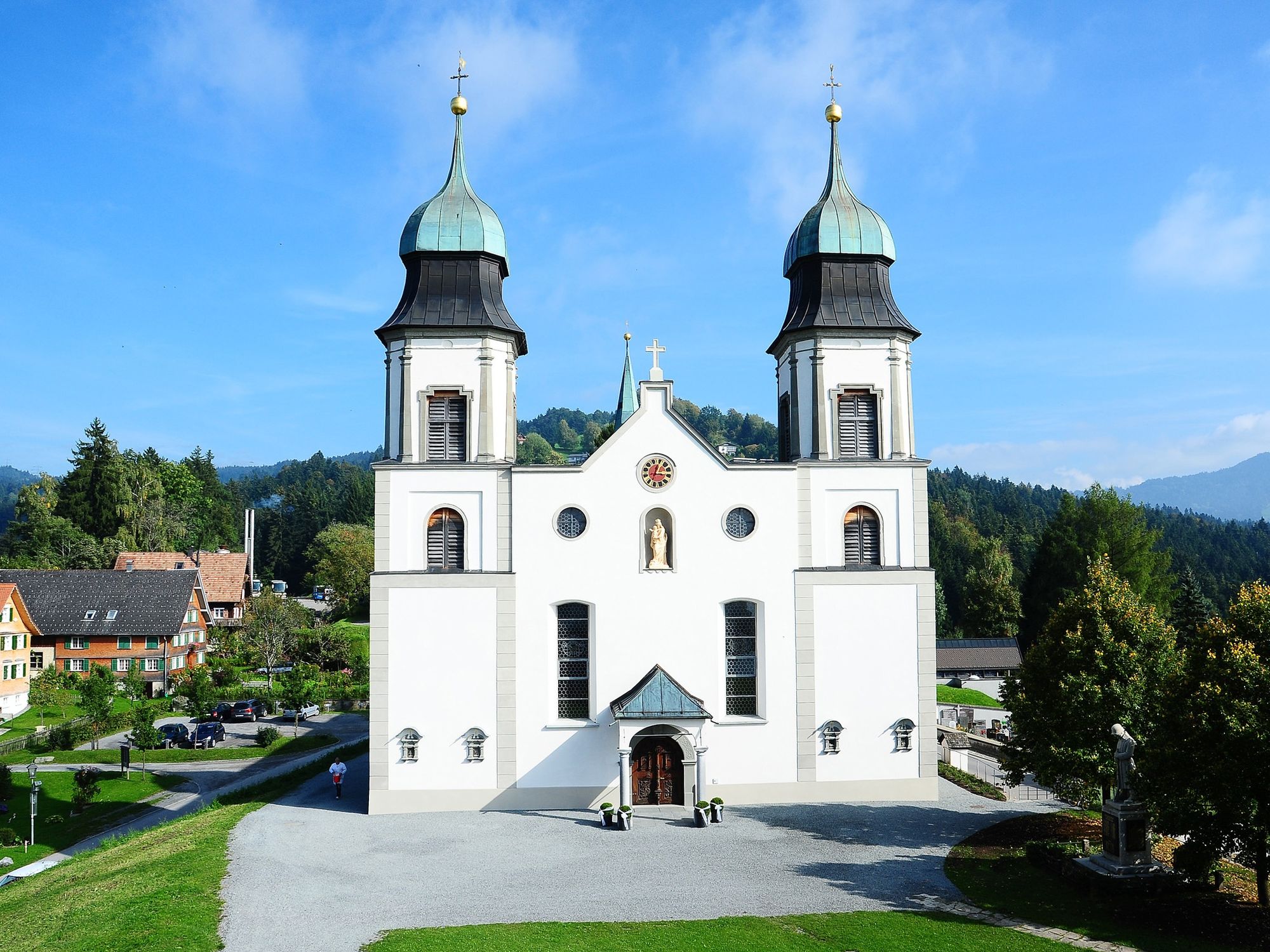
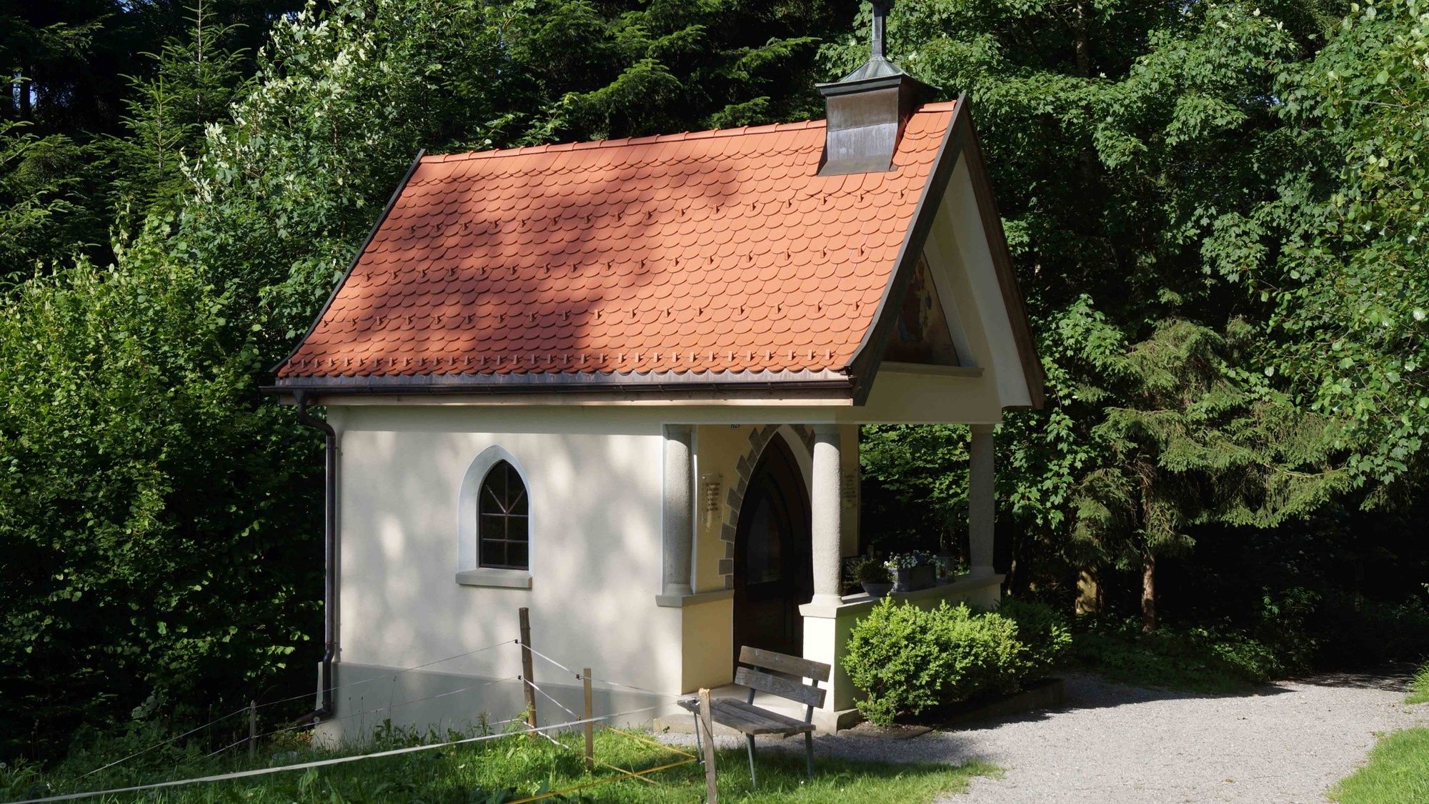
Maria Bildstein – which is a place of pilgrimage – presents a panoramic view from Lake Constance across the Rhine Valley to the Swiss Alps. This route starts in Wolfurt at the Rickenbach bus stop and continues with a visit to the Doppelmayr Zoo and can also be combined with a hike to Bildstein. The route takes hikers through Doppelmayr Zoo uphill into the forest. The shady path is a blessing – particularly on hot and sunny days. The Basilica of Maria Bildstein, one of the most famous pilgrimage churches in the Lake Constance region, presents itself on arrival at the top. The route leads from the basilica to the Panoramaplatz and opens up a breathtaking view across the Bodensee-Vorarlberg region.
- Directions
-
The route starts at the Rickenbach bus stop near the chapel in Wolfurt. It then turns into Brunnengasse and takes walkers and hikers through the old premises of Doppelmayr Seilbahnen GmbH near the Rickenbach stream. It continues at the back along ‘Kellaweg’ through the company car park on to a hidden gravel path to Doppelmayr Zoo. The path through the zoo leads uphill and across the L15 to continue its climb through the forest. The ‘Wurzelweg’ in the shade is particularly suitable on hot summer days. The L15 is reached after a walk of around 40 minutes along the forest path with roots and steps. The route follows this road for a few metres and then takes a left on to a gravel path. It’s just another few metres along the hiking trail past the Marienbrunnen (Mary’s Well) before the magnificent pilgrimage church of Maria Bildstein presents itself. The locals also call this path the ‘Stadtgraben’ (‘City Moat’). The basilica, the landmark of the small community of Bildstein, stands at the top on a beautiful viewing platform that presents views across the Rhine Valley to the Swiss Alps. Refreshing drinks and regional dishes are available at the Kreuz and Ochsen inns. Hikers and walkers may return by the same route back or take the No. 45 bus to Doppelmayr Zoo and walk the last few metres back to the Rickenbach district of Wolfurt.
- Highest point
- 654 m
- Endpoint
-
Basilika Maria Bildstein
- Height profile
-

- Equipment
-
Sturdy shoes recommended
- Safety instructions
-
112 Emergency
- Tips
-
Hikers are recommended to take a short break on the short pilgrimage route to the Marien-Erscheinigungskapelle (Chapel of the Apparition of the Virgin Mary) that also passes the Zwergengarten (Dwarf Garden).
There’s a book box at the children’s playground behind the building yard.
Regional specialities are available from the OXA Lädele.
- Directions
-
Leave the A14 Rhine Valley motorway at the Dornbirn Nord exit. Then follow the L200 towards Bregenzerwald until you reach the Schwarzach turn-off before the Achrain Tunnel. From there follow the brown sign to the ‘Barockkirche Bildstein’ (baroque church).
- Public transportation
-
Bus Nr. 45
www.vmobil.at
- Parking
-
Parking is available where the Bildsteiner Straße starts near Doppelmayr Zoo or at the Rickenbach Chapel.


-

-
AuthorThe tour Through Doppelmayr Zoo to Bildstein is used by outdooractive.com provided.


General info
-
St. Gallen - Bodensee
2066
-
Bodensee - Vorarlberg
1316
-
Bildstein
435


