


- Brief description
-
Challenging, white-blue-white marked circular hike from Dalaas up to Küngs Maisäß and via the Ganzaleita viewpoint and the Kristbergsattel back to Dalaas.
- Difficulty
-
medium
- Rating
-
- Starting point
-
Gasthof Krone, Dalaas
- Route
-
KroneKüngs Maisäß3.1 kmFalle (1703m) (1,686 m)5.2 kmInnerkristberg7.3 kmDalaas (835 m)9.8 kmKrone10.2 km
- Best season
-
JanFebMarAprMayJunJulAugSepOctNovDec
- Description
-
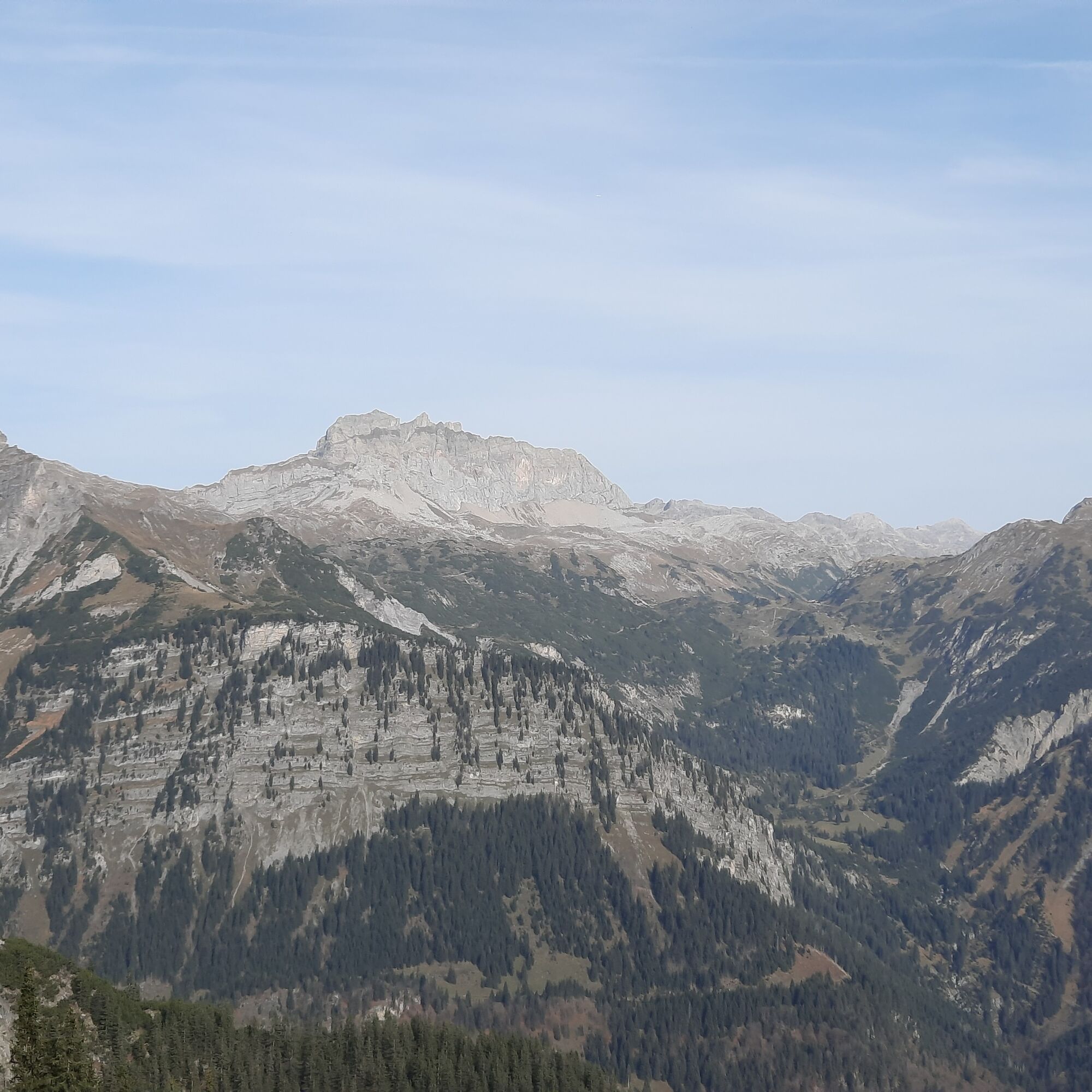
This challenging hike starts at Gasthof Krone in Dalaas. From there, take the tarmac road towards the Müß parcel, where the hiking trail branches off towards Küngs Maisäß. From here, a narrow path, which is marked white-blue-white, leads up through steep and wooded terrain towards Küngs Maisäß. Küngs Maisäß, a restored group of Alpine huts, stands in a clearing with sensational views over the Klostertal valley. From there, the trail continues uphill until it joins another hiking trail. Now turn left and follow the hiking trail towards Falla and Kristbergsattel. Along this path, you will also pass the Ganzaleita viewpoint - very beautiful views towards the Rote Wand and Lechquellengebirge mountains. Continue along the hiking trail to the Kristbergsattel. There the path branches off again and leads through the Dalaas community forest and past the Bruder Hüsle down towards Dalaas. The last section leads through the Poller / Gässle parcel before returning to the starting point.
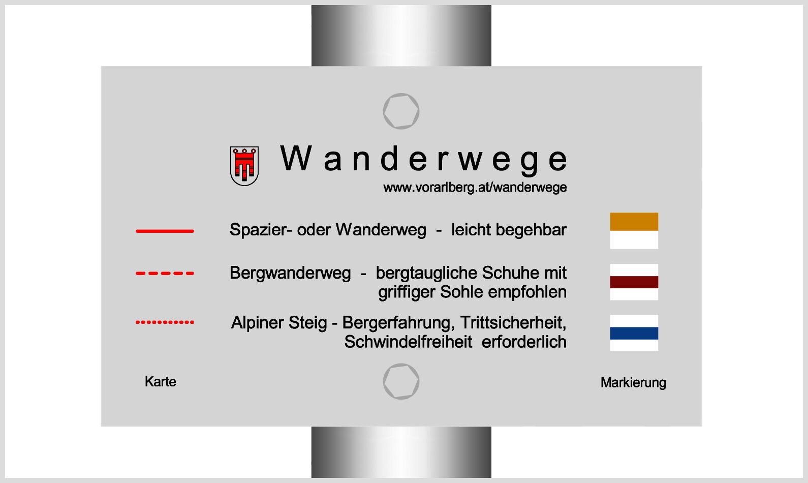
- Directions
-
Gasthof Krone - Parzelle Müß - from here white-blue-white trail (only for experienced hikers) up towards Küngs Maisäß - Küngs Maisäß - junction with hiking trail - turn left towards Kristbergsattel - Falla - Ganzaleita with viewpoint - Kristbergsattel - Dalaaser Gemeindewald/Bruder Hüsle - Poller - Gasthof Krone
- Highest point
- 1,757 m
- Endpoint
-
Gasthof Krone, Dalaas
- Height profile
-

- Equipment
-
Sturdy shoes, warm clothing, rain and sun protection, a snack, a full water bottle and hiking poles are recommended. Mobile phone for emergencies.
- Safety instructions
- Directions
-
maps.google.at
- Public transportation
- Parking
-
Various parking places in Dalaas


- Author
-
The tour Dalaas - Küngs Maisäß ins Montafon - Dalaas | Dalaas is used by outdooractive.com provided.


General info
-
Klostertal
1791
-
Silbertal - Kristberg
486


