- Brief description
-
The path over the Stierlochjoch is a great experience, with a beautiful view over Lake Spullersee, for the whole family.
- Difficulty
-
medium
- Rating
-
- Starting point
-
Hiking starting point Rüfiplatz
- Route
-
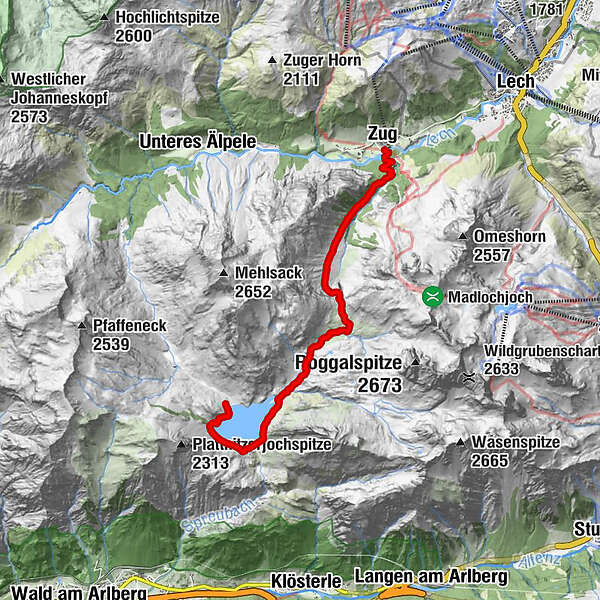
Brazer Staffel4.4 kmZug8.9 km
- Best season
-
JanFebMarAprMayJunJulAugSepOctNovDec
- Description
-
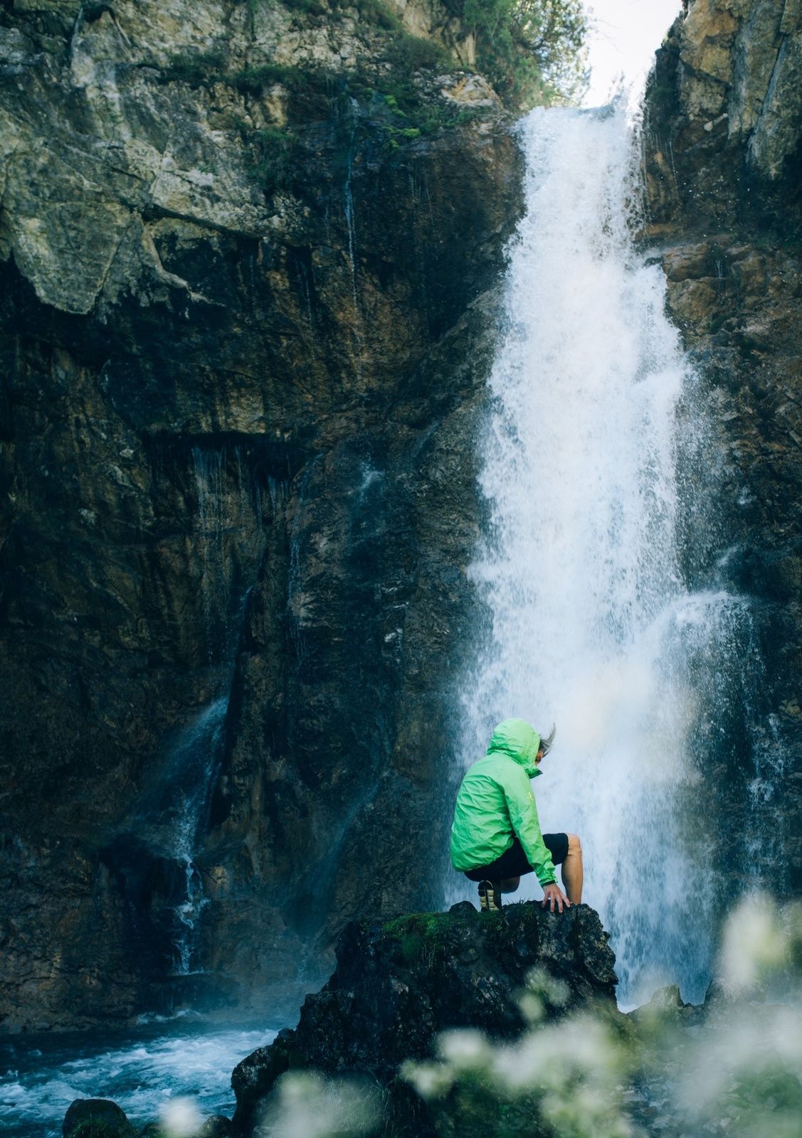
This hike takes you from the hiking starting point at the Rüfiplatz in Lech with the hiking bus to the Zugertal natural jewel. From there, you will circle around Spullerlake and after the dam you will reach the Ravensburgerhütte, where you can stop for a refreshment. If you continue your hike, cross the stream over a narrow stone bridge. At the Alpe Brazer Staffel there is again the possibility to stop for a break or you can continue on the Alpweg and reach the highest point of the hike, the Stierlochjoch. From now on it goes downhill and you reach the waterfall path. At the waterfall is an ideal barbecue area and if you continue walking you can hike back to Lech on the Lechuferweg.
- Directions
-
Directly from the starting point at the Rüfiplatz take the bus direction Spullersee. After the ride through the natural jewel of Zugertal Valley, get off at the last stop. You will circle the Spullersee on a wide alpine path. Over the southern dam we continue around the lake. Only after you have left the lake, the path climbs slightly. At the Ravensburger Hütte, you can stop for a bite to eat and enjoy the fantastic views of the lake below. Strengthened on the alpine path, we continue uphill for a short while. Keep left and take the stone bridge to cross the narrow stream. At the Alpe Brazer Staffel you can stop for a snack to taste fresh alpine cheese, spicy bacon and other specialities of the Alpe. Between the dwelling house and the stable we continue our way uphill on the alp trail, after a few loops we reach the highest point, the Stierlochjoch (2,009 m). From here it goes downhill moderately steep. After a few meters of altitude you leave the wide alpine path and follow the narrow path straight ahead. It always goes slightly downhill first over alpine meadows, then through the forest. You meet a forest track and follow it downhill. Soon a signposted path branches off to the right towards "Wasserfallweg". Now it goes down to the waterfall on a narrow path. Here you will also find a wonderful barbecue area that is especially recommended on hot days. Follow the path downstream towards Zug. You will come across a wide path. Now you can either walk along the Lechuferweg to the right in the direction of Lech, or you can go left to the fishpond and take the bus back to the starting point in Lech.
- Highest point
- 2,013 m
- Endpoint
-
Zug
- Height profile
-

- Equipment
-
Sturdy boots ankle high, hiking map, drinks, Lech Card, bus timetable
- Safety instructions
- Tips
-
Special features: Lake Spullersee is also suitable for fishing. Fishing cards can be obtained from the tourist information office of Lech Zürs Tourismus.
Places of interest: The waterfall with its barbecue area invites you to linger.
Refreshment stops: Ravensburger Hütte, Alpe Brazer Staffel, Fischteich, restaurants in Lech or Zug.
- Additional information
- Directions
-
From Germany: Take the A96 motorway to Bregenz from there on the A14 motorway to Bludenz, continue on the S16 to the Lech Zürs am Arlberg exit. Follow the B197 up to Alpe Rauz, turn left here onto the B198 through Flexengalerie and over the Flexenpass to Lech Zürs am Arlberg.
From Switzerland: Via the A13 motorway and the Feldkirch, Hohenems or Lustenau border crossing on the A14 motorway to Bludenz. Continue on the S16 until exit Lech Zürs am Arlberg. Follow the B197 up to Alpe Rauz, turn left here onto the B198 through Flexengalerie and over the Flexenpass to Lech Zürs am Arlberg.
From Austria: Via the Inntalautobahn A12 and then via the S16 to the exit St. Anton am Arlberg (Arlberg Pass). Follow the B197 first through St. Anton, then through St. Christoph and over the Arlbergpass to Alpe Rauz. Turn right here onto the B198, pass through Flexengalerie and continue to Zürs.
- Public transportation
-
By train to Langen am Arlberg station or St. Anton am Arlberg. From there, buses (No. 750+760) run regularly to Lech Zürs am Arlberg.
- Parking
-
You can park your vehicle either directly at your host or at one of the day parking lots. Or in Lech am Arlberg in the Parkgarage Anger from 7:00 am to 8 pm.
-

-
AuthorThe tour Through the Stierlochjoch is used by outdooractive.com provided.