
- Brief description
-
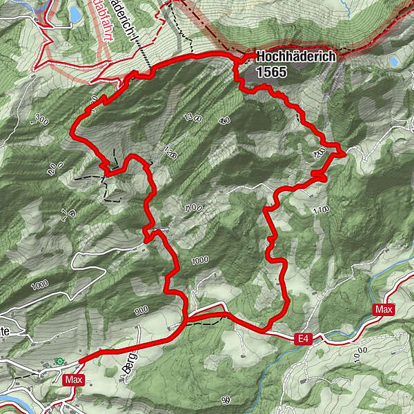
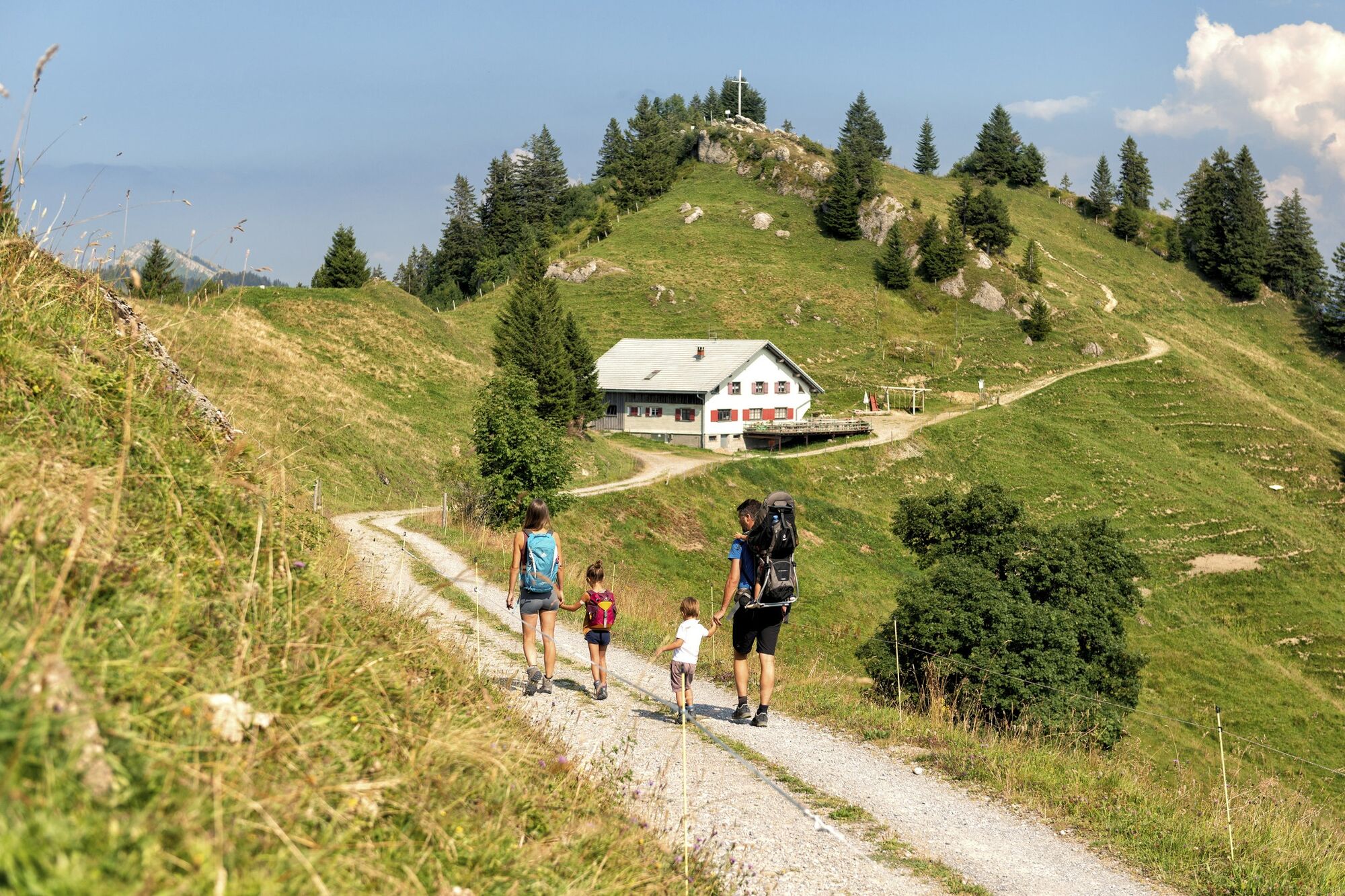
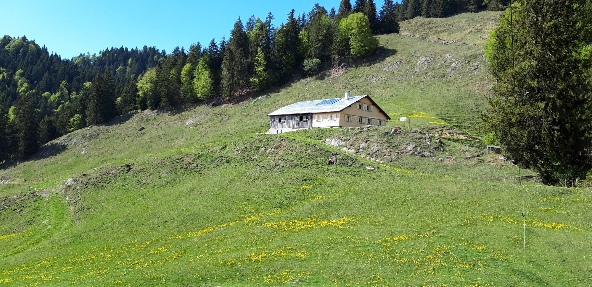
This mountain tour takes you to the most significant summit of the lower Bregenzerwald, the Hochhäderich.
- Difficulty
-
medium
- Rating
-
- Starting point
-
Hittisau-Reute
- Route
-
Alpenrose0.0 kmBerggaststätte Hoch Häderich4.2 kmHochhäderich (1,565 m)4.5 kmAlpenrose8.9 km
- Best season
-
JanFebMarAprMayJunJulAugSepOctNovDec
- Description
-
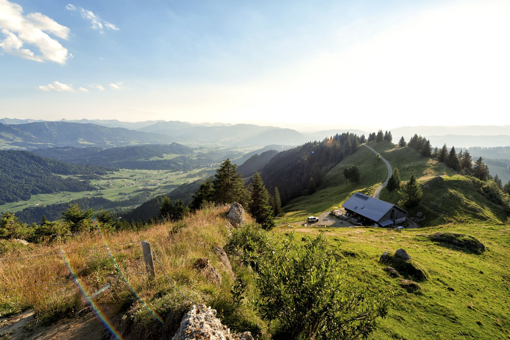
Hochhäderich offers a magnificent view to the north as far as the Allgäu and, to the south, to the Bregenzerwald. You pass large rock faces made up of Nagelfluh rock which are very distinct here. In 2008, 15 towns and villages in the border area of Allgäu and Vorderwald established the "Nagelfluhkette National Park" which covers an area of around 400 km².
- Directions
-
This mountain tour takes you to the most significant summit of the lower Bregenzerwald. Hochhäderich offers a magnificent view to the north as faras the Allgäu and, to the south, to the Bregenzerwald. You walk past huge cliffs of gompholite rock on the path, parts of which are really steep.
- Highest point
- 1,557 m
- Endpoint
-
Hittisau-Reute
- Height profile
-

- Safety instructions
- Tips
-
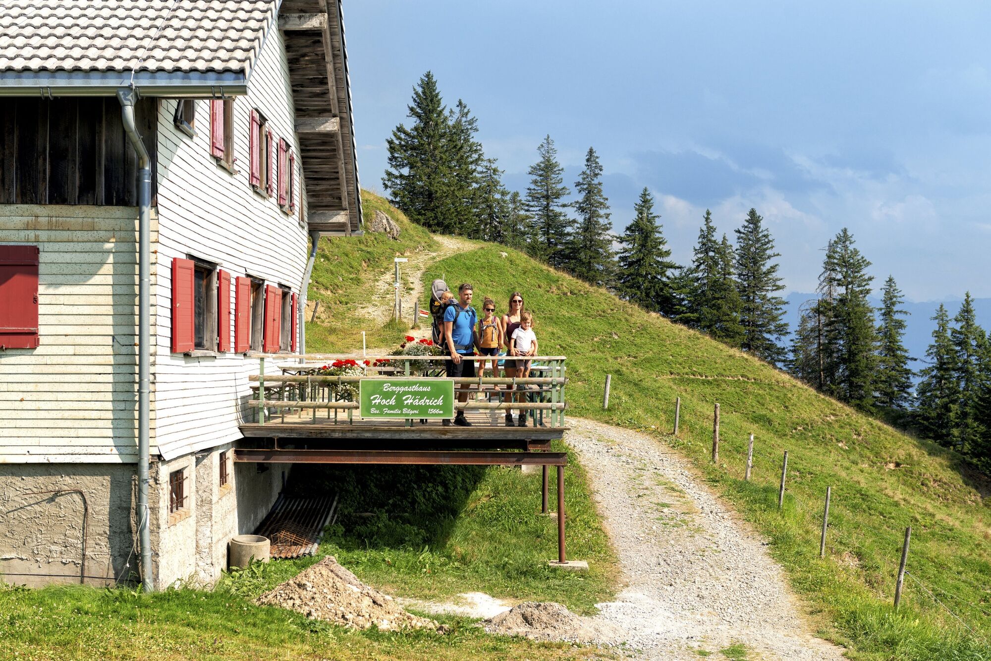
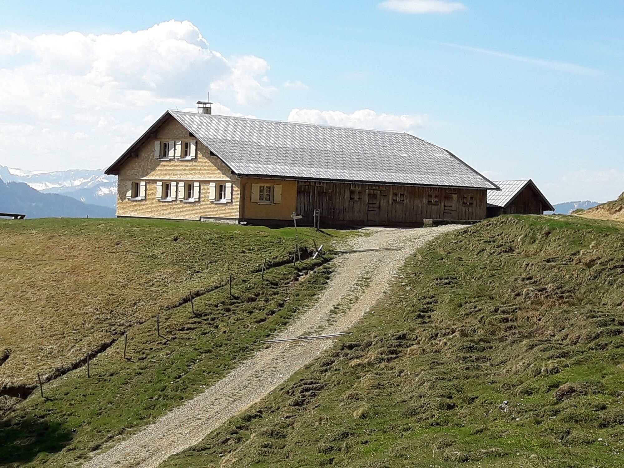
Chances to stop off for a drink/food:
Hochhäderich mountain inn, Gasthof Alpenrose (Reute) - Additional information
- Directions
-
from Germany: Motorway Lindau - Pfänder Tunnel - Motorway exit Dornbirn Nord (toll sticker required) - Bregenzerwald - Alberschwende - Lingenau - Hittisau;
OR Motorway Kempten - Immenstadt - Oberstaufen - Ach - Riefensberg - Krumbach - Hittisau
from Switzerland: Motorway St. Gallen - St. Margrethen/Au - Lustenau - Dornbirn - Bregenzerwald - Alberschwende - Lingenau - HittisauToll Sticker required by law
A toll applies to the use of Austria's motorways and dual carriageways. Types of toll sticker: "corridor" toll (border of Germany to the Hohenems exit, close to the Swiss border),
10-day, 2-month and yearly stickers.
Information: www.asfinag.at - Public transportation
- Parking
-
Parking in the centre of Hittisau

- Author
-
The tour Hittisau | along the Nagelfluh rock face on Hochhäderich is used by outdooractive.com provided.


General info
-
Allgäu
2357
-
Bregenzerwald
2297
-
Hittisau
704