Faschina - Hochschere Fürkele - Buchboden | Faschina & Buchboden


- Brief description
-
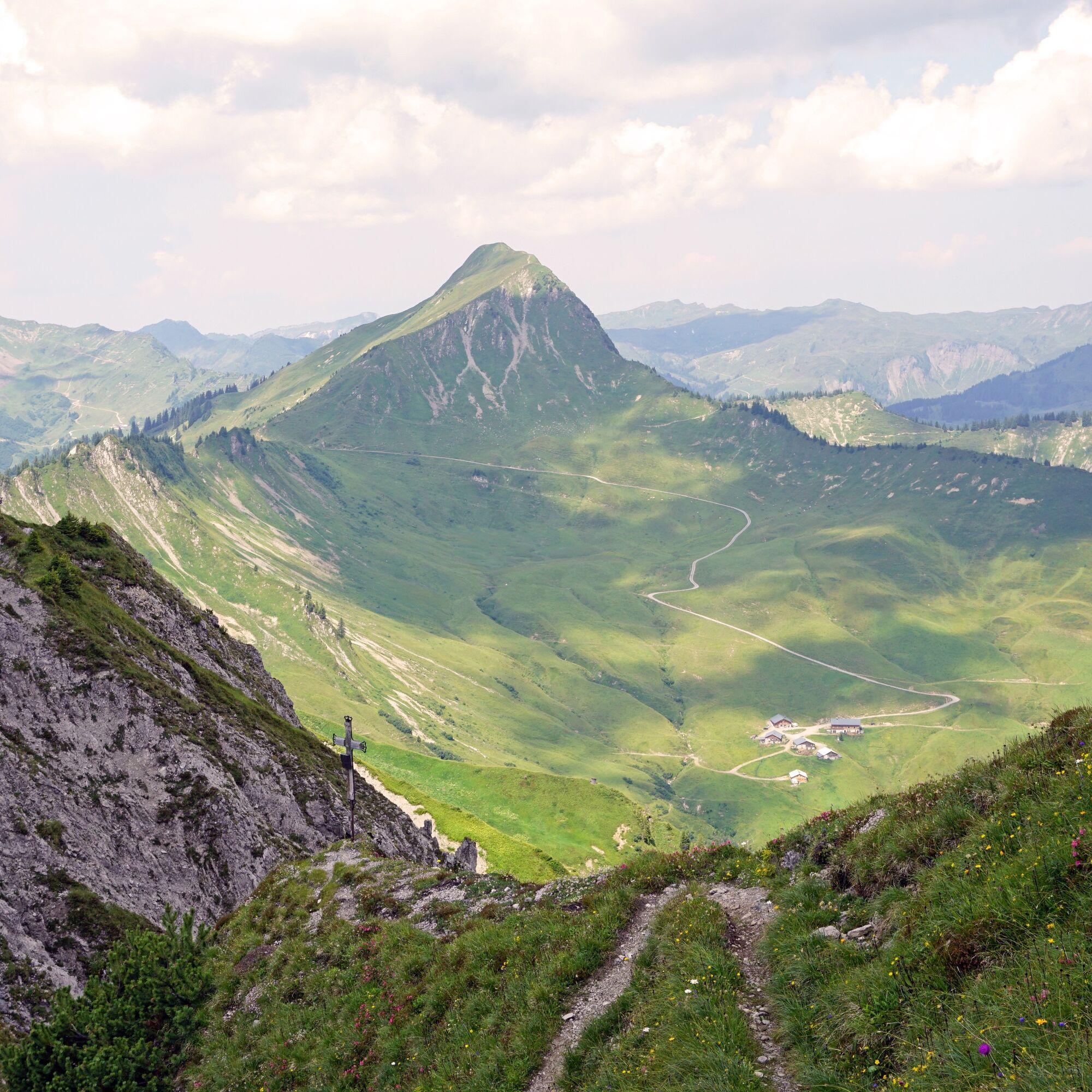
The mountain tour over the Hochschere Fürkele and the Hochschere Weg is one of the most challenging mountain tours in the Großes Walsertal and offers fabulous views.
- Difficulty
-
difficult
- Rating
-
- Starting point
-
Parking lot Faschinapass, Fontanella-Faschina
- Route
-
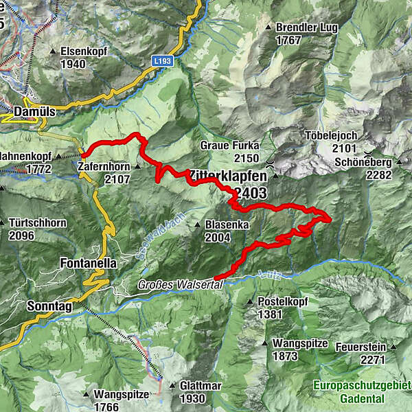
Faschina0.0 kmZafernalpe (1,702 m)4.8 kmOberalp10.2 kmOber Überlutalpe11.1 kmUnter Überlutalpe13.4 kmBuchboden15.5 kmKreuz15.6 km
- Best season
-
JanFebMarAprMayJunJulAugSepOctNovDec
- Description
-
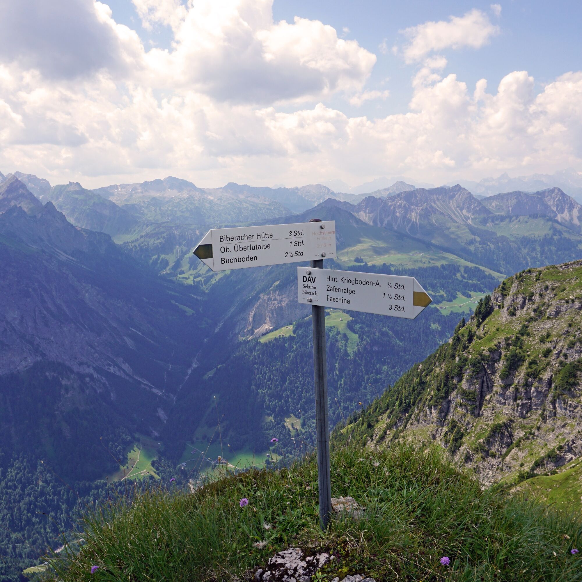
From the Faschinajoch, you first take the goods road up to the Bartholomäus Alpe. From the alpine pasture a hiking trail now leads up to the Gumpener Grätle and at the foot of the Zafernhorn further over the Furka to the Zafernalpe. Passing the Zafernalpe, the alpine trail now leads up to the Hochschere Fürkele and further on the Hochschere trail in the direction of Buchboden. The Hochschere Weg is a demanding and steep climb (descent) that requires surefootedness and a head for heights. On the south side of the Zitterklapfen, the trail leads past the Obere and Untere Überlutalpe into the valley to Sonntag-Buchboden.
- Directions
-
Parking lot at Faschinajoch - Güterweg - Bartholomäusalpe - hiking trail below the Zafernhorn - Zafernalpe - Hochschere Fürkele - Hochschwere Weg - Obere and Untere Überlutalpe - Buchboden
- Highest point
- 2,008 m
- Endpoint
-
Church, Sonntag-Buchboden
- Height profile
-

- Equipment
-
Ankle-high hiking boots with treaded soles, sun and rain protection, snacks, a full water bottle and hiking poles are recommended. Mobile phone for emergencies.
- Safety instructions
- Arrival
-
maps.google.at
- Public transportation
- Parking
-
Public parking in Faschina
- Author
-
The tour Faschina - Hochschere Fürkele - Buchboden | Faschina & Buchboden is used by outdooractive.com provided.