- Brief description
-
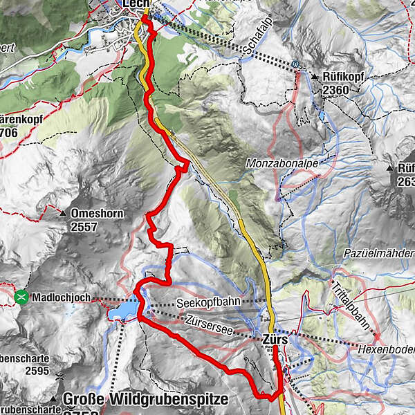
A varied round trip from Zürs to Lake Zurich and back to Lech.
- Difficulty
-
medium
- Rating
-
- Starting point
-
Zürs am Arlberg
- Route
-
Zürs (1,717 m)Arlberghaus - Walserstube0.1 kmMadlochbahn3.1 kmLech (1,444 m)8.2 km
- Best season
-
JanFebMarAprMayJunJulAugSepOctNovDec
- Description
-
The "Green Ring", which surrounds Lech and Zürs on the Arlberg, is a hiking route full of secrets and mysterious beings. Witches, hickeys, giants and the night people are supposed to be in trouble there. The writer Daniela Egger interweaves legends with modern stories in the Green Ring hiking guide, astonishingly explains the names of fields and peaks and leads to the installations of the artist Daniel Nikolaus Kocher along the route. The illustrations in the hiking guide also come from his studio.
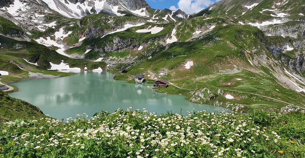
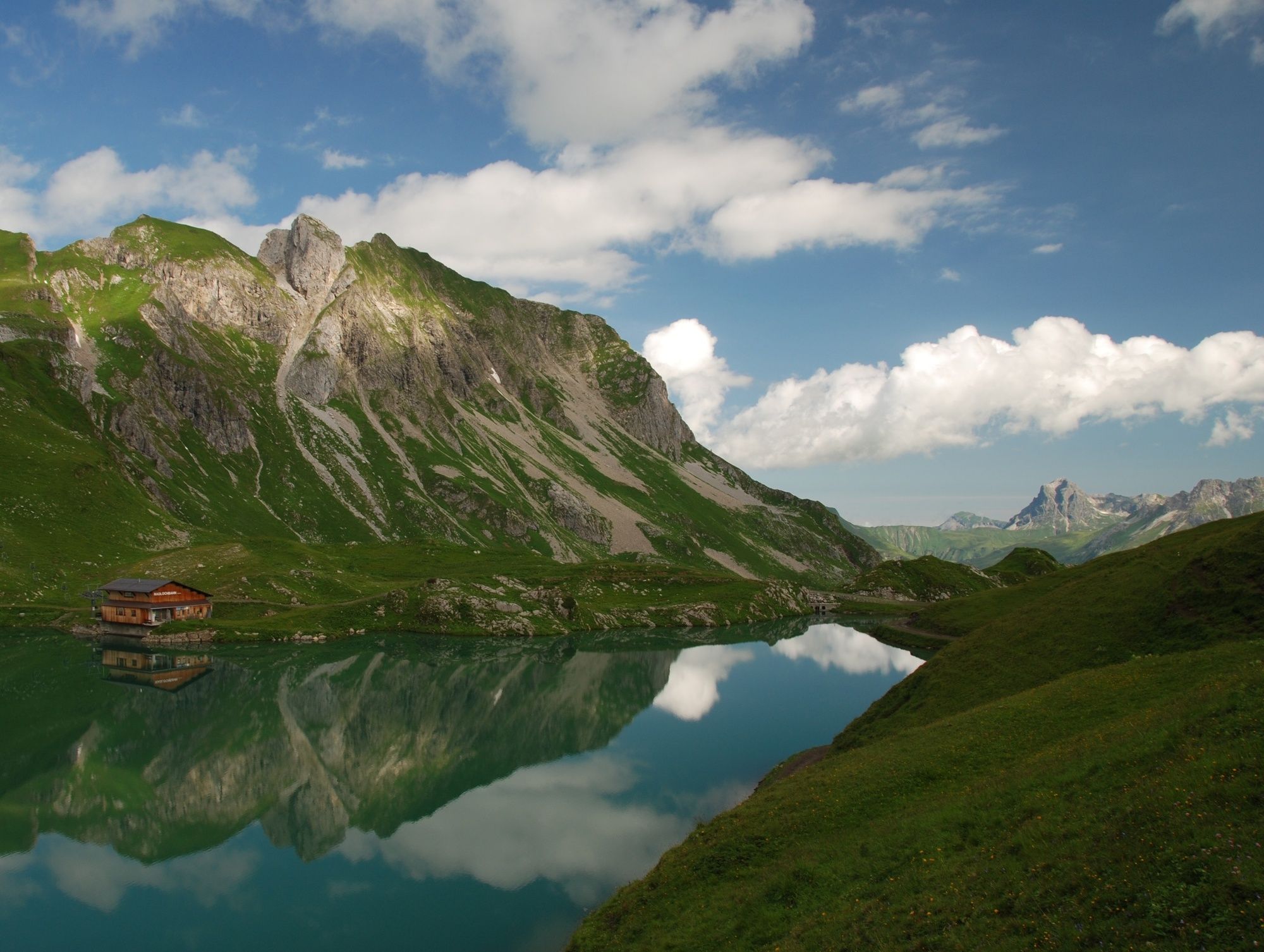
Stops along the way are, for example, the well-equipped hut library, which invites you to linger and browse, the mythical forest, the nature reserve Gipslöcher, the dragonfly lake and the bivouac box, in which you can even stay overnight. - Directions
-
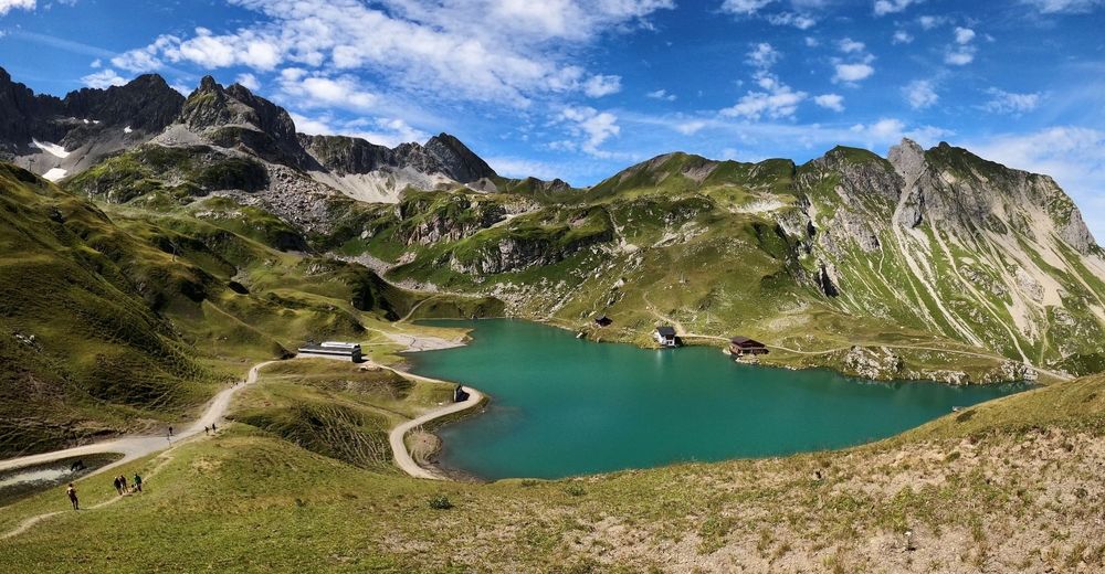
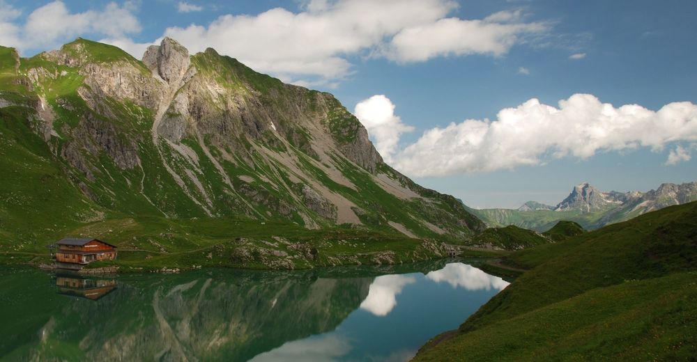
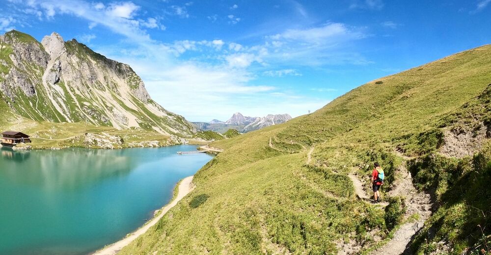
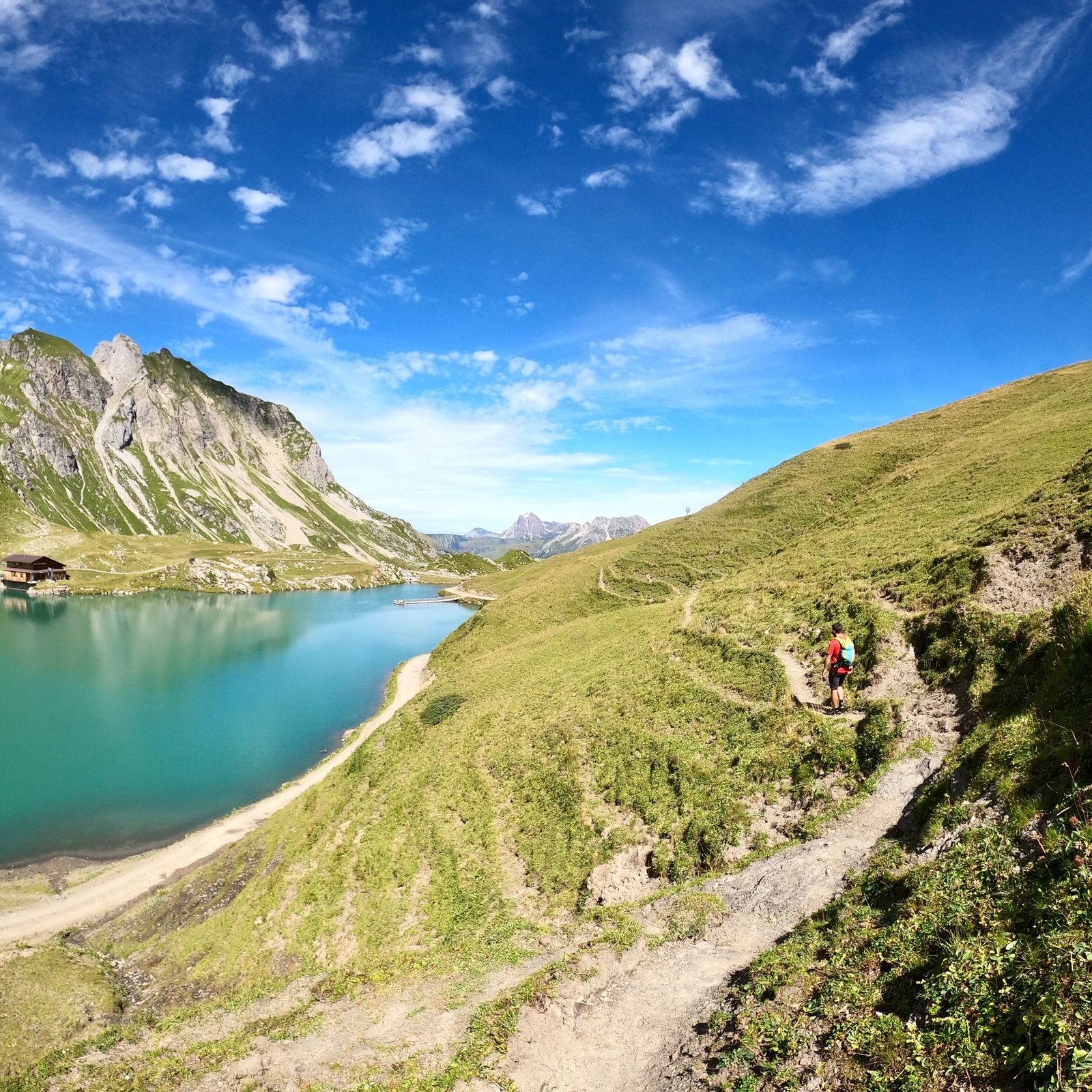
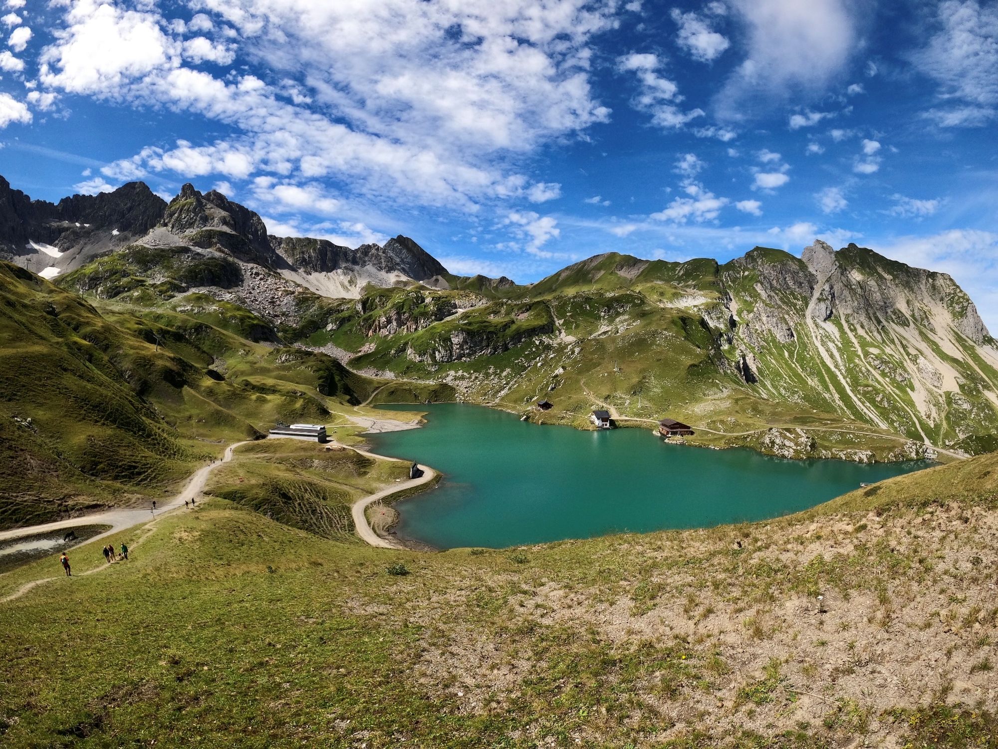
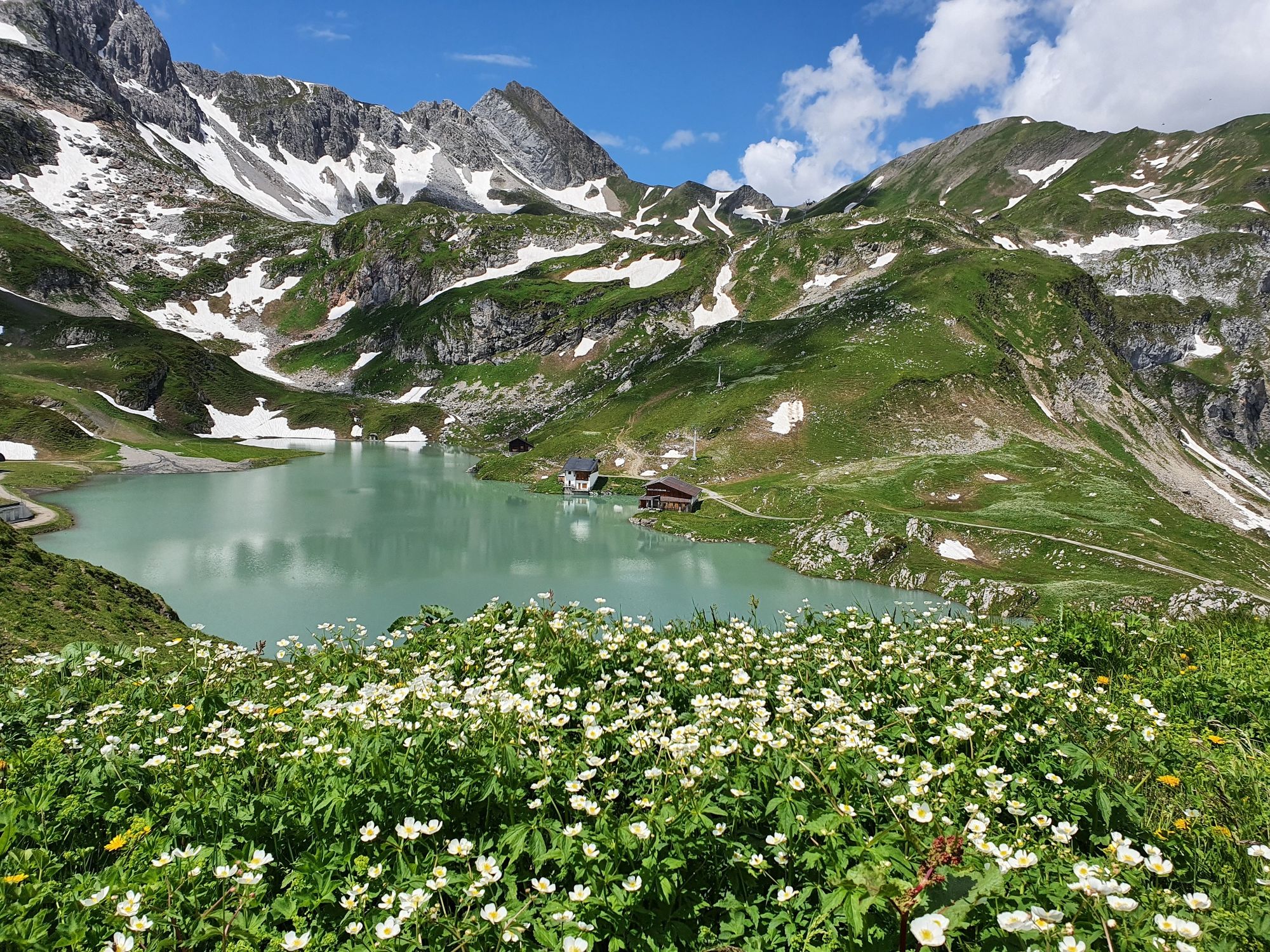
From the starting point at the Rüfiplatz, take the hiking bus in the direction of Zürs am Arlberg. After about 5 minutes you reach the stop "Trittkopf" in Zürs. From this stop, first walk along the road through the centre of Zurich to the roundabout and continue in the direction of Flexenpass. 200 m after the roundabout, a goods road branches off to the southwest on the right, which leads uphill to Lake Zuersersee. The wide stony gravel path leads directly to Lake Zuersersee. The highest point of the hike is reached after about one hour at an altitude difference of 2174 metres with a perfect view of Lake Zuersersee. From the highest point downhill along the forest path to the lake at an altitude difference of 2168 metres. A hilly path leads partly along the lake shore around the lake. The round trip takes a maximum of 30 minutes. Surrounded in a clockwise direction, beautiful views of Oberlech and Lech open up. On the shore of the lake in the direction of Lech, the stony forest path leads east downhill. After about 20 meters a narrow path branches off to the left. The path leads over alpine meadows down to the Madlochalpe 1942 meters. From here the path turns left downhill to Zürsbach. North of the path it goes downhill over alpine meadows. Left view over the shoulder accompanies the Omeshorn. At Köpfe 1917 metres the path is a bit steeper downhill, but after a few hundred metres, the path runs again via alpine meadows to Wiesele to Zürsbach. Along the stream, follow the path to the left back to Lech. The hike is ideal for families and you hike back to Lech am Arlberg along the leisurely stream.
- Highest point
- 2,170 m
- Endpoint
-
Lech am Arlberg
- Height profile
-

- Equipment
-
Good footwear (ankle-high, profile sole), rain cover, drink, snack, Lech Card and bus timetable.
- Safety instructions
- Tips
-
Special features: well-equipped hut library, which invites you to linger and browse, the forest of legends, the nature reserve Gipslöcher, the dragonfly lake and the bivouac box, in which you can even stay overnight.
- Additional information
- Directions
-
From Germany: Take the A 96 to Bregenz, then the A14 to Bludenz, continue on the S16 to the Lech Zürs am Arlberg exit. Follow the B197 to Alpe Rauz, then turn left onto the B198 through the Flexengalerie and over the Flexenpass to Lech Zürs am Arlberg.
From Switzerland: Via the A13 and the border crossing Feldkirch, Hohenems or Lustenau onto the A14 to Bludenz. Continue on the S16 to the Lech Zürs am Arlberg exit. Follow the B197 to Alpe Rauz, then turn left onto the B198 through the Flexengalerie and over the Flexenpass to Lech Zürs am Arlberg.
From Austria: Via the Inntal motorway A12 and then via the S16 to the St. Anton am Arlberg exit (Arlbergpass). Follow the B197 first through St. Anton, then through St. Christoph and over the Arlberg Pass to Alpe Rauz. Turn right here onto the B198 through the Flexengalerie and over the Flexenpass to Lech Zürs am Arlberg.
- Public transportation
- Parking
-
You can either park your car directly by your host or in the Anger underground car park. The underground car park is located directly in the town centre opposite Raiffeisenbank Lech. Opening hours 07:00 - 20:00 o'clock.
-

-
AuthorThe tour Lake Zürsersee is used by outdooractive.com provided.