

© Warth-Schröcken Tourismus - Ratko Fotografie und mehr

© Warth-Schröcken Tourismus - Ratko Fotografie und mehr

- Brief description
-
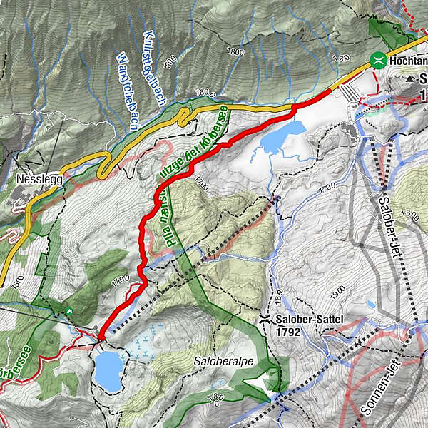
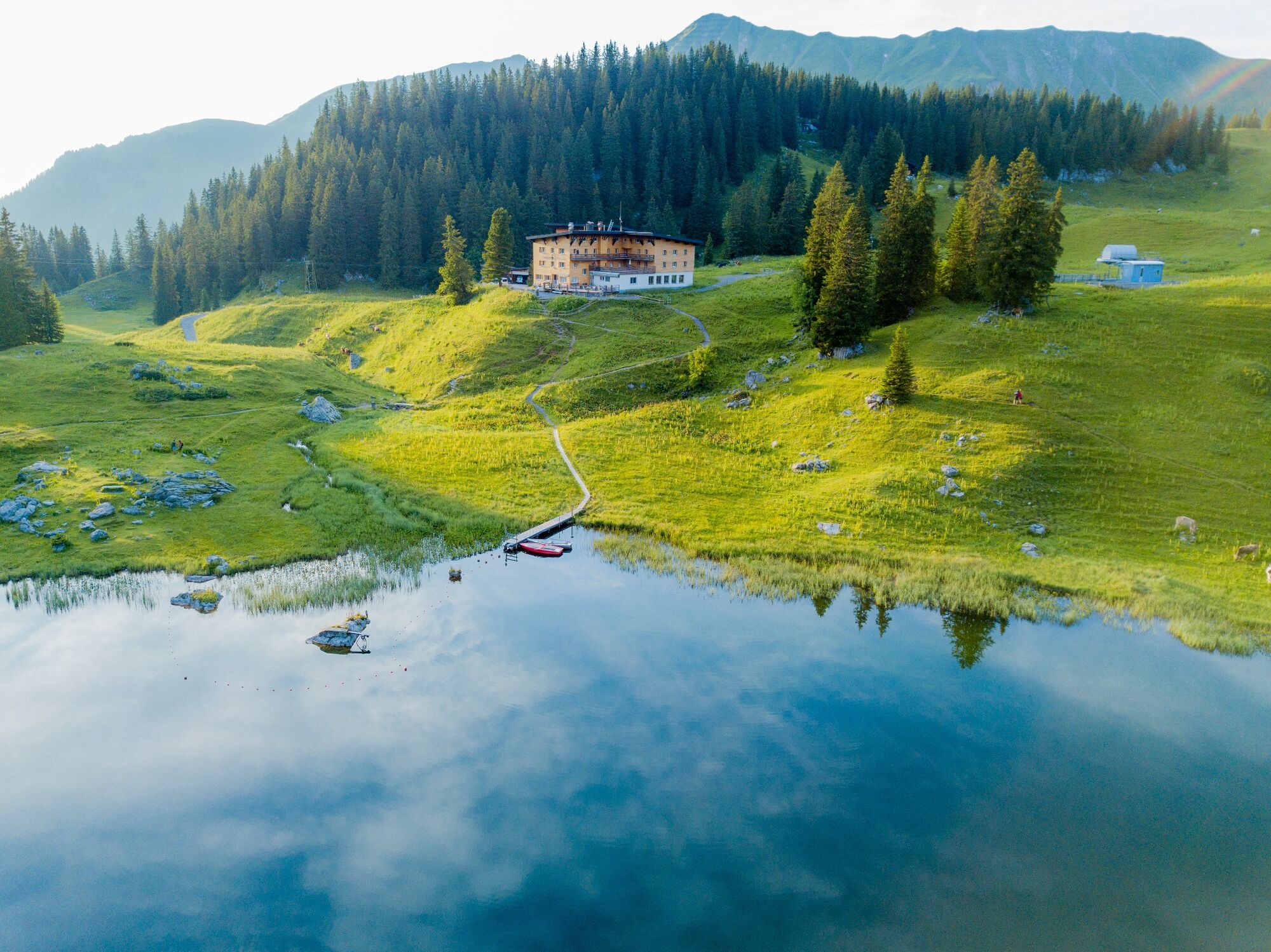
At the Hochtannbergpass the path leads you past Kalbelesee to the picturesque Körbersee. The mountain hotel invites you to take a break before you walk back up the same path.
- Difficulty
-
easy
- Rating
-
- Starting point
-
Hochtannbergpass
- Best season
-
JanFebMarAprMayJunJulAugSepOctNovDec
- Description
-
Touring.
Hochtannbergpass - Kalbelesee - Körberkreuz - Körbersee - Körberkreuz - Kalbelesee - Hochtannbergpass
- Directions
-
Touring.
Hochtannbergpass - Kalbelesee - Körberkreuz - Körbersee - Körberkreuz - Kalbelesee - Hochtannbergpass
- Highest point
- 1,741 m
- Endpoint
-
Hochtannbergpass
- Height profile
-

- Equipment
-
This should never be missing on the mountain.
Backpack, First-Aid Set incl. Bladder plaster, telephone with emergency number, cash, drinking bottle, pocket knife, provisions, sun protection in good weather.
- Safety instructions
-
Emergency numbers.
140 - Alpine emergencies throughout Austria
144 - Alpine emergencies in Vorarlberg
112 - Euro emergency call
- Additional information
- Directions
- Public transportation
- Parking

- Author
-
The tour From Kalbelesee to Körbersee and retour is used by outdooractive.com provided.
GPS Downloads


General info
Refreshment stop
Flora
Fauna
A lot of view
Other tours in the regions


