
- Brief description
-
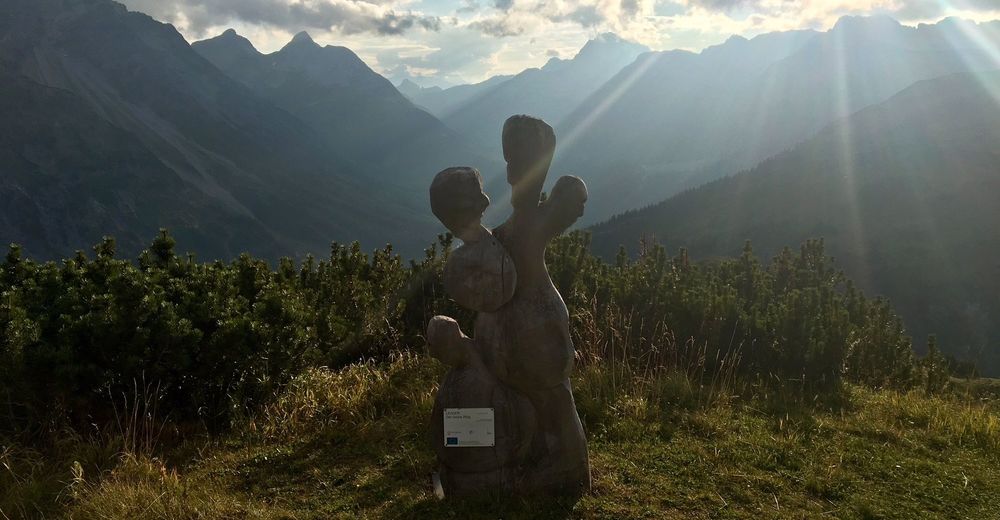
The hiking tour from Zug up to the Kriegerhorn summit is worth the effort, as you will find mythical creatures along the steep forest path through the forest full of mythology.
- Difficulty
-
medium
- Rating
-
- Starting point
-
Bus stop "Zug Kirchle"
- Route
-
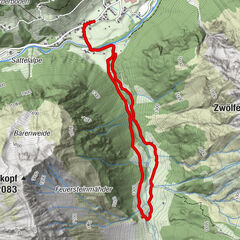
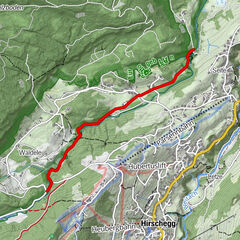
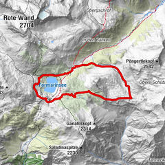
Balmalp2.4 kmBalmengrat2.5 kmBalmengrat2.7 kmKriegerhornbahn3.0 kmZugerberg3.8 kmZug6.2 km
- Best season
-
JanFebMarAprMayJunJulAugSepOctNovDec
- Description
-
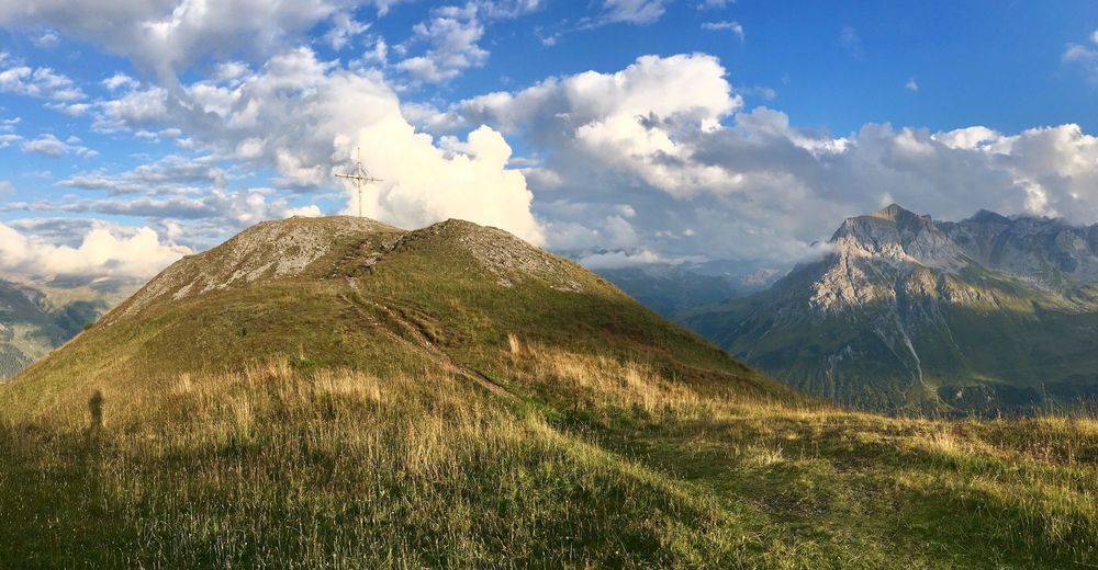
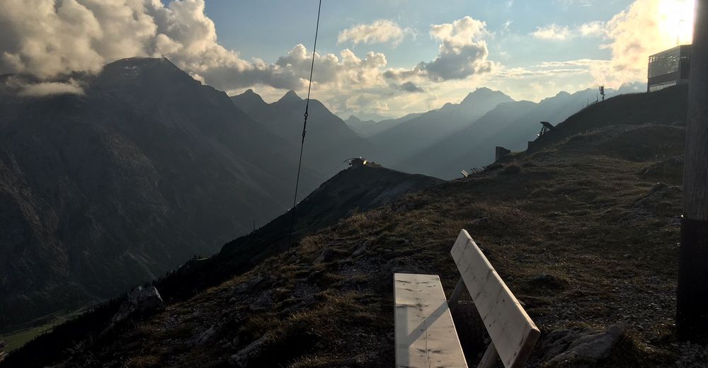
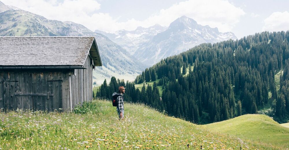
The fabulous forest "Sagenwald" is part of the three-day stage hike "The Green Ring" and surprises with hidden installations and entertaining legends that have been staged with a lot of wit and charm for hikers. Along the steep forest path you will be surprised by petrified magicians and cunning witches before you are rewarded with a magnificent view over the Zuger valley. This hike suits perfectly for a picnic, surrounded by the fairytale landscape, far away from the hustle and bustle of everyday life in the city. The Kriegerhorn, which is located at an altitude of 2,173 m, is the crowning glory of this hike.
- Directions
-
At the hiking starting point Rüfiplatz, catch the hiking bus towards Zug. Get off at the bus stop "Kirchle". Follow the asphalt road through the village as far as the fork to the fishpond. A meadow path branches off to the right, and leads up through the "Graben" to the Alpine pasture fence. Follow the path diagonally to the right, slightly ascending between the cable car support towers 7 and 8 to the edge of the forest. A forest path then rises steeply through the Sagenwald forest up to Balmalp hut. From there continue on a fairly wide alpine pasture trail that is at first quite flat but soon becomes steeper to the right up to the summit of the Kriegerhorn summit (2,173 m).
- Highest point
- 2,162 m
- Endpoint
-
Bus stop "Zug Kirchle"
- Height profile
-

- Equipment
-
Sturdy shoes, walking sticks, a rain jacket, a backpack with snacks and some water are recommended.
- Safety instructions
-
EMERGENCY CALL:
140 Alpine emergencies throughout Austria
144 Alpine emergencies Vorarlberg
112 Euro emergency call (works with any mobile phone/network)
www.vorarlberg.travel/sicherheitstipps
- Tips
-
In the book "A Samurai on the Kriegerhorn" legends are combined with modern stories and lead hikers to the installations along the path.
- Additional information
- Directions
-
From Germany: Take the A96 motorway to Bregenz from there on the A14 motorway to Bludenz, continue on the S16 to the Lech Zürs am Arlberg exit. Follow the B197 up to Alpe Rauz, turn left here onto the B198 through Flexengalerie and over the Flexenpass to Lech Zürs am Arlberg.
From Switzerland: Via the A13 motorway and the Feldkirch, Hohenems or Lustenau border crossing on the A14 motorway to Bludenz. Continue on the S16 until exit Lech Zürs am Arlberg. Follow the B197 up to Alpe Rauz, turn left here onto the B198 through Flexengalerie and over the Flexenpass to Lech Zürs am Arlberg.
From Austria: Via the Inntalautobahn A12 and then via the S16 to the exit St. Anton am Arlberg (Arlberg Pass). Follow the B197 first through St. Anton, then through St. Christoph and over the Arlbergpass to Alpe Rauz. Turn right here onto the B198, drive through Flexengalerie and over the Flexenpass to Lech Zürs am Arlberg.
- Public transportation
-
By train to Langen am Arlberg station or St. Anton am Arlberg. From there, buses (No. 750+760) run regularly to Lech Zürs am Arlberg.
- Parking
-
As there are no public parking spots in Zug, it is highly recommended that you park your car in Lech at the "Angergarage" and take the blue village bus to Zug.


-

-
AuthorThe tour Hiking from Zug up to Kriegerhorn summit is used by outdooractive.com provided.