© Au-Schoppernau Tourismus - Monika Albrecht
© Damüls Tourismus - Monika Albrecht
© Au-Schoppernau Tourismus - Monika Albrecht
© Au-Schoppernau Tourismus - Monika Albrecht

- Brief description
-
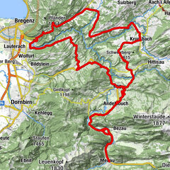
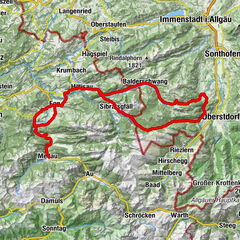
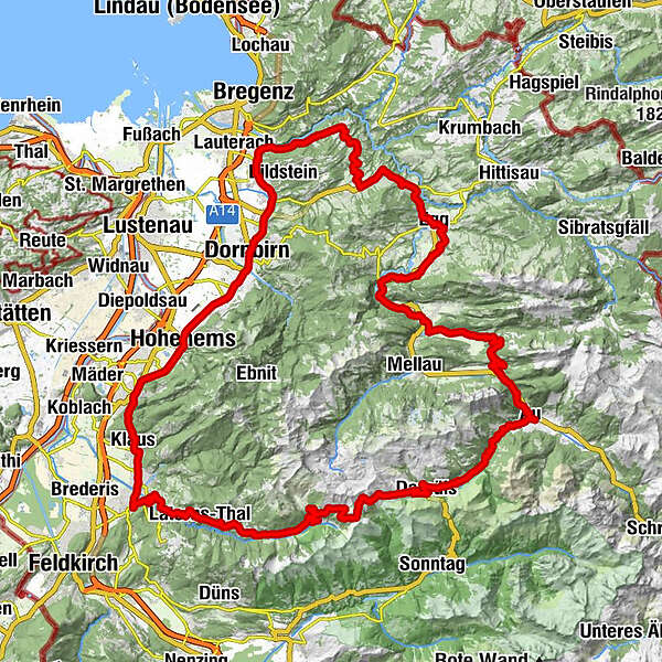
Au - Damüls - Furkapass - Rankweil - Götzis - Hohenems - Dornbirn - Wolfurt - Buch - Alberschwende - Egg - Bezau - Reuthe - Bizau - Schnepfegg - Au-Schoppernau.
- Difficulty
-
difficult
- Rating
-
- Route
-
Lisse0.2 kmAu (800 m)0.3 kmArgenzipfel1.1 kmUntertobel6.4 kmDreihäuser8.2 kmBerghotel Madlener9.2 kmDamüls (1,423 m)10.7 kmFurka12.7 kmHotel Alpengasthof Jägerstüble14.1 kmBad Laterns (1,147 m)23.7 kmBadlaterns (1,200 m)23.7 kmGerstenboden26.2 kmInnerlaterns28.0 kmSchmitten28.6 kmLaterns-Bonacker29.7 kmKapelle Maria Schnee29.7 kmLaterns-Thal31.4 kmHl. Nikolaus31.6 kmBatschuns35.7 kmZwischenwasser35.8 kmKapelle Mariahilf36.7 kmArken (508 m)37.4 kmRankweil38.7 kmAltes Gericht40.2 kmSulz40.4 kmSulnerberg (499 m)40.6 kmRöthis41.0 kmPizzeria Bruno Tinello41.6 kmPfarrkirche zum Heiligsten Herzen Jesu42.1 kmWeiler42.4 kmPizzeria Trattoria Romana42.7 kmKlaus43.0 kmFriedhofskapelle43.5 kmPfarrkirche zur heiligen Agnes43.5 kmKlauser Wald44.1 kmSankt Arbogast45.1 kmWallfahrtskirche St. Arbogast45.2 kmGasthaus Schützen45.2 kmKapelle St. Loy45.6 kmGötzis (448 m)46.4 kmKobel Kapelle47.3 kmHopfreben48.9 kmSchwefel (420 m)49.0 kmGasthaus Adler49.3 kmBrühl49.4 kmSonnwend49.7 kmWinzersteig50.1 kmKanzlei50.2 kmUnters Gsätzle50.3 kmFähnele50.3 kmTorbogen50.3 kmPlatzbruck50.3 kmSt. Karl Borromäus51.0 kmHohenems (432 m)51.1 kmKirchenfeld51.1 kmJudaviertel51.2 kmJudagass51.2 kmBurgäcker52.3 kmBöckeler52.5 kmLetzele52.7 kmPapierhofstatt52.9 kmBrühl53.3 km's Time Out Cafe Restaurant55.3 kmHatlerdorf57.1 kmMarkt58.3 kmDornbirn (437 m)58.5 kmHotel Hirschen60.7 kmWallfahrtskirche Maria Heimsuchung60.7 kmHaselstauden60.9 kmSchwarzach62.4 kmHl. Sebastian62.5 kmHofsteiger62.6 kmMr. Lianghua Qiu62.6 kmRoma Dolce Vita64.2 kmRickenbach64.2 kmHaus Lin64.3 kmKapelle Rickenbach, Hl. Anna64.3 kmWolfurt (420 m)65.4 kmGasthaus Stern Wolfurt65.6 kmHl. Nikolaus66.3 kmBuch72.5 kmKapelle zu den Sieben Schmerzen Mariens75.1 kmFischbach75.1 kmHinterfeld77.0 kmBrugg77.4 kmZipfel77.7 kmAlberschwende77.7 kmBühel77.8 kmWälderstüble78.9 kmRestaurant Engel78.9 kmDresslen79.0 km300-7079.4 kmEngler Rank79.5 kmMüselbach81.8 kmEgg85.1 kmWasserfälle Brühlbach87.2 kmWasserfälle Brühlbach87.4 kmPfarrkirche Andelsbuch88.4 kmAndelsbuch88.4 kmUnterbezegg89.4 kmHll. Martin und Wendelin91.5 kmBersbuch (634 m)91.7 kmSchwarzenberg (636 m)92.2 kmZiegler (S-Line Gastronomie)92.3 kmHof96.3 kmBaien97.1 kmEllenbogen98.1 kmReuthe98.7 kmPfarrkirche Reuthe98.8 kmGasthof Schwanen101.4 kmBizau101.6 kmPfarrkirche Bizau101.6 kmBerghaus Kanisfluh105.8 kmSchnepfegg105.8 kmPfarrkirche Schnepfau107.8 kmSchnepfau107.8 kmPfarrkirche St. Leonhard112.1 kmLisse112.3 kmAu (800 m)112.4 km
- Best season
-
JanFebMarAprMayJunJulAugSepOctNovDec
- Description
-
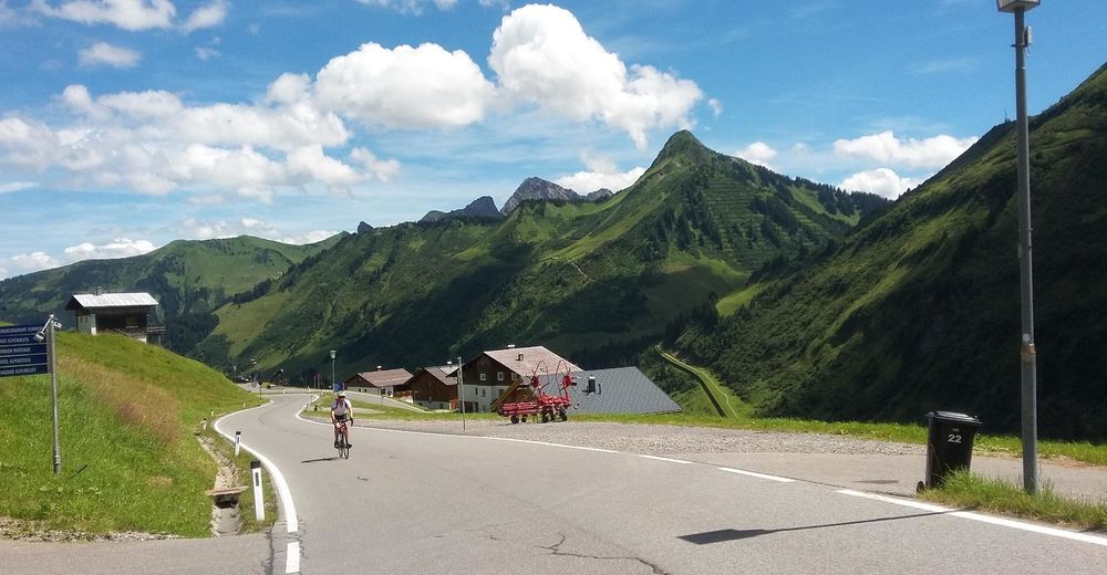
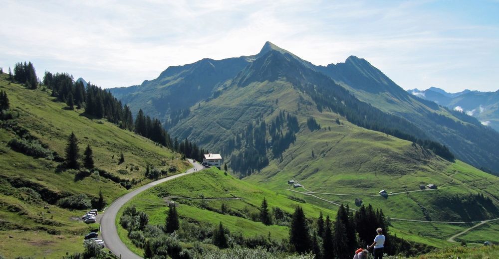
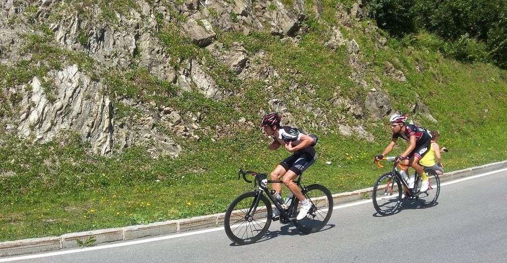
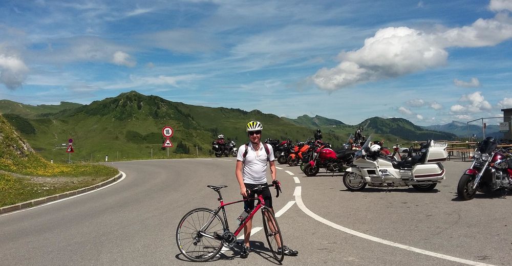
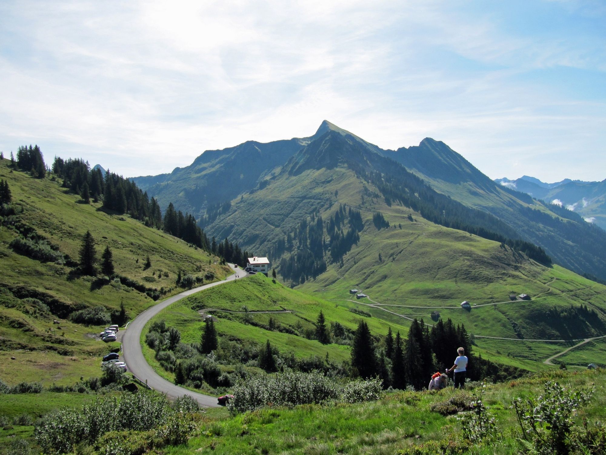
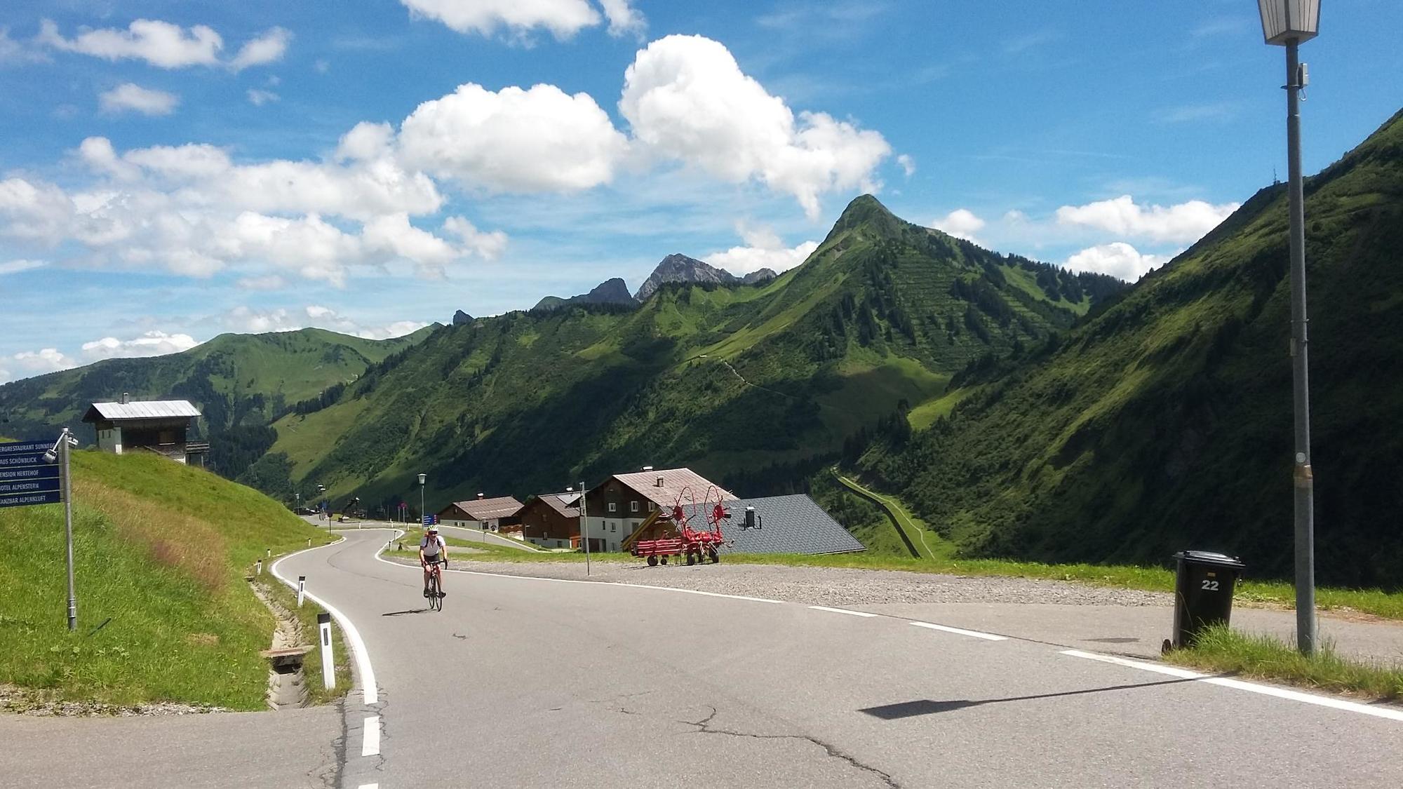
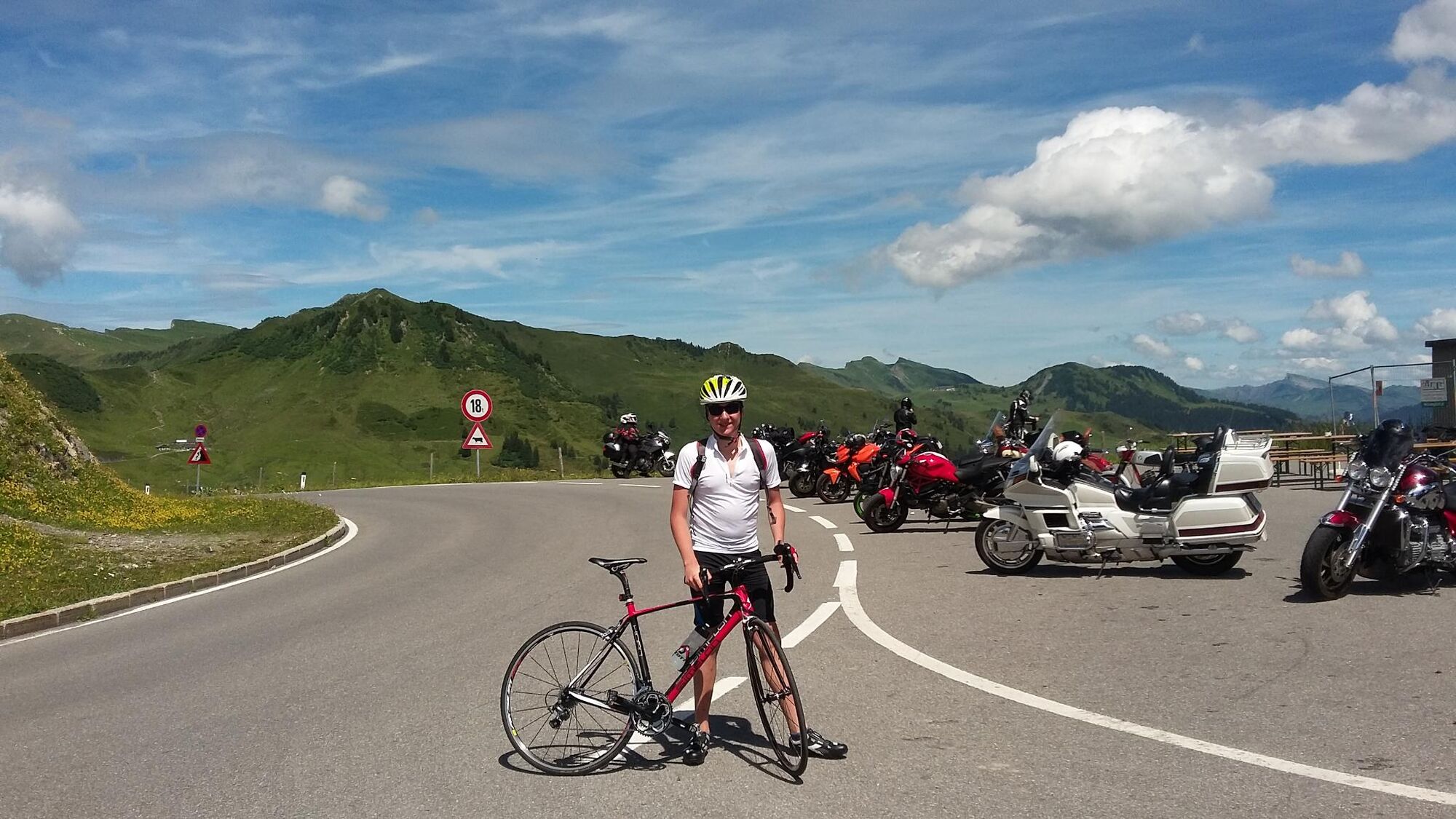
The tour starts with a proverbial “cold start”. The 18-km long climb to the Furkajoch (1,761 m) has 16% ramps in some parts of the start phase. Every metre higher you go rewards you with an even lovelier view of the valley and the massif. From the Furkajoch a fast, long and technically demanding downhill run awaits, taking you through the Laternsertal as far as Rankweil. In Rankweil, turn off to the right on to the L 190 and follow the road through Röthis, Sulz, Klaus, Götzis, Hohenems and Dornbirn as far as Wolfurt. At the entrance to the village of Wolfurt, turn off to the right towards the village centre and then turn off to the right towards Buch. The road to Buch has a slight incline and meanders through the forest. The ride from Buch to Alberschwende is peppered with short climbs and downhill runs. In Alberschwende, turn off to the left and take the L 200 as far as Egg. In Egg, take the Bregenzerwald cycle path as far as Bezau. There, turn off towards Reuthe and Bizau. At the end of Bizau, the approx. 3-km long climb to the Schnepfegg starts. It has steep stretches at the beginning. Make sure to take in the marvellous panorama on the Schnepfegg. The partially narrow road makes for a demanding downhill run to Schnepfau. Take the cycle path back to Au-Schoppernau.
- Highest point
- 1,763 m
- Endpoint
-
Gemeindeamt/Tourismusbüro Au
- Height profile
-


-

-
AuthorThe tour Au-Schoppernau | Furkapass Rhine Valley is used by outdooractive.com provided.
GPS Downloads


Other tours in the regions